
Hlavňovice
Hlavňovice | |
|---|---|
 Centre of Hlavňovice | |
 Hlavňovice Location in the Czech Republic | |
| Coordinates: 49°14′17″N 13°23′42″E / 49.23806°N 13.39500°E | |
| Country | |
| Region | Plzeň |
| District | Klatovy |
| First mentioned | 1428 |
| Area | |
| • Total | 24.10 km2 (9.31 sq mi) |
| Elevation | 687 m (2,254 ft) |
| Population (2023-01-01)[1] | |
| • Total | 500 |
| • Density | 21/km2 (54/sq mi) |
| Time zone | UTC+1 (CET) |
| • Summer (DST) | UTC+2 (CEST) |
| Postal codes | 341 42, 342 01 |
| Website | www |
Hlavňovice is a municipality and village in Klatovy District in the Plzeň Region of the Czech Republic. It has about 500 inhabitants.
Hlavňovice lies approximately 20 kilometres (12 mi) south-east of Klatovy, 58 km (36 mi) south of Plzeň, and 121 km (75 mi) south-west of Prague.
Administrative parts[edit]
The villages and hamlets of Častonice, Čeletice, Cihelna, Horní Staňkov, Javoříčko, Libětice, Milínov, Pích, Přestanice, Puchverk, Radostice, Suchá, Zámyšl and Zvíkov are administrative parts of Hlavňovice.
Demographics[edit]
| Year | Pop. | ±% |
|---|---|---|
| 1869 | 1,543 | — |
| 1880 | 1,478 | −4.2% |
| 1890 | 1,326 | −10.3% |
| 1900 | 1,325 | −0.1% |
| 1910 | 1,249 | −5.7% |
| 1921 | 1,207 | −3.4% |
| 1930 | 1,178 | −2.4% |
| 1950 | 757 | −35.7% |
| 1961 | 764 | +0.9% |
| 1970 | 675 | −11.6% |
| 1980 | 576 | −14.7% |
| 1991 | 542 | −5.9% |
| 2001 | 502 | −7.4% |
| 2011 | 469 | −6.6% |
| 2021 | 491 | +4.7% |
| Source: Censuses[2][3] | ||
Gallery[edit]
-
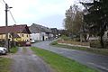 Road
Road -
 Church of Saint John of Nepomuk


References[edit]
- ^ "Population of Municipalities – 1 January 2023". Czech Statistical Office. 2023-05-23.
- ^ "Historický lexikon obcí České republiky 1869–2011 – Okres Klatovy" (in Czech). Czech Statistical Office. 2015-12-21. pp. 7–8.
- ^ "Population Census 2021: Population by sex". Public Database. Czech Statistical Office. 2021-03-27.
External links[edit]
Wikimedia Commons has media related to Hlavňovice.
| Authority control databases: National |
|---|
This Plzeň Region location article is a stub. You can help Wikipedia by expanding it. |