
Pine Orchard, Ontario
Pine Orchard | |
|---|---|
Unincorporated community | |
| Coordinates: 44°03′31″N 79°22′42″W / 44.05861°N 79.37833°W | |
| Country | Canada |
| Province | Ontario |
| Regional municipality | York Region |
| Town | Whitchurch–Stouffville |
| Amalgamation | (With Village of Stouffville) 1 January 1971 |
| Government | |
| • Type | Municipality |
| • Mayor | Iain Lovatt |
| • Councillor, Ward 1 | Ken Ferdinands |
| Elevation | 278 m (912 ft) |
| Time zone | UTC−5 (EST) |
| • Summer (DST) | UTC−4 (EDT) |
| Forward sortation area | |
| Area code(s) | 905 and 289 |
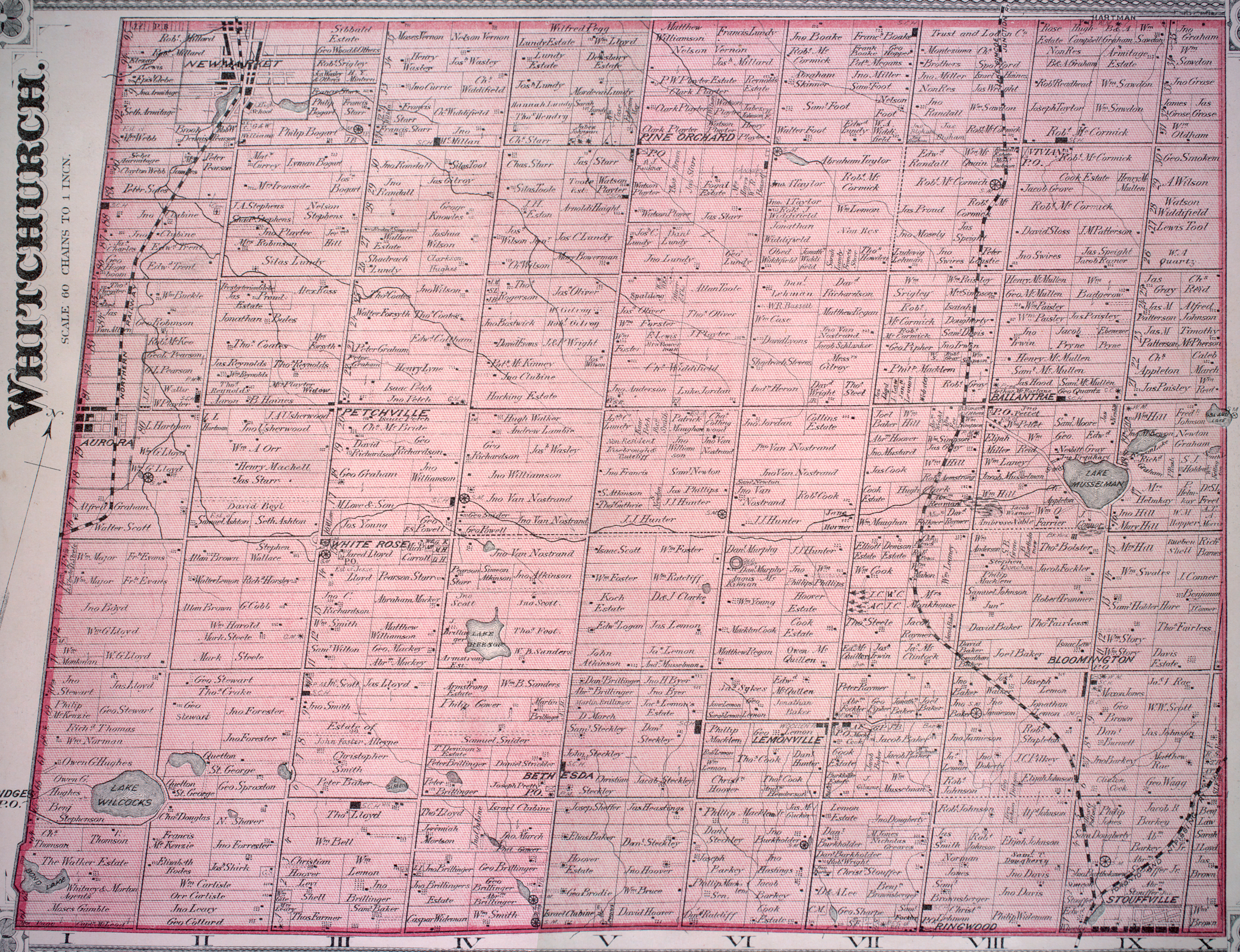
Pine Orchard is a hamlet in York Region, Ontario, Canada, in the town of Whitchurch–Stouffville. It is centred at the intersection of Warden Avenue and Vivian Road in the north-western region of Whitchurch–Stouffville. The original settlers were Quakers who, like the early Mennonites of Whitchurch and Markham townships, were pacifists that came north after the American Revolution. The founder of the hamlet was Isaac Phillips, who arrived from Muncy County, Pennsylvania in 1802. A first post-office was established in 1853, and by 1860 three sawmills were operating in the area.[1] In 1858 the hamlet had a population of 35.[2] The community flourished towards the end of the nineteenth century until township; however at the beginning of the twentieth century the township was almost completely deforested, and the forest industry collapsed. The hamlet's post-office closed in 1914.[3]
References[edit]
- ^ For a brief account of Pine Orchard's history, cf. Jean Barkey et al., Whitchurch Township (Erin, ON: Boston Mills, 1993), 75-77.
- ^ See the detailed 1878 map: Township of Whitchurch, Illustrated historical atlas of the county of York and the township of West Gwillimbury & town of Bradford in the county of Simcoe, Ont. (Toronto: Miles & Co., 1878).
- ^ Jean Barkey, et al., Whitchurch-Township, 144.
External links[edit]
This Ontario geographical article about a location in the Golden Horseshoe is a stub. You can help Wikipedia by expanding it. |