
Bethesda, Whitchurch-Stouffville
Bethesda | |
|---|---|
Unincorporated community | |
| Coordinates: 43°58′02″N 79°21′17″W / 43.96722°N 79.35472°W | |
| Country | Canada |
| Province | Ontario |
| Regional municipality | York Region |
| Town | Whitchurch-Stouffville |
| Amalgamation | (With Town of Stouffville) 1 January 1971 |
| Government | |
| • Type | Municipality |
| • Mayor | Iain Lovatt |
| • Councillor, Ward 3 | Hugo Kroon |
| Elevation | 269 m (883 ft) |
| Time zone | UTC−5 (EST) |
| • Summer (DST) | UTC−4 (EDT) |
| Forward sortation area | |
| Area codes | 905 and 289 |
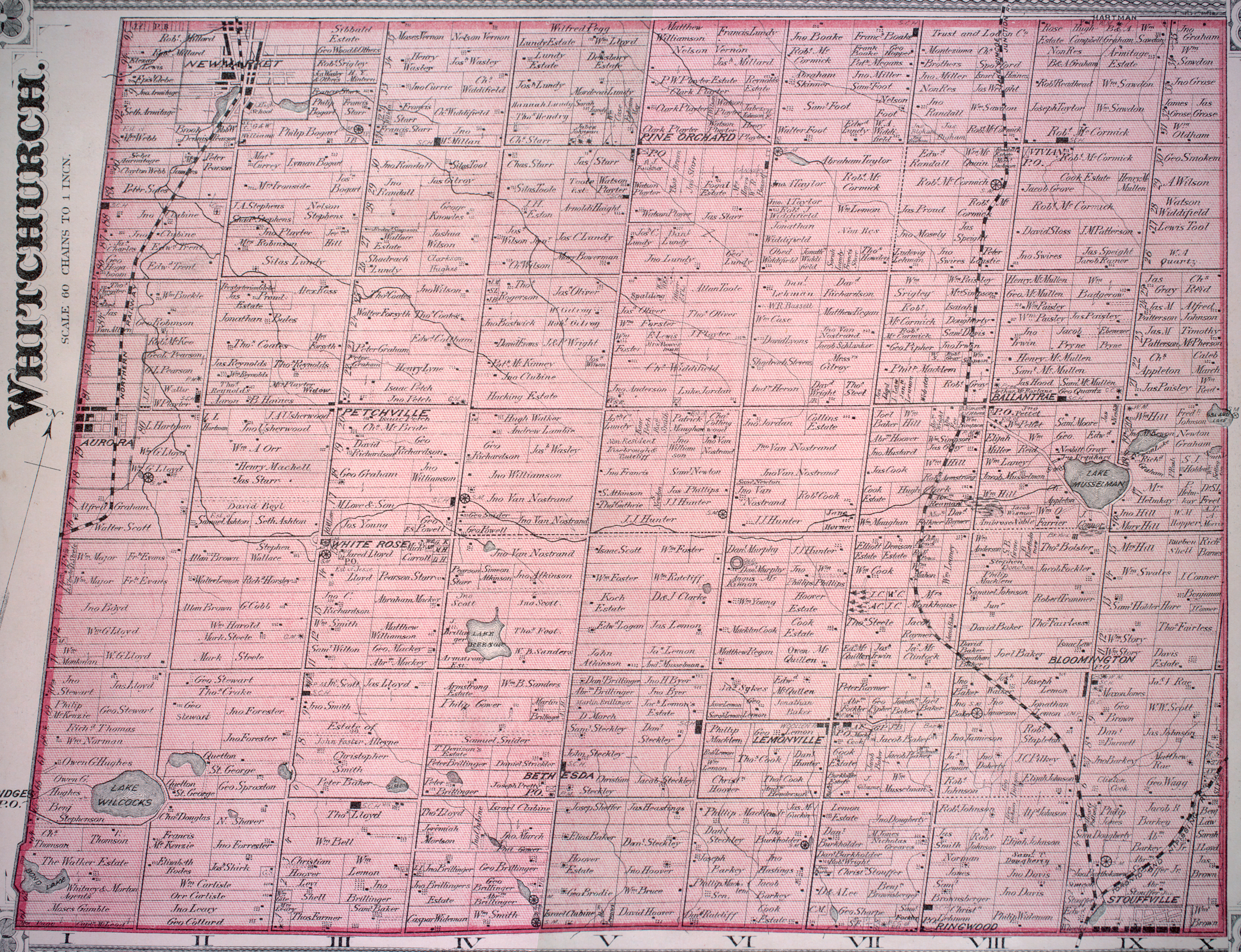
Bethesda is a hamlet in York Region, Ontario, Canada, in the town of Whitchurch-Stouffville. The hamlet is centred at the intersection of Warden Avenue and Bethesda Road in the south-eastern region of Whitchurch-Stouffville; it flourished around 1875.[1]
Mennonites settled in the area starting with Christian Steckley, who came from Pennsylvania in 1795.[2]
The community gained distinction with the formation of a private telephone company, the Bethesda and Stouffville Telephone Association in 1904, with 1188 users from Newmarket to Markham by 1930. The entire system was purchased by Bell Telephone in 1960.[3]
References[edit]
- ^ See the detailed 1878 map: Township of Whitchurch, Illustrated historical atlas of the county of York and the township of West Gwillimbury & town of Bradford in the county of Simcoe, Ont. (Toronto: Miles & Co., 1878).
- ^ Fretz, J. C. (1953). "Bethesda (York County, Ontario, Canada)". Global Anabaptist Mennonite Encyclopedia Online. Retrieved March 24, 2023.
- ^ For a brief account of Bethesda's history, cf. Jean Barkey et al., Whitchurch Township (Erin, ON: Boston Mills, 1993), 72-74.
This Ontario geographical article about a location in the Golden Horseshoe is a stub. You can help Wikipedia by expanding it. |