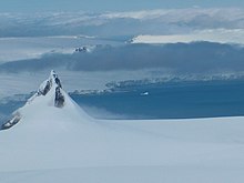
Yovkov Point


Yovkov Point (Yovkov Nos \'yov-kov 'nos\) is a point on the southwest coast of Greenwich Island, Antarctica projecting 150 m southwards into McFarlane Strait, forming the northwest side of the entrance to Kramolin Cove. Formed as a result of Murgash Glacier's retreat in the late 20th and early 21st century. The feature is named after the famous Bulgarian writer Yordan Yovkov (1880–1937).
Location[edit]
The point is located at 62°30′30.3″S 59°54′11″W / 62.508417°S 59.90306°W, which is 3.6 km southeast of Kerseblept Nunatak, 2.2 km south-southwest of Lloyd Hill, 2.95 km southwest of Tile Ridge and 1.98 km west-northwest of Kaspichan Point (Bulgarian topographic survey Tangra 2004/05 and mapping in 2005 and 2009).
Maps[edit]
- L.L. Ivanov et al. Antarctica: Livingston Island and Greenwich Island, South Shetland Islands. Scale 1:100000 topographic map. Sofia: Antarctic Place-names Commission of Bulgaria, 2005.
- L.L. Ivanov. Antarctica: Livingston Island and Greenwich, Robert, Snow and Smith Islands. Scale 1:120000 topographic map. Troyan: Manfred Wörner Foundation, 2009. ISBN 978-954-92032-6-4
References[edit]
- Yovkov Point. SCAR Composite Gazetteer of Antarctica
- Bulgarian Antarctic Gazetteer. Antarctic Place-names Commission. (details in Bulgarian, basic data in English)
External links[edit]
- Yovkov Point. Copernix satellite image
This article includes information from the Antarctic Place-names Commission of Bulgaria which is used with permission.
