
Wikipedia talk:WikiProject UK Railways/Archive 25
| This is an archive of past discussions. Do not edit the contents of this page. If you wish to start a new discussion or revive an old one, please do so on the current talk page. |
| Archive 20 | ← | Archive 23 | Archive 24 | Archive 25 | Archive 26 | Archive 27 | → | Archive 30 |
Wolferton railway station
Comments are invited at Talk:Wolferton railway station#Wholesale changes. --Redrose64 (talk) 23:18, 12 February 2013 (UTC)
![]() Template:Eccles line link has been nominated for deletion. You are invited to comment on the discussion at the template's entry on the Templates for discussion page. Redrose64 (talk) 19:49, 13 February 2013 (UTC)
Template:Eccles line link has been nominated for deletion. You are invited to comment on the discussion at the template's entry on the Templates for discussion page. Redrose64 (talk) 19:49, 13 February 2013 (UTC)
- Same discussion covers Template:Manchester-Ashton line link. --Redrose64 (talk) 20:06, 13 February 2013 (UTC)
Layout of WCML
West Coast RDT
Is there a more detailed version of the WCML diagram anywhere, akin to {{Midland Main Line RDT}} or East Coast Main Line diagram? -mattbuck (Talk) 07:24, 22 January 2013 (UTC)
- Not that I'm aware of, but you could always start one. A copy of Jowett's Railway Atlas would be beneficial in helping create the diagram. Otherwise, there are online OS maps from the 1940s and 1950 which can be used. Mjroots (talk) 21:33, 22 January 2013 (UTC)
- I seem to recall that it was mentioned some 2-3 years ago, not necessarily here or at WT:RAIL. One problem is what to include - should it be just those routes currently served bt VWC, or should it cover all the lines which have been directly served from Euston at some point? Another is complexity - it's potentially even larger than the ECML one - consider that there are five different ways of running a train from Euston to Manchester Picc (ten if you include the Northampton loop). --Redrose64 (talk) 22:02, 22 January 2013 (UTC)
- The previous discussion was in May 2011. Lamberhurst (talk) 22:29, 22 January 2013 (UTC)
- Another issue with complexity is the time taken by the servers to rebuild the page. I edited Fishponds railway station earlier today, and although the article is quite modest in text (and has no templated refs), it took ages to save - and then timed out. I've noticed since about November that any station article that includes
{{Bristol railway map/collapse}}will time out in 50% of save attempts. So, RDTs are slow. --Redrose64 (talk) 23:05, 22 January 2013 (UTC)- If a diagram is to be created, then it will need to be agreed what single railway constitutes the WCML. I'd suggest the traditional LNWR / Caledonian route of London - Birmingham - Crewe - Carlisle - Glasgow. As with the ECML diagram, it can be fairly detailed, but colliery lines should be omitted. Mjroots (talk) 09:37, 23 January 2013 (UTC)
- I'd personally consider the core route London-Tamworth-Glasgow. -mattbuck (Talk) 09:58, 23 January 2013 (UTC)
- Surely the routes through Stoke-on-Trent and to Liverpool are part of the WCML? Not sure about things like the Blackpool branch and the North Wales line, even though they have services to Euston. The branch to Edinburgh is a tricky one as well! G-13114 (talk) 10:04, 23 January 2013 (UTC)
- I'd include the Birmingham Line, the branch through Stockport to Manchester, the Liverpool branch, the Trent Valley Line and the Edinburgh branch but not the Northampton Loop. Difficultly north (talk) - Simply south alt. 10:11, 23 January 2013 (UTC)
- This is a problem with all the long route articles. I think of the WCML as London - Glasgow via the Trent valley but then we'd need to be sure that the WCML article only covered this and that the loops and branches were all covered elsewhere.Geof Sheppard (talk) 17:26, 25 January 2013 (UTC)
- I'd include the Birmingham Line, the branch through Stockport to Manchester, the Liverpool branch, the Trent Valley Line and the Edinburgh branch but not the Northampton Loop. Difficultly north (talk) - Simply south alt. 10:11, 23 January 2013 (UTC)
- Surely the routes through Stoke-on-Trent and to Liverpool are part of the WCML? Not sure about things like the Blackpool branch and the North Wales line, even though they have services to Euston. The branch to Edinburgh is a tricky one as well! G-13114 (talk) 10:04, 23 January 2013 (UTC)
- I'd personally consider the core route London-Tamworth-Glasgow. -mattbuck (Talk) 09:58, 23 January 2013 (UTC)
- If a diagram is to be created, then it will need to be agreed what single railway constitutes the WCML. I'd suggest the traditional LNWR / Caledonian route of London - Birmingham - Crewe - Carlisle - Glasgow. As with the ECML diagram, it can be fairly detailed, but colliery lines should be omitted. Mjroots (talk) 09:37, 23 January 2013 (UTC)
- Another issue with complexity is the time taken by the servers to rebuild the page. I edited Fishponds railway station earlier today, and although the article is quite modest in text (and has no templated refs), it took ages to save - and then timed out. I've noticed since about November that any station article that includes
- The previous discussion was in May 2011. Lamberhurst (talk) 22:29, 22 January 2013 (UTC)
- I seem to recall that it was mentioned some 2-3 years ago, not necessarily here or at WT:RAIL. One problem is what to include - should it be just those routes currently served bt VWC, or should it cover all the lines which have been directly served from Euston at some point? Another is complexity - it's potentially even larger than the ECML one - consider that there are five different ways of running a train from Euston to Manchester Picc (ten if you include the Northampton loop). --Redrose64 (talk) 22:02, 22 January 2013 (UTC)
The Network Rail definition defines the core route as "London Euston to Carstairs via Trent Valley and Crewe for approximately 600km". Lamberhurst (talk) 20:12, 25 January 2013 (UTC)
- I haven't got very far yet (Primrose Hill!), but I've started a diagram at User:Optimist on the run/WCML. Feel free to have a play, change the criteria for inclusion, whatever. I'd hoped to get a bit further, but
there was a signalling failure at WillesdenI was busy with other things. An optimist on the run! 23:26, 25 January 2013 (UTC)- This stuff was debated on article talk page and the consensus seems to have been that the Network Rail definition was unworkable for defining the WCML in the article. G-13114 (talk) 16:30, 26 January 2013 (UTC)
- Working from Jowett's, I've extended the diagram as far as Wolverton (open to corrections and improvement), which is where the Northampton Loop diverges. If someone would add in the general route northwards (Major towns/cities) then I'll have a better idea of where to fill in the gaps. If anyone else wants to have a go, please feel free. Mjroots (talk) 20:44, 26 January 2013 (UTC)
- Now got as far as Carstairs Junction (need to do some work aroung the Wigan area still). I presume Glasgow Central is the Scottish end of the line. Mjroots (talk) 11:23, 30 January 2013 (UTC)
- I've left some comments on the talk page. Thanks for your hard work. An optimist on the run! 12:50, 30 January 2013 (UTC)
- I've done what I can with both diagrams (north & south). Glasgow could probably do with some tweaking, but otherwise they are ready to be released into the wild.
 Mjroots (talk) 21:24, 14 February 2013 (UTC)
- I disagree. According to the same document, the branches to Manchester and Liverpool are needed and Warrington is a bit of a mess. Difficultly north (talk) - Simply south alt. 14:52, 15 February 2013 (UTC)
- As I've said elsewhere, other branches may be added if desired, but it may prove not to be feasible within the constraints of what we are working with. Not sure what is wrong with Warrington, it's accurate as far as I can tell. These diagrams are schematic, not maps. Mjroots (talk) 07:26, 16 February 2013 (UTC)
- I disagree. According to the same document, the branches to Manchester and Liverpool are needed and Warrington is a bit of a mess. Difficultly north (talk) - Simply south alt. 14:52, 15 February 2013 (UTC)
- I've done what I can with both diagrams (north & south). Glasgow could probably do with some tweaking, but otherwise they are ready to be released into the wild.
- I've left some comments on the talk page. Thanks for your hard work. An optimist on the run! 12:50, 30 January 2013 (UTC)
- Now got as far as Carstairs Junction (need to do some work aroung the Wigan area still). I presume Glasgow Central is the Scottish end of the line. Mjroots (talk) 11:23, 30 January 2013 (UTC)
- Working from Jowett's, I've extended the diagram as far as Wolverton (open to corrections and improvement), which is where the Northampton Loop diverges. If someone would add in the general route northwards (Major towns/cities) then I'll have a better idea of where to fill in the gaps. If anyone else wants to have a go, please feel free. Mjroots (talk) 20:44, 26 January 2013 (UTC)
- This stuff was debated on article talk page and the consensus seems to have been that the Network Rail definition was unworkable for defining the WCML in the article. G-13114 (talk) 16:30, 26 January 2013 (UTC)
I think Mjroots deserves a huge round of applause for the work he's done on it - thanks. On the other hand, I feel it does need a good look over from someone else before releasing it. If I get a free day tomorrow I'll have a go. Talking of which, should it be a template (like {{Midland Main Line RDT}}) or an article (like East Coast Main Line diagram)? Remember it's in two parts, and I may split the north section again. An optimist on the run! 18:25, 15 February 2013 (UTC)
- I'd go for separate page like ECML or Midland Main Line. The RDT on Cross Country Route cause the page to take way too long to re-render after a tiny little section edit, see here. --Redrose64 (talk) 19:18, 15 February 2013 (UTC)
I've now included the DC lines to Watford. I've taken out the goods sidings as unnecessary detail, and split the lines through the two Watford tunnels. An optimist on the run! 19:34, 16 February 2013 (UTC)
Passenger Usage
In a separate but related note, for many lines I have been creating passenger usage tables on railway lines around the UK (originally based on Geoff Shepard's idea). If I were to create one for the WCML, what lines should be covered? For example article, see Cornish Main Line and Northern Line (Merseyrail). Simply south...... catching SNOWballs for just 6 years 19:21, 16 February 2013 (UTC)
Walsall question.
Does anyone know when the Chase Line from Birmingham New Street to Walsall was electrified? I assumed it would have been done at around the same time as the Cross City Line in the early 1990s. But I've found this photograph from 1978 showing an EMU at the station. I can't find any information on Google. G-13114 (talk) 22:08, 13 February 2013 (UTC)
- I don't have sources or exact dates to hand, but it pre-dates the Cross-city electrification by some time, and I think it was done the same time as the main-line electrification through Birmingham, in the mid to late 60s. An optimist on the run! 23:05, 13 February 2013 (UTC)
- As Optimist states, most likely at the same time as the Stafford-Birmingham-Rugby route. Consider that the WCML electrification envisaged the use of electric traction for all traffic (unlike earlier schemes where only the passenger service got electric stock); hence the construction of 200 electric locomotives, many more than would be needed for the long-distance passenger services alone.
- Since freight trains (then as now) avoided New Street altogether, by running from Stechford to Bushbury via Aston and Bescot, that route would have been electrified as part of the main scheme; and since the parcels trains (again, electrically hauled) from Curzon Street to the north ran via Lawley Street Junction and Aston, that route would have been electrified too; which means that the short gap between Proof House Junction and Lawley Street Junction (11 chains) would certainly have been electrified at the same time. It would therefore have been a small matter to also electrify from Bescot to Walsall.
- It was certainly done by summer 1980, because that's when I first travelled to Walsall by rail - it was a Class 310 and there were windows in the back of the cab, so standing passengers in the endmost seating bay could see forwards. --Redrose64 (talk) 23:42, 13 February 2013 (UTC)
- The line was electrified under Stage 4 of the EML electrification, and was energised in December 1966. The Birmingham Are was electrified in two stages. Stage 3 electrified from Stafford to Wolverhampton/Bescot and Portobello Jn - Bushbury Jn and was switched on in April 1966. Stage 4 electrified Rugby - Coventry - Birmingham - Wolverhampton, Birmingham - Walsall (via Aston & Soho) and Aston - Stechford, and was switched on in December 1966. My reference sources are as follows (1) the excellent "British Railways Engineering 1948-80" by John Johnson and Robert A. Long (Mechanical Engineering Publications Ltd, 1981) (2) Electric : Euston to Glasgow by O.S. Nock (Ian Allan, 1974) (3) Britain's New Railway by O.S. Nock (Ian Allan 1966) (4) The Electric Railway Society's list of Electrification Dates in the UK. Bhtpbank (talk) 10:40, 14 February 2013 (UTC)
New\backdated usage figures
Years of usage figures from April 2002 and all the effort of adding them to Wikipedia. Now new figures have been released but not the most recent ones but ones from 1997 - 2001. See the usual passenger statistics page and we need to update the infoboxes. Simply south...... catching SNOWballs for just 6 years 23:06, 16 February 2013 (UTC)
- This sounds like something that Wikidata could do - sometime... An optimist on the run! 23:09, 16 February 2013 (UTC)
Naming of Uxbridge Road tube station
Please comment at Talk:Uxbridge Road tube station#Uxbridge Road "tube" station. --Redrose64 (talk) 14:57, 17 February 2013 (UTC)
Railway station categories renaming/deletion
See proposal and comments Wikipedia:Categories for discussion/Log/2013 February 24#British railway stations. --Vclaw (talk) 10:44, 25 February 2013 (UTC)
Freight
I thought the freight coverage on Wikipedia wasn't as comprehensive as the passenger side so I've started on Rail freight transport in Great Britain - feel free to expand and improve. Crookesmoor (talk) 14:34, 27 February 2013 (UTC)
Help needed
Can anyone here tell me how to get the Midland Metro symbol included on the infobox for Birmingham Snow Hill station (and also Jewellery Quarter station and The Hawthorns station)? I've tried but I can't work out how to do it. G-13114 (talk) 23:06, 28 February 2013 (UTC)
- {{Infobox GB station}} calls {{Rail-interchange}} (redirected from {{R-I}}) for parameters symbol and symbol2. According to the Rail-interchange template, the symbol2 should be birmingham (lower case) - but that doesn't seem to work either. An optimist on the run! 23:22, 28 February 2013 (UTC)
DYK help required
I've recently created an article for Denbigh Hall railway station, and I'm trying to get it onto WP:DYK (nom). I'd proposed a hook reading
- ... that due to overrunning engineering works, early railway passengers from London to Birmingham had to change at Denbigh Hall station to continue their journey by stage-coach?
but there's objections to that on the basis that people outside the UK wouldn't understand overrunning engineering works, or at least not recognise it as a modern frequent excuse. Can anyone suggest an alternative hook? I'm hoping for something fairly light-hearted, that gets the point across that trains being replaced by buses (or stagecoaches) is nothing new. An optimist on the run! 09:26, 1 March 2013 (UTC)
- ... that due to builders digging a tunnel through quicksand, early railway passengers from London to Birmingham had to change at Denbigh Hall station to continue their journey by stage-coach? Ning-ning (talk) 10:44, 1 March 2013 (UTC)
- ... that the world's first bustitutes ran from Denbigh Hall station? Ning-ning (talk) 10:47, 1 March 2013 (UTC)
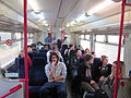
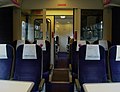
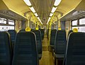
An even tougher challenge
.jpg)
An even thougher challenge. My thought is it's a 166 due to the 2+2 seating, but as for where it's actually going (apparently not Sandhurst)... -mattbuck (Talk) 01:46, 3 March 2013 (UTC)
- One of the next images in that user's flickrstream, with the same datestamp, was taken at Wokingham: [1]. Mackensen (talk) 02:05, 3 March 2013 (UTC)
Format of train times
Please join in the discussion at Wikipedia talk:WikiProject Trains#Format of train times. --Redrose64 (talk) 12:45, 5 March 2013 (UTC)
New station for Ilkeston
Details here. Ilkeston railway station could be open next year. Mjroots (talk) 17:36, 6 March 2013 (UTC)
- The salient word in that article is "if". -mattbuck (Talk) 17:53, 6 March 2013 (UTC)
- I wouldn't trust it as a source either: the javascript slowed my browser to a crawl and triggered the popup blocker. --Redrose64 (talk) 18:09, 6 March 2013 (UTC)
- More reliable source here, but agree with Mattbuck. Wait till there's a definite go-ahead before creating an article, though reference
could behas been made in Ilkeston Junction and Cossall railway station, as this was the station on the same line (c.f. Haxby railway station for example). In the meantime I've created Ilkeston railway station as a dab page for the existing articles on the three former stations in the town. An optimist on the run! 18:18, 6 March 2013 (UTC)
- More reliable source here, but agree with Mattbuck. Wait till there's a definite go-ahead before creating an article, though reference
- I wouldn't trust it as a source either: the javascript slowed my browser to a crawl and triggered the popup blocker. --Redrose64 (talk) 18:09, 6 March 2013 (UTC)
West Malling station renamed?
Per this TV report, the station now apears to be named "West Malling for Kings Hill". Page move in order? Mjroots (talk) 18:49, 8 March 2013 (UTC)
- Network rail timetable and the National rail station details refer to the station as West Malling. Southeastern refer to the station as West Malling <small>(for Kings Hill)</small> in their current Mainline 2 timetable. However, I don't think the part that follows the for is part of the name; in the past these have some very long and I'm trying to find some examples. Edgepedia (talk) 19:50, 8 March 2013 (UTC)
- I think we need confirmation (photos ideally) that the station signage has changed. Lamberhurst (talk) 20:11, 8 March 2013 (UTC)
- The sign is correct. I used to live in Maidstone and travelled the line to work. The "for Kings Hill" was added as a way to encourage more people to commute into London from the housing development at Kings Hill. The problem used to be that people did not realize that there was a railway station with a regular service into London. Now they do! As mentioned, a lot of the stations in the area used to have very long names. A good example, similar to this is Kearsney which has "(for Temple Ewell)" on the signs. There are countless others. Bhtpbank (talk) 21:01, 8 March 2013 (UTC)
- Also, follow the link that Mjroots gave first off, go to the first video clip (headed "Sangeeta reports on the baby, born on a train") at about 00:19 there is a very quick view of a sign "West Malling for Kings Hill" and in the second video clip (the one headed "Passengers delight at early arrival") and at about 00:29 it clearly shows a different sign "West Malling for Kings Hill". --Redrose64 (talk) 21:49, 8 March 2013 (UTC)
- The sign is correct. I used to live in Maidstone and travelled the line to work. The "for Kings Hill" was added as a way to encourage more people to commute into London from the housing development at Kings Hill. The problem used to be that people did not realize that there was a railway station with a regular service into London. Now they do! As mentioned, a lot of the stations in the area used to have very long names. A good example, similar to this is Kearsney which has "(for Temple Ewell)" on the signs. There are countless others. Bhtpbank (talk) 21:01, 8 March 2013 (UTC)
- I think we need confirmation (photos ideally) that the station signage has changed. Lamberhurst (talk) 20:11, 8 March 2013 (UTC)
Identify the train...thing

This moldering old hulk has been sitting at Bombardier's Litchurch Lane works, next to the Cross Country Route for years. Can someone please identify/categorise it for me? -mattbuck (Talk) 15:14, 22 February 2013 (UTC)
- Apparently it's a San Francisco tram, brought to the UK for possible use on Manchester [Metrolink].–Signalhead < T > 15:36, 22 February 2013 (UTC)
- User:Hammersfan uploaded File:SF Muni at Derby.png in 2011. File:BoeingUSSRLV.jpg is the closest match I've found on commons. Edgepedia (talk) 15:58, 22 February 2013 (UTC)
- That is a tram that used to operate on the San Francisco MUNI. It is a Boeing LRV (Light Rail Vehicle) or a US Standard Light Rail Vehicle. In about 2001, Manchester Metrolink was looking for additional trams to operate the Eccles Line, but wanted to avoid procuring more of what they had.
- At the same time, the SF Muni was replacing its Boeing trams with a newer design. The Boeing trams were of a similar design to the Metrolinks vehicles (high floors) and could fit within the gauge. So a tram (Cars 1226 and 1326) were sent across the pond. The "catch" was that if the tram was able to operate successfully over the Metrolink system that they would purchase about a dozen more. In short, the SF Muni found a "sucker" to buy their old life-expired trams. Unfortunatley, the tram derailed at Picadilly on its first test run, and the deal fell through. The SF Muni didn't want the tram back, so it is now a rusting heap of scrap metal. Bhtpbank (talk) 16:01, 22 February 2013 (UTC)
- US Standard Light Rail Vehicle#Problems seems long, although unsourced. Edgepedia (talk) 16:52, 22 February 2013 (UTC)
- At the same time, the SF Muni was replacing its Boeing trams with a newer design. The Boeing trams were of a similar design to the Metrolinks vehicles (high floors) and could fit within the gauge. So a tram (Cars 1226 and 1326) were sent across the pond. The "catch" was that if the tram was able to operate successfully over the Metrolink system that they would purchase about a dozen more. In short, the SF Muni found a "sucker" to buy their old life-expired trams. Unfortunatley, the tram derailed at Picadilly on its first test run, and the deal fell through. The SF Muni didn't want the tram back, so it is now a rusting heap of scrap metal. Bhtpbank (talk) 16:01, 22 February 2013 (UTC)

New one for you all. This was taken at the NRM Locomotion outpost at Shildon. -mattbuck (Talk) 21:20, 2 March 2013 (UTC)
- When the Hastings line was built the contractor cheated when lining the tunnels and after Wadhurst tunnel collapsed in 1862, it was discovered that only four layers of bricks had been used, instead of six. Two more layers were added and special rolling stock was used on the line, such as SR V Schools class and the British Rail Class 201. When the line was electrified in the mid 1980s they singled the line in the tunnels.
- So that's normal width SR stock. Edgepedia (talk) 21:38, 2 March 2013 (UTC)
- With that door hinge it looks like some sort of parcels or guards van? Did coaching stock have this written on the sides? Edgepedia (talk) 21:40, 2 March 2013 (UTC)
- I have another picture of it, [4] -mattbuck (Talk) 01:49, 3 March 2013 (UTC)
- I've never seen one before, but I think that's a horse carriage. These would include accommodation for the stable lad, which is why we have the half compartment and toilet. Is this a Mark 1 coach? Edgepedia (talk) 06:13, 3 March 2013 (UTC)
- With that door hinge, and the curved body profile, it could be almost anything to BR Mark 1 spec; the green livery implies Southern Region allocation; the label clip implies a non-passenger vehicle. Branding like that shown was not applied to all SR-allocated Mark 1 stock, but only those vehicles which might be prone to being sent over the Hastings line in error. The Southern Railway had six or seven route restrictions based upon width, height and length; by Nationalisation, these had been reduced to about three: Restriction 0 was 8'0" wide for the Hastings line; Restriction 1 was 8'6" wide for the routes through Oxted and Tunbridge Wells West (and some others); Restriction 4 was 9'0" wide, essentially the same as BR Restriction C1. Mark 1 horse boxes (Diagram 751) were Restriction 1; of these, nos. 96359-414 were allocated to the Southern when new. There is a photo of one of these - no. S96414 - in
- Parkin, Keith (1991). British Railways Mark 1 Coaches. Penryn: Pendragon. p. 199. ISBN 0-906899-49-4.
{{cite book}}: Invalid|ref=harv(help)
- Parkin, Keith (1991). British Railways Mark 1 Coaches. Penryn: Pendragon. p. 199. ISBN 0-906899-49-4.
- with exactly the branding shown in Mattbuck's photo. Parkin is in error as describing them as having only 13 weeks service - this should read 13 years. --Redrose64 (talk) 19:37, 3 March 2013 (UTC)
- Having only just spotted the 01:49, 3 March 2013 link there's absolutely no doubt. BR Standard Mark 1 Horse Box, Diagram 751; Lot no. 30146 Earlestown 1958; M96300-4, E96305-54, W96355-8, S96359-414; total 115. --Redrose64 (talk) 20:24, 3 March 2013 (UTC)
- With that door hinge, and the curved body profile, it could be almost anything to BR Mark 1 spec; the green livery implies Southern Region allocation; the label clip implies a non-passenger vehicle. Branding like that shown was not applied to all SR-allocated Mark 1 stock, but only those vehicles which might be prone to being sent over the Hastings line in error. The Southern Railway had six or seven route restrictions based upon width, height and length; by Nationalisation, these had been reduced to about three: Restriction 0 was 8'0" wide for the Hastings line; Restriction 1 was 8'6" wide for the routes through Oxted and Tunbridge Wells West (and some others); Restriction 4 was 9'0" wide, essentially the same as BR Restriction C1. Mark 1 horse boxes (Diagram 751) were Restriction 1; of these, nos. 96359-414 were allocated to the Southern when new. There is a photo of one of these - no. S96414 - in
- I've never seen one before, but I think that's a horse carriage. These would include accommodation for the stable lad, which is why we have the half compartment and toilet. Is this a Mark 1 coach? Edgepedia (talk) 06:13, 3 March 2013 (UTC)
- I have another picture of it, [4] -mattbuck (Talk) 01:49, 3 March 2013 (UTC)
Birmingham Central station?
Someone recently edited the Birmingham New Street article with this edit claiming that New Street was originally called 'Birmingham Central' station, using this as a reference. I've also found reference to New Street being described as 'Grand Central' or 'Great Central' station here and here. So I was wondering, was it ever actually called that officially, or was that just a description. I thought you lot with all your reference books etc would know. G-13114 (talk) 18:28, 7 March 2013 (UTC)
- Butt (1995) shows "BIRMINGHAM NEW STREET L&NW/Mid 81 SP 08 OP 1 June 1854. [Replaced Birmingham Curzon Street]." Here, "L&NW/Mid" refers to the pre-grouping co-owners; no other companies are mentioned so we must assume that it was a joint LNWR/Midland station from the start. "81 SP 08" is a map reference in Jowett (1989); "OP" indicates an opening date. There is thus no mention of renaming. The only reason I can think of that they didn't go for a simple "Birmingham" was that the GWR had opened their Snow Hill station a couple of years earlier, which was also relatively central.
- I would say that the "Central Station" shown on this is a descriptive term, rather than evidence of a formal name. Similarly for the other two; these may have been provisional names used at the planning stage, in order to "sell" the idea to the local council, to emphasise its convenience compared to either Curzon Street, Lawley Street or Camp Hill, which were both some way out. The council will have needed quite a bit of persuading, because of the amount of demolition that was required. If they could have got away with more demolition, there would have been a cutting at the eastern end and not a tunnel, and that 1 in 31 down from Proof House Junction could have been level. Indeed, during construction, one street was cut right through, and the railway were required to maintain a right-of-way in its place, which is why the footbridge had no ticket barriers until the 1960s rebuilding - since then, the new shopping centre above the station has served to maintain that right-of-way. --Redrose64 (talk) 21:01, 7 March 2013 (UTC)
- Tony Dewick's Complete Atlas of Railway Station Names also makes no reference to Birmingham Central (Great, Grand or otherwise). On the other hand, it is not Wikipedia's role to judge which sources are accurate, unless there's good evidence to the contrary. One solution may be along the lines of "Acording to some sources, Birmingham New Street was originally named Birmingham Central,<insert ref here>, however other sources do not confirm this.<Butt ref>" — An optimist on the run! (logged on as Pek the Penguin) 08:08, 8 March 2013 (UTC)
- Quick (2009) also makes no reference to "Central", explaining that New Street was originally simply named "Birmingham"; the NS addition came about later. I would not call that (unattributed) map a source for the claim that it was named "Central"; as per WP:EXCEPTIONAL, a better source than that is needed. The fact that several leading texts on stations don't mention it is, in my view, good evidence that the map is not accurate. Lamberhurst (talk) 12:52, 8 March 2013 (UTC)
- Checked Christiansen's West Midlands volume 7 of A Regional History of the Railways of Great Britain and that has no mention of it either. I agree with Redrose that it's desecriptive as in centralised rather than a formal name for the station. NtheP (talk) 14:19, 8 March 2013 (UTC)
- Looking at the references given above, it seems clear that it was just a decription, rather than a part of the station name. Bhtpbank (talk) 16:54, 8 March 2013 (UTC)
- That's roughly the conclusion I had come to. I'll re-edit it before long. G-13114 (talk) 17:17, 8 March 2013 (UTC)
- Just to make things intersting, the new shopping centre being built above the station as part of Birmingham Gateway (presumably replacing the Pallasades) is to be known as Grand Central.[5] An optimist on the run! 11:09, 13 March 2013 (UTC)
- That's roughly the conclusion I had come to. I'll re-edit it before long. G-13114 (talk) 17:17, 8 March 2013 (UTC)
- Looking at the references given above, it seems clear that it was just a decription, rather than a part of the station name. Bhtpbank (talk) 16:54, 8 March 2013 (UTC)
- Checked Christiansen's West Midlands volume 7 of A Regional History of the Railways of Great Britain and that has no mention of it either. I agree with Redrose that it's desecriptive as in centralised rather than a formal name for the station. NtheP (talk) 14:19, 8 March 2013 (UTC)
- Quick (2009) also makes no reference to "Central", explaining that New Street was originally simply named "Birmingham"; the NS addition came about later. I would not call that (unattributed) map a source for the claim that it was named "Central"; as per WP:EXCEPTIONAL, a better source than that is needed. The fact that several leading texts on stations don't mention it is, in my view, good evidence that the map is not accurate. Lamberhurst (talk) 12:52, 8 March 2013 (UTC)
- Tony Dewick's Complete Atlas of Railway Station Names also makes no reference to Birmingham Central (Great, Grand or otherwise). On the other hand, it is not Wikipedia's role to judge which sources are accurate, unless there's good evidence to the contrary. One solution may be along the lines of "Acording to some sources, Birmingham New Street was originally named Birmingham Central,<insert ref here>, however other sources do not confirm this.<Butt ref>" — An optimist on the run! (logged on as Pek the Penguin) 08:08, 8 March 2013 (UTC)
Bluebell railway
Can we keep an eye on the Bluebell Railway article during this week. The extension to East Grinstead is open for driver training atm, and for public services from this Saturday, 23 March. We need to guard against premature updates made in good faith. Mjroots (talk) 07:18, 18 March 2013 (UTC)
TransPennines
It occurs to me that for years on Commons we have accepted North/South TransPennine as a line rather than simply a service. I just wondered is this reasonable, or should we say that the eg South TransPennine is just the Liverpool to Manchester Line followed by the Hope Valley Line followed by the etc etc etc. The reason I ask this is I was wondering what line an EMT 158 at Stockport would be on - Hope Valley would seem reasonable, but SouthTP would possibly be more accurate if it is in fact a line. So... are the TransPennines lines, or merely journeys? -mattbuck (Talk) 20:20, 21 March 2013 (UTC)
- Services. They are not the only ones that are linked in station articles e.g. Thameslink, Great Northern Route, Cross Country Route. Simply south...... catching SNOWballs for just 6 years 20:46, 21 March 2013 (UTC)
- Cross Country Route is a recognised line... please... I don't want to have created an insane map and categorised 100s of images to be told it isn't. Thameslink I think is its own line, albeit shared in all but the central section. GNR I agree is not a line. -mattbuck (Talk) 20:08, 23 March 2013 (UTC)
- As for what line the train is on, it would depend on the destination. Stockport station is a junction but it line the station itself is on, I would say the Crewe to Manchester Line. According to National Rail the TransPennine routes are railway lines. Simply south...... catching SNOWballs for just 6 years 23:17, 23 March 2013 (UTC)
- Cross Country Route is a recognised line... please... I don't want to have created an insane map and categorised 100s of images to be told it isn't. Thameslink I think is its own line, albeit shared in all but the central section. GNR I agree is not a line. -mattbuck (Talk) 20:08, 23 March 2013 (UTC)
Perhaps, if we can come up with coherent names for the 3 lines, this article should be split in 3. Seems a bit odd to have a single article about 3 lines. -mattbuck (Talk) 20:06, 23 March 2013 (UTC)
- Not really. There are articles about mutiple stations and there are the Sutton & Mole Valley Lines. Simply south...... catching SNOWballs for just 6 years 23:20, 23 March 2013 (UTC)
- Sutton & Mole is more a network, whereas LtM is 3 lines which share end points but diverge significantly in the middle. -mattbuck (Talk) 23:45, 23 March 2013 (UTC)
- There is also the Glasgow to Edinburgh Lines article, at least it was intended that way but has been stuck as a disambiguation page. I personally think that the Manchester to Liverpool Lines article should be kept. If it is split up, instead keep it as an overview article with the others being separate sections\articles. Simply south...... catching SNOWballs for just 6 years 23:54, 23 March 2013 (UTC)
- Sutton & Mole is more a network, whereas LtM is 3 lines which share end points but diverge significantly in the middle. -mattbuck (Talk) 23:45, 23 March 2013 (UTC)
The difference between commuter rail and metro\rapid transit
How do you word an article to show that it is a commuter system that is not a metro system, even if it has similarities? I can think of two articles with this potential problem so far. I hope in this discussion I'm not sounding POINTy. The articles in question are Merseyrail and London Overground. I have now added a hidden note is Merseyrail to try to sort this out although maybe someone can look at it. Another article, if it exists, would be commuter rail in Birmingham. Simply south...... catching SNOWballs for just 6 years 20:43, 10 March 2013 (UTC)
- There is a wider article at Urban rail in the United Kingdom, if that's any help. G-13114 (talk) 20:52, 10 March 2013 (UTC)
- FWIW, if this was speaking to a German, I would describe London Underground as U-Bahn, both Merseyrail and London Overground as S-Bahn, and Thameslink as Regio. Then, if I was talking to a French speaker, I would describe London Underground/Overground/Merseyrail as Métro, and Thameslink as RER! Perhaps the distinction is that other services are able to use the same infrastructure if required (national standard loading gauge and national standard signalling). —Sladen (talk) 14:06, 12 March 2013 (UTC)
- Discussion with user started at Talk:Merseyrail#Rapid transit or commuter network?. Input welcome. Simply south...... catching SNOWballs for just 6 years 23:32, 12 March 2013 (UTC)
- For me, the clues are in the words themselves. "Metro" is an abbreviated form of "metropolitan", which to means that it serves a large urban city. Examples would include the Tyne & Wear, Merseyrail, London Underground & Overground systems. The distinction between rapid transit and commuter rail is blurry. To me, rapid transit systems are a high frequency railway, which would most certainly exclude Tyne & Wear and Merseyrail, but include London Underground. The East London Line part of London Overground would be covered, but other parts - perhaps not. Commuter Rail is a service that tends to support the peak travel demand of passengers. This would certainly include all of the systems mentioned, but also cover Thameslink, and probably most of the rail lines into London terminals. I would agree that the terms are not well defined, and that people do use them rather interchangeably. Bhtpbank (talk) 09:18, 13 March 2013 (UTC)
- Bhtpbank, you are saying that metro is not the same thing as rapid transit, and yet if you type "Metro system" in the WP search box you get redirected to Rapid transit! -- Alarics (talk) 09:50, 13 March 2013 (UTC)
- Alarics, please re-read what I wrote, and this time, read it slowly to ensure good comprehension. I think you will then see that what you thought I meant, is not what I said. Bhtpbank (talk) 17:25, 13 March 2013 (UTC)
- The same IP who's edit warring at Merseyrail is at it at the Tyne and Wear Metro article, and keeps changing the definition of the system based on their own views of what represents a 'Metro' system. G-13114 (talk) 03:23, 14 March 2013 (UTC)
- Alarics, please re-read what I wrote, and this time, read it slowly to ensure good comprehension. I think you will then see that what you thought I meant, is not what I said. Bhtpbank (talk) 17:25, 13 March 2013 (UTC)
- Bhtpbank, you are saying that metro is not the same thing as rapid transit, and yet if you type "Metro system" in the WP search box you get redirected to Rapid transit! -- Alarics (talk) 09:50, 13 March 2013 (UTC)
- For me, the clues are in the words themselves. "Metro" is an abbreviated form of "metropolitan", which to means that it serves a large urban city. Examples would include the Tyne & Wear, Merseyrail, London Underground & Overground systems. The distinction between rapid transit and commuter rail is blurry. To me, rapid transit systems are a high frequency railway, which would most certainly exclude Tyne & Wear and Merseyrail, but include London Underground. The East London Line part of London Overground would be covered, but other parts - perhaps not. Commuter Rail is a service that tends to support the peak travel demand of passengers. This would certainly include all of the systems mentioned, but also cover Thameslink, and probably most of the rail lines into London terminals. I would agree that the terms are not well defined, and that people do use them rather interchangeably. Bhtpbank (talk) 09:18, 13 March 2013 (UTC)
- Discussion with user started at Talk:Merseyrail#Rapid transit or commuter network?. Input welcome. Simply south...... catching SNOWballs for just 6 years 23:32, 12 March 2013 (UTC)
Would these two articles benefit from a bit of semi-protection? Just ask and it can be done. Mjroots (talk) 20:19, 15 March 2013 (UTC)
- Yes please, both of them, especially on the Tyne and Wear article. The IP in question seems to believe that this American website, which doesn't even make any mention of the T&WM is an adequate reference for his changes. Replacing a version with references which explicitly defined the Tyne and Wear Metro's status! I'm not going to revert it again in case I go over 3RR, but if anyone else would like to I'd be much obliged! G-13114 (talk) 14:57, 16 March 2013 (UTC)
- Done, article watchlisted, IP given an edit warring notice... Anything else? Lukeno94 (talk) 15:51, 16 March 2013 (UTC)
- Well, G-13114 did ask for semi-prot of both, which you don't appear to have done, so I did that. I should declare that I may possibly have been influenced by this WP:NPA vio. --Redrose64 (talk) 17:35, 16 March 2013 (UTC)
- Yes please, both of them, especially on the Tyne and Wear article. The IP in question seems to believe that this American website, which doesn't even make any mention of the T&WM is an adequate reference for his changes. Replacing a version with references which explicitly defined the Tyne and Wear Metro's status! I'm not going to revert it again in case I go over 3RR, but if anyone else would like to I'd be much obliged! G-13114 (talk) 14:57, 16 March 2013 (UTC)
Could I ask for people's opinions as this is still an open dispute? Should I take this to DRN? Simply south...... catching SNOWballs for just 6 years 15:11, 31 March 2013 (UTC)
- Yes, you should. They've now IP hopped, and are using personal attacks to try and prove their point. Lukeno94 (tell Luke off here) 17:52, 31 March 2013 (UTC)
- I have done so. Please see Wikipedia:Dispute_resolution_noticeboard#Merseyrail.2C_Tyne_and_Wear_Metro. Simply south...... catching SNOWballs for just 6 years 18:56, 31 March 2013 (UTC)
- Could someone semi-protect the T&WM article again? It's getting out of hand again. G-13114 (talk) 13:11, 1 April 2013 (UTC)
- I gave it - and Merseyrail - a full prot. Reasoning shown here. --Redrose64 (talk) 21:14, 1 April 2013 (UTC)
- Could someone semi-protect the T&WM article again? It's getting out of hand again. G-13114 (talk) 13:11, 1 April 2013 (UTC)
- I have done so. Please see Wikipedia:Dispute_resolution_noticeboard#Merseyrail.2C_Tyne_and_Wear_Metro. Simply south...... catching SNOWballs for just 6 years 18:56, 31 March 2013 (UTC)
Where am I?

An FHT 222. My thought is York, but unsure. -mattbuck (Talk) 21:58, 29 March 2013 (UTC)
- Hull trains don't run via York, looks more like King's Cross to me - going by the brickwork visible on the right hand side. NtheP (talk) 22:18, 29 March 2013 (UTC)

- This is King's Cross, doesn't look like it to me. It looks far too open plan to be KCX. It's defifinately Hull if you compare it to other photos of the station. G-13114 (talk) 23:29, 29 March 2013 (UTC)
I'm going to say it is not even First Hull Trains - the Class 222 was withdrawn from Hull Trains in 2009 and the photo was taken in January 2010. Simply south...... catching SNOWballs for just 6 years 15:17, 31 March 2013 (UTC)
- It's Peter Skuce, who has never ever had a camera with the right date. It may claim to be Jan 2010, but on the basis that it's light outside when allegedly 9pm, I doubt it. -mattbuck (Talk) 15:53, 31 March 2013 (UTC)
- King's Cross Platform 7, looking north; Coach A nearest the buffers during a turnaround. A la [6] with GNER HST in platform 8 and GNER IC225 in platform 4. Pre-renovation footbridge support and larger-than-usual central arch visible on the right-hand-side of the photo. I'd concur that the datestamp doesn't match the railway timetable (more likely 56 days since the last set of new batteries), although the time component could be UTC during British Summer Time, which should then match up. —Sladen (talk) 16:54, 31 March 2013 (UTC) Could also be Platform 5, HST in Platform 6.
North British, Arbroath and Montrose Railway
The North British, Arbroath and Montrose Railway article has been nominated for deletion. Mjroots (talk) 09:26, 1 April 2013 (UTC)
Moving Category:United Kingdom metro stations and Category:United Kingdom tram stops
This have been proposed to be moved. Please see Wikipedia:Categories_for_discussion/Log/2013_April_4#Category:United_Kingdom_metro_stations and Wikipedia:Categories_for_discussion/Log/2013_April_4#Category:United_Kingdom_tram stops. Simply south...... eating shoes for just 7 years 17:52, 4 April 2013 (UTC)
Wikipedia being used as a source
On the Office of Rail Regulation 2011/2012 station estimates, quotes Wikipedia as a source of information for station/service information. So I guess this is testament to how well our coverage of railway stations in the UK is! Keep it up! Mark999 (talk) 00:42, 5 April 2013 (UTC)
- Could you please add a link to the page where they say that? --Redrose64 (talk) 12:13, 5 April 2013 (UTC)
- 1112 usage. I noticed that as well. Simply south...... eating shoes for just 7 years 13:14, 5 April 2013 (UTC)
- The references to Wikipedia appear to be explanations to anomalies in station usages, and not to the usage figures themselves. This is just as well, or we'd end up with circular referencing. An optimist on the run! 14:30, 5 April 2013 (UTC)
- Still it is good, they obviously think t is good enough to link to. Mark999 (talk) 23:48, 6 April 2013 (UTC)
- 1112 usage. I noticed that as well. Simply south...... eating shoes for just 7 years 13:14, 5 April 2013 (UTC)
Infobox parameters for GB station usage data
1997-2004
The Office of Rail Regulation has uploaded five more years' worth of station usage data to its website. As with data already published for 2002–03 and 2004–05 onwards, each year's data is downloadable as an Excel spreadsheet. The data newly available are for the years 1997–98, 1998–99, 1999–2000, 2000–01 and 2001–02.
Data for the year 2003–04 are still unpublished.
I tried adding data for the years 1997–2002 to the infobox in a Wikipedia article about a station in Britain. I applied templates in the same format as works for 2002–03 onwards, but the data did not appear on the page. Does the infobox template not accept parameters for earlier years? And there a member of WP UK Railways who know how to revise it so that it will?
Thanks, Motacilla (talk) 20:39, 3 April 2013 (UTC)
- The question should not be about "can we" (to which the answer is "yes"), but "should we"? If we are to show all of the new ones, that will give 13 figures for some stations; but I have seen it stated that only the five most recent figures should be shown. --Redrose64 (talk) 20:55, 3 April 2013 (UTC)
I was wondering about that myself. If the ORR were to publish station data for still earlier years, would we want the infobox for each station to grow ever longer? But the increased timespan of passenger data now available do tell a story for each station, and it would be informative to publish it in some format or other.
One could create a bar chart for each station but repeating that for thousands of stations across Britain would be laborious, and it would need to be updated each year. Or would it be beyond the functionality of Wikipedia to create a template to give each station a year by year bar chart? One that could be fed each year's new ORR spreadsheet as it is published, so and would then automatically update the the individual bar chart in each station's individual article? Perhaps each article's infobox could then display only the most recent year's data, plus the chart.
The chart would, of course, have to become increasingly condensed as the number of years' data increased. But it would increase the amount of information about each station each year, without increasing the amount of space it occupies.
I feel cheeky suggesting such a "live" template, as I imagine it could be a big job to create, even supposing it is possible within WP's current IT. But it is highly relevant information about each station, and Wikipedia is here to inform.
What do you think? Motacilla (talk) 11:50, 4 April 2013 (UTC)
- 2003-2004 will never be published as calculations were not done for that year apparently. I also doubt figures will be published for years before 1996 as this was when privatisation of the UK railways took place. Simply south...... eating shoes for just 7 years 17:57, 4 April 2013 (UTC)
- Don't forget that for many of the lines (and many more still to do) there is {{GBsta-u}} in conjunction with {{GBsta-u A}} (and {{GBsta-u B}} where needed). However, like I have said before these start at 2002 and to do earlier years would muck up the coding. Simply south...... eating shoes for just 7 years 18:41, 4 April 2013 (UTC)
- Wikidata perhaps? -mattbuck (Talk) 22:04, 4 April 2013 (UTC)
- Wikidata looks to be the way to go, dont know how they would appreciate the large bandwith and processing overhead though :) perhaps discussing it with their project staff would be the way to go, may be worth also making sure they understand just how much data there is in two decades of station usage though. WatcherZero (talk) 22:35, 4 April 2013 (UTC)
- Pre-2002 data would imho be an interesting addition to station articles but the problem would be accommodating it within the infobox without this becoming overly long. With this in mind, would it not be possible to present the data in a condensed form, for example, such as in a graph? Lamberhurst (talk) 18:06, 5 April 2013 (UTC)
- Wikidata looks to be the way to go, dont know how they would appreciate the large bandwith and processing overhead though :) perhaps discussing it with their project staff would be the way to go, may be worth also making sure they understand just how much data there is in two decades of station usage though. WatcherZero (talk) 22:35, 4 April 2013 (UTC)
How would Wikidata help with line passenger station usage? Simply south...... eating shoes for just 7 years 20:33, 8 April 2013 (UTC)
2011-2012
I've added 2002–03 passenger total to Birmingham New Street. For data for 1997–98 onwards, please see discussion above. Motacilla (talk) 00:34, 5 April 2013 (UTC)
- I've noticed that the new figures aren't showing up on the London stations. I've seen them added to London Euston, London Marylebone and London King's Cross, but they're not visible. Something needs to be fixed there. G-13114 (talk) 21:56, 7 April 2013 (UTC)
Pantographmawhere?


I'm thinking this is Glasgow, but unsure. Help appreciated. -mattbuck (Talk) 11:37, 7 April 2013 (UTC)
- And the 2nd one has me guessing as well. -mattbuck (Talk) 12:52, 7 April 2013 (UTC)
- The second one is definitely Glasgow Central. The first one is somewhere else, I think, as the roof is of lighter construction.–Signalhead < T > 13:13, 7 April 2013 (UTC)
- 2nd one updated with that. 1st one: Liverpool Lime street perhaps? -mattbuck (Talk) 13:18, 7 April 2013 (UTC)
- The sign in the background (just left of the windscreen wiper) is a dead giveaway for the bottom one. ;) HJ Mitchell | Penny for your thoughts? 16:18, 7 April 2013 (UTC)
- 2nd one updated with that. 1st one: Liverpool Lime street perhaps? -mattbuck (Talk) 13:18, 7 April 2013 (UTC)
- The second one is definitely Glasgow Central. The first one is somewhere else, I think, as the roof is of lighter construction.–Signalhead < T > 13:13, 7 April 2013 (UTC)
- first one is probably on the WCML - Preston or Carlisle?? Bhtpbank (talk) 15:43, 7 April 2013 (UTC)
- There's a reflection of part of a sign in one of the windows, but I can't make it out. HJ Mitchell | Penny for your thoughts? 16:21, 7 April 2013 (UTC)
- first one is probably on the WCML - Preston or Carlisle?? Bhtpbank (talk) 15:43, 7 April 2013 (UTC)
File:First TransPennine Express logo.png
- TransPennine Express ?–Signalhead < T > 18:41, 7 April 2013 (UTC)
- Based on the EXIF time of File:LiverpoolLS-350+142+156-01.jpg being only 2 minutes earlier, I'd say that I took the pantograph picture at Liverpool Lime Street. Thryduulf (talk) 13:07, 9 April 2013 (UTC)
Station usage template
Following the discussions above, I've created a new template, {{Station usage}} {{GB station usage}}, which will return the usage figure for any NR station for a given year. For example {{GB station usage|2011|BHM}} returns ![]() 24.687 million. At present, I've only added the figures for the 2010-2011 season, but if people think this is worth pursuing I'm happy to go on and work on other years. An optimist on the run! 15:46, 8 April 2013 (UTC)
24.687 million. At present, I've only added the figures for the 2010-2011 season, but if people think this is worth pursuing I'm happy to go on and work on other years. An optimist on the run! 15:46, 8 April 2013 (UTC)
- Before implementation the template should be renamed to something like {{GB station usage}} to clarify for any unsuspecting editor, and match {{Infobox GB station}}. I have created similar ridership templates for Canadian systems but they are clearly named. Secondarywaltz (talk) 16:05, 8 April 2013 (UTC)
- I was deliberately leaving it unformatted, so that mathematical functions could be performed on (e.g comparing one year with the previous year to indicate an increase or decrease in usage). It should be fairly straightforward to create another template to format the results in the way used by {{Infobox GB station}}. An optimist on the run! 21:22, 8 April 2013 (UTC)
- Now fully updated to show formatted results, with comparison with previous year. I've also expanded the templates to for 2009-2010 and 2011-2012 statistics. Examples for Birmingham New Street for these years:
- 2009-2010:
 25.268 million
 - 2010-2011:
 24.687 million
 - 2011-2012: 31.214 million
- I was also wondering, should a template be renamed? We have {{GB station usage}} which gives the template you created and {{UKstation usage entry}} which redirects to the line usage template {{GBsta-u A}}. Simply south...... eating shoes for just 7 years 11:17, 9 April 2013 (UTC)
- I also forgot to add, is anything different going to be done with {{Infobox London station}}? The parameters there use a slightly older system that has not changed e.g. railexits1011. Simply south...... eating shoes for just 7 years 11:34, 9 April 2013 (UTC)
- I'll answer these questions one at a time:
- Should a template be renamed? Why not? Secondarywaltz made a good argument for renaming, which I agreed with, and as the template was new I saw no reason to leave a redirect when I moved it.
- We have ... {{UKstation usage entry}} which redirects to the line usage template {{GBsta-u A}}. I don't see how this is relevant, as that template is for formatting tables, and does not generate the usage figures. It could be automatically populated by GB station usage later, although I'm concentraing on the infobox at present.
- Is anything different going to be done with {{Infobox London station}}? I hadn't appreciated this used different statistics to other stations. I'm currently testing changes in template:Infobox GB station/sandbox and template:Infobox GB station/testcases and the results look promising, though there are a few bugs to be ironed out yet. We can decide what to do with London stations later. An optimist on the run! 11:59, 9 April 2013 (UTC)
{{GBsta-u A}} is relevant as when combining both {{GBsta-u}} and {{GBsta-u A}} (and also using {{GBsta-u B}} where necessary) and then filling in the necessary data manually you get this - e.g. Gospel Oak to Barking Line:
| Station usage | ||||||||||||||||||||
|---|---|---|---|---|---|---|---|---|---|---|---|---|---|---|---|---|---|---|---|---|
| Station name | 2002–03 | 2004–05 | 2005–06 | 2006–07 | 2007–08 | 2008–09 | 2009–10 | 2010–11 | 2011–12 | 2012–13 | 2013–14 | 2014–15 | 2015–16 | 2016–17 | 2017–18 | 2018–19 | 2019–20 | 2020–21 | 2021–22 | 2022–23 |
| Gospel Oak | 627,750 | 340,980 | 397,700 | 1,511,609 | 922,699 | 1,052,692 | 956,474 | 1,508,264 | ||||||||||||
| Upper Holloway | 189,632 | 52,331 | 47,992 | 206,090 | 204,715 | 283,884 | 285,272 | 505,822 | ||||||||||||
| Crouch Hill | 72,727 | 45,251 | 44,680 | 271,491 | 152,633 | 189,696 | 171,598 | 321,100 | ||||||||||||
| Harringay Green Lanes | No data | 36,457 | 34,052 | 319,250 | 228,338 | 299,934 | 273,160 | 502,600 | ||||||||||||
| South Tottenham | 135,208 | 45,834 | 42,090 | 243,519 | 183,840 | 232,748 | 225,126 | 441,988 | ||||||||||||
| Blackhorse Road | No data | 26,143 | 22,593 | 169,067 | 86,550 | 69,904 | 184,472 | 444,802 | ||||||||||||
| Walthamstow Queen's Road | 76,675 | 34,379 | 30,503 | 62,520 | 68,681 | 69,418 | 86,904 | 216,142 | ||||||||||||
| Leyton Midland Road | 110,046 | 34,865 | 32,407 | 285,208 | 224,047 | 308,836 | 302,722 | 501,186 | ||||||||||||
| Leytonstone High Road | 60,227 | 31,542 | 26,724 | 261,238 | 224,047 | 251,676 | 244,624 | 416,310 | ||||||||||||
| Wanstead Park | 52,477 | 29,014 | 25,717 | 179,718 | 147,521 | 215,262 | 213,644 | 351,450 | ||||||||||||
| Woodgrange Park | 52,320 | 29,090 | 25,256 | 173,771 | 115,969 | 168,434 | 171,972 | 310,006 | ||||||||||||
| Barking | 4,687,665 | 5,121,894 | 4,908,499 | 3,762,562 | 3,559,402 | 3,753,582 | 4,677,952 | 6,515,606 | ||||||||||||
| The annual passenger usage is based on sales of tickets in stated financial years from Office of Rail and Road estimates of station usage. The statistics are for passengers arriving and departing from each station and cover twelve-month periods that start in April. Methodology may vary year on year. Usage from the periods 2019-20 and especially 2020-21 onwards have been affected by the Covid-19 pandemic | ||||||||||||||||||||
or with {{GBsta-u B}} - Northern Line (Merseyrail):
| Station usage | ||||||||||||||||||||
|---|---|---|---|---|---|---|---|---|---|---|---|---|---|---|---|---|---|---|---|---|
| Station name | 2002–03 | 2004–05 | 2005–06 | 2006–07 | 2007–08 | 2008–09 | 2009–10 | 2010–11 | 2011–12 | 2012–13 | 2013–14 | 2014–15 | 2015–16 | 2016–17 | 2017–18 | 2018–19 | 2019–20 | 2020–21 | 2021–22 | 2022–23 |
| Southport branch | ||||||||||||||||||||
| Southport | 1,080,767 | 1,549,576 | 1,582,115 | 1,669,056 | 1,681,444 | 3,094,576 | 2,949,656 | 2,886,448 | ||||||||||||
| Birkdale | 164,753 | 251,641 | 256,424 | 270,277 | 289,106 | 820,240 | 783,066 | 770,104 | ||||||||||||
| Hillside | 125,031 | 158,618 | 178,252 | 177,678 | 180,744 | 688,812 | 579,460 | 590,254 | ||||||||||||
| Ainsdale | 210,317 | 289,260 | 322,911 | 328,423 | 345,791 | 998,438 | 955,328 | 972,616 | ||||||||||||
| Freshfield | 169,370 | 249,567 | 266,415 | 277,933 | 283,772 | 827,718 | 798,444 | 795,312 | ||||||||||||
| Formby | 279,822 | 424,875 | 482,312 | 525,841 | 553,546 | 1,668,128 | 1,576,974 | 1,595,890 | ||||||||||||
| Hightown | 84,188 | 117,664 | 133,241 | 141,686 | 150,991 | 439,588 | 409,956 | 416,844 | ||||||||||||
| Hall Road | 50,377 | 69,251 | 76,158 | 88,355 | 91,686 | 288,584 | 270,198 | 269,744 | ||||||||||||
| Blundellsands and Crosby | 296,685 | 457,346 | 518,823 | 561,676 | 599,071 | 1,839,920 | 1,717,962 | 1,735,882 | ||||||||||||
| Waterloo (Merseyside) | 433,285 | 601,447 | 660,922 | 669,416 | 720,522 | 1,136,872 | 1,022,416 | 1,014,942 | ||||||||||||
| Seaforth and Litherland | 176,145 | 300,292 | 335,884 | 337,209 | 362,341 | 832,894 | 766,468 | 789,156 | ||||||||||||
| Bootle New Strand | 345,451 | 415,685 | 404,558 | 348,458 | 405,802 | 977,696 | 909,922 | 931,806 | ||||||||||||
| Bootle Oriel Road | 57,791 | 155,295 | 203,956 | 249,030 | 209,041 | 523,944 | 511,614 | 521,576 | ||||||||||||
| Bank Hall | 51,477 | 71,052 | 74,624 | 62,692 | 85,014 | 197,086 | 171,010 | 172,426 | ||||||||||||
| Ormskirk branch | ||||||||||||||||||||
| Ormskirk | 726,015 | 693,376 | 716,362 | 733,381 | 770,621 | 1,026,546 | 998,858 | 878,782 | ||||||||||||
| Aughton Park | 95,060 | 86,413 | 83,012 | 89,200 | 85,699 | 124,736 | 109,592 | 96,224 | ||||||||||||
| Town Green | 188,160 | 183,233 | 203,324 | 202,425 | 206,180 | 259,972 | 239,100 | 193,200 | ||||||||||||
| Maghull | 394,191 | 431,945 | 502,020 | 610,318 | 696,791 | 2,144,046 | 1,999,436 | 1,956,936 | ||||||||||||
| Old Roan | 177,332 | 260,871 | 284,901 | 305,589 | 337,166 | 918,262 | 861,176 | 863,568 | ||||||||||||
| Aintree | 284,514 | 388,230 | 376,908 | 412,132 | 473,143 | 1,251,404 | 1,173,276 | 1,197,258 | ||||||||||||
| Orrell Park | 369,037 | 452,889 | 473,979 | 469,256 | 491,948 | 1,257,746 | 1,170,676 | 1,192,140 | ||||||||||||
| Walton (Merseyside) | 65,155 | 93,261 | 110,471 | 113,214 | 113,131 | 179,148 | 162,612 | 164,478 | ||||||||||||
| Kirkdale | 299,396 | 410,808 | 452,155 | 441,525 | 479,342 | 1,179,346 | 1,085,418 | 1,099,018 | ||||||||||||
| Kirkby branch | ||||||||||||||||||||
| Kirkby | 350,098 | 516,007 | 560,285 | 639,337 | 739,590 | 2,191,476 | 2,050,590 | 2,006,486 | ||||||||||||
| Fazakerley | 215,019 | 300,552 | 329,306 | 318,664 | 330,843 | 889,816 | 832,474 | 864,108 | ||||||||||||
| Rice Lane | 64,677 | 102,525 | 116,590 | 118,113 | 133,723 | 330,818 | 307,116 | 323,310 | ||||||||||||
| Kirkdale | See above | See above | See above | See above | See above | See above | See above | See above | ||||||||||||
| Bank Hall\Kirkdale to Hunts Cross | ||||||||||||||||||||
| Sandhills | 178,991 | 272,009 | 314,309 | 306,134 | 207,944 | 390,346 | 446,210 | 495,458 | ||||||||||||
| Moorfields | 339,533 | 309,014 | 383,815 | 1,577,540 | 2,141,398 | 5,141,655 | 4,445,984 | 4,637,356 | ||||||||||||
| Liverpool Central | 1,086,536 | 982,498 | 1,293,790 | 7,169,618 | 8,856,570 | 19,635,814 | 18,413,982 | 17,958,028 | ||||||||||||
| Brunswick | 224,476 | 352,854 | 407,134 | 410,813 | 442,711 | 1,061,698 | 979,312 | 963,252 | ||||||||||||
| St Michaels | 195,408 | 289,183 | 365,547 | 360,976 | 378,944 | 562,860 | 506,288 | 469,570 | ||||||||||||
| Aigburth | 146,283 | 179,458 | 241,063 | 246,583 | 265,442 | 761,362 | 696,992 | 681,774 | ||||||||||||
| Cressington | 74,789 | 120,034 | 152,383 | 164,734 | 170,409 | 456,042 | 424,174 | 421,076 | ||||||||||||
| Garston (Merseyside) | 141,022 | 190,778 | 222,247 | 42,886 | Closed | Closed | Closed | Closed | ||||||||||||
| Liverpool South Parkway | - | - | - | 288,845 | 419,681 | 568,822 | 581,898 | 641,662 | ||||||||||||
| Hunts Cross | 277,961 | 326,258 | 443,837 | 464,367 | 503,426 | 1,269,710 | 1,190,934 | 1,172,150 | ||||||||||||
| The annual passenger usage is based on sales of tickets in stated financial years from Office of Rail and Road estimates of station usage. The statistics are for passengers arriving and departing from each station and cover twelve-month periods that start in April. Methodology may vary year on year. Usage from the periods 2019-20 and especially 2020-21 onwards have been affected by the Covid-19 pandemic | ||||||||||||||||||||
Although sometimes I wish there was a way to create a template to combine all three templates for simpler entry. Simply south...... eating shoes for just 7 years 12:24, 9 April 2013 (UTC)
- Simply replace the manually-entered u1, u2, u3... figures with those from the raw format template, with {{formatnum:}}} to put commas in the figures. For example
| Station usage | ||||||||||||||||||||
|---|---|---|---|---|---|---|---|---|---|---|---|---|---|---|---|---|---|---|---|---|
| Station name | 2002–03 | 2004–05 | 2005–06 | 2006–07 | 2007–08 | 2008–09 | 2009–10 | 2010–11 | 2011–12 | 2012–13 | 2013–14 | 2014–15 | 2015–16 | 2016–17 | 2017–18 | 2018–19 | 2019–20 | 2020–21 | 2021–22 | 2022–23 |
| Gospel Oak | 627,750 | 340,980 | 397,700 | 1,511,609 | 922,699 | 1,052,692 | 956,474 | 1,508,264 | ||||||||||||
| Upper Holloway | 189,632 | 52,331 | 47,992 | 206,090 | 204,715 | 283,884 | 285,272 | 505,822 | ||||||||||||
| The annual passenger usage is based on sales of tickets in stated financial years from Office of Rail and Road estimates of station usage. The statistics are for passengers arriving and departing from each station and cover twelve-month periods that start in April. Methodology may vary year on year. Usage from the periods 2019-20 and especially 2020-21 onwards have been affected by the Covid-19 pandemic | ||||||||||||||||||||
}}
I've only done u7 and u8 in the above examples, as I haven't entered the data for previous years yet. Obviously like this it will make the UKsta-u A template extremely complex, but this could be simplifies with another template. As I said above, I'm concentrating on the infobox at the moment, but I'll look at this in due course. An optimist on the run! 12:54, 9 April 2013 (UTC)
Problem with File:Fishplate on Bluebell Railway.jpg
Hi, everyone. Please see User talk:Redrose64#Possible help situation, User talk:Old Moonraker#File:Fishplate on Bluebell Railway.jpg missing description details and File:Fishplate on Bluebell Railway.jpg. --Redrose64 (talk) 11:13, 14 April 2013 (UTC)
- Not sure what the problem is? I can confirm that it is indeed a fishplate. Whether or not it is on the Bluebell railway, I cannot say. Bhtpbank (talk) 12:16, 14 April 2013 (UTC)
- I don't know either; I was notifying the Project that Old Moonraker (talk · contribs) (who has not edited for almost eight months) had been templated for a file problem. The impression that I get is that if the problem is not addressed, the file is liable to be sent to WP:FFD. --Redrose64 (talk) 16:55, 14 April 2013 (UTC)
- It's not too clear what is going on, but a bot seems to have identified the image as being a possible candidate for transfer to media commons and another bot has added a question over copyright status in respect of such a possible transfer. Once a copyright question has been raised the "media police" come and threaten to delete images if no reply is received. I think the question is "is the image free of copyright, i.e. what rights has the owner given to wikipedia", rather than is a specific type of "wiggit" (well fishplate) found on a specific railway? Pyrotec (talk) 17:08, 14 April 2013 (UTC)
- I have sourced the original from Flickr. Secondarywaltz (talk) 17:33, 14 April 2013 (UTC)
- It's not too clear what is going on, but a bot seems to have identified the image as being a possible candidate for transfer to media commons and another bot has added a question over copyright status in respect of such a possible transfer. Once a copyright question has been raised the "media police" come and threaten to delete images if no reply is received. I think the question is "is the image free of copyright, i.e. what rights has the owner given to wikipedia", rather than is a specific type of "wiggit" (well fishplate) found on a specific railway? Pyrotec (talk) 17:08, 14 April 2013 (UTC)
- I don't know either; I was notifying the Project that Old Moonraker (talk · contribs) (who has not edited for almost eight months) had been templated for a file problem. The impression that I get is that if the problem is not addressed, the file is liable to be sent to WP:FFD. --Redrose64 (talk) 16:55, 14 April 2013 (UTC)
- I uploaded it to commons and it has geodata. File:Fishplate UK 2006.jpg. If the camera, FinePix S9500, has geotagging built in then that may help prove where it is.--Canoe1967 (talk) 01:04, 21 April 2013 (UTC)
Tanhouse Lane railway station
Tanhouse Lane railway station, a new article about a disused station in Widnes, has been nominated for deletion at Wikipedia:Articles for deletion/Tanhouse lane railway station. I've cleaned up the article a bit, but besides the infobox and navigation template it remains a one-line stub so could do with some attention. The page creator, user:DavidAHull, is quite new to Wikipedia and could probably benefit from some encouragement/mentoring from someone who is better at it than I am. Thryduulf (talk) 08:39, 22 April 2013 (UTC)
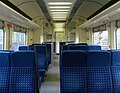
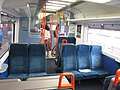
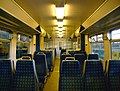
Hide and seek - BREL Mark 3
I could probably find many files in articles where the locations are a mystery - some are easy and some are not. Here are some more examples
150
-
 Slough?
 -
 Somewhere
 -
 This one is probably too difficult
 -
 Can I drive?


- File:FGW Class 150.JPG is definitely at Swindon; there's a sign reflected in the draughtscreen to the right of the pink grabpole. Another giveaway for Swindon is the platform canopy support: it's an original GWR cast-iron column with a concrete block formed around the base, using an oil drum as a mould, like these. They should look like this. --Redrose64 (talk) 20:21, 9 April 2013 (UTC)
- File:150233 C Half Internal.JPG is definitely not Slough - 150s don't operate there, or at least they didn't when the photo was taken. This is a 150/2 internal, they work the South West. It's not anywhere in Bristol, but you can see what looks like a fairly wide gap between the platforms, a modern shelter, and an old-style footbridge. I think Gloucester. By the looks of it (the black stripe and colour of the pavers), File:British Rail Class 150 driving cab.JPG is in platform 3 at Bristol Temple Meads. -mattbuck (Talk) 19:07, 9 April 2013 (UTC)
- You will have to take the timing with a pinch of salt. Judging by one of the Where am I? sections above, I'm not sure the date or time are correct either as many of these are taken by Peter Skuce. Simply south...... eating shoes for just 7 years 19:11, 9 April 2013 (UTC)
- File:150233 C Half Internal.JPG has an interesting red and black thing on the right edge of the frame - looks like a RES liveried DVT or GUV!! I don't think that's a footbridge, it looks more like a signal gantry to me. The corrugated panels on the left remind me of Bristol Parkway but that doens't match the other side of the tracks. Where else was rebuilt at about that time? Gloucester (Cheltenham end of the long platform looking back towards the station)? Geof Sheppard (talk) 13:11, 23 April 2013 (UTC)
- File:150233 C Half Internal.JPG is definitely not Slough - 150s don't operate there, or at least they didn't when the photo was taken. This is a 150/2 internal, they work the South West. It's not anywhere in Bristol, but you can see what looks like a fairly wide gap between the platforms, a modern shelter, and an old-style footbridge. I think Gloucester. By the looks of it (the black stripe and colour of the pavers), File:British Rail Class 150 driving cab.JPG is in platform 3 at Bristol Temple Meads. -mattbuck (Talk) 19:07, 9 April 2013 (UTC)
317
-
 Liverpool Street?
 -
 Liverpool Street?
 -
 Stansted Airport?
 -
 Stratford?
 -
 I think this one is impossible
 -
 Liverpool Street?
 -
 Welwyn Garden City?
 -
 Hitchin?
 -
 Cambridge?
 -
 Stratford?


- File:317340 D DTSO B Standard Class Interior.JPG is definitely not Stratford, since the signal number is K 267 - the signals at Stratford have L or S numbers. K suggests the King's Cross signalling area. --Redrose64 (talk) 18:18, 9 April 2013 (UTC)
- All of the images' locations in the surrounding sections were guesses although you can probably tell by the end I was giving up saying the same thing. Probably once there is consensus, I will update them all over at Commons. Simply south...... eating shoes for just 7 years 18:23, 9 April 2013 (UTC)
- K267 is Kings Cross Suburban platforms. Difficultly north (talk) - Simply south alt. 14:21, 24 April 2013 (UTC)
- All of the images' locations in the surrounding sections were guesses although you can probably tell by the end I was giving up saying the same thing. Probably once there is consensus, I will update them all over at Commons. Simply south...... eating shoes for just 7 years 18:23, 9 April 2013 (UTC)
319
-
 Cheddington?
 -
 St Albans?
 -
 Radlett?
 -
 St Pancras?
 -
 Bedford?
 -
 St Albans?
 -
 St Pancras?
 -
 Too hard to tell


- File:319003 DTSO Internal.JPG's St Pancras - there's a 222 alongside and there appears to be a high roof. File:319217 Standard Class Interior.JPG and File:319217 First Class Interior.JPG are going to be the same place most likely, since carriages are empty and they're close time-wise, but not sure it's Bedford - I don't remember wooden fences on island platforms there - so I guess Luton. I agree File:319427 B First Class Interior.JPG is St Pancras. The last one... unsure, but it looks to be some modern station north of London. I'd ask the author but he's notoriously uncommunicative and rude. -mattbuck (Talk) 19:02, 9 April 2013 (UTC)
321
-
 Too hard to tell
 -
 Too hard to tell
 -
 Too hard to tell
 -
 Too hard to tell
 -
 Too hard to tell
 -
 What is behind picture number 1?
 -
 Wow
Wow


File:V F CC 321404 TSO Internal.JPG will be on the East Coast Main, somewhere fairly south - by the look of it this is at a station being refurbished (scaffolding), and with two fast lines between platforms, which are on the outside of the lines. -mattbuck (Talk) 14:17, 23 April 2013 (UTC)
322 and 442
-
 Somewhere in London and the South East?
 -
 Zzzzzz


- The 322 is potentially identifiable, but I don't know the area enough. -mattbuck (Talk) 14:13, 23 April 2013 (UTC)
455
-
 Too hard to tell
 -
 South West Trains
 -
 And beavers and ducks and walnuts and Grandma


![[4]](http://mattbuck.irongalaxy.com/temp/IMGP1305.JPG)
![[6]](http://staticsplit.files.wordpress.com/2012/06/london-kingcross.jpg)
- 3rd image: 10 minutes later (by EXIF) the same photographer photographed the same unit at London Bridge File:455826 C London Bridge.JPG. Thryduulf (talk) 16:11, 9 April 2013 (UTC)
456

I hope this isn't too many. There are many more out there. Simply south...... eating shoes for just 7 years 15:13, 9 April 2013 (UTC)
- Welcome to my world. Remember to use Template:ukt when categorising on Commons! -mattbuck (Talk) 19:10, 9 April 2013 (UTC)
Prior quad tracking?
- Cross-posted from Talk:Sutton Park Line. An optimist on the run! 22:24, 24 April 2013 (UTC)
Living as I do in a property that overlooks part of this line, a recent bit of musing whilst looking out of the window led me to realise something I should have done many months ago, if not longer... the bridges around Walmley are "too wide"! The ones carrying Penns Lane, Eachelhurst Road and a couple of other minor routes have two double-track-width portals, vs others along the line (as shown by aerial views on Google Maps and similar) having only single portals. The line in each case runs only through the more northerly of the two. The aerial views, and indeed what I can see out of my window, suggest that at some point the ground was at least prepared for the laying of additional Permanent Way, although it either never happened, or it has been lifted a long time since.
This only seems to be the case for a certain distance either side of Penns station - by the time the line passes the nearby "water park" nature reserve to the southeast, or starts to pass through New Hall Valley to the northwest, it has definitely returned to being plain double-track - the embankments/cuttings, bridges etc are only wide enough for that and there's no sign it was ever different.
I guess, therefore, that given the line's mixed use, the station had some kind of passing loop arrangement - presumably the passenger trains travelled along the outermost rails (diverting two lines to the left from the double-track when heading north, or staying on the same line when heading south), and allowed freight trains to pass through the middle pair (diverted one left heading north, one right heading south)? Or even the freights stopped in the middle whilst faster, more easily stop-started passenger trains undertook them on the outside. The potential length of loop is long enough that a not-too-excessive freight train could fit within the diverge/merge points, and a local passenger service could even be overtaken by an express without having to particularly extend its waiting time at the station, but you couldn't realistically have one train in motion overtaking another.
That, or it's actually just ancient sidings, and they ended at buffers up-against the end of the platform in both cases.
Does anyone know what the true history of this piece of track would be in this regard? My only real recourse other than asking here is to go hunt out old maps (...or old low-altitude aerial photos?!) that _might_ show it (if they don't just show the tracks as a single thick black-and-white line that is). If nothing else, it'd make me a bit more grateful, next time some heavily loaded rake of aggregate wagons thunders past, literally making everything in the room shake even on the other side of the building, that they are at least not 10 metres closer still... 146.90.199.209 (talk) 18:38, 24 April 2013 (UTC)
- The 1937 1:2500 map at [7] shows that southeast of Eachelhurst Road, on the site of the Haunchwood Drive estate, there were sidings serving goods sheds and cattle pens. One of those sidings extended under the Eachelhurst Road bridge, but it appears there has only ever been two running lines and Penns station only ever had two platforms. Thryduulf (talk) 08:06, 25 April 2013 (UTC)
Class 12 or 08?

The Class 12 article states that there is only one surviving 12 (curiously with a number starting 15). I saw this shunter at Grosmont on the North Yorkshire Moors Railway - is it misnumbered? -mattbuck (Talk) 15:53, 28 April 2013 (UTC)
- It's a Class 11 with pre-TOPS numbering. NtheP (talk) 16:07, 28 April 2013 (UTC)
- (edit conflict) Almost certainly a bogus number. The class 12 locos were numbered 15211-36. Five-digit numbers beginning 12 fell into two groups: 12000-32 were ex-LMS locos; 12033-12138 were class 11, of which 12033-42 were ex-LMS 7120-9; 12043-68 were built by BR to LMS order; and 12069-12138 were built to BR order. The first batches of Class 08 were numbered 13000-13357 and 13362-6, and from 1957 these were altered by replacing the initial 1 with a D. --Redrose64 (talk) 16:16, 28 April 2013 (UTC)