
Wikipedia talk:WikiProject Ireland Collaboration/Archive 22
| This is an archive of past discussions. Do not edit the contents of this page. If you wish to start a new discussion or revive an old one, please do so on the current talk page. |
| Archive 15 | ← | Archive 20 | Archive 21 | Archive 22 | Archive 23 | Archive 24 | Archive 25 |
Proposal on in article use
I recall once that the WP:IMOS used to say something like the following:
- When referring to places and settlements in the Republic of Ireland in the introduction to articles (and in elements such as info boxes), use [[Republic of Ireland|Ireland]] not [[Ireland]] or [[Republic of Ireland]] e.g. Cork, Ireland.
I'd like that it be reinserted (I think it is common practice anyway). Additional, I'm proposing that the following be added.
- In other places prefer use of [[Republic of Ireland|Ireland]], except where the island of Ireland or Northern Ireland is being discussed in the same context or where confusion may arise. In such circumstances use [[Republic of Ireland]].
- An exception is where the state forms a major component of the topic (e.g. on articles relating the politics or governance) where [[Republic of Ireland|Ireland]] should be preferred and the island referred to as the island of Ireland, or similar.
- Regardless of the above guidelines, always use the official titles of state offices (e.g. President of Ireland).
--rannṗáirtí anaiṫnid (coṁrá) 20:29, 29 November 2009 (UTC)
- Problem. I do myself use "Ireland" in speech but I doubt the way that I speak would be even readable half of the time. Suggesting a guideline without stipulating use of "Republic" is hardly going to define use of that word and if it was all fine before, why does it not say that now? I have no problem using the word Republic. I see no suitable reason to be more or less proud of the republic than of the island. The term "Ireland" in the name of the state was a reference to the island. At no time has the state considered declaring the republic minus Northern Ireland to be Ireland. It doesn't make sense. They have done all they can peacefully to make the north a part of the state since the state was formed. That has not changed one iota even though some would twist things around to say it had. And for why? Because they do not have true experience of Ireland and find it unsettling, wish to shun it. That is not a great basis for a guideline even if concensus were for it which, when put to the naming vote, raises a doubt at least. Naming debate gets around 10 - 20 usual suspects making things up and argueing about what a judge said 40 years ago whereas voting on names gets a couple of hundred speaking loud and clear. We should respect the community both on Wikipedia, and in Ireland, north and south. I do not fear Northern Irish becoming more tolerant of their Irish heratige, I welcome it as would those who created this state in the spirit of the nation and even those in the British parliament who enacted that the whole island should be released together. To shun that, pit them at the post, that just isn't Wikipedias place. They wouldn't have done it 10 or 20 years ago, there is even less reason to do it now beside some feelings of alienation or foreign misunderstandings. We get Northern Irish around where I live all the time. When I lived in Belfast, there was folk from all over the island, especially attending the university, just like any other place. It's not for us to divide them or decide that they are divided. They are that all on their own. Even if the link gets piped, it is not for us to instruct people to do so. It is par with a move of political propaganda. That, at times, I do fear. I don't want to let go of my heritage just because you don't know me and besides, it is more problematic when people see "Ireland" beside that which is republic than when they see "republic". The "monarchy" at the creation of the state was not intended to be a royal house. Viva la Republic. ~ R.T.G 21:31, 29 November 2009 (UTC)
- Could you give examples of where it would be a problem. E.g.:
- "Cork (city) is a city in Ireland."
- "Ireland is divided politically between the Republic of Ireland and Northern Ireland..."
- "Ireland is a member state of the European Union."
- "Douglas Hyde was the first President of Ireland."
- I don't mean you to critique the above examples - you may of course! - but to give other examples that would be problematic. --rannṗáirtí anaiṫnid (coṁrá) 02:54, 30 November 2009 (UTC)
- Could you give examples of where it would be a problem. E.g.:
- Problem. I do myself use "Ireland" in speech but I doubt the way that I speak would be even readable half of the time. Suggesting a guideline without stipulating use of "Republic" is hardly going to define use of that word and if it was all fine before, why does it not say that now? I have no problem using the word Republic. I see no suitable reason to be more or less proud of the republic than of the island. The term "Ireland" in the name of the state was a reference to the island. At no time has the state considered declaring the republic minus Northern Ireland to be Ireland. It doesn't make sense. They have done all they can peacefully to make the north a part of the state since the state was formed. That has not changed one iota even though some would twist things around to say it had. And for why? Because they do not have true experience of Ireland and find it unsettling, wish to shun it. That is not a great basis for a guideline even if concensus were for it which, when put to the naming vote, raises a doubt at least. Naming debate gets around 10 - 20 usual suspects making things up and argueing about what a judge said 40 years ago whereas voting on names gets a couple of hundred speaking loud and clear. We should respect the community both on Wikipedia, and in Ireland, north and south. I do not fear Northern Irish becoming more tolerant of their Irish heratige, I welcome it as would those who created this state in the spirit of the nation and even those in the British parliament who enacted that the whole island should be released together. To shun that, pit them at the post, that just isn't Wikipedias place. They wouldn't have done it 10 or 20 years ago, there is even less reason to do it now beside some feelings of alienation or foreign misunderstandings. We get Northern Irish around where I live all the time. When I lived in Belfast, there was folk from all over the island, especially attending the university, just like any other place. It's not for us to divide them or decide that they are divided. They are that all on their own. Even if the link gets piped, it is not for us to instruct people to do so. It is par with a move of political propaganda. That, at times, I do fear. I don't want to let go of my heritage just because you don't know me and besides, it is more problematic when people see "Ireland" beside that which is republic than when they see "republic". The "monarchy" at the creation of the state was not intended to be a royal house. Viva la Republic. ~ R.T.G 21:31, 29 November 2009 (UTC)
- The state and statistics most notably, definably on those articles where the subject is pertaining to a part of the republic which has a respective counterpart in the north as that is the respect in which the north is. For those subjects such as state, if in the same book as Northern Ireland, redefining the name Ireland based on the value of the republic alone is improper.
- Some want the southern governments articles in particular to be strict with the application of Ireland with claims that that amounts to recognition for the state or its citizens. The states use of the name Ireland is historcally an unchanging reference to the island. Only a few years ago the north might as well have pledged a mutual allegiance to the south on the principle of their relationship. The troubles were all about that process and they *opened up* an official Gaeltacht a mile from Belfast center, amongst other things. It is obviously the north of something. If either state wanted out of that relationship permanently they would have made it clear. In my experience the issue of Ireland and Irish being in the northern states name has been of little concern to loyalists and unionists even though it has indirectly been addressed in politics many times. In fitting words, they would have bloodywell changed it long ago if that was the case. And what they are made of is just as good, and no different, as what anyone else is made of. The republics article does not mention a shamrock or a leprechaun and adding the particulars of citizenship raises a debate and edit war with those who would support that pipe link. How does that translate to recognition and neutrality? Confusion. Define the republic, in this instance, in relation to the north not in relation to itself. ~ R.T.G 05:23, 30 November 2009 (UTC)
- The piping disguise solution is used far too much and, in my view, more often than not leads to confusion. For example, we have RTÉ One being described as Ireland's oldest television channel (when, in fact, it is only the third-oldest - two stations in Northern Ireland being older). Is this not a case where "Republic of Ireland" should be used? Ditto, Scouting Ireland and presumably there are numerous other examples. We need a clearer definition of what is considered to be confusing. Mooretwin (talk) 10:35, 30 November 2009 (UTC)
- Some want the southern governments articles in particular to be strict with the application of Ireland with claims that that amounts to recognition for the state or its citizens. The states use of the name Ireland is historcally an unchanging reference to the island. Only a few years ago the north might as well have pledged a mutual allegiance to the south on the principle of their relationship. The troubles were all about that process and they *opened up* an official Gaeltacht a mile from Belfast center, amongst other things. It is obviously the north of something. If either state wanted out of that relationship permanently they would have made it clear. In my experience the issue of Ireland and Irish being in the northern states name has been of little concern to loyalists and unionists even though it has indirectly been addressed in politics many times. In fitting words, they would have bloodywell changed it long ago if that was the case. And what they are made of is just as good, and no different, as what anyone else is made of. The republics article does not mention a shamrock or a leprechaun and adding the particulars of citizenship raises a debate and edit war with those who would support that pipe link. How does that translate to recognition and neutrality? Confusion. Define the republic, in this instance, in relation to the north not in relation to itself. ~ R.T.G 05:23, 30 November 2009 (UTC)
- You have a point. I suggest that for the RTÉ One example, the line should be removed - if in doubt - rip it out - ClemMcGann (talk) 13:59, 30 November 2009 (UTC)
- Support R.A.'s proposal. BastunĖġáḍβáś₮ŭŃ! 15:21, 30 November 2009 (UTC)
- WTR the RTÉ example, the proposal is to use Republic of Ireland in such circumstances. --rannṗáirtí anaiṫnid (coṁrá) 00:38, 29 December 2009 (UTC)
Rockall
Well I ripped out Clem McGanns edit here [1]. Why should I have to hover over every mention of Ireland with my mouse to see if the the republic is there or not? Just because the north is in the political care of the UK does not make that place less Ireland or the south more so. I thought we were getting that somewheres the last few years? Yes Mooretwin has a point. The existence of the republic is more than acceptable, it is nessecary in many cases to show its existence and not to do so is an expression in almost every case of a point of view that the north would not be Ireland or that there would be no recognisable republic. I can't see what you mean by "WTR". The line was not "in doubt" it was just disagreed upon point of view. It is such common knowledge that a reference would not be required. Why would we delete lines like that? Because the north is in Ireland too and to show that we'd have to show "republic"? ~ R.T.G 05:30, 29 December 2009 (UTC)
- A revert for no good reason, other than to further undermine the credibility of Wikipedia.
- Rockall is disputed by Ireland, Iceland, Denmark and the UK. Ireland's claim is set out here [2] - note - the submission is by Ireland. Is RTG seriously suggesting that Rockall could possibly be disputed between Northern Ireland and the United Kingdom? ?? ClemMcGann (talk) 12:34, 29 December 2009 (UTC)
- I think RTG's point is that the state should be not be called Ireland. That is a valid perspective for numerous reasons but I think we have to balance it against other perspectives (namely that the state - for better or worse - is offically called Ireland and - again for better or worse - is commonly called so as well). --rannṗáirtí anaiṫnid (coṁrá) 13:20, 29 December 2009 (UTC)
- "Why should I have to hover over every mention of Ireland with my mouse to see if the the republic is there or not?" You should not. That is why the proposal is to use [[Republic of Ireland|Ireland]]: "...except where the island of Ireland or Northern Ireland is being discussed in the same context or where confusion may arise. In such circumstances use Republic of Ireland."
- RTÉ is not the oldest TV channel in Ireland. Therefore it would be confusing to say that it is the oldest TV channel in Ireland. The proposal is to use Republic of Ireland in such circumstances (i.e. "RTÉ is the oldest TV channel in the Republic of Ireland").
- WRT the Rockall example, the statement in that article relates to claims mades by states. There can be no confusion with the island of Ireland (even if the two "Irelands" were counterterminous). So "Ireland" is fine in that situation. (If the statement was about the proximity of Rockall to the two "Irelands" then it would be different case and the proposal would be to use "Republic of Ireland" and, maybe for more emphasis, "island of Ireland".) --rannṗáirtí anaiṫnid (coṁrá) 10:58, 29 December 2009 (UTC)
- The island of Ireland has no state. The island of Ireland bears the name Ireland. That is recognised internationally. I thought I asked about preventing people claiming that confusion has not arisen when terming the rpubic as "Ireland" but not a lot were interested in that. The situation without confusion described here has prerequisites to wit, that one should preconceive the notion of the state before reading an article which relies heavily on the pipe. I wish to be shown that a state is in the topic not top have to decide for myself even if people have already decided for me that it should be obvious. If I accepted Ireland to be the name of the island, this piping stuff does not sit obvious at all.
- @Scolaire, didn't you jump the gun with this edit summary? It is a similar gun-jump rush to go around piping everything. Ireland is okay and so is the republic. If only you would accept that. The state is not more significant than the land ever, not in this case anyway. The state is less significant if anything in this case. Why do you even need to debate it? Paring it down to your pleasure? Certainly. ~ R.T.G 14:45, 29 December 2009 (UTC)
- The Rockall article had used "Ireland" (piped) up to Christmas, when RoI was imposed along with "native name" - just how can an uninhabitable rock have a "native name"? - what "natives"? - ClemMcGann (talk) 16:43, 29 December 2009 (UTC)
- Indeed. And the proposal fits with that e.g. "Cork is the a city in Ireland. It is the second-largest city in the Republic of Ireland and the third-largest city on the island of Ireland."
- You are perfectly right to say that a reader should not have to rely on their wits to figure out whether it is the island or the state that is being referred to. We should be clear in our writing. At the same time we don't need to invent artificial concerns to fret over. If "Denmark" is in a dispute over the ownership of Rockall, we can award our readers the wit to determine that by "Denmark" we mean the European state, not the village in Iowa. Likewise, let's award our readers the modicum of wit to determine that by "Ireland" we also mean the European state, and not the landform in the Atlantic. --rannṗáirtí anaiṫnid (coṁrá) 16:45, 29 December 2009 (UTC)
- No I don't think that the difference between Ireland and Ireland even remotely equates the difference between Denmark and Danmark. There are a dozen Waterfords and Dublins around the world. This is about the same thing perceived differently not completely differing things by the same name. Why should we insist that people be referring to the state rather than the island, the main body of Ireland? Is the island of Ireland not recognised by Europe and further internationally? Of course it is. Is Denmark in America possible to view as confused with Danmark in Europe in more senses than its name? If not, the example has a very narrow application. An abstract. ~ R.T.G 17:08, 29 December 2009 (UTC)
- And the state, Ireland, is just as recognised (perhaps more so, wrt its jurisdiction). Specifically in the context of the UN Law of the Sea, it is only sovereign states that are relevant. Northern Ireland is not relevant in this context. Dismabiguation is not required. To include it is POV-pushing. --Red King (talk) 17:22, 29 December 2009 (UTC)
- Why can we assume our readers will have the common sense to discern one "Ireland" from the other in this case? Because it is impossible for 84,421km2 of soil to lodge a legal claim over ownership over 784m2 of rock. We need not worry whether our readers appreciate that the island of Ireland and the state that bears the same name are not counter-terminus. The important point is that an entity called Ireland claims to own a stone called Rockall. --rannṗáirtí anaiṫnid (coṁrá) 17:32, 29 December 2009 (UTC)
- If you were writing about the king of England, Edward, would you describe him as Edward? Why not? All I would have to do was hover over it with my mouse to find the not-at-first-apparent title which he won through sacrificed blood, most likely believed by him to been bestown with the authority of God himself which is the honorary tradition but hey, all that tradition and religion nonesense. Why don't we just ignore the republic and make sure it seems that Ireland is a place only south of the border, just as our hard line loyalism requires? Insisting that we inform people the difference between Ireland and the republic is only catering to republicans who are all evil terrorists against the peace anyway, right? Let's hang all the rebels and stick their heads on poles to remind people what the republic is and who the terrorists are. That's what they used to do up the road from where I live. Supporting natives and their republic is treason to the crown, that's what I always say. I may be native and happy to be in the republic mysef but hey, the UN wouldn't know what I was taling about and I am not about to let anyone tell them. All with me? Say "AYE!" ~ R.T.G 20:44, 29 December 2009 (UTC)
- No I don't think that the difference between Ireland and Ireland even remotely equates the difference between Denmark and Danmark. There are a dozen Waterfords and Dublins around the world. This is about the same thing perceived differently not completely differing things by the same name. Why should we insist that people be referring to the state rather than the island, the main body of Ireland? Is the island of Ireland not recognised by Europe and further internationally? Of course it is. Is Denmark in America possible to view as confused with Danmark in Europe in more senses than its name? If not, the example has a very narrow application. An abstract. ~ R.T.G 17:08, 29 December 2009 (UTC)
Home of the Irish Grand National steeplechase. It's practically dead in the water so I added some and put it into DYK but it might be a bit short. Must be a 5 day old article or increase 5 fold in characters of "prose" to go into DYK. It's definitely 4.5 x the size but regardless of that it was only about 4 or 5 sentences previously. ~ R.T.G 01:55, 30 November 2009 (UTC)
- RTG, I think you want Wikipedia talk:WikiProject Ireland for this. BastunĖġáḍβáś₮ŭŃ! 15:25, 30 November 2009 (UTC)
Floods
Move? See Talk:November 2009 Great Britain and Ireland floods#Requested move. Simply south (talk) 18:02, 30 November 2009 (UTC)
Politics in Ireland
At present, all entries for politics in Ireland or Irish politics redirect towards Politics of the Republic of Ireland. Is that biased or just the reflections of opinions on what fits the definition "Irish" the best? Well I am going to start writing a short article called Politics in Ireland. The first sentence will be, "In Ireland there are two states, Northern Ireland and the Republic of Ireland. " There are of course two main articles for this (NI ones a bit of whopper) so the basic element will be the Ireland where only one state existed and its relation to today and the multitude of branch articles we have from that topic. There is ample online material to put the basics in. Perhaps someone would like to collaborate as neutrality and validity issues may be raised. ~ R.T.G 22:54, 2 December 2009 (UTC)
- P.S. that first line was all I got before inviting so collaboration is wide open and I will go first myself. The title should be Politics of Ireland not Politics in Ireland, shouldn't it? ~ R.T.G 22:56, 2 December 2009 (UTC)
Undeclared societies undermining the integrity of Wikipedia
Hi, of course people have tried to undermine the integrity of Wikipedia and often they do that in groups. If Mr. Blue, Mr. Pink and Mr. Green did it we could say "The group of Mr. Blue, Mr. Pink and Mr. Green seem to be undermining the integrity of Wikipedia." and that could be a very constructive thing to say. In topics relating to this island it is often common to think of Blue, Pink and Green and say "The anarchists are trying to depose you all!" or some other undefined and undeclared group. I deleted an edit [3] which gave no conversation and bascally said, "No! That's a mafia! The mafia is everywhere!" and similar rubbish has ensued recently on the Dunmanway killings aerticle. These allusions do not bear on the content of an article in any way or are they worth considering in accusing editors of conduct, i.e. you accuse Blue, Pink and Green Mrs specifically of something or you accuse noone, certainly not some group you may have imagined. I do not care what ethnicity the "mafia" belonged with, the comment was not smart enough and gave equal credit to claiming, "Those inherently evil will be your downfall!" as it did to what facts are notable and correct for the encyclopaedia. I often say "Some people" when argueing a bit but I do not say "The negroes!" or "The anarchists!" and I should not be allowed to, end, stop. I have read plenty of comments like that in the last month. In future, when I am weighing a comment like, that I want to just delete it and if that person wants to re-weigh in respectably of Wikipedia let them do so. That is what a judge would do and most arguements involving these undeclared groups revolve around the adjudcation of content. In some slot machines coins are seperated by weight. Suggestion of persons unknown in any form whatsoever should weigh delete immediately. Persons which you are seeing but not naming should equally weigh in at = bin whole comment. I see this rarely on talkpages outside of the Ireland scope so it is relevant here. ~ R.T.G 16:40, 18 December 2009 (UTC)
- I went further with this and proposed a rough guideline to handle it without fuss. ~ R.T.G 19:26, 18 December 2009 (UTC)
Northern Ireland could not possibly be involved
Is it fair for us to suggest that Northern Ireland could not be involved in something to which it has been invited for a hundred years? I mean, do we assume that Northern Ireland no longer has a standing invitation to the republic. I think that this question has implication in piping and naming debates. Is the North invited to be part of Ireland or to be part ofthe republic? ~ R.T.G 17:15, 29 December 2009 (UTC)
Is the North invited to be part of Ireland or part of the republic? ~ R.T.G 20:45, 29 December 2009 (UTC)
British "imposition" of the Irish name and area
The trend is to suggest that the British imposed the term Republic. That has already been disputed but I want to point out something that has not for anyone who wants to comment on it. Those of British inclination would historically impose that Ireland be south of the border providing that there be an Ireland which six-county Ulster would not be in, republic or not. That is surely a continuing view of many. Is this not true? ~ R.T.G 17:20, 29 December 2009 (UTC)
Goals of the this project
The goals of the this project are being totally ignored . Should this project be renamed?
As I look at the discussion here. I don't see any bipartisan effort to improve collaboration on and coverage of Irish related matters both North and South I don't use any users coming together as per The aim of this project initially will be to bring editors from Wikipedia:WikiProject Ireland ,Wikipedia:WikiProject Northern Ireland, Wikipedia:WikiProject Irish Republicanism and Wikipedia:WikiProject Unionism together but I do see Currently editors with various viewpoints will often only interact in controversial discussions such as Requested moves and Article for discussion. This project will attempt to bring editors together at first on common uncontroversial matters.
nor do I see any of the following.
- To provide guidelines and recommendations toward a more hospitable editing environment for Ireland topics;
- To monitor and evaluate the tensions, battling and disruption over editing Ireland topics;
- Actively to seek the cooperation of people who are uninvolved or hold different POVs as specified under membership;
- To mobilize members (and like-minded users) to help this WikiProject, collaborate on low-tension articles, and intervene constructively on high-tension articles
- To prevent and resolve POV disputes, while ensuring that articles to convey a neutral and verifiable perspective.
User's here where meant to discuss and improve Sport in Ireland and Irish music like articles as a means to bridging the them V us sort of debates that occur over all wiki in relation to Irish articles. The project was intended to help editors view the people who disagree with them as fellow editors who are most likely attempting to improve and build this encyclopaedia.
Is anyone interested in this or should this project have it's goals removed and it title changed to Wikipedia:WikiProject Ireland Naming debate ? Gnevin (talk) 18:58, 10 February 2010 (UTC)
- Support Move to Wikipedia:WikiProject Ireland Naming debate. --rannṗáirtí anaiṫnid (coṁrá) 19:09, 10 February 2010 (UTC)
- I just see one user using 90% of the page to debate with himself... *shrug*. BastunĖġáḍβáś₮ŭŃ! 15:56, 11 February 2010 (UTC)
So the page is moved. That's good. Now, what about Template:IECOLL, Template:IECOLL-talk, Template:User WPIECOLL and Category:WikiProject Ireland Collaboration members? Is there any point in keeping those now that the debate seems to be over (or at least stopped)? Scolaire (talk) 15:58, 14 February 2010 (UTC)
- I just moved it back, as I don't see any consensus above for a highly-controversial move like this. Just because you don't see the above topics at the moment doesn't mean they shouldn't be discussed here.--SarekOfVulcan (talk) 16:06, 14 February 2010 (UTC)
- Yes, I do -- if I had seen the move suggestion before it was done, I would have chimed in. --SarekOfVulcan (talk) 16:11, 14 February 2010 (UTC)
- Because the goals, as originally stated, were valid, and I think there should continue to be a place for those kind of discussions. Now, if consensus of project members determines otherwise, that's fine, but that consensus hasn't been determined yet.--SarekOfVulcan (talk) 16:34, 14 February 2010 (UTC)
- Support Move to Wikipedia:WikiProject Ireland Naming debate. There was no interest shown in the original objects when the page was originally created, or at any time since. Scolaire (talk) 17:07, 14 February 2010 (UTC)
- I originally thought that this was a joke. Although I do agree that this project has been nothing but a platform for debate since Arbcom gave the order for all discussion over the naming of Ireland articles to be held here, moving the project's name to WikiProject Ireland Naming Debate is ridiculous. We should really keep it at the current name even if it is just to prevent confusion. Footyfanatic3000 (talk · contribs) 01:33, 15 February 2010 (UTC)
- I did mean it as a joke - but let's stop kidding ourselves: this project was set up to address the Ireland-naming issue, it has only ever addressed the Ireland-naming issue, and now that the Ireland-naming has been addressed there is nothing else that it is addressing. Duck?
- There are other areas of internecine disputes affecting Irish editors (and British editors). If there is a desire to use this venue to address those issues (in a positive way) then I'm all for it. -- RA (talk) 15:45, 15 February 2010 (UTC)
- Just a note of clarification this project was not set up to address the Ireland naming issue . It was inspired by Wikipedia:WikiProject Israel Palestine Collaboration and intend to meet the goals listed above. It soon became the venue for the naming discussion Gnevin (talk) 17:21, 15 February 2010 (UTC)
- That's may be what's written on the page ... but that's not what reality was. Of course it doesn't really matter if it was only about the naming issue. Really, the question is, "Now that the Ireland naming issue is over, is this project still useful to the community of should it be wound up?" Are there other issues peole want to address? Should we leave the project open in case it ever needs to be called upon again? -- RA (talk) 18:49, 15 February 2010 (UTC)
- Just a note of clarification this project was not set up to address the Ireland naming issue . It was inspired by Wikipedia:WikiProject Israel Palestine Collaboration and intend to meet the goals listed above. It soon became the venue for the naming discussion Gnevin (talk) 17:21, 15 February 2010 (UTC)
- There are other areas of internecine disputes affecting Irish editors (and British editors). If there is a desire to use this venue to address those issues (in a positive way) then I'm all for it. -- RA (talk) 15:45, 15 February 2010 (UTC)
Please provide an area with definitive and solid Ireland naming material, purpose built, complete and understandable that may be used reliably time and again in reference when such questions may come up (when you are old and gone for instance...). Please do not pretend that such material has been created, (or even believed in) here already. All we need to do is move it, the pile of sith, to some other page... balls. There are principles behind this project which take precedence over the naming debates even if nobody contributes to them while a lot of people want to debate naming. They are not the same thing, naming and collaboration, therefore their popularity and reasoning do not dictate each other i.e. move you self to name talk and leave other bit where finded? Is make taht sense you... .
There is clear calling here to move the naming debate to a perfectly suitable place. That is intelligent and wise probably. Deleting this project in the process would be an effective example of poor guidance.
I vote, in the spirit of this thread, that naming as a lesser topic of collaboration be banned from this project as a particularly virulent choking disease, even if that be at the expense of this project withering and not seeing an edit for the next ten years with exception only for announcements about votes or invitations to concensus building threads etc. This sort of measure is essential to any topic on any project where overshadowing occurs. Blocked arteries. I am not confused at all. Move the naming debate. Let alone the project it has been destroying. Good projects find interest eventually so long as nobody obscures and deletes them.
Bastun, all you are interested in on this page was getting a way on the naming issue, not with choosing a way. Debate black with white and dont grit your teeth. Now blow it out your hole. Did that work? There is only one month of edits on the page. ~ R.T.G 17:09, 15 February 2010 (UTC)
Result of the poll on Ireland article names
So what was the outcome of the Wikipedia:WikiProject Ireland Collaboration/Poll on Ireland article names? Is it published somewhere and why has the section Talk:Ireland#Poll on Ireland article names not been updated to reflect the outcome of the poll? Why is there not a similar section on the ROI talk page? -- PBS (talk) 10:52, 17 February 2010 (UTC)
- The outcome was to maintain the status quo until 2011. -- RA (talk) 11:46, 17 February 2010 (UTC)
- Eh, no. RA, you've been pushing this as an "outcome" for some time now. To clarify. The poll was part of an Arbcom sanctioned process to reach agreement on naming and usage. The process broke down and has not completed. No agreement was reached, and no Arbcom review has taken place. The poll is a partial result, although even that is disputed for various reasons. The poll could be legitimized by asking Arbcom to ratify the result, although I guess they would not do so and ask that the overall process is completed. --HighKing (talk) 11:55, 17 February 2010 (UTC)
- My recollection is that the outcome of the poll was clear and that consensus was reached on in-article naming. That has now been reflected at IMOS. In what way do you claim that the process was not completed? Mooretwin (talk) 12:01, 17 February 2010 (UTC)
- It has not been reflected an IMOS. RA commented out his addition until Arbcom clarified the situation. The poll was part of a process with potentially multiple decisions and potentially multiple polls. But the process has come off the rails, and many of the editors involved may have voted differently if they had been told it was a stand-alone poll (like the 20 or 30 we'd had previously) rather than a more holistic process to deal with the overall issue. Until and unless Arbcom rules that the poll result should now be treated as a stand-alone result as a reflection of the community consensus, it is merely one step that was (very nearly) completed in a multi-step process that has now been aborted. --HighKing (talk) 12:33, 17 February 2010 (UTC)
- Should somebody not ask ArbCom what the situation is? Scolaire (talk) 12:15, 17 February 2010 (UTC)
- I asked Masem, but I think he is ignoring it. I don't blame him. But yes, ArbCom need to officially close this. -- RA (talk) 12:44, 17 February 2010 (UTC)
- The new IMOS has not been struck out. Mooretwin (talk) 13:34, 17 February 2010 (UTC)
- Per a request from HK, I commented out a part of it. See the wikicode of the relevant section. -- RA (talk) 13:51, 17 February 2010 (UTC)
- The "new" IMOS is simply the same as the "old" IMOS, without mentioning the process or the poll. But it doesn't lock it down till 2011 (although I suspect nobody will take up this issue until then anyway). There's a difference between "Arbcom ratified result with lockdown" and apathy, etc. BTW, glad to see you're back editing. --HighKing (talk) 14:32, 17 February 2010 (UTC)
- Thanks. My recollection of the "old" IMOS was that it just stated possible ways to deal with in-article naming, but didn't actually give any guidance as to when one option was more appropriate than another. My recollection is that RA edited it to the current version after consensus had been established at IECOLL. Mooretwin (talk) 16:09, 17 February 2010 (UTC)
- The "new" IMOS is simply the same as the "old" IMOS, without mentioning the process or the poll. But it doesn't lock it down till 2011 (although I suspect nobody will take up this issue until then anyway). There's a difference between "Arbcom ratified result with lockdown" and apathy, etc. BTW, glad to see you're back editing. --HighKing (talk) 14:32, 17 February 2010 (UTC)
- Per a request from HK, I commented out a part of it. See the wikicode of the relevant section. -- RA (talk) 13:51, 17 February 2010 (UTC)
- The new IMOS has not been struck out. Mooretwin (talk) 13:34, 17 February 2010 (UTC)
- I asked Masem, but I think he is ignoring it. I don't blame him. But yes, ArbCom need to officially close this. -- RA (talk) 12:44, 17 February 2010 (UTC)
- Should somebody not ask ArbCom what the situation is? Scolaire (talk) 12:15, 17 February 2010 (UTC)
- It has not been reflected an IMOS. RA commented out his addition until Arbcom clarified the situation. The poll was part of a process with potentially multiple decisions and potentially multiple polls. But the process has come off the rails, and many of the editors involved may have voted differently if they had been told it was a stand-alone poll (like the 20 or 30 we'd had previously) rather than a more holistic process to deal with the overall issue. Until and unless Arbcom rules that the poll result should now be treated as a stand-alone result as a reflection of the community consensus, it is merely one step that was (very nearly) completed in a multi-step process that has now been aborted. --HighKing (talk) 12:33, 17 February 2010 (UTC)
- My recollection is that the outcome of the poll was clear and that consensus was reached on in-article naming. That has now been reflected at IMOS. In what way do you claim that the process was not completed? Mooretwin (talk) 12:01, 17 February 2010 (UTC)
- Eh, no. RA, you've been pushing this as an "outcome" for some time now. To clarify. The poll was part of an Arbcom sanctioned process to reach agreement on naming and usage. The process broke down and has not completed. No agreement was reached, and no Arbcom review has taken place. The poll is a partial result, although even that is disputed for various reasons. The poll could be legitimized by asking Arbcom to ratify the result, although I guess they would not do so and ask that the overall process is completed. --HighKing (talk) 11:55, 17 February 2010 (UTC)
The poll was conducted under a mysterious system (to those used to first past the post contests), so is there agreement of what was the numerical outcome of that poll. I am not asking if it was legitimate just did option "F" come first, or did some other option come first? Second what is IMOS and is there a link to that page? -- PBS (talk) — Preceding undated comment added 03:47, 18 February 2010
- Yes, Masem officially signed off on "F" as the result of the poll. IMOS is Wikipedia:Manual of Style (Ireland-related articles). --Scolaire (talk) 07:20, 18 February 2010 (UTC)
- Thanks. It took me a bit of searching Bastun cosed the poll on 13 September 2009 and Masem protected the page a minute later. I presume that this Wikipedia talk:WikiProject Ireland Collaboration/Poll on Ireland article names#Confirmation of vote result is the sign off by User:Masem. -- PBS (talk) 21:39, 18 February 2010 (UTC)
- Looking at Confirmation of vote result and various comments since (this section and Wikipedia:Arbitration/Requests/Clarification#Request for clarification: Ireland article names) it seems to me that the only user account to still question the outcome of the process is HighKing. Is there anyone else who still questions the validity of a two year moratorium on moving those pages? If not can we agree there is a consensus, add note to the top of the talk pages of the two articles to indicate the outcome, and move on? I suggest HighKing that you let others comment if they support your position and if not accept (grudgingly or graciously) that there is a consensus to accept that there is a two year moratorium on moving the two articles. -- PBS (talk) 21:39, 18 February 2010 (UTC)
- Hi Philip - I like things to be fair and accurate. I've no problem accepting something I don't agree with if that is the consensus. Many of the editors who would agree (and weren't passers-by) have withdrawn from the process. I've officially withdrawn myself. But it's wrong to try to legitimize something, as a stand-alone result, when the process was derailed. The poll was never intended as stand-alone, so to now shoe-horn it as a stand-alone result smacks of exactly the type of majority-based bulldozing that started this entire process off in the first place. If you want to see if there's consensus, then I suggest that you quickly send a notice to everyone that voted. I'm 100% sure you'll get consensus (just like all the other times we voted on just the naming issue). But you see, this was never *just* about the naming issue, it was about the wider Ireland/Republic of Ireland issues, and Arbcom asked us to collaborate to reach a wide-reaching agreement. That never happened. It's sad that some editors here have effectively hijacked this partial step to make it look like a stand-alone vote, just as a means to lock in the status quo (and avoid collaborating) for a number of years. All that this poll has done is confirmed (and proved) that British editors have imposed their majority numbers on a naming issue. The stats back that up. Locking it down in this way is not a good thing. --HighKing (talk) 22:24, 18 February 2010 (UTC)
- I don't believe everyone else see it the way you do, HighKing. I interpreted the vote to be a consensus based, valid and binding way or determining the article names prior to, but independent of, subsequent discussions on in article usage. Now, I agree that it is unfortunate that those subsequent discussions did not really occur and I would argue those are still possible. However part of the reason those discussions never took place was because a small groups of editors vocally objected to the poll (ostensibly because, in retrospect, it did not give them the result they hoped for) and thus withdrew from the process. For some of those same editors to claim because the process is dead, therefore the poll is invalid, is a little disingenuous. We can still resolve the subsequent issues if there are editors willing to engage, but that means accepting the consensus at the point of withdrawal and moving forward in good faith. Rockpocket 22:47, 18 February 2010 (UTC)
- If you can show me where it was agreed that the poll was independent, I'll immediately agree to it as consensus of a standalone vote, fully binding, etc. Actually, while you're at it, try and find where it was agreed to separate the vote from other issues too. If you check the archives, pay special attention to Masem's last attempt at a comprehensive and inclusive poll, and the sudden turnabout into a single-issue vote on the name. --HighKing (talk) 13:34, 19 February 2010 (UTC)
- I didn't say that it was explicitly agreed, I said that was how I interpreted the vote. Lets consider the alternative: can you show me where it was agreed that the result of the vote was to be considered valid only after certain other issues were resolved. If you can then perhaps my interpretation was incorrect, if you can't we are left with different interpretations. Which is fine, but doesn't make either of us right or wrong. Rockpocket 18:41, 19 February 2010 (UTC)
- If you can show me where it was agreed that the poll was independent, I'll immediately agree to it as consensus of a standalone vote, fully binding, etc. Actually, while you're at it, try and find where it was agreed to separate the vote from other issues too. If you check the archives, pay special attention to Masem's last attempt at a comprehensive and inclusive poll, and the sudden turnabout into a single-issue vote on the name. --HighKing (talk) 13:34, 19 February 2010 (UTC)
- "All that this poll has done is confirmed (and proved) that British editors have imposed their majority numbers on a naming issue." Completely incorrect. Both RA's and Valenciano's tallies showed that F was the favoured option for Irish, British and 'other' voters. Only Sarah's tally, using a very skewed methodology, showed otherwise. RA, myself, and some others did indeed try to get consensus afterwards on the other issues. BastunĖġáḍβáś₮ŭŃ! 23:10, 18 February 2010 (UTC)
- Wrong. And I've pointed this out to you twice before now. You keep trotting out RA and Valenciano's tallies as if they were complete and correct. Neither are. One used a subset of voters and the other failed to use STV. I emailed you the analysis last September, and I reran an STV using both OpenSTV and ScottishSTV methods. I'll repost the results (I already posted these here last September).
- All - Winner F, (2nd E) (5th count)
- British only - Winner F (1st count :-)
- Irish only - Winner C (5th count)
- Exclude Irish Votes only - Winner F (3rd count)
- Exclude British Votes only - Winner E (5th count)
- Exclude British and Irish votes - Winner E (5th count)
- For what it's worth - but it seems to me that any combination of excluding British vote results in a different outcome. Excluding Irish votes doesn't change it. This is partly because when we trend the votes we see that 62% of British voters voted for F, while only 33% of Irish, but 39% of others. Also, 35% of voters were British compared with 17% Irish. So I'll stand by what I originally stated - British majority numbers have skewed the result... --HighKing (talk) 13:34, 19 February 2010 (UTC)
- HighKing, you are a lonely voice crying in the wilderness. As I suggested why not let others who disagree that there is a consensus speak up, if they don't then their silence can be taken as consent, and as well over 100 people participated in the poll your voice is not enough to undermine the consensus. -- PBS (talk) 01:56, 19 February 2010 (UTC)
- Don't you mean "lone"? Unless you heard me singing "ronery, I so ronery" in the shower this morning? Let's see, Masem hand-checked the result and announced 239 votes cast, yet failed to spot the vote tamplering, and has since failed to make an announcement of a result including illegally removed votes. Additionally, check back on the discussions had after the poll. The poll was not binding, but rather an indicative poll that the community could decide to adopt (i.e. as part of the process). The process has gone off the rails. Trying to ressurect the poll at this stage, when most of the editors aren't even paying attention, is wrong. Even the discussions held after the result was announced show that many editors were waiting for the process to draw to a close, and even Bastun calls on Masem to "steer things to a conclusion". --HighKing (talk) 13:34, 19 February 2010 (UTC)
- You tried playing the "illegally removed votes" card at the time. Then, as now, few people agreed with your desire to let sockpuppets influence the result. These included Masem, the moderator, who ruled that the votes had been legitimately removed. Valenciano (talk) 14:14, 19 February 2010 (UTC)
- Wrong again. Masem acknowledged one vote which was illegally removed and it appears to have been restored, but doesn't form part of the announced result. You're probably referring to the illegally removed vote for sock reasons, which Masem supported. That's a different issue, but I'm glad you brought it up. Funny how a vote was removed before the editor even socked. The rules was to prevent fraud. It's pretty clear that no fraud was perpetuated, yet the vote was removed. Illegally. --HighKing (talk) 14:33, 19 February 2010 (UTC)
- You tried playing the "illegally removed votes" card at the time. Then, as now, few people agreed with your desire to let sockpuppets influence the result. These included Masem, the moderator, who ruled that the votes had been legitimately removed. Valenciano (talk) 14:14, 19 February 2010 (UTC)
- Don't you mean "lone"? Unless you heard me singing "ronery, I so ronery" in the shower this morning? Let's see, Masem hand-checked the result and announced 239 votes cast, yet failed to spot the vote tamplering, and has since failed to make an announcement of a result including illegally removed votes. Additionally, check back on the discussions had after the poll. The poll was not binding, but rather an indicative poll that the community could decide to adopt (i.e. as part of the process). The process has gone off the rails. Trying to ressurect the poll at this stage, when most of the editors aren't even paying attention, is wrong. Even the discussions held after the result was announced show that many editors were waiting for the process to draw to a close, and even Bastun calls on Masem to "steer things to a conclusion". --HighKing (talk) 13:34, 19 February 2010 (UTC)
- Wrong. And I've pointed this out to you twice before now. You keep trotting out RA and Valenciano's tallies as if they were complete and correct. Neither are. One used a subset of voters and the other failed to use STV. I emailed you the analysis last September, and I reran an STV using both OpenSTV and ScottishSTV methods. I'll repost the results (I already posted these here last September).
- I don't believe everyone else see it the way you do, HighKing. I interpreted the vote to be a consensus based, valid and binding way or determining the article names prior to, but independent of, subsequent discussions on in article usage. Now, I agree that it is unfortunate that those subsequent discussions did not really occur and I would argue those are still possible. However part of the reason those discussions never took place was because a small groups of editors vocally objected to the poll (ostensibly because, in retrospect, it did not give them the result they hoped for) and thus withdrew from the process. For some of those same editors to claim because the process is dead, therefore the poll is invalid, is a little disingenuous. We can still resolve the subsequent issues if there are editors willing to engage, but that means accepting the consensus at the point of withdrawal and moving forward in good faith. Rockpocket 22:47, 18 February 2010 (UTC)
- Hi Philip - I like things to be fair and accurate. I've no problem accepting something I don't agree with if that is the consensus. Many of the editors who would agree (and weren't passers-by) have withdrawn from the process. I've officially withdrawn myself. But it's wrong to try to legitimize something, as a stand-alone result, when the process was derailed. The poll was never intended as stand-alone, so to now shoe-horn it as a stand-alone result smacks of exactly the type of majority-based bulldozing that started this entire process off in the first place. If you want to see if there's consensus, then I suggest that you quickly send a notice to everyone that voted. I'm 100% sure you'll get consensus (just like all the other times we voted on just the naming issue). But you see, this was never *just* about the naming issue, it was about the wider Ireland/Republic of Ireland issues, and Arbcom asked us to collaborate to reach a wide-reaching agreement. That never happened. It's sad that some editors here have effectively hijacked this partial step to make it look like a stand-alone vote, just as a means to lock in the status quo (and avoid collaborating) for a number of years. All that this poll has done is confirmed (and proved) that British editors have imposed their majority numbers on a naming issue. The stats back that up. Locking it down in this way is not a good thing. --HighKing (talk) 22:24, 18 February 2010 (UTC)
- Looking at Confirmation of vote result and various comments since (this section and Wikipedia:Arbitration/Requests/Clarification#Request for clarification: Ireland article names) it seems to me that the only user account to still question the outcome of the process is HighKing. Is there anyone else who still questions the validity of a two year moratorium on moving those pages? If not can we agree there is a consensus, add note to the top of the talk pages of the two articles to indicate the outcome, and move on? I suggest HighKing that you let others comment if they support your position and if not accept (grudgingly or graciously) that there is a consensus to accept that there is a two year moratorium on moving the two articles. -- PBS (talk) 21:39, 18 February 2010 (UTC)
- Thanks. It took me a bit of searching Bastun cosed the poll on 13 September 2009 and Masem protected the page a minute later. I presume that this Wikipedia talk:WikiProject Ireland Collaboration/Poll on Ireland article names#Confirmation of vote result is the sign off by User:Masem. -- PBS (talk) 21:39, 18 February 2010 (UTC)
- @HighKing - yes, we've disagreed before on the interpretation of the tallies. RA's tally [[4]], of Irish voters only, admittedly only goes up to 8th August, but shows F was the preferred option of Irish voters, not C. A quick scan shows four more obvious Irish votes, most of whom also have F as a first preference. I can't locate Valenciano's tally at the moment - Valenciano, could you post a link, please? BastunĖġáḍβáś₮ŭŃ! 14:43, 19 February 2010 (UTC)
- Bastun, why are you happy to use a tally to interpret one part of the results, when the vote itself was held using STV? Nothing to do with the fact that using STV on the subsets shows a completely different results I'm sure, but tallies only take into account first prefs, and is therefore useless as far as this exercise is concerned. Anyway, I reposted the results of the STV run above. --HighKing (talk) 15:43, 19 February 2010 (UTC)
- I'm actually doing the same as you are. You say above counting only Irish votes (presumably you are talking about votes counted under STV? You would have included this in our email discussion but I can't access it now) that C wins. Using STV - not only counting first prefs, as you state above, but going all the way down the "ballot paper" - RA's page which I linked above actually shows that F wins. BastunĖġáḍβáś₮ŭŃ! 15:53, 19 February 2010 (UTC)
- Sure. I'm using STV. But RA uses IRV - a different method (btw, your link above is broken). And he ran his count before the poll closed and only counted 32 as Irish - by my reckoning there's 42 Irish. Odd. Why didn't RA use STV?
- But I'm more curious as to why this is all being reopened again? We've stability now - who knows how long it'll last - and there hasn't been a peep out of the more vociferous anti-RoI editors for a while. I believe we should just let sleeping dogs lie. Or was someone just getting bored? --HighKing (talk) 19:23, 19 February 2010 (UTC)
- I'm actually doing the same as you are. You say above counting only Irish votes (presumably you are talking about votes counted under STV? You would have included this in our email discussion but I can't access it now) that C wins. Using STV - not only counting first prefs, as you state above, but going all the way down the "ballot paper" - RA's page which I linked above actually shows that F wins. BastunĖġáḍβáś₮ŭŃ! 15:53, 19 February 2010 (UTC)
- Bastun, why are you happy to use a tally to interpret one part of the results, when the vote itself was held using STV? Nothing to do with the fact that using STV on the subsets shows a completely different results I'm sure, but tallies only take into account first prefs, and is therefore useless as far as this exercise is concerned. Anyway, I reposted the results of the STV run above. --HighKing (talk) 15:43, 19 February 2010 (UTC)
- @HighKing - yes, we've disagreed before on the interpretation of the tallies. RA's tally [[4]], of Irish voters only, admittedly only goes up to 8th August, but shows F was the preferred option of Irish voters, not C. A quick scan shows four more obvious Irish votes, most of whom also have F as a first preference. I can't locate Valenciano's tally at the moment - Valenciano, could you post a link, please? BastunĖġáḍβáś₮ŭŃ! 14:43, 19 February 2010 (UTC)
- "Why didn't RA use STV?" IRV is STV with a single 'winner'. See the terminology sections of the relevant articles: IRV, STV.
- Like HK says, let's let sleeping dogs lie. There's nothing to be gained by raking over the coals and an encyclopedia that won't write itself. -- RA (talk) 20:10, 19 February 2010 (UTC)
- HighKing it is only sleeping dogs for those who are aware of the discussions after the poll. For those who are not -- including new editors. The template in the section Talk:Ireland#Poll on Ireland article names needs updating and a similar message needs to be placed on the talk page of the ROI article. As as the consensus is that the outcome of the poll is binding, it should show that for two years (from the closure of the poll?) the pages should not be moved. -- PBS (talk) 22:04, 19 February 2010 (UTC)
- Unless HighKing is right and it's not formally closed yet, in which case they will be locked until two years after he allows it to be closed (Summer 2012?). Scolaire (talk) 22:17, 19 February 2010 (UTC)
- It's nothing to do with me, it's to do with the (allegedly) transparent and open collaborative process that we embarked on. Changing the rules halfway through is wrong. If I've erred, I'm sure someone will point it out. In the meantime, if some editors are keen to kick this off again, perhaps it's best, I don't know. All I do know is that a lot of editors are pretty weary and it doesn't help when some are trying to declare victory for what can only be described as a very sad uncollaborative journey. I'm hopeful that some silver linings can be found, but perhaps it's too early still. --HighKing (talk) 00:00, 20 February 2010 (UTC)
- Unless HighKing is right and it's not formally closed yet, in which case they will be locked until two years after he allows it to be closed (Summer 2012?). Scolaire (talk) 22:17, 19 February 2010 (UTC)
<--No one is declaring victory. What is suggested is that a moratorium on moving the pages is agreed for two years based on the poll outcome. AFAICT the notification for the poll was placed on the talk page of the Ireland article on 2 August 2009 by Evertype and had not been substantially altered since. of The notification said:
| A poll has been set up at Wikipedia:WikiProject_Ireland_Collaboration/Poll on Ireland article names. This is a formal vote regarding the naming of the Ireland and Republic of Ireland and possibly the Ireland (disambiguation) pages. The result of this poll will be binding on the affected article names for a period of two years. This poll arose from the Ireland article names case at the Arbitration Committee and the Ireland Collaboration Project. The order that the choices appear in the list has been generated randomly. Voting will end at 21:00 (UTC) of the evening of 13 September 2009 (that is 22:00 IST and BST). |
HighKing did you during the month of August 2009 complain about the wording? Specifically the part that said "The result of this poll will be binding on the affected article names for a period of two years"? --PBS (talk) 13:06, 20 February 2010 (UTC)
Also at the start of the Poll there was the sentence "As there is a stalemate in achieving consensus on the issue, it has been decided to use the results of a poll of all Wikipedia editors to resolve the matter." Did you, HighKing, object to that sentence before you cast a vote in the Poll? -- PBS (talk) 13:06, 20 February 2010 (UTC)
- I think you really have to look at the build-up to truly get an idea of why there appears to be division in understanding of what was going on. I would also suggest that you quit trying to personalize this issue. I'm merely pointing out something extremely simple:
- The poll was never a stand-alone poll, it was part of a process
- The process has not completed, therefore the poll result is not valid
- Chasing through the history of this issue, people seem to readily forget that in the past, we had loads of polls on moving the article name. This eventually resulted in Matt Lewis making one of the first comprehensive package proposals in August 2008. It got people talking. It eventually led to a few more move requests, and in December 2008, a move request was withdrawn based on initial discussions of a compromise package initiated by Mooretwin. On 4th Jan 2009, Arbcom issued a ruling. Please note, very carefully, the ruling from Arbcom where it states The community is asked to open a new discussion for the purpose of obtaining agreement on a mechanism for assessing the consensus or majority view on the appropriate names for Ireland and related articles.. Note the "and related articles" piece. Note that the ruling specifically named and wikilinked is Ireland (and not Republic of Ireland).
- Key point. From Jan 2009 we were talking about a comprehensive solution involving the names of many articles, and also how to use the name within articles. We sometimes referred to the Mooretwin proposal, which was also a comprehensive package.
- In Dec 2008 - Jan 2009, a task force was set up and discussions started here were eventually moved to the Wikiproject page. Note the multiple article solution.
- In December, an appear for an all-encompassing solution was made (and agreed!)
- As a matter of interest, Support or Conditional Support was agreed by Mooretwin, MickMacNee, Evertype, Roadnote, Narson, Xenu, Sillyfolkboy, GoodDay, HighKing, Blue-Haired Lawyer, Cameron, Scolaire, Traditional Unionist, Sarah777, Mais oui, Hohenloh, Angus McLellan, Nuclare, PurpleA, Rockpocket, TheChrisD, ClemMcGann, Redking7, Guliolopez
- Oppose: Djegan, T*85, TheChrisD, Boothy443, Kittybrewster, MartinRe. That's 24 support, 6 against.
- A vote was proposed around Feb/March 2009 - note it was multiple articles, etc.
- We reiterated and it was clarified in March 2009 what exactly the scope of the "process" was. We're told that we have to go with the Arbcom decision, which is appropriate names for Ireland and related articles.
- Here's a reminder on what we were looking at in March 2009
- In April (for example), we're still seeing proposals on multiple articles - the comprehensive solution we've been told to collaboratively find.
- In April, User:PhilKnight analyses and summarizes progress here. He states At first sight, we can deduce that the following options have too much opposition: Ireland as state and Ireland as island AND state (basically a merge). Further, the option Republic of Ireland is a tie and cannot be considered as having consensus.
- In June, we started to see the first proposals. Masem suggested a 3 question poll and again, please note we're *still*, in June, discussing a comprehensive multi-point solution.
- Even RA's first mention of a poll/vote along the lines of Danzig/Gdansk is made here - is dealing with multiple articles
- So that is what we agreed to do. If you read in detail, you'll note that for many, a renaming of the RoI article was pretty much agreed and a cornerstone of the collaboration. It's included in the summaries posted by Arbcom members, and in nearly all of the agreements and polls till June. But we had trouble with the wording of the bigger comprehensive package, so for simplicity it was split up into smaller packages. So to now try to state that we agreed to have a binding one-issue poll is rubbish and ludricious. And the reason why the process failed as it has (and was pointed out to Masem) is that voting on each issue, one at a time, give no incentive to compromise since there's no way to guarantee that whoever compromises on the first issue can expect some compromises on subsequent issues.
- So I stand by what I've said all along, and I really wish people would recapture the spirit of compromise that existed back in Jan 2009. --HighKing (talk) 23:16, 21 February 2010 (UTC)
- I think you really have to look at the build-up to truly get an idea of why there appears to be division in understanding of what was going on. I would also suggest that you quit trying to personalize this issue. I'm merely pointing out something extremely simple:
- Thank you for that very long answer, but you did not answer my questions:
- did you during the month of August 2009 complain about the wording [of the template]? Specifically the part that said "The result of this poll will be binding on the affected article names for a period of two years"?
- Did you object to the sentence at the start of the poll that stated "As there is a stalemate in achieving consensus on the issue, it has been decided to use the results of a poll of all Wikipedia editors to resolve the matter." before you cast a vote in the Poll?
- -PBS (talk) 01:59, 22 February 2010 (UTC)
- You could equally ask if I agreed to the wording of the template, or if it was ever put up for agreement, or what the process for agreeing the wording of the template, or agreeing to the wording of the start of the poll. If you're just on a simplistic point scoring agenda, you could have stated up front and saved me a couple of hours of compiling the response above. I thought you wanted to understand why I maintain the position that the results of the poll don't meet the Arbcom request, and cannot be seen as binding in a stand-alone manner. --HighKing (talk) 02:37, 22 February 2010 (UTC)
- I am not trying to score points, but I don't understand why you are complaining about the wording now, if you did not complain about it at the time it was written. I think it is clear and if you did not the you should have complained before you participated in the Poll. --PBS (talk) 05:16, 22 February 2010 (UTC)
- I do think that the current template is misleading for editors new to this issue, and for those who like me participated in the poll on the understanding of what was written at the start of the poll would be binding, and I think the [ template on talk Ireland should be updated to reflect the consensus view. -- PBS (talk) 05:16, 22 February 2010 (UTC)
- It seems you simply don't want to hear the uncomfortable truth, and you're happy to ignore the history of the project and the instructions of Arbcom. The wording of the poll - in the context of the overall process - is fine. So long as you understand it in the overall context of the entire process. The wording as a standalone poll is incorrect and inaccurate. That is why I have illustrated the history of this issue above - the wording should be understood in that context only. --HighKing (talk) 14:10, 22 February 2010 (UTC)
- You could equally ask if I agreed to the wording of the template, or if it was ever put up for agreement, or what the process for agreeing the wording of the template, or agreeing to the wording of the start of the poll. If you're just on a simplistic point scoring agenda, you could have stated up front and saved me a couple of hours of compiling the response above. I thought you wanted to understand why I maintain the position that the results of the poll don't meet the Arbcom request, and cannot be seen as binding in a stand-alone manner. --HighKing (talk) 02:37, 22 February 2010 (UTC)
- Thank you for that very long answer, but you did not answer my questions:
- HighKing, I take you continued stonewalling as a no, you did not object to the wording at the time you expressed an opinion in the Poll. If my take on that is wrong, then please indicate with a link to the relevant passage.
- It is your opinion about the validity of the process not "an uncomfortable truth". No one in this section has supported you and to date neither has any member of the Arbcom (see here).
- You can not have it both ways either the wording was not suitable for those who arrived from elsewhere to participate in the the Poll and only read Poll's header statement and the presentations linked to the Poll, in which case you should have voiced those opinions at the time (you had a perfect opportunity when writing your statement which is included by a link in the Poll). No editor should have to read the yards of text about the setting up of a poll to divine a meaning that was not clearly expressed in the introduction to the Poll and in the box linking the Poll to Talk:Ireland. If in your opinion that were true, then the Poll was flawed from the start and you should have said so at the time and not participated in it or participated with a statement qualifying you support. In my opinion that you did not do so at the time, holes your subsequent arguments below the waterline. You are in a very small minority on this issue and given the comment by User:Shell Kinney in the current Arbcome request for comments, consider if you really want to continue to oppose what appears to be the general consensus. -- PBS (talk) 23:18, 22 February 2010 (UTC)
- If you wish to call pointing out an uncomfortable truth as "stonewalling", suit yourself. Just a pity you don't wish to understand the validity and factual nature of my points from a procedural point of view, and instead want to get a wee kick out of scoring points. At the time when the wording was chosen, I (and many other editors) was away from Wikipedia for an extended period. I also preferred to believe that we were working collaboratively towards a workable solution and the exact wording of templates and such like were done quickly and not much attention paid to them. Kinda why the process has failed. If more people took less interest in point scoring, we might have made more progress. --HighKing (talk) 11:42, 23 February 2010 (UTC)
- You can not have it both ways either the wording was not suitable for those who arrived from elsewhere to participate in the the Poll and only read Poll's header statement and the presentations linked to the Poll, in which case you should have voiced those opinions at the time (you had a perfect opportunity when writing your statement which is included by a link in the Poll). No editor should have to read the yards of text about the setting up of a poll to divine a meaning that was not clearly expressed in the introduction to the Poll and in the box linking the Poll to Talk:Ireland. If in your opinion that were true, then the Poll was flawed from the start and you should have said so at the time and not participated in it or participated with a statement qualifying you support. In my opinion that you did not do so at the time, holes your subsequent arguments below the waterline. You are in a very small minority on this issue and given the comment by User:Shell Kinney in the current Arbcome request for comments, consider if you really want to continue to oppose what appears to be the general consensus. -- PBS (talk) 23:18, 22 February 2010 (UTC)
It seemhs to me that the template in the section Talk:Ireland#Poll on Ireland article names should be updated to reflect the decision by the ArbCom (Wikipedia:Arbitration/Requests/Clarification#Request for clarification: Ireland article names) and that once updated it should be copied onto talk:Republic of Ireland -- PBS (talk) 01:39, 5 March 2010 (UTC)
Request for Clarification with ArbCom
I have opened a request for clarification regarding the Ireland naming process at ArbCom. If affirmed it will mean that this process will be complete. Please comment:
-- RA (talk) 19:08, 17 February 2010 (UTC)
- Coren seems to have stated for Arbcom that the process completed validly, and that the article names are locked until September 18, 2011. --SarekOfVulcan (talk) 15:59, 18 February 2010 (UTC)
Wow this all appears to have been cleared up. See you all in 2011 for future debates on this issue of the Ireland article names! Considering its March 2010 already it does not seem that long. BritishWatcher (talk) 02:06, 5 March 2010 (UTC)
Requested move
- The following discussion is an archived discussion of a requested move. Please do not modify it. Subsequent comments should be made in a new section on the talk page. No further edits should be made to this section.
The result of the move request was: Not moved. Ucucha 01:00, 25 February 2010 (UTC)
Wikipedia:WikiProject Ireland Collaboration → Wikipedia:WikiProject Ireland Naming debate — Can you please indicate your support or not for this move . This is not a Collaboration , it's a naming debate.There has been 0 collaboration done here. It doesn't do what other collaborations such as Wikipedia:WikiProject Israel Palestine Collaboration and Wikipedia:WikiProject British-Irish Collaboration do or intend to do and WP:DUCK . —Gnevin (talk) 20:03, 17 February 2010 (UTC)
- Oppose move. The Naming Discussion is over, per Arbcom, and just because there has been limited other discussion in the past doesn't mean there shouldn't be in the future--SarekOfVulcan (talk) 20:14, 17 February 2010 (UTC)
- Comment {{IECOLL-talk}} points here while the goals state Currently editors with various viewpoints will often only interact in controversial discussions such as Requested moves and Article for discussion. This project will attempt to bring editors together at first on common uncontroversial matters.. If this is to work it can't be the venue for this naming nonsense Gnevin (talk) 21:33, 17 February 2010 (UTC)
- Comment My "support" above was tongue in cheek. Now that the Ireland-naming issue is behind us (until 2011 at least), we should clear it from the front page and talk page links. This project should remain as an venue to work through cross-article disputes involving Irish (in the Wikipedia sense) editors. I propose that it be formally made a subproject of WikiProject Ireland (if it s not already so). -- RA (talk) 21:57, 17 February 2010 (UTC)
- I'm not suggesting we leave IECOLL as a redirect. I'm suggesting move the current nonsense away and start again Gnevin (talk) 22:01, 17 February 2010 (UTC)
- Gone. (Or at least archived.) See Coren's reponse to my request for clarification above. -- RA (talk) 22:18, 17 February 2010 (UTC)
- Oppose move. This is where everyone expects it to be. Some of us tried moving on to the other remaining issues after the poll, but everyone appeared worn out. Doesn't mean we can't return to it. BastunĖġáḍβáś₮ŭŃ! 00:23, 18 February 2010 (UTC)
- Oppose The page is named for what it could be, and I don't see any problems with it. --HighKing (talk) 01:45, 18 February 2010 (UTC)
Comment Can you feel the collaboration , this project can't work here while it's also the venue of the name nonsenseGnevin (talk) 12:55, 19 February 2010 (UTC)
- Oppose Catalogueing the Ireland-naming facts is unlikely to provide any more of an end than accepting voting, but if ye are going to continue diving in, at least cataloguing is a stand up worthwhile project. I imagine how little I would have to say if that was what the contributors were doing when I first discovered the naming debacle. And I wonder how much more of it I would have read, how much less of a judgemental analysis I would have wished of each contributor. If the facts were being straightened beforehand I probably wouldn't even have voted a preference because I would have felt capable hands were at work rather than a load of people bickering endlessly. ~ R.T.G 22:01, 20 February 2010 (UTC)
Comment if this project is moved to Wikipedia:WikiProject Ireland Naming Debate, what happens to the project which is already on that page? ~ R.T.G 22:25, 20 February 2010 (UTC)
- I just nominated that page for deletion, so it might be moot.--SarekOfVulcan (talk) 23:32, 20 February 2010 (UTC)
- Do you really think that you should delete the north-south collaboration project because you can't settle the predominantly south naming debate? ARBCOM should be asked about it. SarekOfVulcans move of this project was hardly acceptable but moving the naming debate to a specific arena was entirly suitable and should be completed without delay or further efect to this murdered project. ~ R.T.G 16:25, 21 February 2010 (UTC)
- The above discussion is preserved as an archive of a requested move. Please do not modify it. Subsequent comments should be made in a new section on this talk page. No further edits should be made to this section.
Requested move 2
Why don't you move this project or scrap it in favour of a title which may be more encouraging to loyalist and unionist northerners such as Wikipedia:WikiProject Irish North-South Collaboration Project. It would probably be left cold most of the time but at least there would be an opportunity for a fresh page. There is the value of hindsight on runaway train debates such as Naming, and the merits of applying such debate to a sub-project as soon as choking becomes apparent. I am confidently sure that this was the main intention of the collaboration project in the beginning. It is obvious that such collaoration, although suggested in this projects title, has rarely been in consideration of the committed "members" i.e. southern naming disputees and their inparticipant foreign mediation. This specific venue doesn't exist right now, in my opinion. I wont bother creating the page because someone with little interest in such collaboration will probably enter it for deletion without discussion.
- In fact, if I am not mistaken, the first of my posts to receive the collective ignorance of this project involved the lack of intention to collaborate along the north-south divide. Oddly enough. ~ R.T.G 16:46, 21 February 2010 (UTC)
ARBCOM RFC
I have added another request for clarification concerning the intentions of the project and the procedure of the Naming Debate. I think it is prerequisite to display a notice about that in the area concerned. ~ R.T.G 17:46, 21 February 2010 (UTC)
Question
Was there a consensus on how to deal with articles like Politics in the Republic of Ireland, etc.? I've just noticed Template:Television in Ireland, which is actually only about the Republic. Should it not be renamed? Mooretwin (talk) 00:57, 22 February 2010 (UTC)
- The template should probably be broadened - the main article is Television in Ireland which takes an all-Ireland approach. Timrollpickering (talk) 02:11, 22 February 2010 (UTC)
- (edit conflict)The template should definitely be broadened. By multual-agreement, RTÉ/TG4 and BBC/C4 will be free-to-air on an all-island basis come digital terrestrial television (2012). Since the days of the deflector systems, television on the island of Ireland has been effectively one market (albeit it in those days a black market). Right now, half of all homes on the island have Sky/NTL etc. so RTÉ/BBC/etc. are available in half of all homes outside of their designated markets (not accounting for "spill over").
- Since the Politics of Ireland page is merely a dab page, and since the subject is purely political, I would suggest that Politics of the Republic of Ireland be moved to Politics of Ireland. I think that an short section on Northern Ireland would be relevant to that Politics of Ireland article with link out the the main article at Demography and politics of Northern Ireland. -- RA (talk) 09:09, 22 February 2010 (UTC)

- It's nice, but let's not drape it (or any other flag) across this project. -- RA (talk) 12:31, 22 February 2010 (UTC)
- Regarding this message on my talk page: my apologies, I thought your question above was a separate one related your addition of the Four Provinces flag to the front of the project page. I understand now it is to with Template:Television in Ireland?
- I don't think we need flag cruft on those templates and while the Four Provinces flag may be as neutral as flags go, for better or worse Ireland doesn't have a flag. The choice of even relatively neutral flags presents POV issues. Saint Patrick's flag, for example, is relatively neutral too but how would you feel seeing it on templates? -- RA (talk) 13:59, 22 February 2010 (UTC)

- I don't think that Patricks flag is so recognisable as the provincial arms and in the spirit of a collaboration I thought that something making clear representation of different areas would probably be appropriate. There is little to show the north and south in the same situation. Why not build on anything and everything we have? I can think of no other banner which represents the same and I think that this one definitely reprents it. Patricks flag is more familiar as a part of the Union Jack than it is as a symbol of the south which could just reverse any seperation caused by the Tricolour? I would welcome cruft of that nature. You will find it is scarce in the last hundred years. ~ R.T.G 14:19, 22 February 2010 (UTC)
- I agree with HighKing (doesn't happen often, but nice when it does!) and Rannpháirtí anaithnid. Any flag is going to cause some sort of problems, and we don't need the flagcruft anyway. --BrownHairedGirl (talk) • (contribs) 18:54, 22 February 2010 (UTC)
- I don't see any mention of the provincial arms on that page, do you...? The hardest place to find a tree may be in a forest. Objections to wit... "somone will probably object"... and maybe they will. Interesting isn't it..? Projects put little icons on their stuff. That is a matter of fact. ~ R.T.G 12:27, 23 February 2010 (UTC)
- I was tempted to cite the MOS as well but decoded0 against it. My reasoning was that while the Ireland-naming issue may be set in stone for now, other issues aren't. If this is a place to collabroate in an open manner on thorny issues without disrupting the work of the encyclopedia then the flags issue should be up for discussion too (here, at least). It is a valid topic and shouldn't be shut out citing status quo.
- For my part, I'm fairly squarely with the MOS: Ireland (unfortunately) does not have a flag. I remember a comment posted by unionist poster to another forum: "Every time you see an empty flag pole that is the flag of Ireland." Cutting, a little. But undeniably true. -- RA (talk) 12:50, 23 February 2010 (UTC)
- All WikiProjects use symbolism. It just occured to me on the day I posted about it how uncontroversial and representative the provincial arms would be of an island-wide collaboration, based more or less on what those arms are. I don't see any excuses of dissaproval beyond "Someone else wouldn't like it." Could anyone give an opinion like,
- Does the provincial arms represent an island-wide collaboration?
- Do they personally see anything offensive in it?
- If we were to use a flag on this project, it would have to be the four provinces flag. The Saint Patrick's flag is actually sometimes seen as a symbol of unionism. --Footyfanatic3000 (talk · contribs) 17:47, 28 February 2010 (UTC)
- Islands aren't human, and don't have flags. BastunĖġáḍβáś₮ŭŃ! 22:07, 3 March 2010 (UTC)
Discussion: Infobox on Northern Ireland places
In the spirit of moving onto things other than the naming issue, I would like to put this out into the air to get a feel for what others think about the issues involved.
Template:Infobox UK place info box replaced Template:Infobox Place Ireland for places in Northern Ireland in mid 2007. There was at the time some discussion among the editors behind the creation of the UK infobox as to whether they should replace the Ireland info box on NI articles. (It remains in place for the provinces and counties.) The deciding factor for them was the usual state-trump-all-else manner of thinking.
I think that was a sore loss to Wikiproject Ireland. Among the reasons why I think this is because replacing the Ireland infobox in NI articles:
- Created inconsistency among articles on Irish places
- Lost some Irish eccentricities (such as province and coat of arms)
- Introduced a strong GB bias to the information shown (e.g. it shows police, ambulance and fire services information, useful maybe for settlements on GB, redundant for settlements in NI)
- Lost the context of NI places with respect to the island of Ireland (e.g. traditional counties are missing from maps, Ireland south of the border is an unreferenced void, the context of NI on the island of Ireland is not shown).
A few weeks ago as a part of a dispute regarding the content of the UK template, it was suggested that the Ireland template and that template be merged to form a new UK-Ireland template. By doing so, the infobox for NI settlements would be consistent across the island of Ireland across the UK. There are of course practical and emotional issues involved. BrownHairedGirl has given a good overview of these on Template talk:Infobox Place Ireland. Among the reasons she gives are the practical matters of handling disputes over a combined template and the danger that GB editors may be unaccomodating to Irish perspectives. A suggestion she makes is to create a NI-specific infobox. I don't think that that would fly with GB editors, many of whom, from what I can tell, are very quite anti among inconsistency the UKs constituent parts. Another way, of course, is that NI places have the Ireland infobox ... or that we leave things as they are.
Any ideas? Comments? Do other share my concerns?
-- RA (talk) 19:04, 22 February 2010 (UTC)
- The UK place infoboxes I see on Wikipedia for England seem all to have coats of arms and dont have information about emergency services. Infoboxes such as Bangor and Lisburn have coats of arms. Usually the picture of a county in any infobox comes down to the county on its own without reference to any surrounding counties. I dont see why not to show a map with border couties marked on the republic side but the map needs to be available too. ~ R.T.G 21:46, 22 February 2010 (UTC)
- Now that is an oddity: emergency services information for England appears to be optional but for Northern Ireland (where they are least relevant) they are automatically added based on the "country" attribute.
- The coat of arms in some towns in a "static image" attributes - the same attribute used to pass any random image, like a picture of the town. It is not a a specific "coat of arm" field like appears in the Ireland info box. So while it is possible, since it is not a field of its own it appears inconsistently. Many cities in England also don't seem to use the UK infobox at all e.g. Liverpool and Manchester. They use Template:Infobox settlement. Maybe we should simply use that?
- In the towns I've seen in Northern Ireland, there never seems to any sign of the county in the maps - not even an outline - just the council district council areas. I'd happily create the images that would be needed were someone to propose a new style. However, in my conversations with some of the GB editors they seemed quite guarded about the current map images and quite against changing them. However I have since noticed that Scottish settlements use completely different map images.
- How do you feel about inconsistency between the two infoboxes used on the island of Ireland? Do you think it matters? -- RA (talk) 23:16, 22 February 2010 (UTC)
- Just my 2pennethworth, but IMHO, the UK infobox is a heap of crap. The emergency services nonsense is pretty meaningless. As someone who lives close to 2 boundaries, I know that modern technology allows cross border co-operation, and quite often we would get a response from a 'foreign' police and/or ambulance/fire service. Most of the maps require a road atlas consultation before becoming meaningful. The infoboxes are an imposition of the cabal. The Scots faught a very bloody and successful battle against their imposition at the time. I'd be quite happy with a merged infobox if it managed to do away with unnecessary excesses of the current UK infobox. Fmph (talk) 12:53, 23 February 2010 (UTC)
- Template:Infobox settlement looked good. It seems to cover everything and as shown by Rannphairti it is already used in articles of various countries. It is the only one so far of which people could not claim it is used because it is special for their country. Special country infoboxes are a sort of cruft if there is one available outside it. ~ R.T.G 16:52, 3 March 2010 (UTC)
- Agreed - Template:Infobox settlement seems to cover all the bases, and there's no point reinventing the wheel. BastunĖġáḍβáś₮ŭŃ! 22:05, 3 March 2010 (UTC)
- Agreed also. However, I think we would have a great challenge in our hands to convince those contributing to {{Infobox UK place}}. They are very much attached to it.
- In the mean time, I have created a location map for the island of Ireland (Island of Ireland location map.svg). It could be used/mixed with maps at Category:Location maps of the United Kingdom. -- RA (talk) 22:26, 3 March 2010 (UTC)
- Agreed - Template:Infobox settlement seems to cover all the bases, and there's no point reinventing the wheel. BastunĖġáḍβáś₮ŭŃ! 22:05, 3 March 2010 (UTC)
- FYI - I've begun work on this. I've converted the current Irish location template so that it would pass seamlessly into the generic infobox. (There are still one or two issues that I'll sort over the wknd.) You can see it in my 2nd sandbox.
- No new graphics as yet. -- RA (talk) 00:35, 5 March 2010 (UTC)
Arbitration motion regarding Ireland article names
Per motions at Wikipedia:Arbitration/Requests/Clarification:
1) The Arbitration Committee notes that the conditions put forward by remedies during the Ireland article names arbitration case were fulfilled to the Committee's satisfaction and that, as a consequence, remedy 4 ("[...] no further page moves discussions related to these articles shall be initiated for a period of 2 years.") is in force until September 18, 2011.
2) While the related matter of how to refer to Ireland/Republic of Ireland in other places (such as articles) is not directly covered by the aforementioned remedies, the Committee takes notes of the existence of a de facto consensus on the matter owing to the stability of the Ireland manual of style and enjoins the community to avoid needlessly rehashing the disputes.
On behalf of the Arbitration Committee, ~ Amory (u • t • c) 16:34, 5 March 2010 (UTC)
An Srath Bán, anyone translate that?
This is the Irish name for Strabane. It says on the article that it means The White Strand. On the talk page someone said they thought it meant Grassy Meadow by a [sic] River. I cannot speak Irish myself but isn't bán the word for river and trá the word for strand? The question was brought up last summer but not really answered. ~ R.T.G 04:24, 6 March 2010 (UTC)
- According to the Department of Education dictionary (1981) srath means "River valley, low-lying land along river, strath". Bán is an adjective meaning "white", or a noun meaning "grassland". Obviously Strabane is not on the sea; it may be just that locals use strand instead of strath. "Grassy meadow by a river" sounds unlikely to me because nouns such as srath and bán would not usually be stuck together like that in Irish - it would more likely be something like Bán an tSratha. I notice that until 8 April 2009 the opening said "An Srath Bán, Fair River Valley or White Strand". Scolaire (talk) 08:37, 6 March 2010 (UTC)
- A.D. Mills, A Dictionary of British Place-names, says: "Strabane (An Srath Bán) Tyrone. Sraith Bán c.1616. ‘The white riverside land’", according to Encyclopedia.com. Scolaire (talk) 11:07, 6 March 2010 (UTC)
Defining news organisations
Hi, I am trying to start a debate about defining what news organisations, as a reliable source, are good for and/or not good for. Please see Wikipedia_talk:Identifying_reliable_sources#News_Organisations_section ~ R.T.G 18:36, 25 March 2010 (UTC)
Northern Ireland County Maps - no need for the whole island?
Whilst i have several issues to raise, all related, i'm going to approach them one at a time to prevent a wide-ranging debate. First of all i want to bring this one to attention as an editor Dmcq made a few comments to me about the conventions for maps as he initially saw a problem with the all-Ireland county maps i uploaded (colour-wise).
Below is an example of the style of county map i wish to use for Northern Ireland counties. It is based on Wikipedia area map conventions which don't show the entirety of other countries, or their administrative boundaries. However as a concession i have maintained the county borders of the counties in the Republic of Ireland and on Dmcq's advice, expanded it to include the entirety of Donegal to make it easier to locate. As well i was told it would be better to make it not look like an island, which i've also done.

Why am i asking can i use this style when it wouldn't be a problem anywhere else?
Well i know that i will be told that an all-Ireland map must be used to show its relation to the rest of the island - it doesn't. Just because the counties were formerly part of the same country and are still used in an all-Ireland sense by irredentists and the GAA, it doesn't mean that they should be. All-Ireland county maps can be put in the places where they are relevant - in the GAA, Great Famine (Ireland), and the Counties of Ireland articles etc., even the history sections of the county articles if detailing the pre-1921 history of the county in relation to the whole island if really needs be.
When the counties as administrative units where abolished in 1972, they were administrative units of Northern Ireland not Ireland. Today despite having no adminstrative purpose the counties are still counties of Northern Ireland not Ireland (other than GAA county teams). We don't show the administrative counties of Scotland with those of England or Wales. We don't show Alsace and Lorraine in France in relation to the federal states of Germany despite them formerly being part Germany.
So is there any proper objections to why this style can't be used? If not i'll upload the new images and replace the current ones. I will also do the same for Republic of Ireland counties, but they aren't a problem as the whole island will be shown anyways. Mabuska (talk) 22:28, 1 July 2010 (UTC)
- I'm not going to comment on the arguments, only on the image. As far as I'm concerned that map of Northern Ireland is fine. It can be viewed as a magnification of the island or a magnification of the archipelago; either way it conforms with the area map conventions, as you say. Scolaire (talk) 12:14, 2 July 2010 (UTC)
- (edit conflict) As you say, these counties are not administrative sub-divisions of Northern Ireland. Their purpose is solely cultural and geographic, not only to Northern Ireland but to the island of Ireland as per the sources I pointed you to before. I'll post them here again for your convenience:
"The island of Ireland is divided into two major political units - Northern Ireland, which along with England, Scotland, and Wales forms the United Kingdom, and the Republic of Ireland. Of the 32 counties of Ireland, 26 are in the Republic. Of the four historic provinces, three and part of the fourth are in the Republic." Frommer's Ireland, 2006
"The term 'All-Irish' is in common use for many cultural, sports, and other purposes, and many events, competitions, and organizations are 'All-Irish', that is, they cover the entire area of the 32 traditional counties of the island and not just the Republic of Ireland." World and Its Peoples, 2010
"The twenty-six traditional counties of Eire and the six traditional counties of Northern Ireland are used as the standard Irish geographical designations." - Robert A. Faleer, Church Woodwork in the British Isles, 1100-1535, 2009
- These references are not from "irredentist" or the GAA but uninvolved (two are even British) sources outside of the politics of Ireland.
- I think a zoomed in map is a good idea to show the Northern Ireland context. It shows the counties up better. Showing a strong border between Northern Ireland and the Republic of Ireland is a good idea too. However, since these are cultural units, and not political, and since they are normally seen in an all-island context, I think a the yellow shading should extend to the whole island (while keeping the NI counties zoomed in). That is the context in which reliable sources described them in.
- I'm sure we disagree. But please bear in mind that what you are proposing would quite radically change the context of maps that have been in use without a problem for years now. You are also proposing to do so for reasons that are contradicted by reliable sources that place the counties in an all-island context. --RA (talk) 12:20, 2 July 2010 (UTC)
- Bjmullan he who casts the first stone is the sinner. Its POV pushing by forcing Northern Ireland to always be in an all-Ireland context and using lame excuses to back up the irredentism. Only members of WikiProject Republicanism seem against the idea, but then Irish republicans are advocates of the outdated "32-county all-Ireland" system.
- Anyways your selective reading again Bjmullan (and not the first time seeing our other recent discussion). I never said that things north of the border mustn't be associated with the rest of the island - i made it clear they can be shown in the relevant places.
- RA your quotes are irrelevant and are simply twisting out of context to support the "against" arguement. Why are they irrelevant...
- Frommers just simply states that there are "32" counties in Ireland, not that there is any current connection between them, just states how many are in each country. No connection shown or detailed.
- World and Its Peoples you have taken out of context to support irredentism. The book is simply stating that all-Irish means that it encompasses the entirety of the island which is divided into 32 counties (across two countries). That doesn't qualify the need to have all-Ireland depicted. Only one "all-Irish" cultural group make use of a county system - the GAA.
- Faleers doesn't make reference that there is any current connection between the counties of both counties other than the fact both use counties as standard geographical designations. But then they are also for England, Wales, etc.
- So what examples of cultural use is there for "32 counties"? Other than by the GAA and republican irredentists (GAA should be included in that as they are a heavily republican leaning organisation)? Several editors have made it clear that such irredentism is outdated.
- Whilst they have no administrative function anymore, the fact is the six counties of Northern Ireland last served an administrative purpose as part of Northern Ireland, not the extinct state that existed beforehand. So most recently they are historical units of Northern Ireland and that means they should be given priority to it not an extinct political entity.
- As i stated above, the pre-Northern Ireland historical and GAA's "32-counties" context can be shown in the relevant sections of the article or relevant articles. I'm not saying they should be ignored completely. They just have no need or purpose in the infoboxes of the Northern Ireland county articles.
- However i would be happy enough to include it as a magnification of the British Isles (or archipelago in Scolaires words). Mabuska (talk) 17:18, 2 July 2010 (UTC)
- Mabuska, all of the sources I quoted above are written in the present tense and are recently published. You asked for examples of the 32 counties being used in being used in cultural contexts. You mention the the GAA. An example relevant to today is 32 Matarthons, a charity event to run a marathon in each of the 32 counties of Ireland in 32 days (it begins today). Even events as innocuous as the Irish Garden Award are organised on a 32 county basis (prizes are awarded for the best garden in each of the 32 counties of Ireland and then for an overall winner). This is not republicanism or "irredentism" (though I accept that there is an element in which the 32 counties are symbols of republicanism). It is just the reality of the topic and is supported by reliable sources. --RA (talk) 18:20, 2 July 2010 (UTC)
- Your maps bring nothing to the party but your POV. As for selective reading what about selective geography. Bjmullan (talk) 18:29, 2 July 2010 (UTC)
- I must disagree with the people here saying they must be shown on an all Ireland map. The quoted references above even show that the next higher unit in which the counties fall is either Northern Ireland in a political context or Ulster in a historical context. The mention of all Ireland in them is as the next higher level. The United Kingdom is at the same level in distance as Ireland as far as context is concerned and there is no need to show it either. I see no point in including Great Britain and Ireland as a small map in the picture but that's what you'd have to show if you included two levels up. Dmcq (talk) 18:48, 2 July 2010 (UTC)
- Northern Ireland is the next higher order in a political context, yes. If it were merely a matter of local government in Northern Ireland there wouldn't be a question. They could be shown in the same way as the districts of Northern Ireland. The POV issue arises because the counties, as an encyclopedia topic, relate to both Ireland and to Northern Ireland/Republic of Ireland. It is casting them in one light only (which ever light) and not the other that raises POV issues.
- Reliable sources commonly (usually?) set the counties in a 32-county context as the first order of magnitude and then divide them between Northern Ireland and the Republic of Ireland. Here are some more examples of how sources describe the counties of Ireland:
"Ireland is divided in to 32 counties: 26 in the Republic of Ireland and six in Northern Ireland" - Ryan Ver Berkmoes, Western Europe (Lonely Planet)
"Northern Ireland is comprised of six of Ireland's 32 counties." - Michael McKernan, Owen McQuade, Northern Ireland Yearbook 2005
"Ireland is divided into 32 counties comprising the four traditional provinces of Ulster, Leinster, Munster, and Connaught. Between 1920 and 1922, it split into to political entities, the Irish Free State, established in 1922, and Northern Ireland, consisting of six Ulster counties." - Margaret Scanlan, Culture and Customs of Ireland
- I disagree that the United Kingdom is at the same level in distance as Ireland. That is not how reliable sources treat the topic. If these were still administrative units of local government in the United Kingdom, it may be so. As they stand, their relevance to the UK is very secondary to their relevance to Northern Ireland and to Ireland as a whole. I do agree that the Northern Ireland/Republic of Ireland context should be an important feature, which is why I support a zoomed-in map for the counties that are in Northern Ireland.
- The current maps (and their predecessors) get around these problem by use of colour to clearly distinguish Northern Ireland from the Republic of Ireland and thus which counties are in Northern Ireland and which are in the Republic of Ireland. --RA (talk) 14:49, 3 July 2010 (UTC)
- I must disagree with the people here saying they must be shown on an all Ireland map. The quoted references above even show that the next higher unit in which the counties fall is either Northern Ireland in a political context or Ulster in a historical context. The mention of all Ireland in them is as the next higher level. The United Kingdom is at the same level in distance as Ireland as far as context is concerned and there is no need to show it either. I see no point in including Great Britain and Ireland as a small map in the picture but that's what you'd have to show if you included two levels up. Dmcq (talk) 18:48, 2 July 2010 (UTC)
- Your maps bring nothing to the party but your POV. As for selective reading what about selective geography. Bjmullan (talk) 18:29, 2 July 2010 (UTC)
- Mabuska, all of the sources I quoted above are written in the present tense and are recently published. You asked for examples of the 32 counties being used in being used in cultural contexts. You mention the the GAA. An example relevant to today is 32 Matarthons, a charity event to run a marathon in each of the 32 counties of Ireland in 32 days (it begins today). Even events as innocuous as the Irish Garden Award are organised on a 32 county basis (prizes are awarded for the best garden in each of the 32 counties of Ireland and then for an overall winner). This is not republicanism or "irredentism" (though I accept that there is an element in which the 32 counties are symbols of republicanism). It is just the reality of the topic and is supported by reliable sources. --RA (talk) 18:20, 2 July 2010 (UTC)
How can it be selective geography when depicting the counties of Northern Ireland? (the direct last entity of the now defunct administrative six counties of Antrim, Armagh, Down, Fermanagh, Londonderry, and Tyrone) Its selective geography argueing against that and using geography and pre-modern history to advance such ends.
As Laurel Lodged (a proud Republic of Ireland citizen person going by their profile) said RA, its time to change tactics. The 32 marathon hardly falls into a cultural context. Its only stating 32 counties in the sense of running through the 32 counties that are in total on the island going through both countries. It doesn't say that they are connected culturally or historically. And the garden awards is hardly cultural either. I have never heard/read of both in any newspaper or media up here, unionist leaning or nationalist leaning and i watch/read media from a mixed variety of agendas or as someone said to me once "checking out what the 'enemy' are saying", though i don't see any as an "enemy" as i think the Newsletter (staunch unionist) is a pile of worthless dogs ballocks and the Irish News (staunch nationalist) as better articled/storied but too many one-sided viewpoints. Unless there is a source that explicity states that the "32 counties" is a common widespread cultural (and i highlight that) thing (outside of a republican irredentism) then there is no right to enforce such a minority view on Wikipedia. I'm sure arbitration would see it in the same manner. Its as stupid and inane as trying to deny Arthur Guinness was a unionist or a member of the Church of Ireland from birth to death by using sources that dont state it - and many don't.
Laurel Lodged and Canterbury Tail have already, and no doubt others would, argued against this minority view. Am i a bigot for wanting to see the state of Northern Ireland and its counties shown seperate? Its the manual of style for other Wiki articles and i am often quoted specific articles when they are alleged to back up not allowing this or that that disagrees with certain all-Ireland POVs. I have showing several contradictions to this in regards to declaring the country in county navboxes (several Republic of Ireland ones clearly state Ireland in their title) but i'm told as other UK counties don't do so then Northern Ireland ones can't. This is blantant wiki-gaming and wiki-lawyering. Wikipedia:Ignore all rules is there to prevent such dispicable tactics but oh no i'm not allowed to.
Just to repeat i am not against the idea of showing the all-Ireland context so i'm hardly an anti-irredentist bigot. I however believe they have their proper place in the historical and sporting sections, not in the introduction infobox or ledes of currently existing political entities that have nothing to do with a fantasy state that hasn't existed since 1921. I don't see such compromising views coming from the those against the idea. The failure to compromise says it all.
The fact such issues have been before and no doubt will be continually ignored and some made-up or minor facet picked up upon to argue against shows there is no real proper reasoning against its usage. Mabuska (talk) 22:23, 2 July 2010 (UTC)

- I've added three more quotes above. I don't like being cast in a role where I have to argue one POV when there are in fact two. We need to strive for NPOV which means that both perspectives need to come across. (Our interactions over the last few weeks have cast us both into type roles, I feel. I don't think that suits either one of us. I feel uncomfortable in that role and from your post above I feel you do too. In a final version the borders between the counties of the ROI would be visible.)
- The sources I've added, indeed all the ones I find, seem to emphaise two common threads with respect to this topic:
- That Ireland has 32 counties
- That these are divided between the Republic of Ireland and Northern Ireland
- My concern about the map above is that it shows the counties in the sense in which they are divided between Northern Ireland and the Republic but it does not show the counties in the sense in which they are described by RS as being a part of a larger whole. We need to treat topics as they are described by reliable sources, regardless of our own perspectives.
- I think zoomed in is good. It is the grey across the border, suggesting that the counties there are unrelated (contrary to RS), is my problem. Something like the image on the right would be more suitable IMHO.
- (Also, although I know you worked form map I did of the island of Ireland, I don't think the discticts of NI need to be shown.) --RA (talk) 14:49, 3 July 2010 (UTC)
- That Ireland has 32 counties is something about Ireland, not about any particular county and not particularly notable in the context of any particular county. I agree a political map of the island of Ireland should probably show all 32 counties as well as the two countries, not least because you can without cluttering it up too much. As I said above the larger whole is at two removes from the county. Dmcq (talk) 15:17, 3 July 2010 (UTC)
- That sounds like a fairly weak argument. The maps are to show the counties in context and the question is which context. Reliables sources put the the counties of Ireland in the context of Ireland as a whole and with respect to whether they are in the Republic of Ireland or in Northern Ireland. I'm conscious that I am the only person thus far that has referred to how reliable sources treat this topic. --RA (talk) 15:38, 3 July 2010 (UTC)
- That Ireland has 32 counties is something about Ireland, not about any particular county and not particularly notable in the context of any particular county. I agree a political map of the island of Ireland should probably show all 32 counties as well as the two countries, not least because you can without cluttering it up too much. As I said above the larger whole is at two removes from the county. Dmcq (talk) 15:17, 3 July 2010 (UTC)

- I've posted another suggestion to the right. --RA (talk) 15:50, 3 July 2010 (UTC)
- It's the interpretation of the sources I've disputed. The statement that Ireland has 32 counties is a statement about Ireland. It isn't a particularly strong statement about the counties themselves. You might as well say France is one of the countries of the world (reliably sourced), therefore a world map must be used for France. The map looks wrong because the dark red and light red look associated, and I'm not sure red would be a popular colour in the Republic either! Graying of the countries around is the usual convention on Wikipedia. Dmcq (talk) 16:26, 3 July 2010 (UTC)
- "The statement that Ireland has 32 counties is a statement about Ireland." — Not the counties? That's quite pedantic. Here's more references that place the counties of Ireland as the object in the sentence:
"England's King John created the first 12 counties of Ireland, with Mary I and Elizabeth I adding others. There are today 32 counties in Ireland, of which six are in Northern Ireland, and thus part of te United Kingdom of Great Britain and Ireland, with the remaining with the Republic of Ireland." — R. Thomas Collins, Joseph S. Wood, One Life at a Time: A New World Family Narrative, 1630-1960
"The thirty-two counties of Ireland were created between the late twelfth and early seventeenth centuries. County boundaries typically follow lines drawn anciently between powerful Gaelic families. The county has become one of the most basic land divisions in Ireland and is similar in many ways to a state in the United States (see figure 4-1). Each county is comprised of a number of civil parishes. County Leitrim has the fewest civil parishes, with only seventeen. One-fourth of the counties in Ireland contain over one hundred civil parishes each." - David Ouimette, Finding Your Irish Ancestors: A Beginner's Guide
- "Graying of the countries around is the usual convention on Wikipedia." — The usual convention of showing the counties of Ireland on Wikipedia is like this. That is how it has been since February 2004. They are shown like that because it is most appropriate to the topic, as the sources I've been quoting demonstrate. That is a very long consensus that you want to change solely to conform to convention that is not even a guideline. Wikipedia is a project to write an free encyclopedia. Images on Wikipedia are used to illustrate topics in that encyclopedia. They are not created merely to conform to conventions that may be artificial with respect to that topic or that may present information in a manner that is inappropriate to the topic. We put the topic first. Always. Not "conventions". --RA (talk) 18:08, 3 July 2010 (UTC)
- I've read your references and the six counties are still in Northern Ireland or part of Ulster. Part of what an encyclopaedia is about is pedantry. There is no more need to show Ireland as separated from anything else than it is to show Northern Ireland like an island. Showing the actual geography is better for people new to the subject so they don't have to learn funny conventions. I understand you have a convention but you should use the best convention in the interest of improving Wikipedia. Having unnecessary different conventions in different articles is not helpful to readers. Trying to improve the conventions and achieving consensus if you believe the convention here is better would be the best way to proceed I believe. Dmcq (talk) 21:40, 3 July 2010 (UTC)
- "I've read your references and the six counties are still in Northern Ireland or part of Ulster." Still? Did you expect that to change over the course of this thread? :-D Look, what I'm saying it that both contexts are important to a proper (and neutral) treatment of this topic: (a) the all-island context, and (b) the NI/ROI context. That is how the topic is described by reliable sources. What ever maps we use need to show both contexts, not one perspective at the expense of the other. That's a relatively easy task from a graphic design perspective.
- I can't say that I really followed the rest of what you wrote. If the current mapping conventions are unable to express a subject appropriately, we don't bend the subject to suit the mapping conventions. Well-produced maps (of which a standardised presentation is important) is something we should strive towards; but not at the cost of the subject they are supposed to be depicting. When you talk about the "actual geography", it sounds like you mean the "geography" that can be expressed by the mapping convention. In fact, the "actual geography" is the "geography" that is expressed by reliable sources when describing a topic. We work the convention around that, not the other way around.
- (Incidentally, I pointed Mabuska to the convention before. I'm thoroughly in support of it but not at the expense of individual subjects. Where the convention doesn't fit, it can be expanded upon or worked around the subject. The subject itself always take priority, not the convention.) --RA (talk) 22:47, 3 July 2010 (UTC)
- You still have not explained why the rest of Ireland should be shown but not the UK. I have given a straightforward and reasonable reason. They are not immediately relevant in the context of the county. The immediate political context of the counties is Northern Ireland, or the Six Counties as they have been called. Their historical immediate context is Ulster. I believe it would be better to show the context of the counties of the Republic of Ireland as in their individual provinces. Wouldn't it better for people to see immediately for instance what provinces Kilkenny, Leitrim or Monaghan are in? Dmcq (talk) 23:25, 3 July 2010 (UTC)
- "You still have not explained why the rest of Ireland should be shown but not the UK." See 14:49, 3 July 2010 (UTC). Reliable sources frame the counties in the context of Ireland. I haven't seen any that frame them in the context of the UK. That's the long and the short of it. The UK context doesn't seem to be that important to the topic whereas the Ireland context does.
- "I believe it would be better to show the context of the counties of the Republic of Ireland as in their individual provinces." Why only the Republic of Ireland? I wouldn't be opposed to it. How would you intend to do it? However, from the RS on the subject that I've seen the Ireland-context and the ROI/NI-context appear to be the salient contexts. --RA (talk) 00:09, 4 July 2010 (UTC)
- You link to four websites:
- Link 1 lists counties in the UK "including those in England, Wales, Scotland and Northern Ireland." Northern Ireland is in the UK so it is not surprising that the counties in Northern Ireland appear on this list.
- Link 2 doesn't mention the Northern Ireland counties. (This is the mot reliable of the four sources.)
- Link 3 doesn't mention the Northern Ireland counties.
- Link 4 doesn't mention the context that you say it does. (It does say that County Antrim has "one of the most beautiful stretches of coastline in Ireland", which I will personally attest to. It is a stunning drive.)
- I think our discussion has come to a natural end. --RA (talk) 10:01, 4 July 2010 (UTC)
- Well I just picked a couple out of a search for uk counties without looking too deeply. Some people seem to think the UK is the same as Great Britain. Yes Northern Ireland is in the UK and therefore as you say it is not surprising that the counties of Northern Ireland appear in a list of the counties of the UK. By your argument then it should appear in a UK map. Exactly how is that different from your argument that it should appear in a map of the whole of Ireland when its local context is either Northern Ireland or Ulster? Dmcq (talk) 11:32, 4 July 2010 (UTC)
- You link to four websites:
RA the proposed map i put up above is more than adequate without adding in other colours. The counties of Northern Ireland are part of the United Kingdom so having a colour to highlight the Republic of Ireland counties and their relation is flawed as Scotland thus should be as well to show its relation (seeing as they are part of the same country; the UK). Having Scotland and the Republic of Ireland grey keeps the relation the same, shows that the article is about Northern Irelands counties and follows the conventional styles, and quite frankly looks better.
You have failed to respond to most (maybe all) of my points, especially on the fact the counties last served an administrative purpose as part of Northern Ireland not Ireland (a dead state since 1921). Thus technically in an immediate historical context they must be described in relation to Northern Ireland. Northern Ireland is a currently existing state to which they belong so its context takes priority. Any further historical context to extinct political entities can be expanded upon in the history section - which alot of these county articles needs beefing up. The fact the six counties constitute six GAA county teams can be clearly stated in the sporting section just like all other sporting statements are and map provided if needs be. The See Also section can also be used to list links where the counties have an "all-Ireland 32 county " style, i.e. the GAA where you can use 32-county maps all you want as they have proper context there.
And don't forget there aren't 32 counties in Ireland anymore - doesn't the Republic of Ireland now have 29 counties since 1994? Thus the 32-county map is also out of reality (other than for the GAA and traditionalists) and would add to even more confusion for the reader.
RA you've done it again - quoting manual of styles which contradict other arguements. Your link to County Armagh back in 2004 using the 32-county map as your reason for why it must be continued in use? Well on our previous discussion on "32 counties" in the ledes of Northern Ireland articles - the term wasn't used until this year as a temporary measure until we can get it sorted. If we follow the longest manual of style in the history of an article then we must remove that from the ledes of all the Northern Ireland county articles but you've already made it clear you won't budge on that issue.
A very long concensus? When Morwen added their maps, there was no concensus on what manual of style to use. Longevity doesn't equal credability. Any attempts such as this [8], to change the style have been reverted by those who are adament in maintaining the irredenist style and maintaining all-Ireland only. However that map, if converted to a more detailed one, i think looks quite good and shows its relation to the island and its country (the UK) quite clearly. However as its part of the UK, the Republic will have to remain greyed out, otherwise we'd only end up having Northern Ireland look like an independant state.
If you have no more to contribute and i assume you don't accept my proposed maps meaning i don't have concensus to add them (was there even a concensus for the current style? i don't think there is, and after all concensus can change), shall we take this to a more formal process? Mediation? I don't think it'll work as we'll just go round and round. Arbitration? Its messy and they are no doubt sick of Irish issues appearing all the time. But a definite policy is required on this - and the wider issue. Mabuska (talk) 19:06, 4 July 2010 (UTC)
- Mabuska, you seek consensus and question the current maps for not having any. Surely that they have been used for six years without question is proof of a some sort of consensus. I will repeat again that your proposal does not improve the graphics in ANYWAY and only look to push your pov. Bjmullan (talk) 20:19, 4 July 2010 (UTC)
- I agree with Mabuska, that the maps should relate to Northern Ireland, rather than Ireland, in the same way that the maps for Scottish, English and Welsh counties relate to Scotland, England and Wales respectively and not Great Britain. This should also mean, however, that maps for counties in the Republic of Ireland should relate only to the Republic, and not the entire island (although in practice, this might not make any difference, given the geography). Mooretwin (talk) 20:34, 4 July 2010 (UTC)
- I think that we all agree that articles relating to NI can only should NI maps but a county is not just about NI and it's about the 32 counties and the whole of Ireland. See the references that RA has added above. Bjmullan (talk) 20:44, 4 July 2010 (UTC)
- That depends, in my view, in what the articles are about. Currently, for example, the County Armagh article says, first that, it is "one of the six counties that form Northern Ireland". If the articles were about the historic counties of Ireland, I might agree with you, but they appear to be written about the here and now. Mooretwin (talk) 20:49, 4 July 2010 (UTC)
- Totally agree. An article on a Northern Irish county should have a map that focuses just on Northern Ireland not the whole island. The image on County Armagh currently is totally unacceptable. BritishWatcher (talk) 20:55, 4 July 2010 (UTC)
- That depends, in my view, in what the articles are about. Currently, for example, the County Armagh article says, first that, it is "one of the six counties that form Northern Ireland". If the articles were about the historic counties of Ireland, I might agree with you, but they appear to be written about the here and now. Mooretwin (talk) 20:49, 4 July 2010 (UTC)
- I think that we all agree that articles relating to NI can only should NI maps but a county is not just about NI and it's about the 32 counties and the whole of Ireland. See the references that RA has added above. Bjmullan (talk) 20:44, 4 July 2010 (UTC)
- I agree with Mabuska, that the maps should relate to Northern Ireland, rather than Ireland, in the same way that the maps for Scottish, English and Welsh counties relate to Scotland, England and Wales respectively and not Great Britain. This should also mean, however, that maps for counties in the Republic of Ireland should relate only to the Republic, and not the entire island (although in practice, this might not make any difference, given the geography). Mooretwin (talk) 20:34, 4 July 2010 (UTC)
That means nothing bjmullan to the discussion as you aren't up to date on the whole 32 county issue. That is only a temporary stop-gap measure (due to a break taken in discussion on the matter) which i also made clear above. You will find this discussion at section 2 of WikiProject Ireland discussion and a further discussion on it here NPOV notice board. So it is irrelevant. Even the articles edit history shows that i clearly state its only an agreed temporary measure. Bjmullan You have failed to address any of my points and fall into labelling people as "pov pushers". There is really no need for me to repeat anymore of what i've said above here at present or over at the two discussions i pointed you to. Oddly enough you and RA have both failed to mention or comment upon the compromise/solution i clearly set out and keep setting out - why can't the all-Ireland maps be put where they are relevant and can be put into a proper context - in history/sport sections/articles? The Counties of Ireland already does it and the article can be linked to quite easily. Mabuska (talk) 21:27, 4 July 2010 (UTC)
- "...why can't the all-Ireland maps be put where they are relevant and can be put into a proper context..." I'm assuming that you mean to change the main map images on each of the county articles? That is really the only perspective that I am looking at it from. From that perspective, the 32 county aspect is relevant. Reliable sources put these counties in that context simultaneously to their context of being in NI/ROI. I am simply focused on the county articles and how the topic is approached in reliable sources. --RA (talk) 22:05, 4 July 2010 (UTC)
- (edit conflict) Mabuska, your posts are very long. I feel I have answered your question before but I'll be more direct about doing so now. I hope I haven't missed anything, if I have please point out where.
- "Having Scotland and the Republic of Ireland grey keeps the relation the same…" — And that is the problem. The relationship between County Antrim and Scotland is not the same as the relationship between County Antrim and the island of Ireland. Verifiable sources described the counties as being the counties of Ireland. That context is as important to the topic as is the fact that they are counties of Northern Ireland/Republic of Ireland. It is a question of NPOV: we have to perspectives both supported by reliable sources (indeed both described at the same time and in the same sources). We need to balance both, not choose one over the other.
- "Thus technically in an immediate historical context they must be described in relation to Northern Ireland." — An immediate historical context. The abundant reliable sources that I have cited during the course of this discussion simultaneously place them in the immediate current context of the island of Ireland. The role that the counties played in the local government of Northern Ireland is historical. The role that they place in relation to the island of Ireland, and Northern Ireland/Republic of Ireland, is current. The sources describe them so in the present tense.
- "Well on our previous discussion on '32 counties' in the ledes of Northern Ireland articles…" — Wikipedia is not a battle field. Please don't carry wars across discussions. And if you do, please don't misrepresent what I have said elsewhere.
- "Any attempts such as this [9], to change the style have been reverted by those who are adament in maintaining the irredenist style and maintaining all-Ireland only." — I favor a zoomed in map to that puts focus on the Northern Ireland context. I don't support a map that removes the all-Ireland context merely to conform to one purgation of world view. Not while reliable sources continue to place the counties in a 32-county context.
- "And don't forget there aren't 32 counties in Ireland anymore..." — This statement is contradicted by reliable sources. See above. Remember, verifiability, not truth. We don't do original research here.
- "However as its part of the UK, the Republic will have to remain greyed out, otherwise we'd only end up having Northern Ireland look like an independant state." — How does that illustrate the 32-county aspect of the topic that is described in the reliable sources that I have cited above?
- "Northern Ireland is a currently existing state to which they belong so its context takes priority." — Not "belong", but "are located in". That is important. As an encyclopedia, we don't involve ourselves in politics. We don't divvy up articles between contending politic entities and spin one set or articles in an orange hue and another set of articles in a green hue. We simply treat the topic fairly and in its own terms. In our discussion before, I have said that priority should be given the NI/ROI context of the counties. But "Priority" does not mean "exclusive" however. There are two contexts that are most pertinent to the counties of Ireland: the island of Ireland and the two jurisdictions that they appear in.
- "Longevity doesn't equal credability." — It does equal consensus. Six years is long time. Many editors have worked with these maps since. Consensus can change but you will need to do the uphill work.
- "…shall we take this to a more formal process? Mediation? I don't think it'll work as we'll just go round and round." — First, I genuinely respect your adherence to the principle of consensus. It is very admirable quality, particularly since topics such as these can drive sane people crazy. I'm fine with mediation but think we should get more input first. We haven't hit the wall yet. In all of our interactions I've been willing to compromise and meet half-way. There are two POVs here. We are bound to go round and round when one side is unwilling to move for the sake of reaching NPOV.
- "Abritation?" — I don't think we've gone that far yet. Bear in mind also, they don't rule on content.
- I've posted an invite at WikiProject Ireland and WikiProject UK geography get feedback on this discussion. --RA (talk) 22:05, 4 July 2010 (UTC)
- All your references show is that an article counties of Ireland should show all the counties which I fully agree with. It doesn't go the other way round any more than having an article about countries of the world listing all the countries implies that each country should be shown on a map of the whole world. However France would be shown in the context of Europe and the European Union. By the way I believe the boundaries of the provinces should be shown in the article counties of Ireland. Dmcq (talk) 22:26, 4 July 2010 (UTC)
- "However France would be shown in the context of Europe and the European Union." Yes, those are important contexts in which to show France. We look to reliable sources to decide what contexts are important for topics. We do so neutrally and without attention to the political perspectives we come from. In reliables sources that discuss the counties of Ireland, two contexts keep appearing: (a) the context of the island of Ireland and (b) the context of the jurisdiction in which they appear. Those would appear to be the important contexts. Thankfully they are not mutually exclusive. With some intelligence we can conceive a map that shows both. Just as the current maps do. --RA (talk) 22:33, 4 July 2010 (UTC)
- All your references show is that an article counties of Ireland should show all the counties which I fully agree with. It doesn't go the other way round any more than having an article about countries of the world listing all the countries implies that each country should be shown on a map of the whole world. However France would be shown in the context of Europe and the European Union. By the way I believe the boundaries of the provinces should be shown in the article counties of Ireland. Dmcq (talk) 22:26, 4 July 2010 (UTC)
- Take for example this book. It is devoted exclusively to Northern Ireland. A section of it deals with the counties of Northern Ireland. The topic we want to describe. What is the first line that it says about these counties? "Northern Ireland is comprised of six of Ireland's 32 counties." Immediately - the very thing is say - is to put the counties of Northern Ireland in the context of the 32 counties of Ireland. That is clearly an important context in which to understand this topic. One we should not remove from the maps that use illustrate the counties that the book goes on to describe. --RA (talk) 22:44, 4 July 2010 (UTC)
If i remember RA you are the one who told me to take any issues and raise them here. I have done so at your request. The NPOV notice board is there to get the points of view of those uninvolved and neutral to the issue. It ended with Red King calling for the admins to be brought in as it was clear there was no concensus in the possibility of forming.
Secondly those sources you provided above i showed why they are irrelevant to the issue and how you have taken them out of context. You cited them to back up the "cultural" link however they don't make a mention of the word or imply a cultural link. I have reliable sources (Readers Digest etc.) that explicitly don't state Northern Irelands counties in an all-Ireland context (or UK for that matter), just simply Northern Ireland. There are many equal counter-arguements to their exclusion.
If i remember correctly on the issue of content disputes the process goes along the lines of at its simplest; NPOV board, mediation, and if all else falls arbitration or whatever its called.
And on 6 years of concensus i don't see any concensus on the issue here at the minute so there is no concensus. Mabuska (talk) 22:40, 4 July 2010 (UTC)
- "If i remember RA you are the one who told me to take any issues and raise them here. I have done so at your request. ..." — Please be calm. We are colleauges, not competitors. We are working together on a shared project, not against each other to advance our own world view.
- "I have reliable sources (Readers Digest etc.) that explicitly don't state Northern Irelands counties in an all-Ireland context (or UK for that matter)..." — They "explicitly" don't state it? How does a sources explicitly not state something? So far, of the two of us, I'm the only one producing reliable sources. If you have source that contradicts what I have shown, please produce them. We work of reliable sources here. Not individual Wikipedian views.
- "If i remember correctly on the issue of content disputes the process goes along the lines of at its simplest; NPOV board, mediation, and if all else falls arbitration or whatever its called." — Let's not begin assume that we are going down that route. Let's begin with co-operation in mind, not conflict. --RA (talk) 23:03, 4 July 2010 (UTC)
- Please assume good faith RA and don't assume we are attacking each other - we aren't. Don't assume i am not being calm, a persons context is hard to tell via a keyboard without explicitly stating it. And a source can explicitly not state something by simply not stating it. Your reliable sources i showed above are taken out of context so please stop calling them reliable for the time-being. Mabuska (talk) 23:10, 4 July 2010 (UTC)
- Also i have plenty of reliable sources that state Londonderry in regards to the city as its official and legal name but that doesn't mean i can use it Wikipedia. Mabuska (talk) 23:15, 4 July 2010 (UTC)
Arbitrary break (RfC requested)
Several proposals have been made to the maps to be used to represent the counties of Ireland, particularly the counties of Northern Ireland. Below are what have been referred to during the course of the discussion above.
- Maps of County Armagh
-
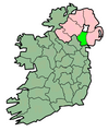 Map used since 2005
 -
 Map proposed by Hogweard in 2009
 -
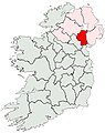 Update to colours in 2009 (← text amended by RA)
 -
 Current maps Recent update to colours of 2010 map
 -
 Current proposal by Mabuska
 -
 Counter proposal by RA 1
 -
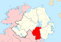 Counter proposal by RA 2
 -
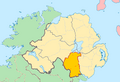 Proposal by Dmcq
 -
 New proposal from Mabuska with different shades for the rest of Ireland and Scotland


The salient points raised are (please add):
- Northern Ireland and Republic of Ireland are in two different states
- The counties of Northern Ireland no longer serve a local government function in Northern Ireland
- Reliable sources place the counties of Ireland in two simultaneous contexts: (a) the island of Ireland, (b) the jurisdiction in which they are located
- There is a concerns of "irredentist" qualities in the maps of the counties of Ireland
--RA (talk) 22:27, 4 July 2010 (UTC)
- I have no problem with "Current proposal by Mabuska", "Counter Proposal by RA1/RA2.Mabuskas is my fav as it shades out the Republic of Ireland rather than making it a brighter colour than NI and the county in question. Strongly oppose the other 3. BritishWatcher (talk) 22:40, 4 July 2010 (UTC)
- Other saliant points:
- The six counties of Northern Ireland last served as admnistrative units for Northern Ireland, their current entity, not an extinct entity that hasn't existed since 1921. They are still used by people in this country in geographical/historical senses but not in as big a 32-county all-Ireland context as implied. Any such 32-county all-Ireland contexts can be placed in relevant articles (Counties of Ireland) or history/sport sections - a compromise i've advocated but little comment on.
- The "reliable sources" have been shown above to be taken out of context to back up a contentious view.
- RA1 an RA2 have Scotland greyed out despite the fact Northern Ireland and Scotland belong to the same country (the UK), whilst the Republic of Ireland and Northern Ireland don't. Keeping Republic and Scotland the same ensures it doesn't favour advocating one connection over the other.
- By the way your maps table is wrong. The updated current ones are actually replacements for Superfopps so insanely pale maps that it almost looks like one country (which you didn't complain about). So i've added it into the table. Mabuska (talk) 23:01, 4 July 2010 (UTC)
- With respect to Scotland being greyed out, I kept Scotland greyed out in RA1 because you had it greyed out. I coloured it in in RA2 since it is part of the same state as Northern Ireland.
- With respect to the sources I have produced being taken out of context, I've quoted them again below. Can you please quote reliable sources that contradict them. Otherwise, we have to assume they are correct.
- With respect to me not complaining about you changing Superfopps colours, you can take that as a sign of support. It's not a case that other editors are either with you or against you. We work together. Sometimes we disagree. But it is not a battle, we are not at war, we are not fighting on opposing sides. We are collaborating on a project together as colleagues.
- About people in "this country" (I assume you mean the UK? Wikipedia itself is hosted in the USA and the Neterlands) not using the counties in "in as big a 32-county all-Ireland context", have you not yourself referred to the GAA as an example of people who do? Can we please keep statements of fact to statements of fact, and not commentary or spin. With that in mind, I have also amended you comment regarding Superfopp image in the gallery above. --RA (talk) 23:17, 4 July 2010 (UTC)
- Other saliant points:
- "England's King John created the first 12 counties of Ireland, with Mary I and Elizabeth I adding others. There are today 32 counties in Ireland, of which six are in Northern Ireland, and thus part of te United Kingdom of Great Britain and Ireland, with the remaining with the Republic of Ireland." — R. Thomas Collins, Joseph S. Wood, One Life at a Time: A New World Family Narrative, 1630-1960
- "The thirty-two counties of Ireland were created between the late twelfth and early seventeenth centuries. County boundaries typically follow lines drawn anciently between powerful Gaelic families. The county has become one of the most basic land divisions in Ireland and is similar in many ways to a state in the United States (see figure 4-1). Each county is comprised of a number of civil parishes. County Leitrim has the fewest civil parishes, with only seventeen. One-fourth of the counties in Ireland contain over one hundred civil parishes each." - David Ouimette, Finding Your Irish Ancestors: A Beginner's Guide
- "The island of Ireland is divided into two major political units - Northern Ireland, which along with England, Scotland, and Wales forms the United Kingdom, and the Republic of Ireland. Of the 32 counties of Ireland, 26 are in the Republic. Of the four historic provinces, three and part of the fourth are in the Republic." Frommer's Ireland, 2006
- "The term 'All-Irish' is in common use for many cultural, sports, and other purposes, and many events, competitions, and organizations are 'All-Irish', that is, they cover the entire area of the 32 traditional counties of the island and not just the Republic of Ireland." World and Its Peoples, 2010
- "The twenty-six traditional counties of Eire and the six traditional counties of Northern Ireland are used as the standard Irish geographical designations." - Robert A. Faleer, Church Woodwork in the British Isles, 1100-1535, 2009
- "Ireland is divided in to 32 counties: 26 in the Republic of Ireland and six in Northern Ireland" - Ryan Ver Berkmoes, Western Europe (Lonely Planet)
- "Northern Ireland is comprised of six of Ireland's 32 counties." - Michael McKernan, Owen McQuade, Northern Ireland Yearbook 2005
- "Ireland is divided into 32 counties comprising the four traditional provinces of Ulster, Leinster, Munster, and Connaught. Between 1920 and 1922, it split into to political entities, the Irish Free State, established in 1922, and Northern Ireland, consisting of six Ulster counties." - Margaret Scanlan, Culture and Customs of Ireland
- I'm originally from ROI, and I understand what you're saying. But since you've opened this up for comment, other editors who are not so familiar are going to be passing by, reading your posts, and not understand what you're both talking about. So spell it out in a concise form, (and be brief), so that they'll understand. Because the way you're all talking regarding the administrative functions of counties, and referencing 1921, not to mention maps that look alike, makes it clear as mud to the uninitiated.Malke2010 23:27, 4 July 2010 (UTC)
- I hope I can summarise this fairly. Probably the easiest way of putting it is to pose the polar opposites. Should the maps of counties of Ireland be shown:
- (a) Without distinction between the counties of Republic of Ireland and counties of Northern Ireland. Just show Ireland as one.
- (b) Without relationship between the counties of Northern Ireland and the counties of the Republic of Ireland. Just show the Republic of Ireland (and blank out Northern Ireland) or just show Northern Ireland (and blank out the Republic of Ireland).
- Mabuskas position in (b). My position is that we need to find a balance between the two.
- The maps in use (broadly the same since c.2005) show a balance between the two (NI and ROI are clearly distinguished from each other). What appears to have kicked off the issue for Mabuska is that an editor altered the maps to reduce the visual difference between NI and ROI in the maps. That has been reversed and the difference now is more pronounced. I think we can go further than that by zooming in on Northern Ireland for the Northern Ireland counties. --RA (talk) 10:52, 5 July 2010 (UTC)
- I hope I can summarise this fairly. Probably the easiest way of putting it is to pose the polar opposites. Should the maps of counties of Ireland be shown:
- I'm originally from ROI, and I understand what you're saying. But since you've opened this up for comment, other editors who are not so familiar are going to be passing by, reading your posts, and not understand what you're both talking about. So spell it out in a concise form, (and be brief), so that they'll understand. Because the way you're all talking regarding the administrative functions of counties, and referencing 1921, not to mention maps that look alike, makes it clear as mud to the uninitiated.Malke2010 23:27, 4 July 2010 (UTC)
How many of them are book sources RA? Do they have page numbers and ISBNs? I have already described how several of them are taken out of context and whilst i don't seem to have such a big book collection as you, there are many sites, most of which i would say are reliable with several taken from (direct quotes from) reliable sources, i.e. Lewis Topographical 1837, Atlas and Cyclopedia of Ireland (1900), and the BBC, that all clearly omit the 32 county or even the entire all-Ireland context and phrasing in their description of counties.
Your sources look at the all-Ireland context, not the individual county context. These articles in question are about individual counties. Your sources are perfect for the Counties of Ireland, Ireland, Northern Ireland, and Counties of Northern Ireland articles or history sections. However on the individual county level do you have sources that explicity state the 32 county relation? We are after all on about the individual six counties of Northern Ireland not counties in general. The sources i've listed below describe counties in their individual context without making references to an all-Ireland county context. Do you have reliable sources that explicitly state something along the lines of: County Antrim... is one of the 32 counties of Ireland? It seems to be practice to leave the 32 county context to the higher-levels such as the island of Ireland not the lower-levels such as individual counties. Why can we not follow this style?
On maps which this is directly about Search Google for County Antrim or County Londonderry etc. - the vast majority (and thats before you exclude the Wikipedia copies) don't show the county in an all-Ireland context - most are of the county alone or within Northern Ireland or UK excluding Ireland (or including with Republic of Ireland county-less).
- The argument here isn't that the sources aren't WP:reliable sources, they are obviously reliable sources about Ireland and counties of Ireland. The problem is that arguing from these sources in this case is WP:SYNTHESIS as they are not reliable sources for the notable facts about the counties. They only say in that part that Ireland has 32 counties. They might list county Antrim later and one can then infer it is one of the 32 counties but that certainly doesn't give it lead importance. A reliable source for the main notable facts about County Antrim would start off saying something like 'County Antrim is...' Dmcq (talk) 14:38, 5 July 2010 (UTC)
- Down. County in Northern Ireland, stretching from the Mourne Mountains to the Irish Sea. Downpatrick is the county town. Reader's Digest Universal Dictionary, 1998, ISBN 0 276 42419 0
- Northern Ireland. Province ( :-) ) of the United Kingdom consisting of 6 of the counties in the ancient Irish province of Ulster, by which name it is often inaccurately known. Reader's Digest Universal Dictionary, 1998, ISBN 0 276 42419 0
- The island of Ireland also doesn't make mention of 32 counties, other than indirectly by saying 26 went to one side and 6 the other. Its map of the Republic of Ireland also doesn't show the Northern Ireland counties. Reader's Digest Universal Dictionary, 1998, ISBN 0 276 42419 0
- Library Ireland - County Antrim, a source from 1900 when all-Ireland was a state and no mention at all of 32-counties specifically on the county pages. The only reference is at the introduction to the book which is on about the entirety of the island which fits in well for the Counties of Ireland article and not individual county articles.
- County Antrim.com - just states its location on the island of Ireland. Not reliable IMO but still a source
- Lewis' Topographical 1837, County Antrim - no mention of 32-counties. The same for the other counties.
- Public Records Office of Northern Ireland - Main Administrative land divisions - Counties
- Public Records Office of Northern Ireland - counties of Northern Ireland
- CAIN Map of Northern Ireland - no reference to rest of island.
- Visit Ireland - About Ireland; County Guide no reference to 32 county context just states was part of the island and partition.
- BBC h2g2 County Down - no mention of all-Ireland context and same for other Northern Ireland counties
- Maps of the UK - County Armagh - Republic of Ireland is clearly greyed out.
Mabuska (talk) 00:12, 5 July 2010 (UTC)
- "How many of them are book sources RA?" All. "Do they have page numbers and ISBNs?" Yes.
- Anything you write above that I might disagree with isn't worth splitting hairs over. The issue I have (the same issue that you have) is NPOV. I think you are perfectly fair in bringing up the question of NPOV with respect to the maps and to ask if they advance one POV over another. Where I think you fall down is by advancing a position that doesn't redress the balance between POVs but simply obliterates the other POV altogether.
- To my mind, the articles in question relate equally to two series: Counties of Ireland and Counties of Northern Ireland. To my mind, those are the two most imporant contexts of the articles. (I'm not going to beat you over the head with any more RS, you get my point: both perspectives are fact based.) The maps need to be up to the task of representing both of those contexts fairly and neutrally. If there is imbalance in how they represent one or the other then that should be redressed; but deleting one perspective or the other is not going to achieve that.
- A very nice video explaining NPOV has been added to the WP:NPOV page. Take a look at it and see what I mean by the need to balance perspectives between sources and not just pick one over another. --RA (talk) 10:52, 5 July 2010 (UTC)
- That was well said, RA. The goal, of course, is that the article is for everybody to read, not just Irishmen who know about these matters. We all know that the rest of the world, when they think of Ireland, think of the Troubles and Catholic versus Protestant, and the British Army versus the IRA, etc. It's helpful to keep in mind that people in the rest of the world don't have the latest situation at the front of their brains. I've met Ivy League educated people who still think it's 1972 in NI. For the most part, readers need to know counties were taken over, fought over, then given up for the sake of peace, and we've all moved on. The maps should show that.
- Think of how the BBC handles Derry versus Londonderry. They account for both POV's so that the guy with no POV will understand what's going on. It's got to be that way with the maps. You've got to concede what the reality is. ROI/NI will always be related. You've got to account for both POV's so that the guy with no POV understands what he's seeing when he looks at that map.Malke2010 14:21, 5 July 2010 (UTC)
- For the most part, readers need to know counties were taken over, fought over, then given up for the sake of peace, and we've all moved on. The maps should show that.
- Why does an article on a county of Northern Ireland today need to show an image of the whole island of Ireland which means the vast majority of the image simply focuses on a foreign country? An image on an article about a county of Northern Ireland should focus on Northern Ireland surely? BritishWatcher (talk) 14:25, 5 July 2010 (UTC)
- Please don't try to sound like your being NPOV and i'm being POV on sources. RA you seem to be the only person who is really supporting and giving sources for the all-Ireland 32-county dimension. Other editors commenting on the other strand of this topic, other than Asarlai and Bjmullan (who provide nothing to back up their stances), don't see a need for the dimension to be made so clear and with it being labelled as "out-dated" and "irredenist" by them.
- @ Malke: i have already proposed a more than fitting compromise to RA that he (as far as i can remember) failed to discuss. That compromise was that the map i propose be used for the infobox, whilst one depicting the county in relation to the whole island can be found in relevant articles; i.e. Counties of Ireland etc. or in the history section of the individual county articles depicting their former status as one of the adminstrative counties of the extinct political state of Ireland - a line can be given in the section (or sport section or both) as to how its still used in an all-Ireland context by the GAA or whatever. That way we get both maps in, in contexts that i don't think are controversial or contentious, which i think is more than fair. Mabuska (talk) 10:40, 7 July 2010 (UTC)
- NPOV means striking a balance between sources, not editors. I have replied to your comment regarding use of different maps in different contexts. I agreed with it. In respect to the articles on the individual counties, these are an area where the maps should show both the all-Ireland context and the Northern Ireland context because the topic of those articles is relevant to both contexts. Again, the counties of Ireland/Northern Ireland/Republic of Ireland are put in that context by reliable sources. I've quoted some for you. This is a point that you have studiously avoided except to offer an opinion that perspective is "outdated" or "irredentist", something that is itself either contradicted by sources (all of which speak in the present tense) or not supported by them.
- Just stick with the contexts these things are put in by the sources and let the reader decide what's morally right or wrong or outmoded. I'm all on for avoiding contention or controversy where there is no need for it or where it doesn't belong, but in this case I think you are seeing controversy and politics where it does not exist - at least not in reliable sources. --RA (talk) 10:59, 7 July 2010 (UTC)
- It was Red King and Laurel Lodged that said it was outdated originally. You are the only one who is strenously trying to keep this context in place - more than just me have disagreed with it so please don't try to make it seem thats its just me against the world. I have quoted "reliable" sources that showed the context is not universally used - so what makes your sources the be-all-end-all that must be adhered to? Were is striking the balance there?
- "I have replied to your comment regarding use of different maps in different contexts. I agreed with it. In respect to the articles on the individual counties, these are an area where the maps should show both the all-Ireland context and the Northern Ireland context because the topic of those articles is relevant to both contexts."
- You didn't comment on my compromise on whether it is acceptable or not - just the issue of different maps for different contexts. What is wrong with my proposed compromise? It avoids claims of possible irredentism and allows both opinions to be satisifed with both maps included. Mabuska (talk) 11:34, 7 July 2010 (UTC)
- I think RAs sources are WP:SYNTHESIS rather than reliable sources on the individual counties. However personally I wouldn't mind something like the RA1 picture with the greyed out bits being shaded a light green and pink to show the different jurisdictions. The tourist boards cooperate a lot on trying to bring in some money and there's no harm in showing some connections. Just my POV. Dmcq (talk) 11:52, 7 July 2010 (UTC)
- Good point about the tourist boards. And the RA1 picture is good. But Mabuska's proposal is still a good one because it would include a link that would show the other counties in context. And also look at what this says about how maps should look: [10].Malke2010 20:49, 7 July 2010 (UTC)
- And also, if the plan is to link to the Counties of Ireland, then we need to move the map of the counties to near the top of the article, otherwise, when the reader clicks on the link, all they see are paragraphs. They need to see the map straight off, so I moved it for now.[11].Malke2010 20:57, 7 July 2010 (UTC)
- Dmcq, that been my point all along. These aren't alien places to each other. County Armagh relates to County Louth in a way that Dumfriesshire and Cumbria do not. It is certainly not simply a cases that the ROI and UK are separate states. In terms of the island of Ireland, these are related geographic divisions.
- Malke, what I understand is that Mabuska is saying that maps showing the southern counties could be used on certain unstated articles where they would be "appropriate". GAA-related articles, for example, I think. Also, Mabuska has argued very strenuously before that references to the counties of Ireland should be removed from the articles relating to the Northern Ireland counties. (See a previous discussion at Wikipedia talk:WikiProject Ireland. I believe that is the next topic up for discussion.) In general, however, horse-trading such what you describe above don't work in my experience. It relies on editors who are not party to this discussion abiding by a "deal" made here between a limited number of editors. Not to mention that links don't exist in every circumstance that we are creating content for. (Wikipedia is published in paper and audio form as well and we do not know how what links will exist in 3rd parties publications, if they are even published in hypertext at all.) What ever style of map is chosen for the county articles it should be chosen because it is appropriate for the article, not as part of a wider "deal". --RA (talk) 21:44, 7 July 2010 (UTC)
- And also, if the plan is to link to the Counties of Ireland, then we need to move the map of the counties to near the top of the article, otherwise, when the reader clicks on the link, all they see are paragraphs. They need to see the map straight off, so I moved it for now.[11].Malke2010 20:57, 7 July 2010 (UTC)
- Good point about the tourist boards. And the RA1 picture is good. But Mabuska's proposal is still a good one because it would include a link that would show the other counties in context. And also look at what this says about how maps should look: [10].Malke2010 20:49, 7 July 2010 (UTC)
- I think RAs sources are WP:SYNTHESIS rather than reliable sources on the individual counties. However personally I wouldn't mind something like the RA1 picture with the greyed out bits being shaded a light green and pink to show the different jurisdictions. The tourist boards cooperate a lot on trying to bring in some money and there's no harm in showing some connections. Just my POV. Dmcq (talk) 11:52, 7 July 2010 (UTC)
Yes, I see your point about the horse trading and other editors. I'm still sure we can work something out. I still think the BBC's Derry/Londonderry approach is best all around. We do have to think of the guy who knows very little and doesn't have a dog in the fight. He just wants information. And I know everybody's got a POV, but that's the point of the BBC's settling on their approach. All right, maybe we should just put it to a vote. There's no voting, so maybe everybody pick a map and lets see where we're at.Malke2010 23:46, 7 July 2010 (UTC)
So are we any closer to getting an agreement that the images should be changed to either RA1/2 or Mabuska's one? I think the case for a change has been very strongly put and would bring things into line with how other maps of national counties are shown. BritishWatcher (talk) 20:56, 7 July 2010 (UTC)
- While I have no problem agreeing to a change, I don't think we should be comparing NornIreland counties with natioanl entities elsewhere. It is, of course, a province, not a country. Fmph (talk) 21:39, 7 July 2010 (UTC)
- Well wikipedia considers it a country but no matter what type of entity northern ireland is i do not see justification for showing a map which mostly covers a separate sovereign nation on an article about a county of Northern Ireland. Even if Northern Ireland was simply a considered territory that would still apply. BritishWatcher (talk) 22:35, 7 July 2010 (UTC)
- And United Kingdom sys "The United Kingdom is a constitutional monarchy and unitary state consisting of four countries: England, Northern Ireland, Scotland and Wales". You might want to try sticking provinces in there and see how far it gets you! :) Dmcq (talk) 22:56, 7 July 2010 (UTC)
- It would get you as far as the UK governments submission to the UN on the standardisation of geographic names: "Defintions: United Kingdom of Great Britain and Northern Ireland (usually shortened to United Kingdom). The United Kingdom is a constitutional monarchy consisting of four constituent parts: 2 countries England + Scotland. 1 principality: Wales. 1 province: Northern Ireland" (link). But I know that some here on Wikipedia get excited if you don't call the "four constituent parts" "counties". --RA (talk) 00:19, 8 July 2010 (UTC)
- And United Kingdom sys "The United Kingdom is a constitutional monarchy and unitary state consisting of four countries: England, Northern Ireland, Scotland and Wales". You might want to try sticking provinces in there and see how far it gets you! :) Dmcq (talk) 22:56, 7 July 2010 (UTC)
So RA i once again ask you what about my compromise? Are you continually going to avoid answering it directly? Or are you continually going to try to demean me? I noticed you also failed to answer a question of mine above as well as good points made by other editors:
- Do you have any sources that explicitly state something along the lines of: "County Antrim is a county of Northern Ireland and is one of the 32 counties of Ireland"? You have sources that state that Ireland consists of 32 counties, and as Dmcq states that is a level-up from Northern Ireland which makes your sources perfect for articles about all-Ireland or Irish counties in general. They don't deal specifically with individual counties which these articles are on about. I provided sources that show that context is left out of individual county levels. Do you have any "reliable" sources to contradict them on an individual level?
- I entirely quote Dmcq which backs up what i stated in the above point:
| “ | The argument here isn't that the sources aren't WP:reliable sources, they are obviously reliable sources about Ireland and counties of Ireland. The problem is that arguing from these sources in this case is WP:SYNTHESIS as they are not reliable sources for the notable facts about the counties. They only say in that part that Ireland has 32 counties. They might list county Antrim later and one can then infer it is one of the 32 counties but that certainly doesn't give it lead importance. A reliable source for the main notable facts about County Antrim would start off saying something like 'County Antrim is... | ” |
I would also advise you to stop twisting and lying please as well RA as its really testing my patience as you continually try to demean me. To set your statements straight:
| “ | (b) Without relationship between the counties of Northern Ireland and the counties of the Republic of Ireland. Just show the Republic of Ireland (and blank out Northern Ireland) or just show Northern Ireland (and blank out the Republic of Ireland). Mabuskas position in (b). My position is that we need to find a balance between the two. | ” |
- When did i say use blank out Northern Ireland or the Republic of Ireland? If you look at my proposal you can clearly see the neighbouring counties of the Republic of Ireland are shown which is more than Wikipedia map conventions would go, and which i explicitly stated at the start was a compromise for you.
- On county ledes, i'm not against some form of inclusion, i am (and Canterbury Tail, Laurel Lodged, Red King etc.) against your proposal (iirc) of including "32 counties" for various reasons. If longevity is your backup here, well the county ledes articles didn't contain "32 counties" until this year when we added it last month as a temporary agreement between us while we recessed on it. Remember it started off with all of us agreeing to remove Supefopps undiscussed addition of "traditional counties of Ireland". In fact i'd even accept something along the lines of "one of the counties of the island of Ireland" etc. - but Canterbury Tail and Laurel Lodged etc. would have to agree to it as well not just me and they are more adament than i am - yet you continually pick on me.
- I have made it clear the maps including the southern counties can be used on the individual county articles - its part of my compromise you keep neglecting to state whether you agree with it or not. We can even move the history section as high as possible to give it more prominence even though it is usually nearly the first section after the lede anyways. The fact you are saying "on certain unstated articles" is blatant horseshit and is testing my patience.
So stop lying and twisting please and answer the question... what is wrong with the compromise? I'll restate it here, reword it to make it clearer and more specific, and put it in a nice clear cquote box so everyone can clearly see it:
| “ | The map proposed by me, Mabuska, should be used for the infobox of the individual counties of Northern Ireland as they are still counties of Northern Ireland despite not being admnistrative units anymore. A map depicting the entirety of Ireland and its counties can be used in the History section of the individual county articles to clearly show its relation to the rest of the islands counties when they were part of the same country. A statement along with a wiki-link can be added after the description of its former status to clearly state that the individual county is still used in an all-Ireland sense by the GAA etc. | ” |
What is wrong with this? It satisifies both our ends as both maps get included and out into clear contexts and will i believe avoid future problems. What does everyone else think about this? Mabuska (talk) 00:22, 8 July 2010 (UTC)
- You're saying to have both maps, one with the county, then the county in relation to the rest of Ireland, the whole island, not just in relation to the other counties of NI? That seems a good solution.Malke2010 00:44, 8 July 2010 (UTC)
- I have answered you question regarding the "compromise" several times now. I will answer it again now. With respect to the History section of county articles, as I have written before, reliable sources refer to the counties of Ireland (all 32 of them) in the present tense. It is thus verifiably not "history". With respect that where you write, "The fact you are saying 'on certain unstated articles' is blatant horseshit and is testing my patience." What you wrote was that, "That compromise was that the map i propose be used for the infobox, whilst one depicting the county in relation to the whole island can be found in relevant articles; i.e. Counties of Ireland etc.…" It was that section of what you wrote that I was referring to.
- About the question of original research, the question as to whether County Antrim one of the 32 counties of Ireland question is pedanty and an attempt at gaming the system. None the less:
"Next there are the counties. This is the most important because it is how the Irish think and talk. These are the "states" of Ireland, from which individuals and family hail, with which citizens identify (as in "He's a Corkman married to a Donegal girl"). Each county is the butt of the next's jokes ("A Dublinman, a Meath man, and a Kildare man walking a pub…", and they all tangle in fierce athletic contests in pursuit of national titles in Gaelic football and hurling. The island's 32 counties, grouped under the four traditional provinces of Ireland cited above, are listed here: [the author then lists the 32 counties, including County Antrim, and notes that it is a part of Northern Ireland]." – Suzanne Rowan Kelleher, Frommer's Ireland 2005, John Wiley and Sons: Hoboken, 2005
- That citation also nicely explains the relevance of the 32 counties in the present day (i.e. not history, not "irredentist", and all-island).
- "If you look at my proposal you can clearly see the neighbouring counties of the Republic of Ireland are shown which is more than Wikipedia map conventions would go, and which i explicitly stated at the start was a compromise for you." Fair enough. My counter proposal only changes it so that the opposite side of the border is coloured in a different colour it in instead of greying it out. This is since one of the important contexts in which the counties should be understood crosses the international border and grey implies that what is across the border is irrelevant. Why can you not agree to that?
- About the previous (next?) discussion, what you describe here wasn't my impression but that is a discussion for another day. If I misrepresented you, I am sorry.
- If I have missed something, (as I have written before) please let me know. You wrote quite a lot and it is easy to miss something. --RA (talk) 01:03, 8 July 2010 (UTC)
- Okay then, so we'll have the bordering ROI counties green for that part (very light), what color for the NI county? What about a nice tasteful, light orange?Malke2010 01:21, 8 July 2010 (UTC)
- Let's avoid colours with political association and pick one from the pallet. The colours I used were derivations of those used for "Locator maps (blank)" and "Areas maps". TBH I think the two colour schemes I used were the best going but if others can suggest others that would be more suitable then we can mock those up too and see what they look like. --RA (talk) 06:12, 8 July 2010 (UTC)
- Okay then, so we'll have the bordering ROI counties green for that part (very light), what color for the NI county? What about a nice tasteful, light orange?Malke2010 01:21, 8 July 2010 (UTC)
- So your compromise is to have in the infobox a map like urs or RA1/2 which focuses just on Northern Ireland and its county, then in the history section of the articles on the county have a island wide image. I would fully support that, no problem with a whole island image within the article in the history section, it is use of it in the infobox i have a big problem with. There is no justification for the infobox image to mostly show another sovereign state. BritishWatcher (talk) 01:08, 8 July 2010 (UTC)
- And I would agree too except that that is how reliable sources treat the topic today. Some topics cross international borders and to be illustrated properly need to be shown in that light rather than be artificially chopped. --RA (talk) 06:12, 8 July 2010 (UTC)
- Just to be clear here, I am referring to the greying-out of the rest of the island of Ireland, which suggests that it is unrelated context. As the RS demonstrate the counties of Ireland (north and south) are inter-related topics. There is a strong (contemporary) all-island context that the couties should be placed in. Zooming in on Northern Ireland, I'm fine with. Undermining one context to advance another (which ever that may be), I'm not fine with.
- In that context RA 2 is probably better that RA 1 because it uses the convention to colour the UK (i.e. Scotland is marked in the colour used to refer to another part of the same state as Northern Ireland) whilst the rest of Ireland is shown in one of the supplementary colours from the pallet. The vice versa for the a county in the ROI would zoom out to show the ROI (effectively the whole island) and show Scotland in grey and NI in the supplementary colour. Mabuska, what do you disagree with about this? --RA (talk) 07:48, 8 July 2010 (UTC)
- So you would accept RA2 in the infoboxes for the 6 Northern Ireland county articles? Going with that image seems like a good compromise to resolve this matter which has lasted some time now. The county articles for Republic of Ireland would obviously have to show the whole of the island still, as long as NI is a different colour to the rest of the ROI then that seems reasonable. BritishWatcher (talk) 08:42, 8 July 2010 (UTC)
- That seems perfectly fair to me. It strikes a good balance and takes reduces all-Ireland dimension in the maps used on NI county articles (by clipping the island of Ireland and focusing on Northern Ireland).
- So, for counties in Northern Ireland:
- Zoom in on Northern Ireland for Northern Ireland counties
- Show outline of counties for whole island (those than can be seen)
- Use convention at Wikipedia:WikiProject Maps/Conventions (i.e. Northern Ireland in #FEFEE9 other parts of UK in #F6E1B9)
- Except shade rest of Ireland (that which can be seen) in an alternative colour (suggest #FFD0D0).
- For counties in ROI counties:
- Zoom out to show all of the Republic of Ireland (will effecively be the whole island)
- Show outline of counties for whole island
- Use convention at Wikipedia:WikiProject Maps/Conventions (i.e. Republic of Ireland in #FEFEE9, Scotland in #E0E0E0).
- Except shade rest of Ireland (i.e. Northern Ireland) in an alternative colour (suggest #FFD0D0).
- --RA (talk) 09:28, 8 July 2010 (UTC)
- Shading the Republic pink when showing Northern Ireland is very strange. The traditional colour in maps of the world for the UK is red and for Ireland is green. Pale versions of those can do the job fine. Anyway that reference for Northern Ireland being a province looks a good reliable relevant source so I'll try sticking it into the UK article Dmcq (talk) 10:50, 8 July 2010 (UTC)
- I agree with all of the above by RA except the colour proposed for the Republic of Ireland. I think it would be best to use the green colour used in the "current map" shown above for the Republic rather than the pinky colour. BritishWatcher (talk) 14:01, 8 July 2010 (UTC)
- Shading the Republic pink when showing Northern Ireland is very strange. The traditional colour in maps of the world for the UK is red and for Ireland is green. Pale versions of those can do the job fine. Anyway that reference for Northern Ireland being a province looks a good reliable relevant source so I'll try sticking it into the UK article Dmcq (talk) 10:50, 8 July 2010 (UTC)
- I'm very dubious about using political colours. It would be best to keep things as neutral as possible, IMHO. Bear in mind too that Northern Ireland the the Republic will never be seen shaded in the alterante colour at the same time (unlike the current maps).
- The only reason I picked the pink was because it was the colour that worked best from the pallet. How about we do up some mock up in different colours and see what works best before we make a decision? We should possibly get winder input also on details such as these if there is general agreement here on an approach. --RA (talk) 14:20, 8 July 2010 (UTC)
- Agreed a selection of different colours to compare would be good, i dont mind if it is not green, but id rather a less bright colour than pink. A post on each of the county articles should get enough feedback over the next day or two, if nobody from there responds then there is no one to complain about the maps being changed based on consensus here if it is reached. BritishWatcher (talk) 14:37, 8 July 2010 (UTC)
- Posting to the pages is a good idea. But leave it run for longer - a week (even two?) - to get as wide a input as possible, most people don't post as often as we do. There's no great rush and it will take time to do the maps anyway, whatever we decide.
- You're right about pink. It's a bit loud and Dmcq made a remark earlier that it was too close to the red used for the county as well. We could do up a northern and a southern county in different schemes to see each. --RA (talk) 14:52, 8 July 2010 (UTC)
- Agreed a selection of different colours to compare would be good, i dont mind if it is not green, but id rather a less bright colour than pink. A post on each of the county articles should get enough feedback over the next day or two, if nobody from there responds then there is no one to complain about the maps being changed based on consensus here if it is reached. BritishWatcher (talk) 14:37, 8 July 2010 (UTC)
RA i already told you about lying and twisting. Your quote on my comment you gave above left out the end of it which shows your twisting what i am saying to suit your own ends. Heres the full quote without your selective editing (i've highlighted the bit you left out):
| “ | That compromise was that the map i propose be used for the infobox, whilst one depicting the county in relation to the whole island can be found in relevant articles; i.e. Counties of Ireland etc. or in the history section of the individual county articles depicting their former status as one of the adminstrative counties of the extinct political state of Ireland - a line can be given in the section (or sport section or both) as to how its still used in an all-Ireland context by the GAA or whatever. That way we get both maps in, in contexts that i don't think are controversial or contentious, which i think is more than fair. Mabuska (talk) 10:40, 7 July 2010 (UTC) | ” |
Personally i shouldn't really argue with RAs proposed maps however i oppose giving one external entity more prominence than another. Northern Ireland is part of the UK so why should Scotland in the map not get more prominence? That is why my map has both the Republic of Ireland and Scotland greyed out as it avoids giving bias to one connection over the other. That is NPOV RA. Adding different colours to Scotland and the Republic of Ireland is visually distracting from the topic - it doesn't favour one context over the other by having the UK bits and Republic of Ireland bits showing both greyed out the same colour. This issue will be resolved by sources and RA your sources still on context:
Your new Frommer's quote is also a level-up context, i.e. all-Ireland context. It doesn't deal with individual counties on their own. Another source for the Counties of Ireland article which already includes a list. As Dmcq said on lists:
| “ | They might list county Antrim later and one can then infer it is one of the 32 counties but that certainly doesn't give it lead importance. A reliable source for the main notable facts about County Antrim would start off saying something like "County Antrim is... | ” |
Such lists are easy to find, just as it is to find lists on UK counties. Does Frommers go on about the individual county describing it in its own entry as one of the 32 counties of Ireland? These articles are on about individual counties not Counties of Ireland as a whole. I already provided an encyclopedia reference that clearly omits this as well as omitting it as part of the UK - instead it mentions only Northern Ireland. Heres more encyclopedic references omitting this context on indiviual counties: [12] [13] [14] [15] All of these leave out references to the rest of Ireland (except Encartas reference to Ulster) or the rest of the UK - so why should we use lists about all-Ireland not individual counties as a reliable source when specifically on individual counties other reliable encyclopedic sources don't?
Whilst everyone agrees with both our maps RA, i have reliable encyclopedic sources that deal specifically with individual counties that exclude the all-Ireland context and even the UK context. Your sources deal with describing the counties of Ireland in general not individually or specifically in their own entries.
So once more RA do you have any sources that contradict the ones i've provided on the individual counties? We are dealing after all with individual county articles here not Irish counties in general. My compromise allows for an all-Ireland map showing all the counties in relation in the history section where your source fit in perfectly as they deal with the all-Ireland context? It also keeps neutrality on NI's relation to the Republic and the UK by them being shaed out the same colour. If we based this on sources on individual counties and maintaining NPOV in relation to external entities then there would be no disagreement. Mabuska (talk) 21:02, 8 July 2010 (UTC)
Question
Before the editor altered the maps, was there a disagreement between any of you at that time? Is it possible to just go back to what was there before?Malke2010 13:03, 5 July 2010 (UTC)
- There appears to be several people unhappy with the old map, the minor alteration to the colour changes nothing. It can not be right that a map focusing on Northern Irelands counties needs to show the whole of the island of Ireland and a separate sovereign state (Republic of Ireland). It is like having the regions of France shown on a map focusing on a German state. BritishWatcher (talk) 13:58, 5 July 2010 (UTC)
- Well not quite like that if you read the various agreements between the UK and Ireland. With them it would be just as unreasonable to show them in a UK only context. It should just go with how people normally refer to them which is as in Northern Ireland. Dmcq (talk) 14:49, 5 July 2010 (UTC)
Voting time
Questions removed by me as there isn't any point - BLAH!!!! Mabuska (talk) 14:08, 9 July 2010 (UTC)
- Could you just tone it down a bit please, this is supposed to be a cooperative venture. I'd like RA 1 but with different colours even if yours is more standard. I believe RA was going to do another one or two with different colours. Both the UK and the Republic have strong ties with Northern Ireland. People are agreeing to get rid of the 32 county maps, RA 1 doesn't show all 32 why are you saying RA hasn't provided any real compromise? Are you talking about the wording as well now or just the maps? Dmcq (talk) 10:24, 9 July 2010 (UTC)
- Too many questions there one only one is really needed. Lets just get the different colours as suggested above so we can all look at a selection of differing colours (more than just RA1/2 and ur one). There seems agreement to change the infobox image, just a case of picking the colours and getting wider input from the county articles b4 going ahead. BritishWatcher (talk) 11:06, 9 July 2010 (UTC)
- Anyway I've stuck in my own proposal along with the other maps above based on colouring NI using a dark yellow I got from the Red Hand of Ulster flag, the Republic and Great Britain base don the green and pink in the existing maps. Dmcq (talk) 11:18, 9 July 2010 (UTC)
- Its not meant to be an angry post. I've removed half of the questions and most of the waffle to be more specific. As everyone has already agreed to the new map shape, is it really a compromise. Just to make clear the entire issue is only about colours to be used - though i still feel that the source issue has not been resolved that backs up the requirement for different colours for the Republic and Scotland. I just wanted everybodys view on whether his sources are suitable, reliable and relevant when i've provided sources that contradict. Added in the fact other editors have popped in and stated they would prefer such contexts omitted. So why should RAs contexts get priority when there are unresolved issues on them?
- If multiple colours are to be added in a description or explaination is going to be needed somewhere in the infobox to make it clear to the viewer what exactly is being described and making clear the counties connections to both the Republic and the UK. There is also no point in my compromise which would of included a nice all-Ireland 32 county map in each county article, but i'll probably stick it in anyways as it'd provide a pre-1921 context for the history sections.
- Your colours Dmcq no offence are ghastly - RAs are better :-) In fact if we are to ignore contradicting sources altogether and accept RAs opinion i would have to choose RA1 but with an alteration - a different colour for Scotland to show the UK context that doesn't set it too far apart since the relation to the rest of Ireland context is being depicted and thus a neutral balance must be maintained. Mabuska (talk) 12:33, 9 July 2010 (UTC)
- If the colours used between the rest of Ireland and Scotland are a stark contrast i'd feel it might need to be as how is the unwitting reader going to know why there are different colours? I've put a new proposal up above.. Yes the two shades used for the rest of Ireland and Scotland are similar but importantly they are clearly different - and both work supplementary with the colour of Northern Ireland's counties showing the seperate connections the counties have with both contexts. I actually like it more than my first proposal which is duller -though i'd still prefer neutrality with the one colour.
- Maybe Scotland could do with a stronger tint of orange? Mabuska (talk) 12:56, 9 July 2010 (UTC)
- I like the colour you used for the Republic of Ireland, but not the colours for Northern Ireland / the county. My ideal one is the green u used for ROI (or the green on the current map), the white / red used in RA1/2 and Mabuskas first for NI / the county. When it comes to dealing with Scotland, the colour used in "New proposal from Mabuska " for ROI or Scotland look fine. BritishWatcher (talk) 13:31, 9 July 2010 (UTC)
- I'm assuming from the way you've worded your comment your on about Dmcq's map and not mine. I'm also assuming your happy enough BW to accept a map that'll look like the national flag of the Republic of Ireland? lol :-P
- Personally i'd rather steer away from using steorotypical colours, i.e. green for the republic and orange for Northern Ireland as Dmcq's proposal sorta provides. There are people on both sides of the border who would find offence with those colour associations/connoctations - and could lead to future problems. The orange for external states is in the Wikipedia Map Conventions as well as grey - though grey does do more to give a feeling of exclusion than the orange. So i am happy to accept the inclusiveness provided by the two different shades of orange which shows two different but related contexts in relation to NI's counties. Mabuska (talk) 14:03, 9 July 2010 (UTC)
- I like the soft green or colour that dmcq used. The colour u used for Republic of Ireland in ur original proposal was good too. I didnt like the colours Dmcq used for Northern Ireland and the county. The white and red used in urs and RA1/2 looks the best for Northern Ireland and the county. No strong feelings on the Scotland bit as its only tiny on the map, what ever is in line with conventions. BritishWatcher (talk) 14:14, 9 July 2010 (UTC)
- So basically you prefer my original proposal? Me too but thats neither here nor there anymore :-) The white/red is Wiki convention for highlighting the subject matter in the relevant state that it belongs to so we should leave that as it is as none of us are in real disagreement about that. Mabuska (talk) 18:47, 9 July 2010 (UTC)
- I like the soft green or colour that dmcq used. The colour u used for Republic of Ireland in ur original proposal was good too. I didnt like the colours Dmcq used for Northern Ireland and the county. The white and red used in urs and RA1/2 looks the best for Northern Ireland and the county. No strong feelings on the Scotland bit as its only tiny on the map, what ever is in line with conventions. BritishWatcher (talk) 14:14, 9 July 2010 (UTC)