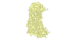
Verdeña
Verdeña | |
|---|---|
 | |
 | |
| Comarca | Montaña Palentina |
| Municipality | Cervera de Pisuerga |
| Province | Palencia |
| Autonomous community | Castile and León |
| Population (2020) | |
| • Total | 10 |
| Area code | 34 |
Verdeña is a settlement in the province of Palencia (Castile and León, Spain) and is part of the municipality of Cervera de Pisuerga.
Geographical context[edit]
It is part, along with Estalaya, Celada de Roblecedo, San Felices de Castillería and Herreruela de Castillería, of the Castillería Valley.
It is 15 km from Cervera de Pisuerga, the municipal capital, in the region of Montaña Palentina. It is located in a mountainous area (lat.42º57'ON; long.4º28'OW), at 1239 m altitude.
Demography[edit]
Population evolution in the 21st century:[1]
| Vertical bar chart Demography of Verdeña between 2000 and 2019 |
 |
| Legal population (2000-2019), according to the municipal census of the National Institute of Statistics. |


History[edit]
At the fall of the Ancien Régime, the town became a constitutional municipality[2] and in the 1842 census it had 12 households and 62 residents, to later[3] become part of Celada de Roblecedo.
The town was the birthplace of Matías Barrio y Mier (10-02-1844), doctor in Law and graduate in Philosophy and Letters and Theology. He studied as an archivist, librarian and antiquarian at the Escuela Superior Diplomática. He was a lawyer, professor at the University of Alcalá and prosecutor. He was also a legislator and president of the Carlist minority in the Congress of Deputies. He also devoted himself to writing. He died in Madrid (26-06-1909), and his mortal remains rest in the Verdeña cemetery.
19th century[edit]
This is how Verdeña is described on page 672 of volume XV of the Diccionario geográfico-estadístico-histórico de España y sus posesiones de Ultramar, a work promoted by Pascual Madoz in the mid-19th century:[4]
VERDEÑA
A place attached to the municipality of San Felices de Castillería in the province and diocese of Palencia (20 leagues), judicial district of Cervera de Río Pisuerga (2), territorial audience and general captaincy of Valladolid (28).
Located in a valley surrounded by slopes with a cold climate, well ventilated and prone to flank pains and colds.
It consists of 26 houses of few comforts; school some seasons, and a parish church served by a priest of provision of the ordinary.
The term bordered by N with Monte and sale of San Bartolomé; E Celada; S Estalaya, and W Venta Morena.
Its land enjoys mountain and plain, and is moderately productive.
The roads are local and bad.
Productions: wheat, barley, rye, oats and grass; raising sheep, cattle and horses; hunting hares, partridges, wolves and roe deer.
Industry: agriculture and livestock.
Population: 12 neighbors, 62 souls.
Productive capital: 19,188 reales. Taxable: 969 reales.
See also[edit]
References[edit]
- ^ Nomenclature: Population of the Continuous Census by Population Unit as of January 1 (in Spanish)
- ^ Municipality Code INE - 345137
- ^ Between the 1857 census and the previous one.
- ^ Madoz, Pascual (1850). "Diccionario Geográfico-Estadístico-Histórico de España y sus posesiones de Ultramar" (in Spanish).
