
User:Sengkang/Gallery/Queenstown Planning Area
< User:Sengkang | Gallery
This is a catalogue of photographs that I have taken of Singapore geographical features, infrastructure and buildings in my leisure time. All images shown may be used anywhere in Wikipedia. Do drop me a note at my talk page if you intend to use them for other purposes. Thanks!
Queenstown Planning Area[edit]

Buona Vista[edit]
-
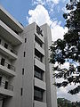
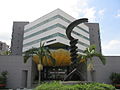
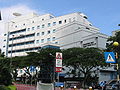
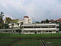
 Biopolis
 -
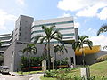
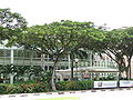
 Biopolis
 -
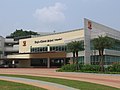
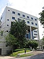
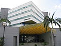
 MOE HQ Building


Dover[edit]
-
 Dover Road

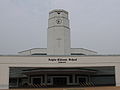
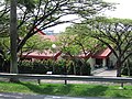
Anglo-Chinese School (Independent)[edit]
-
-
-

-

-

-

-
-

-

-
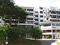
 Boarding School
 -
 Boarding School
,_Nov_06.JPG)
_2,_Nov_06.JPG)
_3,_Nov_06.JPG)
_4,_Nov_06.JPG)
_5,_Nov_06.JPG)
_6,_Nov_06.JPG)
_7,_Nov_06.JPG)
_8,_Nov_06.JPG)
_9,_Nov_06.JPG)
_Boarding_School,_Nov_06.JPG)
_Boarding_School_2,_Nov_06.JPG)
Dover MRT station[edit]


Institute of Technical Education Headquarters[edit]


Singapore Polytechnic[edit]


National University of Singapore[edit]


-
 Alumni House
 -
 Central Library
 -
 Central Library (plot behind)
 -
 Clementi Road Entrance A
 -
 Eusoff Hall
 -
 Faculty of Arts & Social Sciences
 -
 Faculty of Arts & Social Sciences
 -
 Faculty of Arts & Social Sciences
 -
 Faculty of Arts & Social Sciences
 -
 Faculty of Arts & Social Sciences
 -
 Faculty of Arts & Social Sciences
 -
 Faculty of Arts & Social Sciences, The Deck
 -
 Faculty of Arts & Social Sciences, The Shaw Foundation Building
 -
 Faculty of Arts & Social Sciences, The Shaw Foundation Building
 -
 Faculty of Engineering
 -
 Faculty of Engineering
 -
 Faculty of Engineering
 -
 Faculty of Engineering
 -
 Faculty of Engineering
 -
 Faculty of Engineering
 -
 Faculty of Engineering
 -
 Faculty of Engineering
 -
 Faculty of Engineering
 -
 Faculty of Engineering
 -
 Faculty of Engineering
 -
 Faculty of Engineering
 -
 Faculty of Engineering
 -
 Faculty of Engineering
 -
 Faculty of Engineering, The Techno Edge
 -
 Faculty of Science
 -
 Faculty of Science
 -
 Faculty of Science
 -
 Faculty of Science, Lim Seng Tjoe Lecture Theatre
 -
 Faculty of Science, The Frontier
 -
 Football field and running track
 -
 Kent Ridge Bus Terminal
 -
 Kent Ridge Crescent
 -
 Kent Ridge Crescent
 -
 Kent Ridge Guild House
 -
 Kent Ridge Hall
 -
 Kuok Foundation House
 -
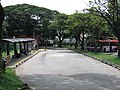
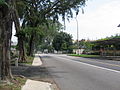
 Lower Kent Ridge Road
 -
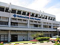 National University Hospital
 -
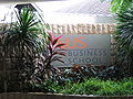
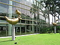
 NUS Business School
 -
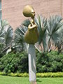
 NUS Business School
 -
 NUS Business School
 -
 NUS Business School
 -
 NUS Business School
 -
 NUS Business School, Institute of South Asian Studies
 -
 NUS Business School, Hon Sui Sen Memorial Library
 -
 NUS Business School, Hon Sui Sen Memorial Library
 -
 NUS Business School, Hon Sui Sen Memorial Library
 -
 NUS Business School, Hon Sui Sen Memorial Library
 -
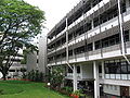
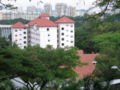
 Ridge View Residences
 -
 Ridge View Residences
 -
 Ridge View Residences
 -
 Ridge View Residences
 -
 School of Computing
 -
 School of Computing
 -
 School of Computing
 -
 School of Computing
 -
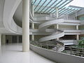
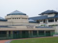
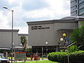
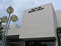
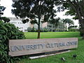
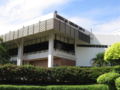
 University Cultural Centre
 -
 University Cultural Centre
 -
 University Cultural Centre
 -
 University Cultural Centre
 -
 University Cultural Centre
 -
 University Cultural Centre
 -
 University Cultural Centre
 -
 University Cultural Centre
 -
 University Cultural Centre
 -
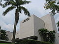
 University Hall
 -
 University Hall
 -
 University Hall
 -
 Yoo Loo Lin School of Medicine
 -
 Yoo Loo Lin School of Medicine
 -
 Yoo Loo Lin School of Medicine
 -
 Yoo Loo Lin School of Medicine
 -
 Yusof Ishak House
 -
 Yusof Ishak House


Pasir Panjang[edit]
-
 Pasir Panjang Road
 -
 Pasir Panjang Road
 -
 Pasir Panjang Road
 -
 Norwegian Seamen's Mission
 -
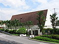
 Pasir Panjang Christ Church
 -
 PSA Vista
 -
 The Salvation Army Pasir Panjang Corps


Haw Par Villa[edit]


Machine-Gun Pillbox[edit]


Pasir Panjang Ferry Terminal[edit]
-

-

-

-

-
-
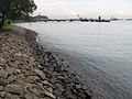
 Pasir Panjang Lighter Jetty


