
User:Sengkang/Gallery/Downtown Core Planning Area/Marina Bay
This is a catalogue of photographs that I have taken of Singapore geographical features, infrastructure and buildings in my leisure time. All images shown may be used anywhere in Wikipedia. Do drop me a note at my talk page if you intend to use them for other purposes. Thanks!
Marina Bay[edit]


-
 Marina Bay and Marina Centre
 -
 Marina Bay and Marina Centre
 -
 Marina Bay and Marina Centre
 -
 Marina Bay, Marina Centre and Esplanade Bridge
 -
 Benjamin Sheares Bridge
 -
 Change Alley Aerial Plaza
 -
 Change Alley Aerial Plaza
 -
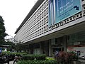
 Customs Harbour Branch
 -
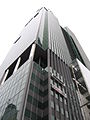
 Overseas Union House


Clifford Pier[edit]


Esplanade Bridge[edit]


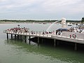
Marina Bay Floating Platform[edit]


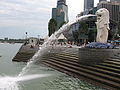
Merlion[edit]
-

-

-
-

-

-
 Small Merlion
 -
 Merlion Park


One Fullerton[edit]


One Marina Boulevard[edit]
-

-
-

-
 Stone Sculptures
 -
 Stone Sculptures


One Raffles Quay[edit]
-
 Under construction
 -
 Under construction
 -
 Under construction


