User:Run to the hills, cos the end of the world is soon!/sandbox/Infobox AP/doc
| Embleton Perth, Western Australia | |||||||||||||||
|---|---|---|---|---|---|---|---|---|---|---|---|---|---|---|---|
| Coordinates | 31°54′14″S 115°54′36″E / 31.904°S 115.910°E | ||||||||||||||
| Population | 2,434 (2006 census)[1] | ||||||||||||||
| • Density | 1,430/km2 (3,710/sq mi) | ||||||||||||||
| Postcode(s) | 6062 | ||||||||||||||
| Area | 1.7 km2 (0.7 sq mi) | ||||||||||||||
| Location | 8 km (5 mi) NE of Perth City | ||||||||||||||
| LGA(s) | Bayswater City | ||||||||||||||
| State electorate(s) | Maylands, Bassendean | ||||||||||||||
| Federal Division(s) | Perth | ||||||||||||||
| |||||||||||||||
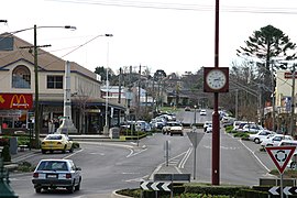
| Warragul Victoria | |||||||||||||||
|---|---|---|---|---|---|---|---|---|---|---|---|---|---|---|---|
 | |||||||||||||||
| Coordinates | 38°9′0″S 145°56′0″E / 38.15000°S 145.93333°E | ||||||||||||||
| Population | 16,700 (2011)[2] | ||||||||||||||
| Postcode(s) | 3820 | ||||||||||||||
| Elevation | 143 m (469 ft) | ||||||||||||||
| Location | |||||||||||||||
| LGA(s) | Baw Baw Shire | ||||||||||||||
| County | Buln Buln | ||||||||||||||
| State electorate(s) | Narracan | ||||||||||||||
| Federal Division(s) | McMillan | ||||||||||||||
| |||||||||||||||
| |||||||||||||||
| Brighton Council Tasmania | |||||||||||||||
|---|---|---|---|---|---|---|---|---|---|---|---|---|---|---|---|
| Coordinates | 42°43′14″S 147°17′40″E / 42.72056°S 147.29444°E | ||||||||||||||
| Population | 16,358 (2010)[3] | ||||||||||||||
| • Density | 97.37/km2 (252.2/sq mi) | ||||||||||||||
| Established | 1863 | ||||||||||||||
| Area | 168 km2 (64.9 sq mi) | ||||||||||||||
| Mayor | Tony Foster | ||||||||||||||
| Council seat | Brighton | ||||||||||||||
| Region | Brighton/Bridgewater | ||||||||||||||
| State electorate(s) | Lyons | ||||||||||||||
| Federal Division(s) | Lyons | ||||||||||||||
| Website | Brighton Council | ||||||||||||||
| |||||||||||||||
| District Council of Cleve South Australia | |||||||||||||||
|---|---|---|---|---|---|---|---|---|---|---|---|---|---|---|---|
 Location of the District Council of Cleve | |||||||||||||||
| Coordinates | 33°44′25″S 136°22′24″E / 33.7403°S 136.3733°E | ||||||||||||||
| Population | 1,908 (2009)[4] | ||||||||||||||
| • Density | 0.42337/km2 (1.09652/sq mi) | ||||||||||||||
| Established | 1911 | ||||||||||||||
| Area | 4,506.7 km2 (1,740.0 sq mi) | ||||||||||||||
| Mayor | Roger Nield [5] | ||||||||||||||
| Council seat | Cleve | ||||||||||||||
| Region | Eyre and Western[6] | ||||||||||||||
| State electorate(s) | Flinders | ||||||||||||||
| Federal Division(s) | Grey | ||||||||||||||
| Website | District Council of Cleve | ||||||||||||||
| |||||||||||||||
- ^ Australian Bureau of Statistics (25 October 2007). "Embleton (State Suburb)". 2006 Census QuickStats. Retrieved 2008-10-05.
- ^ Cite error: The named reference
ABSwas invoked but never defined (see the help page). - ^ Australian Bureau of Statistics (31 March 2011). "3218.0 - Regional Population Growth, Australia, 2009-10". Retrieved 23 August 2011. Estimated resident population (ERP) at 30 June 2010.
- ^ Australian Bureau of Statistics (30 March 2010). "Regional Population Growth, Australia, 2008–09". Retrieved 4 June 2010.
- ^ "Elected Members". District Council of Cleve. Retrieved 15 February 2016.
- ^ "Eyre Western SA Government region" (PDF). The Government of South Australia. Retrieved 10 October 2014.


