From Wikipedia, the free encyclopedia
| Mount Tai |
|---|
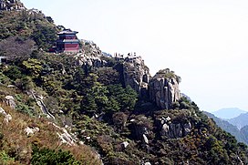
 The landscape of Mount Tai with a temple situated at one of its slopes |
|
| Elevation | 1,532.7 m (5,029 ft) |
|---|
| Prominence | 1,505 m (4,938 ft)[1] |
|---|
| Listing | Ultra |
|---|
| Coordinates | 36°15′21″N 117°06′27″E / 36.25583°N 117.10750°E / 36.25583; 117.10750[1] |
|---|
|
|
| Location | Tai'an, Shandong |
|---|
|
| Age of rock | Cambrian |
|---|
| Mountain type | metamorphic, sedimentary |
|---|
|
| Easiest route | cable car |
|---|
|
|
| Official name | Mount Taishan |
|---|
| Type | Mixed |
|---|
| Criteria | i, ii, iii, iv, v, vi, vii |
|---|
| Designated | 1987 (11th session) |
|---|
| Reference no. | 437 |
|---|
| State Party | People's Republic of China |
|---|
| Region | Asia-Pacific |
|---|
|
|
|---|
|
|
| Motripa/sandbox/sandbox/Infobox/Place |
|---|
|
| Chinese | 泰山 |
|---|
| Literal meaning | Mount Tai |
|---|
|
|
|


