User:JavaHurricane/sandbox/2016 Pacific hurricane season
| JavaHurricane/sandbox/2016 Pacific hurricane season | |
|---|---|
 Season summary map | |
| Seasonal boundaries | |
| First system formed | January 7, 2016 (record earliest) |
| Last system dissipated | November 26, 2016 |
| Strongest storm | |
| Name | Seymour |
| • Maximum winds | 150 mph (240 km/h) (1-minute sustained) |
| • Lowest pressure | 940 mbar (hPa; 27.76 inHg) |
| Seasonal statistics | |
| Total depressions | 23, 4 unofficial |
| Total storms | 22 |
| Hurricanes | 13 |
| Major hurricanes (Cat. 3+) | 6 |
| Total fatalities | 11 total |
| Total damage | $96 million (2016 USD) |
| Related articles | |
The 2016 Pacific hurricane season was an event of tropical cyclone formation. It was an above average season that produced 23 depressions, 22 named storms, 13 hurricanes and six major hurricanes.
Seasonal forecasts[edit]
| Record | Named storms |
Hurricanes | Major hurricanes |
Ref | |
|---|---|---|---|---|---|
| Average (1981–2010): | 15.4 | 7.6 | 3.2 | [1] | |
| Record high activity: | 1992: 27 | 2015: 16 | 2015: 11 | [2] | |
| Record low activity: | 2010: 8 | 2010: 3 | 2003: 0 | [2] | |
| Date | Source | Named storms |
Hurricanes | Major hurricanes |
Ref |
| May 6, 2016 | SMN | 10 | 7 | 3 | [3] |
| May 27, 2016 | NOAA | 13–20 | 6–11 | 3–6 | [4] |
| Area | Named storms |
Hurricanes | Major hurricanes |
Ref | |
| Actual activity: | EPAC | 20 | 11 | 6 | |
| Actual activity: | CPAC | 2 | 2 | 0 | |
| Actual activity: | 22 | 13 | 6 | ||
On May 6, 2016, the Mexican Servicio Meteorológico Nacional (SMN) released its outlook for the 2016 Pacific hurricane season, forecasting a below-average season with 10 named storms, seven hurricanes and three major hurricanes.[3] On May 27, the United States National Oceanic and Atmospheric Administration (NOAA) released its outlook, forecasting a near to above-average season with 13–20 named storms, 6–11 hurricanes and 3–6 major hurricanes.[4]
Seasonal summary[edit]

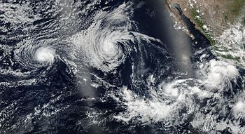
Systems[edit]
Hurricane Pali[edit]
| Category 2 hurricane (SSHWS) | |
| Duration | January 7 – January 14 |
|---|---|
| Peak intensity | 100 mph (155 km/h) (1-min); 978 mbar (hPa) |
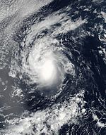
As the 2014–16 El Niño event reached its peak in December 2015 and January 2016, a strong westerly wind burst, a classic signature of an El Niño, occurred across the equatorial Western and Central Pacific. This long-lived burst led to the development of Tropical Depression Nine-C in late December 2015, along with its Southern Hemisphere twin, Cyclone Ula. Though the depression dissipated at the start of the new year, a low-latitude trough continued to exist over the equatorial Pacific. At 0000 UTC on January 6, a weak surface low formed within this trough about 1,425 mi (2,295 km) southwest of Honolulu, Hawaii over the central north Pacific at a latitude of 1.9°N. The low drifted west-northwestwards as the subtropical ridge over the Pacific was weakened by a passing cold front. Deep convection gradually increased and became better organized, and at 0600 UTC on January 7, the CPHC upgraded the low to Tropical Depression One-C. The ridge aloft shifted north during this time, imparting easterly vertical wind shear over the nascent depression. The ridge, however, also enhanced the depression's outflow, which led to a marked increase in the deep convection around the system's center. As a result, the depression strengthened into Tropical Storm Pali at 1200 UTC that day. Pali continued to strengthen through the first half of the following day and nearly reached hurricane strength, when increasing wind shear disrupted the tropical cyclone. The system turned to the northwest under the influence of the easterly flow aloft as it steadily weakened, with convection sheared to the west and pulsing intermittently.[5]
As the storm fell to minimal tropical storm strength, the shallow system decelerated as steering currents weakened. The ridge diminished and moved southwards through January 10, which led to a decrease in wind shear and allowed Pali to reintensify. The system reached hurricane strength at 0000 UTC on January 12 while moving northeast through a region of low wind shear and high sea-surface temperatures of 28 to 29°C. Eighteen hours later, Pali reached peak intensity with estimated maximum peak winds of 100 mph (155 km/h) and a minimum central pressure of 978 mbar (28.9 inHg). At peak intensity, Pali displayed a well-defined eye on geostationary satellite energy. Throughout 12 January, Pali was driven southwards by a deep ridge that was building to the north of the cyclone. As the system continued southwards towards the Equator, increasing vertical wind shear and a loss of planetary vorticity due to the weaker Coriolis force near the Equator caused Pali to weaken quickly beginning January 13. The eye became barely discernible by 0600 UTC, and storm's deep convection soon began to rapidly decay and become disorganized. At 1800 UTC on January 14, Pali degenerated into a remnant low at a low latitude of 2.3°N. The remnants of the cyclone dissipated within the following six hours.[5]
Pali set several records during its lifetime. When Tropical Depression One-C formed at 0600 UTC on January 7, it surpassed 1989's Tropical Storm Winona to become the earliest recorded tropical cyclone in the eastern North Pacific. Six hours later, the depression intensified into a tropical storm to break the record for the earliest recorded named storm in the eastern North Pacific, surpassing Winona. When Pali strengthened into a hurricane on January 12, it became the earliest recorded hurricane in the basin, surpassing 1992's Hurricane Ekeka. Unrelated to Pali, Hurricane Alex also coexisted with Pali during January 2016. This marked the first time that an Atlantic off-season tropical cyclone coexisted with an off-season Pacific tropical cyclone.[5][6][7]
Tropical Depression One-E[edit]
| Tropical depression (SSHWS) | |
| Duration | June 6 – June 8 |
|---|---|
| Peak intensity | 35 mph (55 km/h) (1-min); 1006 mbar (hPa) |
Tropical Storm Agatha[edit]
| Tropical storm (SSHWS) | |
| Duration | July 2 – July 5 |
|---|---|
| Peak intensity | 50 mph (85 km/h) (1-min); 1002 mbar (hPa) |
A tropical wave moved off the coast of Africa on June 17. Over the next few days, the wave moved westwards briskly across the central Atlantic and crossed Central America and Colombia on June 23. The wave continued to move west-northwestwards over the next few days, well south of the coast of Mexico. During this time, only sporadic convection developed due to strong northerly upper-level winds and entrainment of mid-level dry air over Mexico into the system. By June 30, the northerly shear subsided enough for a low pressure area to develop several hundred miles west-southwest of Manzanillo, Mexico. An intense burst of deep convection early on July 1 led to the spin-up of a tight low-level circulation center within the broader cyclonic gyre. Convection continued to steadily increase and become better defined, and a tropical depression formed by 0000 UTC on July 2 about 690 miles (1,110 km) southwest of the southern tip of the Baja California Peninsula. [8]
The cyclone only slowly strengthened due to intrusions of dry air, attaining tropical storm strength 18 hours later, whereupon it was assigned the name Agatha. Continuing to gradually strengthen, Agatha reached its peak intensity at 0600 UTC on July 3 with estimated maximum winds of 50 mph (85 km/h) and a minimum central pressure of 1,002 mbar (29.6 inHg). Around this time, microwave imagery indicated that the system had developed a small mid-level eye feature. A combination of increasing southwesterly vertical wind shear, dry air, and sea surface temperatures (SSTs) less than 26°C caused deep convection to steadily erode, which led to the onset of a weakening trend. Agatha weakened into a tropical depression at 1800 UTC on July 4, and degenerated into a post-tropical remnant low 12 hours later while located 1,305 mi (2,100 km) west of the southern tip of the Baja California Peninsula. Over the next three days, the remnants of Agatha travelled westwards, across 140°W into the Central Pacific basin. The remnants dissipated 700 nmi west of the Hawaiian Islands at 1200 UTC on July 8.[8]
Agatha was the second-latest earliest named storm in the Eastern Pacific east of 140°W, behind only 1969's Tropical Storm Ava, which became a tropical storm on July 2, 1973.[8]
Hurricane Blas[edit]
| Category 4 hurricane (SSHWS) | |
| Duration | July 2 – July 10 |
|---|---|
| Peak intensity | 140 mph (220 km/h) (1-min); 947 mbar (hPa) |
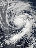
The origins of Blas can be traced to a tropical wave which moved off the west coast of Africa on June 19. The wave crossed the Atlantic Ocean and the Caribbean Sea with limited shower and thunderstorm activity. The wave moved into the Eastern Pacific on June 29. Deep convection associated with the system increased over the next few days as the system moved westwards south of the Mexican coast. By July 1, an area of low pressure had formed several hundred miles to the south of the southwestern coast of Mexico. The low-level circulation of the system became better defined later that day with convective banding features becoming evident. The NHC estimated that the system coalesced into a tropical depression at 1800 UTC on July 2 while centred around 575 mi (925 km) south-southwest of Manzanillo, Mexico. Twelve hours later, the depression strengthened into a tropical storm.[9]
Over the next several days, Blas tracked west-northwestwards to the south of a mid-level ridge through an environment conducive for intensification, characterized by low wind shear and warm waters of 29°C. Blas strengthened quickly, reaching hurricane strength by 1200 UTC on July 4. Thereafter, Blas underwent rapid intensification and attained major hurricane strength by 1800 UTC on July 5. Six hours later, Blas reached peak intensity with maximum sustained winds of 140 mph (220 km/h) and an estimated central pressure of 947 mbar (28.0 inHg). Blas weakened slightly to 125 mph (205 km/h) six hours later, but held this strength for nearly a day. The system turned northwestwards due to a break in the ridge and moved over progressively cooler waters below 26°C, which caused Blas to steadily weaken. The cyclone fell below major hurricane strength at 0000 UTC on July 8, and the storm weakened to a tropical storm by 0600 UTC on July 9. Devoid of organized deep convection, Blas degenerated into a remnant low by 0600 UTC on July 10. The now-shallow system was steered westwards by the low-level easterlies before it dissipated by 0000 UTC on July 12 while located about 920 mi (1,480 km) east of the Hawaiian islands.[9]
Hurricane Celia[edit]
| Category 2 hurricane (SSHWS) | |
| Duration | July 6 – July 16 |
|---|---|
| Peak intensity | 100 mph (155 km/h) (1-min); 972 mbar (hPa) |
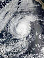
Celia originated from a tropical wave that left the western coast of Africa on June 22. The wave crossed the Atlantic Ocean and the Caribbean Sea with only limited shower activity. The system crossed Central America on July 1 and moved over the far eastern North Pacific. A positive, favourable phase of the Madden–Julian oscillation (MJO) in the region helped to cause a gradual increase in deep convection near the wave over the next few days. A broad low pressure area developed in association with the wave several hundred miles south of Manzanillo, Mexico on July 5. The low continued to become better defined over the following day, and thunderstorm activity increased and became better organized. As a result, a tropical depression formed at 1800 UTC on July 6, about 545 mi (875 km) south-southwest of Manzanillo. The nascent depression moved westwards to west-northwestwards to the south of a subtropical ridge that extended westwards from northern Mexico. Moderate southeasterly shear and mid-level dry air caused the depression's convection to become a little less organized on July 7, but deep convection increased early the following day, with a couple of curved bands developing around the cyclone's center. At 1200 UTC on July 8, the depression strengthened into a tropical storm and was named Celia.[10]
Around this time, Celia moved over the cold wake of Hurricane Blas, causing convection to weaken a little. As a result of the cooler SSTs, Celia strengthened only a little over the next 24 hours, in spite of otherwise favorable atmospheric conditions. By 1800 UTC on July 9, Celia had moved over warmer waters west of the cold wake, which led to faster strengthening. The cyclone's inner-core convection became better organized, and a ragged eye formed by 1800 UTC on July 10, signalling Celia's intensification to hurricane strength. Gradual strengthening continued, and Celia attained peak intensity at 1800 UTC on July 11, with estimates maximum winds of 100 mph (155 km/h) and a minimum pressure of 972 mbar (28.7 inHg). After maintaining this strength for eighteen hours, Celia began to weaken as it moved over slightly cooler waters and into a more stable air mass. The cyclone weakened into a tropical storm at 0600 UTC on July 13 while located about 1,380 mi (2,220 km) west of the southern tip of the Baja California peninsula. Deep convection continued to gradually decrease as the system moved west-northwestwards over 24 °C (75 °F) waters. The system crossed into the Central Pacific shortly after 0600 UTC on July 15, and cool waters and unfavorable thermodynamic conditions caused Celia's deep convection to dissipate later that day. Celia degenerated into a remnant low by 0600 UTC on July 16. The remnants of Celia continued westwards across the Central Pacific ultimately degenerating into a trough of low pressure by 1800 UTC on January 21 about 865 mi (1,390 km) west-northwest of Kauai.[10]
While the remnants of Celia passed to the north of the Hawaiian Islands on July 18 and 19, a band of enhanced tropical moisture moved across the island chain. This led to rainfall accumulations of 1 to 2.5 inches of rain across portions of the islands. As a result, the National Weather Service (NWS) office in Honolulu issued several flash flood watches and warnings during the afternoon and evening of July 18. Additionally, large swells due to Celia and its remnants led to wave heights up to 10 feet (3.0 m) along the east-facing shores of the islands between July 16 and 19, which caused NWS Honolulu to issue high surf advisories. Rough surf due to the swells led to two deaths by drowning on the southeastern shore of Oahu on July 16. There were no reports of damage associated with Celia or its remnants.[10]
Hurricane Darby[edit]
| Category 3 hurricane (SSHWS) | |
| Duration | July 11 – July 26 |
|---|---|
| Peak intensity | 120 mph (195 km/h) (1-min); 958 mbar (hPa) |
Tropical Storm Estelle[edit]
| Tropical storm (SSHWS) | |
| Duration | July 15 – July 22 |
|---|---|
| Peak intensity | 70 mph (110 km/h) (1-min); 990 mbar (hPa) |
A tropical wave moved off Africa's west coast on July 4. It reached the eastern Caribbean Sea on July 10 and travelled across Central America into the Eastern Pacific on July 12 and 13. A low pressure area developed in association with the wave on July 15 around 0000 UTC, a few hundred miles southwest of the southern coast of Mexico, and as the associated deep convection increased in coverage and organization, a tropical depression formed at 1200 UTC that day. The depression strengthened into a tropical storm, named Estelle, at 0000 UTC on July 16, about 355 mi (570 km) south-southwest of Manzanillo, Mexico. The nascent storm initially moved west-northwestwards under the influence of a strong region of high pressure located over United States-Mexico border that extended westwards over the Pacific Ocean. Though SSTs under the storm were 28-29°C, Estelle only gradually intensified due to moderate northeasterly shear. The cyclone reached its peak intensity of 70 mph (110 km/h) at 1800 UTC on July 17, while located about 460 mi (740 km) south-southwest of the southern tip of the Baja California Peninsula. At peak intensity, Estelle displayed a short-lived, ragged eye.[11]
Though the shear affecting Estelle decreased shortly after the cyclone's peak, Estelle failed to generate much inner-core convection, and the cyclone weakened slightly on July 18 while passing near Clarion Island. Some restrengthening occurred the following day, and by early on July 20, a mid-level eye feature formed in microwave imagery. However, the system began to weaken after crossing the 26°C isotherm into cooler, unfavourable waters by 0600 UTC that day. The storm degenerated into a post-tropical cyclone around 0000 UTC on July, when it was no longer producing any significant deep convection. The remnant low weakened further and dissipated shortly after 0600 UTC on July 24, about 920 mi (1,480 km) east-northeast of the Hawaiian Islands.[11]
Hurricane Frank[edit]
| Category 1 hurricane (SSHWS) | |
| Duration | July 21 – July 28 |
|---|---|
| Peak intensity | 85 mph (140 km/h) (1-min); 979 mbar (hPa) |
Frank's origin was associated with a large-amplitude tropical wave that moved off the west coast of Africa on July 10. The wave moved across the Atlantic with little thunderstorm activity, and reached the western Caribbean Sea on July 18. Over the next couple of days, the system developed a well-defined mid-level circulation, while its convection increased. At 0600 UTC on July 21, the system developed into a tropical depression about 295 mi (475 km) south of Manzanillo, Mexico. Six hours later, the depression intensified into a tropical storm and was named Frank. Initially, the storm moved westwards, away from Mexico's southwestern coast, around the periphery of a large mid-level anticyclone that was centered over the southern plains of the United States. The storm passed near Socorro Island on July 23 with winds of 65 mph (100 km/h). Over the next two-three days, as steering currents weakened, Frank slowed down, while its intensity fluctuated due to the influence of moderate easterly wind shear.[12]
As the subtropical ridge reamplified and a stronger steering pattern became established, Frank began to move a little faster on July 26. Around the same time, a ragged eye developed, and the cyclone's thunderstorm activity became better organized. The storm intensified into a hurricane at 1200 UTC that day, and attained its peak intensity twelve hours later, with estimated winds of 85 mph (140 km/h) and a minimum pressure of 979 mbar (hPa). Following peak intensity, Frank moved over cooler waters, resulting in rapid weakening. Frank's deep convection dissipated, leading to its degeneration into a remnant low by 1200 UTC on July 28, which dissipated by 0000 UTC on July 31.[12]
Hurricane Georgette[edit]
| Category 4 hurricane (SSHWS) | |
| Duration | July 21 – July 27 |
|---|---|
| Peak intensity | 130 mph (215 km/h) (1-min); 952 mbar (hPa) |
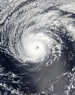
The disturbance that spawned Georgette was first trackable on July 13, just west of Central America. The disturbance moved westwards over the next few days, with convection generally limited to the Intertropical Convergence Zone (ITCZ). The disturbance produced a broad area of low pressure on July 17, which was accompanied by a few curved bands. Development was initially slow due to northwesterly wind shear associated with the outflow of Tropical Storm Estelle, but as Estelle moved away from the disturbance over the next couple of days, the shear lessened somewhat. Banding features increased on July 20, and a large area of deep convection developed near the center of the low. A well-defined circulation developed early on the following day, and the deep convection became organized enough a few hours later to mark the development of a tropical depression near 0600 UTC, about 805 mi (1,295 km) southwest of Manzanillo, Mexico. The nascent depression moved west-northwestwards, along the southwestern periphery of a subtropical ridge, while northeasterly shear prevented development of the depression. 30 hours after genesis, the depression strengthened into Tropical Storm Georgette.[13]
On July 22, microwave data indicated that the small storm was developing an inner core, but easterly shear caused the cyclone's circulation to become tilted. The shear began to relax the following day, which allowed Georgette to gradually intensify as it turned northwestwards. The cyclone strengthened to hurricane strength at 0000 UTC on July 24. Due to the low shear and the vertical alignment of the low- and mid-level circulation centers, Georgette rapidly intensified later that day, and the cyclone reached peak intensity at 0600 UTC the following day with estimated sustained winds of 130 mph (215 km/h) and a minimum pressure of 952 mbar (hPa), while located about 600 mi (965 km) southwest of Cabo San Lucas, Mexico. Scatterometer data from around peak intensity showed that Georgette remained a very small system, with tropical-storm-force winds extending only 45 mi (70 km) from the center of the cyclone.[13]
Later on July 25, Georgette began moving over cooler waters, triggering a rapid weakening trend that brought the system below hurricane strength the following day. The system continued to weaken as it moved through an increasingly unfavourable environment of even cooler waters and dry air, while slowing down as the subtropical ridge steering the cyclone weakened due to a mid- to upper-level trough. All deep convection associated with Georgette dissipated early on July 27, leading to the system's degeneration into a post-tropical cyclone at 0600 UTC that day, while about 1,240 mi (1,995 km) west-southwest of the southern tip of the Baja California Peninsula. The remnants of Georgette dissipated early on July 30.[13]
Tropical Storm Howard[edit]
| Tropical storm (SSHWS) | |
| Duration | July 31 – August 3 |
|---|---|
| Peak intensity | 60 mph (95 km/h) (1-min); 998 mbar (hPa) |
Howard originated from an area of disturbed weather that was noted within the eastern Pacific ITCZ, to the south of south of Eastern Mexico, on July 26. The disturbance moved westwards and spawned a broad area of low pressure on the following day several hundred miles south of Manzanillo, Mexico. While the low initially continued west-northwestwards with few signs of development, deep convection associated with the system increased and became more consolidated. Satellite images indicated that the low-level circulation had become better defined by 1200 UTC, and the NHC estimated that a tropical depression formed at this time about 865 mi (1,390 km) southwest of the southern tip of the Baja California Peninsula. The depression moved west-northwestwards while a mid-level ridge to the north built westwards. Early the following day, the cyclone strengthened into a tropical storm, as its cloud pattern became better organized.[14] Though significant intensification was limited by moderate vertical wind shear and marginally warm waters, Howard gradually strengthened over the following day. The cyclone's convective banding features became better defined and the center became increasingly embedded in the central dense overcast. At 0600 UTC on August 2, the storm reached a peak intensity of 60 mph (95 km/h), which it held for 18 hours. Thereafter, as Howard moved over cooler waters, the cyclone's convection began to diminish, and the storm weakened. At 1200 UTC the following day, Howard degenerated into a post-tropical cyclone, while maintaining gale-force winds. The remnant low moved westwards in the low-level trade wind flow for several days while gradually weakening, and ultimately opened up into a trough while passing near Oahu around 1800 UTC on August 7.[14]
Tropical Storm Ivette[edit]
| Tropical storm (SSHWS) | |
| Duration | August 2 – August 8 |
|---|---|
| Peak intensity | 60 mph (95 km/h) (1-min); 1000 mbar (hPa) |
Ivette formed from a tropical wave that left the western coast of Africa on July 21 and moved across the Atlantic Ocean and the Caribbean Sea with little convection. After it reached the eastern North Pacific on July 28, associated deep convection slowly increased over the next few days. Shower and thunderstorm activity further increased on August 1 due to the approach of an eastward-moving convectively coupled Kelvin wave, and a broad area of low pressure formed a couple hundred miles south of the southern tip of the Baja California Peninsula. Convection became better defined over the next two days, and the low developed into a tropical depression at 0000 UTC on August 3, about 750 mi (1,205 km) southwest of the southern tip of the Baja California Peninsula, after forming a well-defined center of circulation. Six hours later, the depression strengthened into a tropical storm. For the first five days of its existence as a tropical cyclone, Ivette decelerated and moved westwards to west-northwestwards under the influence a large subtropical ridge located to the north.[15]
Though the warm waters Ivette passed over and the unstable, moist environment around the cyclone favoured intensification, Ivette intensified very slowly due to moderate northerly wind shear. The storm reached its peak intensity of 60 mph (95 km/h) around 1800 UTC on August 5, while located about 1,475 mi (2,375 km) west-southwest of the southern tip of the Baja California Peninsula. After maintaining peak strength for about 12 hours, Ivette began to gradually weaken due to a combination of increasing southwesterly vertical wind shear and a drier, more stable environment. As Ivette crossed into the Central Pacific by 0600 UTC on August 8, it weakened into a tropical depression about 990 mi (1,595 km) east of Hilo, Hawaii. Twelve hours later, Ivette degenerated into post-tropical remnant low. The remnants of Ivette moved west-southwestwards over the next several days before dissipating by 0600 UTC on August 11, about 375 mi (605 km) south of Hilo.[15]
Tropical Storm Javier[edit]
| Tropical storm (SSHWS) | |
| Duration | August 7 – August 9 |
|---|---|
| Peak intensity | 65 mph (100 km/h) (1-min); 997 mbar (hPa) |
Javier formed from the remnants of Hurricane Earl, which made landfall in Belize as a Category 1 hurricane on August 4. While Earl's low-level circulation dissipated over the mountains of Mexico on August 6, its mid- to upper-level circulation moved quickly westwards across central Mexico, while the southern portion of Earl's broad circulation began interacting with the eastern Pacific ITCZ. By 1800 UTC on August 6, surface observations indicated that a low pressure area had formed along the ITCZ just west of Acapulco, Mexico, while new convection began developing over the Pacific and over land. This convective activity became better organized over the next few hours, and a tropical depression developed at 0600 UTC the following day, about 120 mi (195 km) south-southeast of Manzanillo, Mexico. Six hours later, the depression strengthened into a tropical storm about 50 mi (80 km) south of Manzanillo. Over the next two days, the small storm moved northwestwards along the periphery of a deep-layer subtropical ridge, remaining just offshore of southwestern Mexico.[16]
In spite of being located over warm waters conducive for development, Javier struggled to intensify due to moderate easterly mid-level wind shear. Nonetheless, a NOAA Hurricane Hunter aircraft found that Javier had intensified to a peak strength 65 mph (105 km/h) around 1800 UTC on August 8, while the storm was located about 70 mi (115 km) southeast of Cabo San Lucas, Mexico. After Javier reached its peak intensity, increasing easterly mid-level shear caused the decoupling of the low- and mid-level centers, resulting in a weakening trend through landfall. Javier made landfall around 0330 UTC on August 9 near San José del Cabo with winds of 50 mph (80 km/h). Interaction with the mountainous terrain of the Baja California Peninsula caused Javier to weaken rapidly, and the cyclone weakened into a depression at 1200 UTC. Six hours later, Javier degenerated into a remnant low, about 50 mi (80 km) south of Cabo San Lazaro, Mexico. The remnant circulation of Javier dissipated by 1800 UTC on August 10 just west of La Bocana, Mexico.[16]
The outer fringes of Javier caused flooding in Colima. Landslides occurred along the Lázaro Cárdenas and the Mexican Federal Highway 200.[17] In Manzanillo, a bridge collapsed and numerous federal highways were damaged while the city's port was closed due to high waves.[18] Shortly after Javier attained tropical storm status, a "green" alert was issued for the municipality of Los Cabos.[19] Officials opened 18 shelters across the southern Baja California Peninsula, while also closing ports.[20] Later, when Javier was forecast to become a hurricane, an "orange" alert was issued for the entire state of Baja California Sur.[21] In the municipalities of La Paz and Los Cabos, authorities delayed the start of the school year.[22] Six flights were canceled to and from San José del Cabo.[23] Meanwhile, a "blue" alert was declared for Sonora.[24]
Tropical Storm Kay[edit]
| Tropical storm (SSHWS) | |
| Duration | August 18 – August 23 |
|---|---|
| Peak intensity | 50 mph (85 km/h) (1-min); 1000 mbar (hPa) |
An ill-defined tropical wave moved into the Eastern Pacific on August 11. During the next couple of days, the wave produced disorganized convection while moving westwards to the south of Central America and southeastern Mexico. The disturbance slowed down on August 13, and on the following day developed a broad cyclonic gyre. The circulation of the disturbance became better defined over the next two days, and a low pressure area formed on August 17. In spite of strong easterly shear, deep convection associated with the low increased in coverage, and acquired enough persistence for the system to be classified as a tropical depression around 1200 UTC on August 18. At formation, the depression was located about 410 mi (660 km) south-southeast of the southern tip of the Baja California Peninsula. 18 hours later, the slow-moving depression strengthened into Tropical Storm Kay.[25]
At first, Kay only slightly intensified due to a combination of the shear and the cyclone's broad wind field. After passing Socorro Island on August 19, the storm turned west-northwestwards the following day. Around 1200 UTC on August 20, Kay attained its peak intensity with estimated winds of 50 mph (85 km/h). Microwave data from around the time showed a mid-level eye feature about 30 mi (50 km) to the west of the low-level circulation center. Over the next 24 hours, this separation between the low- and mid-level centers increased, causing some weakening, before a decrease in the shear allowed Kay to restrengthen to its peak intensity by 1800 UTC on August 21. Thereafter, the system crossed the 26°C isotherm and ingested drier air, causing weakening to commence. Having lost all of its deep convection, Kay degenerated into a remnant low by 1200 UTC on August 23. The remnants of Kay continued to move west-northwestwards for several days before dissipating on August 26, about 675 mi (1085 km) west of the southern tip of the Baja California Peninsula.[25]
Hurricane Lester[edit]
| Category 4 hurricane (SSHWS) | |
| Duration | August 24 – September 7 |
|---|---|
| Peak intensity | 145 mph (230 km/h) (1-min); 944 mbar (hPa) |
Hurricane Madeline[edit]
| Category 4 hurricane (SSHWS) | |
| Duration | August 26 – September 2 |
|---|---|
| Peak intensity | 130 mph (215 km/h) (1-min); 950 mbar (hPa) |
Hurricane Newton[edit]
| Category 1 hurricane (SSHWS) | |
| Duration | September 4 – September 7 |
|---|---|
| Peak intensity | 90 mph (150 km/h) (1-min); 977 mbar (hPa) |
Hurricane Orlene[edit]
| Category 2 hurricane (SSHWS) | |
| Duration | September 11 – September 17 |
|---|---|
| Peak intensity | 110 mph (175 km/h) (1-min); 967 mbar (hPa) |
Hurricane Paine[edit]
| Category 1 hurricane (SSHWS) | |
| Duration | September 18 – September 20 |
|---|---|
| Peak intensity | 90 mph (150 km/h) (1-min); 979 mbar (hPa) |
Tropical Storm Roslyn[edit]
| Tropical storm (SSHWS) | |
| Duration | September 25 – September 29 |
|---|---|
| Peak intensity | 50 mph (85 km/h) (1-min); 999 mbar (hPa) |
Hurricane Ulika[edit]
| Category 1 hurricane (SSHWS) | |
| Duration | September 26 – September 30 |
|---|---|
| Peak intensity | 75 mph (120 km/h) (1-min); 992 mbar (hPa) |
Hurricane Seymour[edit]
| Category 4 hurricane (SSHWS) | |
| Duration | October 23 – October 28 |
|---|---|
| Peak intensity | 150 mph (240 km/h) (1-min); 940 mbar (hPa) |
Tropical Storm Tina[edit]
| Tropical storm (SSHWS) | |
| Duration | November 13 – November 14 |
|---|---|
| Peak intensity | 40 mph (65 km/h) (1-min); 1004 mbar (hPa) |
Tropical Storm Otto[edit]
| Tropical storm (SSHWS) | |
| Duration | November 25 (Entered basin) – November 26 |
|---|---|
| Peak intensity | 70 mph (110 km/h) (1-min); 993 mbar (hPa) |
Other systems[edit]
Storm names[edit]
The following names were used for named storms that formed in the northeastern Pacific Ocean during 2016. No names were retired during the 39th session of the RA IV hurricane committee on March 26, 2017; as such, they will all be reused in the 2022 season.[26] This was the same list used in the 2010 season, except for the name Ivette, which replaced Isis, after it became synonymous with the Islamic State of Iraq and Syria.[27] Therefore, the name Ivette was used for the first time this year.
|
|
Otto entered the northeastern Pacific basin from the Atlantic basin, having survived its passage over Central America as a tropical cyclone. The name "Otto" was later retired due to its significant impacts in Central America.[28]
For storms that form in the Central Pacific Hurricane Center's area of responsibility, encompassing the area between 140 degrees west and the International Date Line, all names are used in a series of four rotating lists.[29] The next four names slated for use are shown below, though only two were used during the season.
|
|
|
|
Season effects[edit]
This is a table of all the storms that have formed in the 2016 Pacific hurricane season. It includes their duration, names, landfall(s), denoted in parentheses, damages, and death totals. Deaths in parentheses are additional and indirect (an example of an indirect death would be a traffic accident), but were still related to that storm. Damage and deaths include totals while the storm was extratropical, a wave, or a low, and all the damage figures are in 2016 USD. Impacts in the Atlantic and western Pacific basins are excluded.
| Saffir–Simpson scale | ||||||
| TD | TS | C1 | C2 | C3 | C4 | C5 |
| Storm name |
Dates active | Storm category at peak intensity |
Max 1-min wind mph (km/h) |
Min. press. (mbar) |
Areas affected | Damage (USD) |
Deaths | Ref(s) | ||
|---|---|---|---|---|---|---|---|---|---|---|
| Pali | January 7 – 14 | Category 2 hurricane | 100 (155) | 978 | None | None | None | |||
| One-E | June 6 – 8 | Tropical depression | 35 (55) | 1006 | Southwestern Mexico | Minor | None | |||
| Agatha | July 2 – 5 | Tropical storm | 50 (85) | 1002 | None | None | None | |||
| Blas | July 2 – 10 | Category 4 hurricane | 140 (220) | 947 | Hawaii | None | None | |||
| Celia | July 6 – 16 | Category 2 hurricane | 100 (155) | 972 | Hawaii | None | 2 | |||
| Darby | July 11 – 26 | Category 3 hurricane | 120 (195) | 958 | Hawaii | Minimal | None | |||
| Estelle | July 15 – 22 | Tropical storm | 70 (110) | 990 | None | None | None | |||
| Frank | July 21 – 28 | Category 1 hurricane | 85 (140) | 979 | Baja California Peninsula, Nayarit | None | None | |||
| Georgette | July 21 – 27 | Category 4 hurricane | 130 (215) | 952 | Hawaii | None | None | |||
| Howard | July 31 – August 3 | Tropical storm | 60 (95) | 998 | Hawaii | None | None | |||
| Ivette | August 2 – 8 | Tropical storm | 60 (95) | 1000 | None | None | None | |||
| Javier | August 7 – 9 | Tropical storm | 65 (100) | 997 | Western Mexico, Northwestern Mexico, Baja California Peninsula | Minimal | None | |||
| Kay | August 18 – 23 | Tropical storm | 50 (85) | 1000 | None | None | None | |||
| Lester | August 24 – September 7 | Category 4 hurricane | 145 (230) | 944 | Hawaii | None | None | |||
| Madeline | August 26 – September 2 | Category 4 hurricane | 130 (215) | 950 | Hawaii | Minimal | None | |||
| Newton | September 4 – 7 | Category 1 hurricane | 90 (150) | 977 | Baja California Peninsula, Northwestern Mexico, Southwestern United States | $95.8 million | 9 | |||
| Orlene | September 11 – 17 | Category 2 hurricane | 110 (175) | 967 | None | None | None | |||
| Paine | September 18 – 21 | Category 1 hurricane | 90 (150) | 979 | Baja California Peninsula, Southwestern United States | Minimal | None | |||
| Roslyn | September 25 – 29 | Tropical storm | 50 (85) | 999 | None | None | None | |||
| Ulika | September 26 – 30 | Category 1 hurricane | 75 (120) | 992 | None | None | None | |||
| Seymour | October 23 – 28 | Category 4 hurricane | 150 (240) | 940 | Baja California | None | None | |||
| Tina | November 13 – 14 | Tropical storm | 40 (65) | 1004 | Western Mexico | None | None | |||
| Otto | November 25 – 26 | Tropical storm | 70 (110) | 993 | None (after crossover) | None | None | |||
| Season aggregates | ||||||||||
| 23 systems | January 7 – November 26 | 150 (240) | 940 | $95.8 million | 11 | |||||
See also[edit]
- Tropical cyclones in 2016
- List of Pacific hurricanes
- Pacific hurricane season
- 2016 Atlantic hurricane season
- 2016 Pacific typhoon season
- 2016 North Indian Ocean cyclone season
- South-West Indian Ocean cyclone seasons: 2015–16, 2016–17
- Australian region cyclone seasons: 2015–16, 2016–17
- South Pacific cyclone seasons: 2015–16, 2016–17
- South Atlantic tropical cyclone
Notes[edit]
References[edit]
- ^ "Background Information: East Pacific Hurricane Season". Climate Prediction Center. College Park, Maryland: National Oceanic and Atmospheric Administration. May 22, 2014. Retrieved May 29, 2014.
- ^ a b National Hurricane Center; Hurricane Research Division; Central Pacific Hurricane Center (April 4, 2023). "The Northeast and North Central Pacific hurricane database 1949–2022". United States National Oceanic and Atmospheric Administration's National Weather Service. A guide on how to read the database is available here.
 This article incorporates text from this source, which is in the public domain.
- ^ a b http://smn.cna.gob.mx/tools/DATA/Ciclones%20Tropicales/Proyecci%C3%B3n/2016.pdf
- ^ a b "Near-normal Atlantic hurricane season is most likely this year - National Oceanic and Atmospheric Administration". Retrieved 1 September 2016.
- ^ a b c Wroe, Derek; Houston, Sam (December 13, 2018). "Hurricane Pali" (PDF). National Hurricane Center. Retrieved December 31, 2020.
{{cite web}}: CS1 maint: url-status (link) - ^ Masters, Jeff (January 13, 2016). "Unprecedented: Simultaneous January Named Storms in the Atlantic and Central Pacific". Weather Underground. Archived from the original on January 15, 2016. Retrieved January 1, 2021.
- ^ Bob Henson (January 7, 2016). "Rare January Depression in Central Pacific; Atlantic Subtropical Storm Next Week?". Weather Underground. Archived from the original on January 8, 2016. Retrieved May 10, 2017.
- ^ a b c Stewart, Stacy R. (September 19, 2016). "Tropical Storm Agatha" (PDF). National Hurricane Center. Retrieved January 2, 2021.
{{cite web}}: CS1 maint: url-status (link) - ^ a b Pasch, Richard J. (March 13, 2017). "Hurricane Blas" (PDF). National Hurricane Center. Retrieved January 9, 2021.
{{cite web}}: CS1 maint: url-status (link) - ^ a b c Brown, Daniel P.; Jacobson, Chris (January 25, 2017). "Hurricane Celia" (PDF). National Hurricane Center and Central Pacific Hurricane Center. Retrieved January 27, 2021.
{{cite web}}: CS1 maint: url-status (link) - ^ a b Berg, Robbie (August 23, 2016). "Tropical Storm Estelle" (PDF). National Hurricane Center. Retrieved May 23, 2021.
{{cite web}}: CS1 maint: url-status (link) - ^ a b Avila, Lixion A. (September 20, 2016). "Hurricane Frank" (PDF). National Hurricane Center. Retrieved May 23, 2021.
{{cite web}}: CS1 maint: url-status (link) - ^ a b c Blake, Eric S. (October 27, 2016). "Hurricane Georgette" (PDF). National Hurricane Center. Retrieved June 6, 2021.
{{cite web}}: CS1 maint: url-status (link) - ^ a b Pasch, Richard J. (March 21, 2017). "Tropical Storm Howard" (PDF). National Hurricane Center. Retrieved June 8, 2021.
{{cite web}}: CS1 maint: url-status (link) - ^ a b Beven II, John L.; Landsea, Christopher W.; Jelsema, Jon (January 18, 2017). "Tropical Storm Ivette" (PDF). National Hurricane Center and Central Pacific Hurricane Center. Retrieved June 9, 2021.
{{cite web}}: CS1 maint: url-status (link) - ^ a b Stewart, Stacy R. (January 3, 2017). "Tropical Storm Javier" (PDF). National Hurricane Center. Retrieved June 9, 2021.
{{cite web}}: CS1 maint: url-status (link) - ^ "Deja tomenta Javier daños a carreteras e infraestructura de Colima". Terra. August 8, 2016. Retrieved August 9, 2016.
- ^ "Tormenta 'Javier' provoca inundaciones y daños en carreteras de Colima". El Financiero (in Spanish). August 8, 2016. Retrieved August 9, 2016.
- ^ "Activan alerta preventiva por "Javier" en Baja California Sur". El Universal (in Spanish). August 7, 2016. Retrieved August 9, 2016.
- ^ "Mexico hunts for missing after landslides kill 45". ReliefWeb. Agence France-Presse. August 8, 2016. Archived from the original on August 20, 2016. Retrieved August 10, 2016.
- ^ "Emiten alerta naranja en BCS por tormenta tropical "Javier"". El Universal (in Spanish). August 8, 2016. Retrieved August 9, 2016.
- ^ "Fuertes lluvias se mantienen en BCS por "Javier" habilitan 19 albergues". El Universal (in Spanish). August 8, 2016. Retrieved August 9, 2016.
- ^ "Volaris cancela vuelos por tormenta Javier". El Universal (in Spanish). August 8, 2016. Retrieved August 9, 2016.
- ^ "Sonora emite la alerta azul por la tormenta "Javier"". El Universal (in Spanish). August 8, 2016. Retrieved August 9, 2016.
- ^ a b Kimberlain, Todd B. (November 12, 2016). "Tropical Storm Kay" (PDF). National Hurricane Center. Retrieved June 11, 2021.
{{cite web}}: CS1 maint: url-status (link) - ^ "Tropical Cyclone Names". National Hurricane Center. National Oceanic and Atmospheric Administration. 2013-04-11. Archived from the original on May 8, 2013. Retrieved May 8, 2013.
- ^ "'Isis' among names removed from UN list of hurricane names". Reuters. April 17, 2015. Retrieved January 7, 2016.
- ^ "World Meteorological Organisation retires storm names Matthew and Otto". National Oceanic and Atmospheric Administration. 27 March 2017. Retrieved 27 March 2017.
- ^ "Pacific Tropical Cyclone Names" (PHP). Central Pacific Hurricane Center. National Oceanic and Atmospheric Administration. April 11, 2013. Archived from the original on May 8, 2013. Retrieved May 8, 2013.


