User:Gardar Rurak/sandbox5
Cityscape[edit]

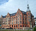
Aarhus presents architectural styles spanning the Middle Age to modern day; especially Neoclassicism, National Romanticism and Functionalism are well represented. The skyline is defined by 4-6 story buildings and is predominantly a mix of townhouses, perimeter blocks and free-standing towers. The history of the city is evidenced by its layout; the streets Volden (The Rampart) and Graven (The Moat) mark the west and north boundary of the early Viking age settlement, along with the river and coast to the south and east.[1] The Allégaderingen ring road traces the city walls as they stood up to the 1850s and Ringgaden from the 1920s encompass most of the neighborhoods developed during the Industrial Revolution.[2]

The Latin Quarter is the oldest area, defined by narrow, curved streets and low, dense housing, some dating as far back as the 1500s. Surrounding it are neighborhoods that were created during the Industrial Revolution in the period 1850-1940. The earliest of this growth spread organically, with limited central planning, and can be seen in Nørre Stenbro, Øgadekvarteret and northern Frederiksbjerg, characterized by 2-3 story townhouses of varying styles and heights. The sustained population growth necessitated the first urban planning schemes resulting in larger and more uniform developments; mostly 4-6 story city blocks, characteristic for Trøjborg, Vesterbro Torv and the south of Frederiksbjerg. Later the political ideals of the 1960s spurred massive housing projects in the suburbs, such as Gellerup and Tilst, where large free-standing concrete blocks were built to provide cheap, quality housing. The decline of manufacturing in the later 20th century left many central industrial sites vacant which, since the turn of the millennium, are being converted into modern mixed-use developments such as the Docklands and CeresByen. In 2017 the city council is scheduled to complete a zoning policy for the industrial south harbor borough to eventually have it redeveloped into the first high-rise neighborhood in the city.
The rise of the suburbs and increasing traffic in the 20th century meant large areas of the city were given over to car-centric infrastructure, notably the river was paved over in the 1920s to create a new thoroughfare. This tendency was reversed in the 2000s; the river was fully uncovered in 2016 while prominent public spaces such as Bispetorv, Europaplads and Mindebro Torv were converted from roads or parking spaces to public squares. The increasing pedestrianization is symptomatic for a shift in the approach to urban and traffic planning which has fundamentally changed central areas of the inner city and greatly expanded recreational areas since the 1990s.
Publications[edit]
- Jantzen, Connie (2013). Spor i byrummet efter det ældste Aarhus. Den Gamle By. ISBN 978-87-7934-296-5.
...[edit]
- http://www.aarhus.dk/~/media/Dokumenter/Teknik-og-Miljoe/Byudvikling-og-Mobilitet/Mobilitet/Debatoplaeg-Mobilitetsplan-Aarhus-Midtby-14-10-2015-digital.pdf
- http://www.aarhus.dk/~/media/Dokumenter/Teknik-og-Miljoe/Trafik-og-Veje/Planlaegning/Cykelhandlingsplan/Cykelhandlingsplan.pdf
- https://www.aarhus.dk/~/media/eDoc/3/1/2/3128679-5015835-1-pdf.pdf
- http://jyllands-posten.dk/aarhus/erhverv/ECE8405198/hoejhuse-musik-og-groenne-omraader-paa-sydhavnen/
- https://www.aarhus.dk/da/omkommunen/nyheder/2015/April/Den-nye-Europaplads-er-klar-til-brug.aspx
https://www.aarhus.dk/~/media/eDoc/C/1/2/C125711F0048D96EC1257AA9002F4503attach3.pdf
 Frederiks Allé | |
| Native name | Frederiks Allé Error {{native name checker}}: parameter value is malformed (help) |
|---|---|
| Length | 1,000 m (3,300 ft) |
| Location | Indre By and Frederiksbjerg, Aarhus, Denmark |
| Postal code | 8000 |
Frederiks Allé (lit. "Frederik's Boulevard") is a street in the Indre By and Frederiksbjerg districts in Aarhus, Denmark. The street runs north to south from Frederiksgade to De Mezas Vej. Frederiks Allé is a major thoroughfare that absorbs a lot of the traffic from the southern suburbs and is functionally an extension of Skanderborgvej. Frederiks Allé runs past the City Hall Park and Concert Hall Park and divides the parks. The street is named for King Frederik VI (1768 – 1839)
http://aarhus-city.dk/besoeg-aarhus-city/city-omrader/frederiksalle/ https://aarhuswiki.dk/wiki/Frederiks_All%C3%A9
History[edit]
External links[edit]
References[edit]
- ^ Jantzen 2013, p. 63, line 13: "Den nuværende gade Volden løber langs denne volds inderside ... Gaden Graven, der er anlagt dels over og dels langs den nordre voldgrav, følger voldens forløb ud mod kysten. "
- ^ "Kulturhistorisk redegørelse 2013" (PDF) (in Danish). page 103, line 42: Aarhus Municipality. Retrieved 27 January 2017.
Sidste grænseforløb for købstadskernen kaldet "Vejen bag om byen" ligger i dag som Allégaderingen.
{{cite web}}: CS1 maint: location (link) - ^ "Frederiks Allé" (in Danish). Aarhus City Archives. Archived from the original on 31 January 2017. Retrieved 31 January 2017.
- ^ "Frederiks Allé" (in Danish). Aarhus City Foreneing. Archived from the original on 31 January 2017. Retrieved 31 January 2017.
- Publications
- Weinreich, Mogens (2007). Kend din by II. Østjysk Hjemstavnsforening. ISBN 978-87-985681-6-2.
- Sejr, Emanuel (1961). Gamle Århusgader II. Universitetsforlaget. ISBN 87-89386-58-2.
56°08′57″N 10°11′53″E / 56.1493°N 10.1980°E


