
User:El Foes/sandbox

| Loch Tay | |
|---|---|
 Loch Tay at Kenmore in spring | |
| Location | Perthshire, Scotland |
| Coordinates | 56°30′56″N 4°08′46″W / 56.51556°N 4.14611°W |
| Type | Loch |
| Primary inflows | Dochart, Lochay |
| Catchment area | 232 sq mi (600 km2)[1] |
| Basin countries | United Kingdom |
| Max. length | 14.55 mi (23.42 km)[1] |
| Max. width | 0.7 mi (1.1 km)[1] |
| Surface area | 10.19 sq mi (26.4 km2)[1] |
| Average depth | 60.66 m (199.0 ft)[1] |
| Max. depth | 154.8 m (508 ft)[1] |
| Islands | 7 |
| Settlements | Killin, Kenmore, Lawers |
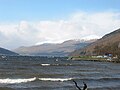
Loch Tay (Scottish Gaelic, Loch Tatha) is a freshwater loch in the central highlands of Scotland, in the district of Perthshire.
It is a long narrow loch of around 14.55 mi (23.42 km) long, and typically around 1 to 1½ miles wide, following the line of the valley from the south west to north east. It is the sixth largest loch in Scotland by area and over 150 m (490 ft) deep at its deepest.
Ben Lawers on its north shore is at 1214 m the 10th highest mountain in the British Isles, and is the highest peak in a group of seven munros.

Killin at the head of the loch, and Kenmore at the outflow of the River Tay, are the main settlements on the lochside today. The smaller settlements of Acharn, Ardeonaig and Ardtalnaig are located on the south side of the loch whilst Fearnan and Lawers are on the north side. The loch is fed by the rivers Dochart and Lochay at its head and numerous smaller streams.
The loch is a popular spot for salmon fishing.
The loch, and many of its surroundings, feature in the traditional Scottish 'Loch Tay Boat Song' (Scottish Gaelic, Iorram Loch Tatha).
Loch Tay railway station was on the Killin Railway. It is now closed.
In ancient times (in the Iron Age) people lived on defensible, man-made islands on the loch, called Crannogs. More than 20 submerged crannogs have been identified in the loch. An example has now been reconstructed on the south side of the loch at the Scottish Crannog Centre.
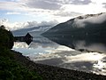
Gallery[edit]
-
 Loch Tay at Kenmore (in winter)
 -
 Loch Tay at Kenmore (in summer)
 -
 Loch Tay Crannog
 -
 Loch Tay looking east from Morenish
 -
 Loch Tay


References[edit]
External links[edit]
Tay Category:Protected areas of Perth and Kinross Tay
This Perth and Kinross location article is a stub. You can help Wikipedia by expanding it. |