
User:Brit in Seoul/sandbox
Mapo
마포구 | |
|---|---|
| 마포구 · 麻浦區 | |
 | |
 Location of Mapo-gu in Seoul | |
| Country | South Korea |
| Region | Sudogwon |
| Special City | Seoul |
| Administrative dong | 24 (16 actual precincts) |
| Area | |
| • Total | 23.87 km2 (9.22 sq mi) |
| Population (2015[1]) | |
| • Total | 381,330 |
| • Density | 16,000/km2 (41,000/sq mi) |
| Time zone | UTC+9 (Korea Standard Time) |
| Postal code | 03900 ~ 04299 |
| Area code(s) | +82-2 300,700,3150 |
| Website | Mapo-gu official website |
Mapo District (Korean: 마포구, romanized: Mapo-gu) is one of the 25 districts of Seoul, South Korea.
Mapo has a population of 381,330 (2015) and has a geographic area of 23.87 km2 (9.22 sq mi), and is divided into 24 dong (administrative neighborhoods). Mapo is located in western Seoul on the northern bank of the Han River, bordering the Gyeonggi Province city of Goyang to the northwest, and the Seoul city districts of Gangseo to the west, Yeongdeungpo to the south, Yongsan to the southeast, Jung to the east, and Seodaemun and Eunpyeong to the north.
Mapo is home to several universities and government buildings, and is well known for the Hongdae club district around Hongik University. Mapo is connected to the Seoul Metropolitan Subway's Line 2, Line 5, and Line 6, as well as the Airport Railroad, and the Korail Gyeongui-Jungang Line, which all pass through this district. The Seoul World Cup Stadium, a famous landmark in Seoul, is located in Sangam in northwest Mapo.
Description[edit]
Mapo is one of the 25 autonomous districts in Seoul. It is the most westerly district on the north side of the Han River and its river bank is one of the longest of all the districts, giving rise to a long riverside park. The district is dominated by universities (Hongik University, Yonsei University, Ewha Women's University and Sogang University all lie in or close to the district and have given rise to a large student population and extensive nightlife and leisure facilities. The district is also home to numerous other leisure and sports facilities including Mangwon Han River Park, Nanji Hang River campsite, Yeontral Park and Seoul World Cup Stadium which was erected for the 1988 Seoul Summer Olympic Games. To the west of the district is Digital Media City which, as its name infers, is dedicated to digital media and is home to several mainstream media outlets. There are several major subway stations in the district which act as transfer stations, foremost among which are Hongik University Station and Gongdeok Station which are served by three and four different lines respectively.
Etymology[edit]
The name "Mapo" comes from the name of an old ferry across the Han River, and can roughly be translated as "hemp ferry."
Mapo-dong# Eastern area
This was where Maponaru Port was in the past, and the name "Mapo-dong" originated from the port's name. Maponaru Port was the most crowded of the five water transportation hubs along the Hangang River (Ttukseom, Noryang, Yongsan, Yanghwajin, and Mapo) and originally called "Samgae" which later changed to "Mapo".
History[edit]

.jpg)
‘Mapo has been a region favored by many poets and artists from across the country for its beautiful riverscape’
The current name of the area came from its old names such as Mapogang and Mapohang. Located by the banks of the Hangang River in middle western Seoul, the Mapo area had three mountain ranges―Wausan Mountain Range branching off from Ansan and Nogosan and Yongsan Mountain Ranges―that stretched towards the Hangang River. Along the mountain ranges were three lakes named Seoho, Mapo and Yongho, respectively. These three lakes were collectively called "Samgae," meaning "three ports" of which Mapo was referred to as "Mapogang" or "Mapohang". The current name "Mapo" came from these old names. The Mapo area, as a hub for waterway transport and an area with storages for grain from the three southern provinces, saw the development of prosperous fishing villages since ancient times. During the early Joseon era, the area was under the jurisdiction of Hanseong-bu. Though it was located within 10 li (equivalent to about 4 km) of the fortress, it is presumed that it was not an independent administrative district. By the late Joseon Dynasty, five bang (Dumo-bang, Hangang-bang, Dunji-bang, Yongsan-bang, and Seogang-bang) were newly established as administrative districts within Hanseong-bu and part of the current Mapo-gu was incorporated into Yongsan-bang and Seogang-bang.
Today's Mapo-gu was established on October 30, 1944 as a district including the areas separated from Seodaemun-gu and Yongsan-gu in accordance with the Japanese Government-General of Korea Ordinance No. 350. At the time of its establishment, Mapo-gu had 23 jeong within it: Ahyeon-jeong, Gongdeok-jeong, Singongdeok-jeong, Dohwa-jeong, Mapo-jeong, Tojeong-jeong, Yonggang-jeong, Yeomni-jeong, Daeheung-jeong, Sinsu-jeong, Gusu-jeong, Hyeonseok-jeong, Sinjeong-jeong, Hajung-jeong, Changjeon-jeong, Donggyo-jeong, Seogyo-jeong, Sangsuil-jeong, Hasuil-jeong, Dangin-jeong, Hapjeong-jeong, Mangwon-jeong, and Yuldo-jeong. After the Japanese forces withdrew with the liberation of Korea on August 15, 1945, the US military government started to rule South Korea. On October 16, 1945, the "gu yeokso" that was in charge of the administration of each gu changed to "gu cheong" (gu office), and "gujang," the title of the head of gu, also changed to "gucheongjang". Since then, the Mapo Guyeokso was called "Mapo-gu Cheong" and 23 jeong within the gu were referred to as "dong."
"donghoe" was replaced by "dong." With this, administrative dong were organized under the jurisdiction of each gu for effective administrative work. Mapo-gu had 19 administrative dong including Ahyeon 1, 2, 3, 4, and 5-dong, Singongdeok 1 and 2-dong, Dohwa 1 and 2-dong, Gwannan-dong, Daeheung-dong, Yeomni-dong, Sinseok-dong, and Segyo-dong.
Afterwards, there were several more changes in the administrative dong names and the areas under the jurisdiction of each dong. Pursuant to Seoul City Ordinance No. 2016 on September 1, 1985, part of Yonggang-dong was incorporated into Yeomni-dong. On June 1, 1989, in accordance with Seoul City Ordinance on the Dong Names and Deliminations in Mapo-gu No. 84, the entire Hasu-dong was integrated into Sangsu-dong; the 28-beonji area in Mangwon-dong and all the rest of Mangwon-dong except for the areas under the jurisdiction of Mangwon 1 and 2-dong were incorporated into Seogyo-dong and Hapjeong-dong, respectively. In this process, today's administrative organization of Mapo-gu was completed. Mapo-gu is now envisioning a brighter future.
Administration[edit]


Mapo District Office[edit]
Mapo District Office is located in Seongsan-2 precinct, near World Cup Stadium (5 minutes on foot). Seoul Metropolitan Subway Line 6 passes near the office, and it has a station name "Mapo-gu Office" 150 metres (490 ft) east of the office. The district office has 5 Bureaus, 1 Community Health Center, 36 Divisions, 1 Room, 1 Task Force Team, 16 Community Service Centers. Mapo District Office employs about 1,300 personnel. The entire office is headed by Administrator. Current Administrator is Hong-seop Park (2017).
Administrative Divisions[edit]
Mapo District was formed in 1944 from portions of Seodaemun and Yongsan Districts. The dong (동) structure was revised in 1985 and 2008. Roughly 53% of Mapo District's area is taken up by residences, many of which are high-rise apartment buildings. Much of the remaining area (43%) is greenspace, including the World Cup Park and additional parkland along the Han River.[2]
In the 2008 revamping of the precinct (dong) administration, some smaller precincts were merged to form larger precincts, effectively reducing the number of precinct administrative offices. As a result, the number of precinct offices decreased to 16 from 24. However, addresses remained the same.
These are the revamped administrative precincts:
- Gongdeok-dong (공덕동; 孔德洞)
- Ahyeon-dong (아현동; 阿峴洞)
- Dohwa-dong (도화동; 桃花洞)
- Daeheung-dong (대흥동; 大興洞)
- Yonggang-dong (용강동; 龍江洞)
- Hapjeong-dong (합정동; 合井洞)
- Seogyo-dong (서교동; 西橋洞)
- Seogang-dong (서강동; 西江洞)
|
Economy[edit]

.jpg)
Hongdae
AK&Hongdae Location188, Yanghwa-ro, Mapo-gu Contact+82-2-789-9800 Websitehttp://www.akand.co.kr/hongdae AK&Hongdae is a local-friendly shopping center located at Exit 4 of Hongik University Station on the Seoul Subway Line 2.
Hongtong Street Location77, Eoulmadang-ro, Mapo-gu Hongtong Street is located across Hongdae Pedestrian-Friendly Street in the Hongik University District. The street is lined with small but stylish clothing stores, showing the fashion senses of young trendsetters in the district at a glance
Digital Media City
Transport[edit]
Subway
AREX

Education[edit]

Four college or university institutions, including Sogang University and Hongik University, are located within Mapo District. The area around Hongik University, also known as Hongdae, is well known as one of the cultural centers of Seoul, and was named one of the coolest neighborhoods in the world in 2016.[3] There are eight high schools, including Seoul Girls' High School, along with 12 middle schools and 20 elementary schools serving the community. There are three special schools for handicapped or industrial educations. Due to the presence of university students in the district, Mapo District offers a large variety of shopping and dining options. The area around Ewha Women's University is known for its affordable yet trendy merchandise, while neighboring Shinchon has an enormous number of take out and sit down restaurants.
International schools:
Green Space[edit]
File:Mangwon Hangang Park.png
Mangwon Hangang
Gyeongui Line Forest Park
Landmarks[edit]
Kim Dae-jung Library Location5-26, Sinchon-ro 4-gil, Mapo-gu Contact02-2123-6890 Websitehttps://www.kdjlibrary.org/ Kim Dae-jung Library opened in November 2003 as Asia's first presidential library. Kim, the 15th President of the Republic of Korea and the Nobel Peace Prize winner, donated the library building, over 16,000 materials and 10,000 books, and the Nobel Peace Prize money to Yonsei University. This library was established based on his wish to contribute to the development of the university and its founding philosophy.
President Park Chung-hee Memorial Library Location386, World Cup-ro, Mapo-gu Contact+82-2-716-9345 Websitehttp://www.presidentparkchunghee.org/ The library operates an exhibition hall that shows the history of South Korea's transition from ruins after the Korean War to a new Asian economic power that created the Miracle on the Han River. Here, parents' and children's generations can together see their country's history of industrialization at a glance
Sport[edit]
Seoul World Cup Stadium Location240, World Cup-ro, Mapo-gu Contact+82-2-2128-2002 Websitehttp://www.sisul.or.kr/open_content/worldcup/ Seoul World Cup Stadium is Asia's largest soccer stadium that can accommodate over 66,000 people. The stadium was designed in the form of a Hwangpo Dotbae, a traditional Korean boat that was used to transport goods through the rivers during the Joseon era, and a Bangpaeyeon (shield kite), a traditional Korean kite.
Sister cities[edit]
References[edit]
- ^ Korean Statistical Information Service > Population and Household > Census Result (2015) > Population by Administrative district, Sex and Age / Alien by Administrative district and Sex, Retrieved 2017-03-08.
- ^ 구정여건 (in Korean). Retrieved 2006-06-21.
- ^ The 15 Coolest Neighborhoods in the World in 2016, retrieved November 17, 2016
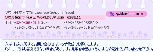
- ^ Home page Archived 2015-03-19 at the Wayback Machine. Japanese School in Seoul. Retrieved on January 15, 2015. See address here "ソウル特別市麻浦区上岩洞1582"
External links[edit]
![]() Media related to Mapo-gu, Seoul at Wikimedia Commons
Media related to Mapo-gu, Seoul at Wikimedia Commons
- Mapo-gu government website (in English)
| Districts |
|  | ||||
|---|---|---|---|---|---|---|
| Business districts |
| |||||
37°33′50″N 126°54′30″E / 37.5638°N 126.9084°E
| The Sheffield College | |
|---|---|
| Location | |
| , , S2 2RL | |
| Information | |
| Type | Further Education, Higher Education |
| Established | 1993 |
| Local authority | South Yorkshire Mayoral Combined Authority |
| Principal | Angela Foulkes |
| Staff | 2,741[1] |
| Gender | Mixed |
| Age | 16 to Adult |
| Enrolment | 13,500 (including 2,501 apprentices (2020/21)[2] |
| Ofsted Report Result | "Requires Improvement"[3] |
| Website | www |
- ^ "The Sheffield College; About Us". The Sheffield College. c. 2022. Retrieved 2022-04-26.
- ^ "The Sheffield College; About Us". The Sheffield College. c. 2022. Retrieved 2022-04-26.
- ^ "LTE Group Ofsted Report (pdf)". Ofsted. 2019-09-24. Retrieved 2022-04-26.