
User:Aloha0808/sandbox
グレンウッド・スプリングス(コロラド) | |
|---|---|
 Glenwood Springs view towards south as seen from Glenwood Caverns | |
 Location in Garfield County, Colorado | |
| Coordinates: 39°33′N 107°19′W / 39.550°N 107.317°W | |
| Country | United States |
| State | Colorado |
| County | Garfield County Seat[1] |
| Incorporated | September 4, 1885[2] |
| Government | |
| • Type | Home Rule Municipality[1] |
| Area | |
| • Total | 4.8 sq mi (12.5 km2) |
| • Land | 4.8 sq mi (12.4 km2) |
| • Water | 0.0 sq mi (0.0 km2) |
| Elevation | 5,761 ft (1,756 m) |
| Population (2010) | |
| • Total | 9,614 |
| • Density | 1,784.2/sq mi (690.7/km2) |
| Time zone | UTC-7 (MST) |
| • Summer (DST) | UTC-6 (MDT) |
| ZIP codes[4] | 81601, 81602 (PO Box) |
| Area code | 970 |
| FIPS code | 08-30780 |
| GNIS feature ID | 0204659 |
| Website | City of Glenwood Springs |
The City of Glenwood Springs is a Home Rule Municipality that is the county seat and the most populous city of Garfield County, Colorado, United States.[5] The U.S. Census Bureau stated that the city population was 9,614 in 2010 census.[6] Glenwood Springs is home to one of the campuses and the administrative offices of the Colorado Mountain College system.
Glenwood Springs was named the "Most Fun Town in America" by Rand McNally and USA Today in their 2011 Best of the Road Rally contest.[7]
History[edit]
Glenwood Springs was originally known as "Defiance". Defiance was established in 1883, a camp of tents, saloons, and brothels with an increasing amount of cabins and lodging establishments. It was populated with the expected crowd of gamblers, gunslingers, and prostitutes. Town Founder Isaac Cooper's wife Sarah was having a hard time adjusting to the frontier life and in an attempt to make her environment somewhat more comfortable, persuaded the founders to change the name to Glenwood Springs, Colorado, after her beloved hometown of Glenwood, Iowa.[8]

Its location at the confluence of the Colorado River and the Roaring Fork River as well as gaining a stop on the railroad historically made it a center of commerce in the area. The city has seen famous visitors including President Teddy Roosevelt who spent an entire summer vacation living out of the historic Hotel Colorado. Doc Holliday, a wild west legend from the O.K. Corral gunfight, spent the final months of his life in Glenwood Springs and is buried in the town's original Pioneer Cemetery above Bennett Avenue. Infamous serial killer Ted Bundy was imprisoned in the Glenwood Springs jail until he escaped on the night of December 30, 1977, an escape which went undetected for 17 hours.[9]
Geography[edit]
According to the United States Census Bureau, the city has a total area of 4.8 square miles (12 km2), of which, 4.8 square miles (12 km2) of it is land and 0.21% is water.
Glenwood Springs is one of the most walkable towns in America, a distinction that has been recognized by PBS[10] and Walking Magazine.
The town itself is situated in the river valleys at the confluence of the Colorado River and the Roaring Fork River. The area surrounding Glenwood Springs is steeply contoured on all sides with numerous caves to be found.
Climate[edit]
| Climate data for Glenwood Springs (1981–2010 normals, extremes 1893–present) | |||||||||||||
|---|---|---|---|---|---|---|---|---|---|---|---|---|---|
| Month | Jan | Feb | Mar | Apr | May | Jun | Jul | Aug | Sep | Oct | Nov | Dec | Year |
| Record high °F (°C) | 60 (16) |
67 (19) |
79 (26) |
88 (31) |
95 (35) |
102 (39) |
102 (39) |
100 (38) |
100 (38) |
88 (31) |
80 (27) |
65 (18) |
102 (39) |
| Mean daily maximum °F (°C) | 35.5 (1.9) |
41.0 (5.0) |
51.5 (10.8) |
59.4 (15.2) |
69.8 (21.0) |
81.0 (27.2) |
87.3 (30.7) |
85.1 (29.5) |
76.2 (24.6) |
63.8 (17.7) |
47.2 (8.4) |
35.4 (1.9) |
61.2 (16.2) |
| Mean daily minimum °F (°C) | 13.4 (−10.3) |
18.5 (−7.5) |
26.6 (−3.0) |
32.1 (0.1) |
39.2 (4.0) |
46.0 (7.8) |
52.8 (11.6) |
52.0 (11.1) |
43.6 (6.4) |
33.2 (0.7) |
23.9 (−4.5) |
14.9 (−9.5) |
33.1 (0.6) |
| Record low °F (°C) | −38 (−39) |
−30 (−34) |
−14 (−26) |
2 (−17) |
17 (−8) |
27 (−3) |
30 (−1) |
28 (−2) |
20 (−7) |
10 (−12) |
−12 (−24) |
−22 (−30) |
−38 (−39) |
| Average precipitation inches (mm) | 1.49 (38) |
1.10 (28) |
1.42 (36) |
1.52 (39) |
1.79 (45) |
1.07 (27) |
1.07 (27) |
1.27 (32) |
1.95 (50) |
1.85 (47) |
1.34 (34) |
1.28 (33) |
17.15 (436) |
| Average snowfall inches (cm) | 17.9 (45) |
11.2 (28) |
6.6 (17) |
1.8 (4.6) |
0.3 (0.76) |
0 (0) |
0 (0) |
0 (0) |
0 (0) |
1.1 (2.8) |
5.3 (13) |
14.9 (38) |
59.3 (151) |
| Average precipitation days (≥ 0.01 in) | 8 | 7 | 8 | 8 | 7 | 5 | 6 | 8 | 7 | 6 | 6 | 8 | 84 |
| Source: WRCC (temperature and precipiation data 1981–2010, snowfall 1893–2012)[11] | |||||||||||||
Demographics[edit]

| Census | Pop. | Note | %± |
|---|---|---|---|
| 1890 | 920 | — | |
| 1900 | 1,350 | 46.7% | |
| 1910 | 2,019 | 49.6% | |
| 1920 | 2,078 | 2.9% | |
| 1930 | 1,825 | −12.2% | |
| 1940 | 2,253 | 23.5% | |
| 1950 | 2,412 | 7.1% | |
| 1960 | 3,637 | 50.8% | |
| 1970 | 4,106 | 12.9% | |
| 1980 | 4,637 | 12.9% | |
| 1990 | 6,561 | 41.5% | |
| 2000 | 7,736 | 17.9% | |
| 2010 | 9,614 | 24.3% | |
As of the census[12] of 2000, there were 7,736 people, 3,216 households, and 1,926 families residing in the city. The population density was 1,611 people per square mile (622.3/km²). There were 3,353 housing units at an average density of 698.5 per square mile (269.7/km²). The racial makeup of the city was 90.42% White, 0.23% African American, 0.71% Native American, 0.80% Asian, 0.08% Pacific Islander, 5.82% from other races, and 1.94% from two or more races. Hispanic or Latino of any race were 13.30% of the population. 13.9% were of German, 13.3% English, 12.9% Irish, 7.6% American and 7.0% Italian ancestry according to Census 2000.
There were 3,216 households out of which 30.0% had children under the age of 18 living with them, 47.7% were married couples living together, 8.5% had a female householder with no husband present, and 40.1% were non-families. 29.7% of all households were made up of individuals and 8.5% had someone living alone who was 65 years of age or older. The average household size was 2.37 and the average family size was 2.97.
In the city the population was spread out with 23.1% under the age of 18, 9.5% from 18 to 24, 33.3% from 25 to 44, 24.9% from 45 to 64, and 9.2% who were 65 years of age or older. The median age was 36 years. For every 100 females there were 103.5 males. For every 100 females age 18 and over, there were 100.7 males.
The median income for a household in the city was $43,934, and the median income for a family was $52,903. Males had a median income of $38,506 versus $29,272 for females. The per capita income for the city was $23,449. About 3.5% of families and 7.9% of the population were below the poverty line, including 6.0% of those under age 18 and 5.5% of those age 65 or over.
Education[edit]
Glenwood Springs is the headquarters of the Roaring Fork RE-1 school district and the Colorado Mountain College. In all, the city has 5 public K-12 schools: Glenwood Springs High School, Yampah Mountain High School (an alternative school not part of RE-1), Glenwood Springs Middle School, Glenwood Springs Elementary School, and Sopris Elementary School. St. Stephen's Catholic Elementary School, which was founded in 1982, is K-8.
Transportation[edit]

Amtrak[edit]
Amtrak services regularly stop at Glenwood Springs, the second busiest station in Colorado, behind only Denver. The California Zephyr operates daily in both directions between Chicago and Emeryville, California (across the bay from San Francisco).
Amtrak takes a scenic route through the mountains between Denver and Glenwood Springs. Much of the route follows the Colorado River and is away from roads and major development. Part of the route near Glenwood Springs was used for locations in the 1995 action movie Under Siege 2: Dark Territory, starring Steven Seagal.
Bus[edit]
Roaring Fork Transportation Authority(RFTA, pronounced "rafta") provides bus transit in Glenwood Springs and throughout the Roaring Fork Valley. The city also operates an intracity bus service, Ride Glenwood. Ride Glenwood offers a main route from the west side of town along the 6&24 corridor, through downtown, to the south part of Glenwood along Hwy 82. Greyhound Lines also stops in Glenwood Springs on trips between Denver and Las Vegas.
Automobile[edit]
Glenwood Springs lies along I-70 at exit 116 (main exit), about 150 miles (240 km) west of Denver. I-70 is one of the main east-west routes through the Rocky Mountains.
Airport[edit]
Glenwood Springs Airport, a municipal airport, was built in the early 1940s. Its airport code is KGWS. The airport was also named the 4th most challenging mountain airport by the Aircraft Owners and Pilots Association (AOPA). The main reasons cited were the airport's mountainous location, the runway, and the unpredictable wind gusts, which caused a crash in 2007.[1] In 2004 a Cessna crashed into an apartment near the airport due to engine problems.[2]
Recreation[edit]
Outdoor recreation opportunities in Glenwood Springs abound; many visitors choose to have their experiences arranged by an outfitter. Activities include whitewater rafting, kayaking, cycling, rock climbing, horseback riding, all-terrain vehicle (ATV) tours, off-road Hummer tours, Segway tours, world-class fishing, and lodge stays in Glenwood Canyon.
Skiing[edit]
Glenwood Springs lies about 45 miles (70 km) north of Aspen and 60 miles (100 km) west of Vail. There are 6 world-class ski resorts in this triangle: Aspen Mountain, Snowmass, Aspen Highlands, and Buttermilk in the Aspen area and Beaver Creek and Vail Mountain in the Vail area. There is also a family ski resort, Sunlight Mountain, 10 miles (16 km) from town. Another ski area, Red Mountain, existed until the mid-1900s. Some of the ski lift towers can still be seen. Nowadays the old service road acts as a hiking trail.
Rafting, kayaking, and fishing[edit]
Two rivers, the Colorado River and Roaring Fork River, converge in Glenwood Springs. Both are used extensively for recreation by locals, visitors and commercial outfitters. The waters of the Roaring Fork are "Gold Medal" fishing waters.
Mountain biking[edit]
There are quite a few noted mountain bike trails in the Roaring Fork Valley, all requiring fitness and stamina. The favored routes for locals are the Forest Hollow Trail that winds along the rim above Glenwood Canyon and the Scout Trail, an extreme drop from the canyon rim into downtown Glenwood. Red Mountain, also known as the Jeanne Golay Trail, is a dirt trail up Red Mountain that locals use for training and exercise.
Golf[edit]
Glenwood Springs is home to a 9-hole golf course referred to by locals as "The Hill" and is within driving distance of mountain golf. One golf club received Golf Magazine's "Best of America's New Courses" list.
Bike trails[edit]
The 16 miles (26 km) long recreation trail through Glenwood Canyon is sandwiched between the canyon walls and the Colorado River. It is suitable for families and recreational riders, with several access points and rest areas along the way. Bike rentals and shuttles are available at several outfitters in town. There is a paved loop along the Roaring Fork River that takes you from one end of town to the other and back again. The Rio Grande trail runs roughly 41 miles (66 km) from Glenwood Springs to Aspen along the railroad tracks of the former Denver and Rio Grande Western Railroad.
Glenwood Caverns[edit]
A tram takes visitors up to what was formerly called the "Fairy Caves", now known as the Glenwood Caverns, which also has a recreation complex. It includes North America's first Alpine roller coaster, and a Screamin' Swing called the "Giant Canyon Swing", which swings riders out over the edge of Glenwood Canyon, looking down at the Colorado River 1,300 feet below.
Hanging Lake[edit]
Hanging Lake is located in Glenwood Canyon about 7 miles (11 km) east of Glenwood Springs. The lake is reached via a trailhead located near I-70 in the bottom of the canyon. In the summer of 2010 the boardwalk at the lake was replaced.
Hot Springs[edit]

Glenwood Hot Springs is a premier Colorado Hot Springs resort. The large pool is kept at a comfortable 93 degrees Fahrenheit year round and is the world's largest hot mineral springs pool. The smaller "Therapy Pool" averages 104 degrees Fahrenheit year round is known for its healing minerals. There is a 107 room lodge, which includes unlimited access to the hot springs and a full hot breakfast for all guests. Spa of the Rockies is an award winning mineral spa that specializes in natural, mineral based treatments. Other amenities include a full service athletic club, gift shop and restaurant. Two waterslides, mini golf, and a cold water kiddy pool are open during the warmer months. Yampah Hot Springs vapor caves are historic underground steam baths. They are over 100 years old and were used by the Ute Indians as a source of rejuvenation and healing. Today, the vapor caves consist of three adjoining underground rock chambers. Cave temperatures average 110 to 112 °F (43 to 44 °C). The hot springs and mineral caves are tourist attractions and were a main reason for the settlement of Glenwood Springs.
Notable people[edit]
- Doc Holliday — Wild West gunfighter, gambler, and dentist
- Bobby Julich — Bike racer and silver medalist at the 2004 Athens Olympics
- Scott McInnis — Former U.S. Congressman from Colorado
- Blake Neubert — Artist
- Sarah Schleper — Alpine skier.
- John David Vanderhoof — Former Colorado governor
See also[edit]
References[edit]
- ^ a b "Active Colorado Municipalities". State of Colorado, Department of Local Affairs. Retrieved 2007-09-01.
- ^ "Colorado Municipal Incorporations". State of Colorado, Department of Personnel & Administration, Colorado State Archives. 2004-12-01. Retrieved 2007-09-02.
- ^ "US Board on Geographic Names". United States Geological Survey. 2007-10-25. Retrieved 2008-01-31.
- ^ "ZIP Code Lookup" (JavaScript/HTML). United States Postal Service. Retrieved September 23, 2007.
- ^ "Find a County". National Association of Counties. Retrieved 2011-06-07.
- ^ http://quickfacts.census.gov/qfd/states/08/0830780.html
- ^ http://www.visitglenwood.com/most-fun-town
- ^ http://www.basecampco.com/
- ^ Michaud, Stephen, and Hugh Aynesworth. The Only Living Witness. Authorlink 1999, paperback. ISBN 1-928704-11-5. p. 212-213.
- ^ http://www.pbs.org/americaswalking/travel/travelmost.html
- ^ "General Climate Summary Tables - Glenwood Springs, Colorado". Western Regional Climate Center. Retrieved December 17, 2012.
- ^ "American FactFinder". United States Census Bureau. Retrieved 2008-01-31.
External links[edit]
Glenwood Tourism:
- Glenwood Springs Chamber Resort Association website
- Glenwood Springs Official Travel website
- Glenwood Caverns Adventure Park
| Major cities |  | |
|---|---|---|
| Other communities | ||
| Near valley | ||
| Ski resorts | ||
| Bodies of water | ||
Municipalities and communities of Garfield County, Colorado, United States | ||
|---|---|---|
| Cities | 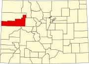 | |
| Towns | ||
| CDPs | ||
| Unincorporated communities | ||
| Ghost town | ||
Category:Cities in Garfield County, Colorado Category:Roaring Fork Valley Category:Hot springs of Colorado Category:County seats in Colorado Category:Spa towns in the United States Category:Cities in Colorado