Tengjhih National Forest Recreation Area
| Tengjhih National Forest Recreation Area Chinese: 藤枝國家森林遊樂區 | |
|---|---|
 | |
| Map | |
| Geography | |
| Location | Taoyuan, Kaohsiung, Taiwan |
| Coordinates | 23°4′4.5″N 120°45′16.2″E / 23.067917°N 120.754500°E |
| Elevation | 500-1,804 meters |
| Area | 770 hectares |
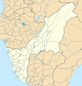
The Tengjhih National Forest Recreation Area (traditional Chinese: 藤枝國家森林遊樂區; simplified Chinese: 藤枝国家森林游乐区; pinyin: Téngzhī Guójiā Sēnlín Yóulè Qū) is located in Baoshan Village, Taoyuan District, Kaohsiung, Taiwan.
Administration[edit]
The forest recreation area is administered by the 70th, 71st and 72nd offices of the Forestry Bureau.[1]
Geography[edit]
The forest spreads over an area of 770 hectares with height ranges from 500 to 1,804 meters. It has a mean temperature of 18-21°C.[2] The forest consists of Chinese firs, maples, cherry trees, plum trees etc.[3]
Facilities[edit]
The forest is equipped with log cabins, watchtower, meteorology station and alarm. Various activities can also be done in the forest, such as jungle trekking, hiking, mount climbing, bird watching etc.[4]
References[edit]
- ^ "Tengjhi National Forest Recreation Area". Taoyuan District Office, Kaohsiung City. Retrieved 19 April 2018.
- ^ "Tengjhih Forest Recreation Area". National Forest Recreation. Retrieved 16 December 2016.
- ^ "Tengjhih National Forest Recreation Area". Travel King. Retrieved 16 December 2016.
- ^ Yolanda. "Tengzhi National Forest Recreation Area". Maolin National Scenic Area. Retrieved 16 December 2016.
External links[edit]
Wikimedia Commons has media related to Tengjhih National Forest Recreation Area.
- Official website (in Chinese)

