From Wikipedia, the free encyclopedia
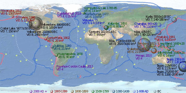 Clickable imagemap of notable volcanic eruptions. The apparent volume of each bubble is linearly proportional to the volume of tephra ejected, colour-coded by time of eruption as in the legend. Pink lines denote convergent boundaries, blue lines denote divergent boundaries and yellow spots denote hotspots.


