Template:Infobox U.S. county/testcases2
| This is the template test cases page for the sandbox of Template:Infobox U.S. county. to update the examples. If there are many examples of a complicated template, later ones may break due to limits in MediaWiki; see the HTML comment "NewPP limit report" in the rendered page. You can also use Special:ExpandTemplates to examine the results of template uses. You can test how this page looks in the different skins and parsers with these links: |
Testing sandbox version[edit]
3 zones via 2TZ sandbox[edit]
Malheur County | |
|---|---|
 Location within the U.S. state of Oregon | |
 Oregon's location within the U.S. | |
| Country | |
| State | |
| Time zones | |
| • Summer (DST) | UTC−7 (PDT) |
2 zones via 2TZ sandbox[edit]
Malheur County | |
|---|---|
 Location within the U.S. state of Oregon | |
 Oregon's location within the U.S. | |
| Country | |
| State | |
| Time zones | |
| North of 42.45° N latitude[1] | UTC−7 (Mountain) |
| • Summer (DST) | UTC−6 (MDT) |
| South of 42.45° N latitude[1] | UTC−8 (Pacific) |
| • Summer (DST) | UTC−7 (PDT) |
1 zone as TZ via 2TZ sandbox[edit]
Malheur County | |
|---|---|
 Location within the U.S. state of Oregon | |
 Oregon's location within the U.S. | |
| Country | |
| State | |
| Time zone | |
| A note about the time zone above | UTC−7 (Mountain) |
| • Summer (DST) | UTC−6 (MDT) |
| Website | foo |
1 zone as TZ1 via 2TZ sandbox[edit]
Malheur County | |
|---|---|
 Location within the U.S. state of Oregon | |
 Oregon's location within the U.S. | |
| Country | |
| State | |
| Time zone | |
| North of 42.45° N latitude[1] | UTC−7 (Mountain) |
| • Summer (DST) | UTC−6 (MDT) |
1 zone as TZ2 via 2TZ sandbox[edit]
Malheur County | |
|---|---|
 Location within the U.S. state of Oregon | |
 Oregon's location within the U.S. | |
| Country | |
| State | |
| • Summer (DST) | UTC−7 (PDT) |
1 zone as TZ via 2TZ sandbox (#2)[edit]
Montgomery County | |
|---|---|
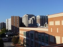
 Downtown Silver Spring | |
| Motto(s): "Gardez Bien" (English: Watch Well) | |
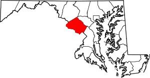
 Location within the U.S. state of Maryland | |
 Maryland's location within the U.S. | |
| Country | |
| State | |
| Founded | 1776 |
| Named for | Richard Montgomery |
| Seat | |
| Largest city | Germantown |
| Area | |
| • Total | 507 sq mi (1,313 km2) |
| • Land | 496 sq mi (1,285 km2) |
| • Water | 12 sq mi (31 km2) 2.3% |
| Population (2012) | |
| • Total | 1,004,709 |
| • Density | 1,959.2/sq mi (756.2/km2) |
| Website | www |
Testing main template[edit]
1 zone as TZ via production[edit]
Montgomery County | |
|---|---|
 Downtown Silver Spring | |
| Motto(s): "Gardez Bien" (English: Watch Well) | |
 Location within the U.S. state of Maryland | |
 Maryland's location within the U.S. | |
| Country | |
| State | |
| Founded | 1776 |
| Named for | Richard Montgomery |
| Seat | |
| Largest city | Germantown |
| Area | |
| • Total | 507 sq mi (1,313 km2) |
| • Land | 496 sq mi (1,285 km2) |
| • Water | 12 sq mi (31 km2) 2.3% |
| Population (2012) | |
| • Total | 1,004,709 |
| • Density | 1,959.2/sq mi (756.2/km2) |
| Website | www |
2 zone as TZ1/2 via production[edit]
Malheur County | |
|---|---|
 Location within the U.S. state of Oregon | |
 Oregon's location within the U.S. | |
| Country | |
| State | |
| Founded | February 17, 1887 |
| Named for | Malheur River |
| Seat | Vale |
| Largest city | Ontario |
| Area | |
| • Total | 9,930 sq mi (25,700 km2) |
| • Land | 9,887 sq mi (25,610 km2) |
| • Water | 43 sq mi (110 km2) 0.43% |
| Population (2010) | |
| • Total | 31,313 |
| • Density | 3/sq mi (1.2/km2) |
| Time zones | |
| North of 42.45° N latitude[1] | UTC−7 (Mountain) |
| • Summer (DST) | UTC−6 (MDT) |
| South of 42.45° N latitude[1] | UTC−8 (Pacific) |
| • Summer (DST) | UTC−7 (PDT) |
| Website | www |


