Template:Infobox French commune/forsubst/testcases

From Wikipedia, the free encyclopedia


Test 3[edit]

Live version of template Sandbox version of template
Fort-de-France
Coat of arms of Fort-de-France
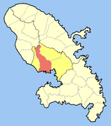
Location of the commune (in red) within Martinique
CountryFrance
Overseas region and departmentMartinique
ArrondissementFort-de-France
IntercommunalityCentre de la Martinique
Government
 • Mayor (2008–2014) Serge Letchimy
Area
1
44.21 km2 (17.07 sq mi)
Population
 (2007)
91,249
 • Density2,100/km2 (5,300/sq mi)
Time zoneUTC−04:00 (AST)
INSEE/Postal code
97209 /97200
Elevation0–1,070 m (0–3,510 ft)
1 French Land Register data, which excludes lakes, ponds, glaciers > 1 km2 (0.386 sq mi or 247 acres) and river estuaries.
Fort-de-France
Coat of arms of Fort-de-France
Location of the commune (in red) within Martinique
CountryFrance
Overseas region and departmentMartinique
ArrondissementFort-de-France
IntercommunalityCentre de la Martinique
Government
 • Mayor (2008–2014) Serge Letchimy
Area
 • Total44.21 km2 (17.07 sq mi)
Highest elevation
1,070 m (3,510 ft)
Lowest elevation
0 m (0 ft)
Population
 (2007)
 • Total91,249
 • Density2,100/km2 (5,300/sq mi)
Time zoneUTC−4
INSEE
97209
Postal code
97200

Test 4[edit]

Live version of template Sandbox version of template
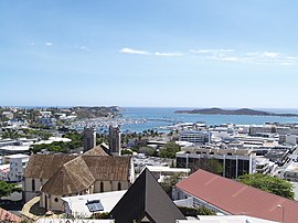
Nouméa
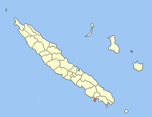
Location of the commune (in red) within New Caledonia
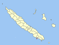
Location of the commune (in red)
within New Caledonia
CountryFrance
Sui generis collectivityNew Caledonia
ProvinceSouth Province
(provincial seat)
Government
 • Mayor (2020–2026) Sonia Lagarde
Area
1
45.7 km2 (17.6 sq mi)
Population
 (2009 census)
97,579
 • Density2,100/km2 (5,500/sq mi)
Ethnic distribution
 • 1996 censusEuropeans 50.9%
Kanaks 22.9%
Polynesians 12.3%
Other 13.9%
Time zoneUTC+11:00
INSEE/Postal code
98818 /98800
Elevation0–167 m (0–548 ft)
(avg. 20 m or 66 ft)
1 New Caledonia Land Register (DITTT) data, which exclude lakes and ponds larger than 1 km² (0.386 sq mi or 247 acres) as well as the estuaries of rivers.
Nouméa
Location of the commune (in red) within New Caledonia
Location of the commune (in red)
within New Caledonia
CountryFrance
Sui generis collectivityNew Caledonia
ProvinceSouth Province
(provincial seat)
Government
 • Mayor (2020–2026) Sonia Lagarde
Area
 • Total45.7 km2 (17.6 sq mi)
Elevation
20 m (70 ft)
Highest elevation
167 m (548 ft)
Lowest elevation
0 m (0 ft)
Population
 (2009 census)
 • Total97,579
 • Density2,100/km2 (5,500/sq mi)
Ethnic distribution
 • 1996 censusEuropeans 50.9%
Kanaks 22.9%
Polynesians 12.3%
Other 13.9%
Time zoneUTC+11:00
INSEE
98818
Postal code
98800

Test 5[edit]

Live version of template Sandbox version of template
Pape'ete
Pape'ete waterfront
Pape'ete waterfront
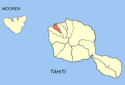
Location of the commune (in red) within the Windward Islands
CountryFrance
Overseas collectivityFrench Polynesia
SubdivisionWindward Islands
Government
 • Mayor (2020–2026) Michel Buillard
Area
1
17.4 km2 (6.7 sq mi)
Population
 (August 2007 census)
26,017
 • Density1,500/km2 (3,900/sq mi)
INSEE/Postal code
98735 /98714
Elevation0–621 m (0–2,037 ft)
1 French Land Register data, which excludes lakes, ponds, glaciers > 1 km2 (0.386 sq mi or 247 acres) and river estuaries.
Pape'ete
Pape'ete waterfront
Pape'ete waterfront
Location of the commune (in red) within the Windward Islands
CountryFrance
Overseas collectivityFrench Polynesia
Administrative subdivisionWindward Islands
Government
 • Mayor (2020–2026) Michel Buillard
Area
 • Total17.4 km2 (6.7 sq mi)
Highest elevation
621 m (2,037 ft)
Lowest elevation
0 m (0 ft)
Population
 (August 2007 census)
 • Total26,017
 • Density1,500/km2 (3,900/sq mi)
INSEE
98735
Postal code
98714

Test 6[edit]

Live version of template Sandbox version of template
Saint-Denis
Panoramic view of the city from the heights of Bellepierre
Coat of arms of Saint-Denis
CountryFrance
Overseas region and departmentRéunion
ArrondissementSaint-Denis
IntercommunalityNord de la Réunion
Government
 • Mayor (2008–2014) Gilbert Annette
Area
1
142.79 km2 (55.13 sq mi)
Population
 (2007)
142,241
 • Density1,000/km2 (2,600/sq mi)
Time zoneUTC+04:00
INSEE/Postal code
97411 /97400
Elevation0–2,276 m (0–7,467 ft)
(avg. 23 m or 75 ft)
1 French Land Register data, which excludes lakes, ponds, glaciers > 1 km2 (0.386 sq mi or 247 acres) and river estuaries.
Saint-Denis
Panoramic view of the city from the heights of Bellepierre
Coat of arms of Saint-Denis
CountryFrance
Overseas region and departmentRéunion
ArrondissementSaint-Denis
IntercommunalityNord de la Réunion
Government
 • Mayor (2008–2014) Gilbert Annette
Area
 • Total142.79 km2 (55.13 sq mi)
Elevation
23 m (75 ft)
Highest elevation
2,276 m (7,467 ft)
Lowest elevation
0 m (0 ft)
Population
 (2007)
 • Total142,241
 • Density1,000/km2 (2,600/sq mi)
Time zoneUTC+04:00
INSEE
97411
Postal code
97400