
Talk:Midwestern United States/Archive 2
| This page is an archive of past discussions. Do not edit the contents of this page. If you wish to start a new discussion or revive an old one, please do so on the current talk page. |
majority of the midwest?
Is this statement just somebody's opinion or is there some scientific/geographic basis for this claim: "The majority of the midwest can now be categorized as urbanized areas or pastoral agriculture. "??? For instance, the Great Lakes basin as well as northern Wisconsin and Minnesota are heavily carved out by glaciers which is why Minnesota is the land of 10,000 lakes and the Boundary waters while the Upper Peninsula of Michigan has the Porcupine Mountains and several significant waterfalls. It sounds like someone is just recounting the geographic featurs of their road trip to Saint Louis. MPS 04:38, 24 January 2006 (UTC)
size information
hi, i would like to suggest to include the size of the midwest area, at least roughly. i was just searching for information on the region, and while the article gave me pretty much everything i needed, i had to calculate the approximate size by adding up the sizes of the 12 states, which makes about 2.1 million km². i see that the geographical definitions of the region vary and maybe there are also other reasons not to include this number, so...just a suggestion.
also, using the census.gov site, i could roughly split the stated population number into the different ethnical groups, so maybe that's also something that could be added.
THE MIDWEST IS IN THE FREAKING EAST, NOT MIDDLE!!
Yes, the westernmost Midwest states, which are sometimes thought of as WESTERN states, are in the north-middle of the US, but the rest are not. Iowa, Minnesota, and Missouri are all close enough to the middle, and really Wisconsin and Illinois too, but Indiana, Ohio, and Michigan are all as close to the east coast as they are to Kansas and the center-most great plains. That's east in my book.
Well your book is clearly wrong. the Midwest does not refer to the center of the counrty and to the west, rather, it can be seen as the oppisite dirrectional wise to the Middle-East
- You make important points, I made some small alterations though to the Coast reference and also the direction by which it spanned. Craig R. Nielsen 20:59, 28 April 2006 (UTC)
- Of course, as I mentioned earlier in this discussion page, I'm not convinced eastern Ohio and the whole of West Virginia and Kentucky are "Midwestern" anyway. -- SwissCelt 11:43, 29 April 2006 (UTC)
- I agree, Ohio should probably stay because of the Northwest Territory and Western Ohio, but West Virginia and Kentucky are south of the river and don't even consider themselves the Midwest. Craig R. Nielsen 18:17, 29 April 2006 (UTC)
- As a native Clevelander, we Eastern Ohioans consider ourselves Midwestern, although I was told that some other people don't. However, after going to college in Rhode Island, I can assure you that we have much more in common with the Midwest than with the East Coast, or even with western PA. It was always weird to come home and have people in stores greet and smile at you, after living among the prickly New Englanders for nine months!
- I agree, Ohio should probably stay because of the Northwest Territory and Western Ohio, but West Virginia and Kentucky are south of the river and don't even consider themselves the Midwest. Craig R. Nielsen 18:17, 29 April 2006 (UTC)
- Of course, as I mentioned earlier in this discussion page, I'm not convinced eastern Ohio and the whole of West Virginia and Kentucky are "Midwestern" anyway. -- SwissCelt 11:43, 29 April 2006 (UTC)
--72.195.134.10 05:38, 25 July 2006 (UTC)Joe
- Growing up in Minnesota, we considered Ohio "East". Living in New York City, we most certainly did NOT consider Ohioans to be Easterners. And now living in Florida, and knowing some people from Ohio living here, I can say that they are Midwestern, by geography, culture and language (verbiage and accent), and possibly most importantly, by self-description.
- I have never in my 45 years seen anyone refer to West Virginia as Midwestern. West Virginia is not geographically, not culturally, not linguistically, and probably not by the self-description of its residents, either, a Midwestern state. Even the West Virginia listing in Wikipedia makes no mention of any kind of Midwestern identity.
--ScottyFLL 20:15, 28 August 2006 (UTC)
- Well, as a native Ohioan also now living in Florida, and having also lived in Pennsylvania, I can tell you there are some New Yorkers who don't even consider Philadelphians to be Easterners. West Virginia and Eastern Kentucky share much culture, geography, and more with Eastern Ohio and Western Pennsylvania. The region is Appalachian, not Midwestern (and probably not Eastern, either). -- SwissCelt 22:28, 5 October 2006 (UTC)
- I'm a native Minnesotan myself, and I always considered "Upper Midwest" to be MN, the Dakotas, Iowa, and Wisconsin. Add Illinois, Missouri, Nebraska and Kansas for the entire "Midwest". I'm very surprised to see Great Lakes and Appalachian states included. ⇔ ChristTrekker 17:24, 6 June 2007 (UTC)
- IMO there's is a pretty good map of the Midwest from the Census Bureau. But in order for it to be used properly the article should be distinguished between the cultural Midwest and the geographic Midwest and perhaps there should be two different maps covering them. Clearly the CB map covers geographic map, whereas much of the anecdotal info presented in this discussion covers the midwestern culture, where I feel new map is needed. This map could be modeled similar to the map on the Upland South page.- thank you Astuishin (talk) 07:24, 30 June 2007 (UTC)
Rust Belt
The Midwestern United States#Definition section seems to use Rustbelt as a synonym for Eastern or Northeastern, but the Rust Belt article itself shows it as centered on Midwestern cities, with little penetration to the east of the Alleghenies. --JWB 22:21, 21 July 2006 (UTC)
- No, I think the section was comparing the Rustbelt cities (Cleveland, Youngstown, etc.) to Northeastern cities such as Rochester, Allentown, and Springfield (Mass). The comparison can certainly be made, as these Rustbelt cities more closely resemble the cities in the Northeast than to "other" Midwestern cities such as Indianapolis, Des Moines, Dayton, etc. Personally, I even notice a difference between Lima, Ohio, which is certainly Midwestern, and Warren, Ohio, which is Rustbelt. These similarly-sized cities are in major decline after losing much industry, but Lima remains an agricultural center where Warren was never much of an agricentre. -- SwissCelt 22:36, 21 July 2006 (UTC)
- It doesn't mention Rochester, Allentown, or Springfield MA, leading you to wonder whether it is talking about NYC etc.
- Digging a bit deeper, the section seems to be using 'Metropolis and 'Rustbelt' in the specific sense of The Day America Told the Truth, which is not obvious, as it doesn't say so. It also seems to be using 'Heartland' in some specific jargony sense, though I'm not sure where that's from; it's not from Nine Nations of North America either. --JWB 05:07, 22 July 2006 (UTC)
- It seems to me that Rustbelt is being used as a synonym of "Post-Industrial" and Midwest is being used as a synonym of "Agricultural" in this section. Detroit and Flint, Michigan, Gary, Indiana, and Duluth, Minnesota (among others, I'm sure) had similar industrial declines, and no one is arguing that they're not Midwestern. I think this section needs to be revised... the Post-Industrial/Agricultural split has nothing to do with whether a state or city is "Midwestern" or not. --Sarnacke 20:33, 5 August 2006 (UTC)
- I've tried to revise the section a bit, and have moderated the language to be more inclusionary in tone.
Mideast
Due to the archaic nature of the name for this region, it will now be corrected to the Mideast. Not to be confused with Middle East. The Mideast region of the United States lies on the middle and eastern part of the US, while the new Midwest region will consist of what was called "the Rockies." Senate voting will begin on tuesday. —Preceding unsigned comment added by 66.97.134.122 (talk • contribs)
- So, you have essentially decided to vote to rename a region of the United States? Can we rename West Virginia while we're at it? It's in the East. And it's actually probably better referred to, in relation to the state of Virginia, as Northwest Virginia. Or maybe we can just merge them.
--ScottyFLL 19:53, 28 August 2006 (UTC)
Just put Ohio in the Northeast. —The preceding unsigned comment was added by 70.106.141.157 (talk) 06:12, February 24 (UTC)
- Just forward that comment to the Census Bureau and historians. I'm sure they'll agree. Confiteordeo 12:56, 24 February 2007 (UTC)
That was in the 1700s! Its 2007 now, and with Kansas as the most central state in the union, Ohio and Eastern Michigan are now part of the Northeast. Anything west of that is still close enough to be part of the Midwest.
- You aren't by chance the same person as User:71.235.81.39? You know, the person who keeps posting his disgust about Connecticut being claimed to be part of New England. Pfly 05:38, 4 June 2007 (UTC)
No, I know Connecticut is part of New England. Just like how Ohio is part of the Non-New England Northeast.
Defining regions by highway signs
"Highway signs along eastbound Interstate 80 in Ohio's Trumbull and Mahoning counties, located at Ohio's eastern border, display "New York City" as their control city. Thus, it is arguable that this shows an affinity for Ohioans in that area to the Northeast."
- I've heard a lot of ways to define regions, but this is a new one for me. While I doubt one could argue convincingly that highway sign control cities say much of anything about the people living near the signs, the idea that you could delineate regions this way is strange enough to make me want to see a map of regions based on this system. I'm skeptical that there GIS data on highway sign locations and their control cities exists, but if it does, let me know and I'll make a map of the regions of America based on it, just for fun.
- Still, in this article, this sentence strikes me as somewhat desperate in trying to define regional boundaries. Pfly 22:32, 27 September 2006 (UTC)
traficant
someone inserted that James Dan Traficant was a "left wing liberal" Democrat, I deleted this as such lables are POV and in this case wholly inaccurate, he was a conservative leaning Dem, praised by Rush Limbaugh as his "favorite democrat", considered switching parties prior to his indictment...
Interesting facts
I like the idea of including this info, but I didn't like where it was in the article nor the format. Can someone think of a better place for it? Maybe a new article of some kind? It would need a context, though, since Wikipedia isn't a travel guide. Confiteordeo 01:31, 8 November 2006 (UTC)
Interesting sights to see in various midwestern states include: OHIO: Rock and Roll Hall of Fame; Amish communities; Cedar Point Amusement Park; Wright Air Force Museum; Pro Football Hall of Fame INDIANA: Indianapolis Motor Speedway; Dunes State Park; Notre Dame University; College Football Hall of Fame; MICHIGAN: Henry Ford's Greenfield Village museum; Mackinac Island; various ski resorts WISCONSIN: Wisconsin Dells scenic river gorge; Circus World in Baraboo; scenic Door County peninsula ILLINOIS: Cultural attractions of Chicago; Abraham Lincoln home; Ronald Reagan home MISSOURI: Gateway Arch, Six Flags park, and outstanding St. Louis Zoo; city of Branson with live music show theaters, amusements, and hill scenery; Harry Truman home NEBRASKA: Pioneer Village museum in Minden SOUTH DAKOTA: Black Hills; Mount Rushmore; Badlands; Corn Palace MINNESOTA: fishing in countless lakes; gigantic Mall of America; Mayo Clinic NORTH DAKOTA: Badlands; International Peace Garden KANSAS: Aerospace Museum in Hutchinson; Eisenhower home; reconstructed Dodge City
NE Ohio
Whether or not NEO is "midwestern" is always a sticky point, but I'd say that the region does not have as many *cultural* similarities to areas as far east as New York City and Northern New Jersey. Obviously, the region has a lot more in common with Western PA and the westernmost part of New York, but even then, only really with the areas surrounding Pittsburgh and Buffalo, respectively. I think a closer parallel could be drawn between NEO and metro Detroit. Yes, many of the early settlers in the region came from New England, but that's true for a lot of other inland states. Many of the immigrants to the region were Eastern European and Irish, and to a lesser extent Italian, but this is true of a lot of cities, including Chicago and Milwaukee, and Detroit, which are all unquestionably Midwestern. Simply put, I don't think you can shoehorn Northeast Ohio into the East, although it definitely isn't Iowa. In my opinion, the best term for the Cleveland-Akron and other such metro areas would be "inland north," or "Great Lakes," although the latter certainly wouldn't include Pittsburgh. Confiteordeo 01:52, 8 November 2006 (UTC)
Military recruits by state
I have removed the following for lack of documentation:
- The Midwest remains, with the South, a disproportionately large source of servicemembers for the United States military, and remains a thoroughly patriotic and American center.
The 2005 recruit-to-population ratio of the U.S. military is:
Illinois: 0.89
Indiana: 1.01
Iowa: 0.90
Kansas: 1.19
Michigan: 0.94
Minnesota: 0.70
Missouri: 1.22
Nebraska: 1.18
North Dakota: 0.88
South Dakota: 1.27
Ohio: 1.02
Wisconsin: 0.92
The national ratio is 1.0. Using the narrow definition of Midwestern states (boldfaced above), the recruit-to-population ratio is 0.91, below the national average. Using the broader definition of Midwestern states, the ratio is 1.01.
Source: Tim Kane, Ph.D., Who Are the Recruits? The Demographic Characteristics of U.S. Military Enlistment, 2003–2005, The Heritage Foundation, 2006. Table 9: U.S. Military Recruits by State.
— Walloon 02:08, 8 November 2006 (UTC)
These numbers can't be recruit-to-population ratios for each state. Are they percentages, by chance? Or maybe a ratio between each state's percentage of recruits and the national average? (I'm guessing this one, since you said the national ratio is 1.0, which it of course would be by definition if this is the case, as a ratio of something to itself.) A recruit-to-population ratio of 1.0 for a state would mean everyone in the state is a recruit, and a ratio above 1.0 would be impossible. — 71.115.91.118 15:46, 9 December 2006 (UTC)
1.00 indicating an exact proportional representation of that state's recruitment to the national average. A number above 1.00 indicates that the state recruited more of its population than the national average, a number below 1.00 means that the state recruited less of its population than the national average. See the original report, linked above, if you have any other question. — Walloon 22:43, 10 December 2006 (UTC)
Thanks for the clarification. That's what I suspected, but not what it said above. 71.115.91.118 01:28, 11 December 2006 (UTC)
Linguistic Influence
The Teslur project maps [1] and the Atlas of North American English (chapter eleven [2]) show that the area most free of regional dialect elements is centered on south-central Iowa, east to the Quad Cities, and west to about Lincoln, Nebraska. While there is no such thing as a "General American" accent, the speech found in this part of the Midwest is quite neutral. I re-wrote the section to reflect this, and I eliminated the reference to "General American," since this idea really only exists in textbooks designed to teach English to foreigners. As for the origins of Midwestern speech, all American accents are ultimately derived from the accents of the original British colonists. About the recent edits about the history of the accent: the settlement patterns outside of the original colonies are quite nebulous, so it's hard to say that Midwestern accents "originated" in the northeast. If you can find a reference to support those origins, please feel free to reinsert the information, with the proper source. Confiteordeo 23:18, 9 November 2006 (UTC)
Border states
In the editing of this page and several other pages relating to the cultural regions of the Eastern United States, it has become apparent that many users are willing to rapidly - and often, without great thought/research/consideration - pigeonhole the old "border states" into one region. This became somewhat evident on this page when the comment "Kentucky and W. Virginia are rarely considered part of the Midwest" was added to the regional map. The discussions on this page reveal similar opinions.
Let us remember that the border states of MO, KY, WV, DE, and MD have always - and probably always will - be marked by incredible varieties in the local cultures, habits, customs, climates, and self-identifications. To attempt to establish, as many people have, that "Missouri is ENTIRELY Midwestern" or that "Kentucky is ENTIRELY Southern" or that "DE is now ENTIRELY Northeastern" is incredibly naive and shows a total lack of understanding of the history and cultures of these states. Even without a thorough analysis, simply glancing at the demographics, linguistic profiles, religious affiliations, and political habits of these states should instantly render us more cognizant of their transitional natures. Little Dixie, Missouri; Northern Kentucky and Louisville; the Northern Pahandle of West Virginia; Southern Coastal Delaware; these are all regions of border states (and there are certainly many more) that, through their marked differences with a so-called "prevalent" culture in the same state, reveal that the border states were forged of both Northern/Midwestern and Southern/Appalachian cultural elements. There are plenty of citizens of MO and MD who, due to their heritages and lifestyles, would prefer to be considered Southern, just as there are plenty of citizens of KY and WV who, for the same reasons, would prefer to be considered Northern or Midwestern. And I would certainly trust these citizens to more correctly identify their own cultural backgrounds than a random Wikipedia editor working off of some grade-school stereotypes and a relatively minor understanding of these states.
In the future, it would be great to see some acknowledgment of the cultural differences in this region. It is time that some people realize that cultural influences do not abruptly shift and end at rivers or lines on maps. —The preceding unsigned comment was added by 70.168.88.158 (talk) 06:34, 7 December 2006 (UTC).
Kentucky & West Virginia--zero evidence
Ohio is not in the Midwest either
- You've got to make a better argument against Ohio than that. Frank12 05:19, 16 July 2007 (UTC)
Edits of article on the Midwestern United States
Dear sir,
I was responsible for removing a comment on the article regarding the Midwestern United States that I believe constitutes an opinion, not research or fact, and was in contradiction to information listed regarding the regional map; this information pertained specifically to the border states of Kentucky and West Virginia. I have already written an explanation of the reasoning behind my actions on the discussion page, entry 19, "Border states."
You are partially correct in your assumption; the ENTIRETY of the states of Kentucky and West Virginia are "rarely" considered Midwestern - I don't think this is ever the case for any of the border states, as their unique cultures are derivatives of the cultures of both North and South. However, WV and KY are currently both shaded states on the regional map, and the text currently under the regional map clearly states that "regional defintions vary from source to source...all OR portion of the striped states may or may not be considered part of the Midwestern United States." In their linguistic influences, agriculture, social customs, and general aspects there are parts of both KY and WV that are clearly far, far more Midwestern than Southern or Appalachian. In terms of climate, KY and WV will almost always be listed in the "Midwest" or "Northern" regions on weather charts; this is the case for the Weather Channel. (KY, in fact, sits right at the point where humid subtropical transitions into humid continental, and both of these climates are experienced in different parts of the state.) Simply search the picture function of any major search engine (Google, Yahoo, etc.) and you will find maps - many from private companies, educational and government bodies - that include KY as part of the Midwest. Remember, even border state Missouri is not universally accepted as Midwestern; I have read articles in which Missourians state disgust at having been regarded as "Southerners" in states such as Iowa and Illinois. The North Midland dialect of American English - considered "standard" American English and highly typical of the Midwest - dips into parts of both KY and WV. Numerous schools in KY participate in Midwestern athletic conferences - WKU in Bowling Green is in the Gateway Football Conference (member states Illinois, Indiana, Missouri, Kentucky, Iowa, and Ohio) and Northern Kentucky University in Highlands Heights is in the Great Lakes Valley Conference (member states Missouri, Illinois, Wisconsin, Indiana, and Kentucky.)
We all tend to jump to conclusions at times, but the regional map on the page was correct as it was - parts of KY and WV are Midwestern, and parts aren't; this is exactly why they are striped instead of shaded, with adequate information provided to clarify the symbolism of that distinction. I will continue to monitor the page to assure that it stays that way. —The preceding unsigned comment was added by Gator87 (talk • contribs) 09:22, 7 December 2006 (UTC).
- I have never seen a reliable source that calls them Midwestern. Please provide citations. Rjensen 16:10, 7 December 2006 (UTC)
I am rather surprised that you continue to fail to acknowledge that a portion of a state can have a culture that fits in with one region, while another portion may not. Why is this such a difficult concept to grasp, and why do you continue to pigeonhole these states exclusively into one region, or out of another one, when throughout history they have served as gradual transitional areas? As previously stated, I do not think that anybody will (or has) attempt(ed) to make the argument that the entirety of any of the border states could be included in one region for cultural purposes (this is why they are always striped states on their respective pages; on the other US region pages, no states are explicitly excluded by a comment that contradicts the explanation.) There are probably no sources that regard the entirety of WV or KY as Midwestern because the entirety of these states are clearly not. The regional map has been well established and the explanation that was there prior to this comment being added was sufficient. "Portions" of WV and KY do, in fact, have a culture that is closer to Midwestern than the cultures of other region, and several metropolitan areas (Cincinnati, Louisville, Ashland-Huntington) straddle these states and states in the Census-bureau defined Midwest.
I have provided, in my previous argumentation, several pieces of evidence and areas of contention that demonstrate that portions/regions of these states have a predominantly Midwestern persona. People, such as myself, who have visited these states and these regions know this to be the case. Your Census citation proves that (to the government) these states are not Midwestern in their entirety, or even predominantly Midwestern throughout - and once again, nobody has been trying to establish that.
- Wiki goes for the consensus of scholars--there MUST be citations. originial research is not allowed. Rjensen 20:17, 7 December 2006 (UTC)
- I jsut checked the new Midwest Encyclopedia (2006) -- none of the experts providing text or maps includes KY or WVa as part of the Midwest region. When I lived there (a decade ago) people in KY never called themselves Midwestern. Rjensen 23:00, 7 December 2006 (UTC)
- "When I lived there...people never considered themselves Midwestern." THAT is clearly original research. Sir, you continue to treat this as if it is a debate of entirety, when it is a debate regarding particular sub-regions, not entire states. The vast majority of people in the Northern Kentucky counties of Boone, Kenton, and Campbell do consider themselves Midwesterns, as does a sizable (but smaller) majority of people in metro Louisville, which includes several counties in Indiana. Sources such as the Weather Channel include KY and WV in Midwestern maps, and several colleges in these states participate in Midwestern athletic conferences. When Sen. Barack Obama recently spoke to a crowd of citizens in Louisville, he referred to them as "Midwestern." I am not attempting to provide original research - YOU are the person who has consistently ignored the fact that the map that was on this page for most of the page's existence included KY and WV as striped states, and this was agreed upon by the Wikipedia community with no consensus to change it.
—The preceding unsigned comment was added by 70.168.88.158 (talk) 04:34, 8 December 2006 (UTC).
- I cited the new "The Amnerican Midwest" Encyclopedia (2006): it rejects KY and WVa in its maps and text. As does every other expert source. Betetr read some history of Louisville!Rjensen 04:41, 8 December 2006 (UTC)
- As a native of the Kentuckiana region, I feel more than confident in my history of the state and city - and the vast majority of historical scholars acknowledge that the border states reflect the cultures of both South/Appalachia and Midwest/North/Northeast. Please regard the debate on the US Regional maps page, and you will see that the regional map for this article was agreed upon by the Wikipedia community. The same comment is used for the other US regions in describing the map, and should be used here to maintain consistency as this article is part of a larger project. —The preceding unsigned comment was added by Gator87 (talk • contribs) 04:48, 8 December 2006 (UTC).
I feel that Kentucky is indeed a Southern state (yes I'am a native of Louisville Kentucky). Yes while it may be considered Midwestern in some sources the state is generally considered Southern. In the Southern focus study Kentucky tied with Virginia having 86% of it's residence identifying as Southerners. Kentucky clearly does however have Midwestern influence, and it's most prominent in Northern Kentucky. Conversely Southern Indiana is said to have more in common with the South than the Rest of the Midwest as it's culturally and economically tied to the "Gateway city to the South" Louisville. Other than Northern Kentucky it's obvious that the rest of KEntucky is prodominantly Southern in culture. To honestly group Kentucky in the same region as Minnesota over Alabama is Historically inaccuarte.—The preceding unsigned comment was added by 74.128.200.135 (talk • contribs) 17:55, December 10, 2006 (UTC).
Other regional maps
It should be noted that, essentially, what other users have been attempting to do recently is change the content of the regional maps. If they wish to pursue this option, they should do so on the appropriate pages, and there should be an informed debate regarding that issue. For a very long time, the border states have been striped on all of these regional maps, with an appropriate description given in the image caption; this was done for a reason and it is the result of a general consensus among the Wikipedia community. It is bizarre that some users wish to single-handedly alter this consensus for their own purposes. Personal opinions should not be allowed to take precedence over the established consensus of the Wikipedia community. —The preceding unsigned comment was added by 70.168.88.158 (talk) 22:26, 7 December 2006 (UTC).
false OR map not acceptable
After many weeks the editor who drew an incorrect map has failed to show that it is a) correct and b) not OR. There has been zero reliable sources provided to show that West Virginia is part of the Midwest, for example. The result is an encyclopedia that says X "may or may not be true" . Rjensen 09:55, 23 December 2006 (UTC)
West Virginia, LOL try Kentucky. Niether of these states belong in these definitions of the Midwest. Louisvillian 17:26, 23 December 2006 (UTC)
- While I don't care enough about the issue to fight over it, I thought I'd offer some sources that do support the claim of parts of West Virginia (and Kentucky) as being part of the cultural Midwest. But first, the underlying problem with this map, and the similar red and red-striped maps on all the pages on regions of the United States, is they try to define cultural regions based on political boundaries (state lines). But cultural regions rarely coincidence precisely with political boundaries, and rarely have sharp and widely-agreed upon boundaries at all. However, people generally talk about cultural regions in terms of states, and since cultural regions don't have sharp boundaries it is near impossible to find any two people who agree on where exactly to draw a cultural boundary within a state (for example, people can almost come to blows over where the boundary between northern and southern California is).
- This is why the red and red-striped map style was adopted, the long and controversial history of which can be read in the talk archives of Wikipedia:WikiProject United States regions. There you can find people saying, years ago now, that yes, regions do not correspond precisely to states, but trying to map the boundaries at a sub-state level will likely lead to even worse argument over where the "correct" boundaries are. Therefore the "least worst" map style was decided to be one based on states but using the weasel-worded phrase: "The states shown in dark red are usually included, while all or portions of the striped states may or may not be considered part of <region name>." (See Wikipedia:WikiProject U.S. regions/Maps). Since people feel strongly about cultural regions and states, the maps and their captions have often been changed from this original design, this being a wiki and all (the "may or may not be true" text is a particularly bad change). Now I'm not saying the map style hashed out long ago at the region wikiproject need be adhered to, just giving some history of these maps.
- I do agree that the Ohio River is the common definition of the boundary between the Midwest and the South, and it does look odd to see West Virginia and Kentucky shown striped (on both the Midwest and South pages). A map that made Kentucky and West Virginia wholly Southern would be fine with me and probably less subject to endless wiki argument. The mixed nature of these states could just be described in text. One of my favorite sources for American geography is the "Shaping of America" book series by D.W. Meinig. In tracing the geographic history of the US, he makes many comments about the culturally mixed nature of the region along the Ohio River and how there are strong Southern influences upon Ohio, Indiana, and Illinois, and Northern influences upon West Virginia and Kentucky.
- Going back in time, the strongest evidence can be seen in the Civil War era. He makes a convincing argument as to why the South and North could not be easily split apart. Although the Ohio River was then, as now, the common definition of the border, in truth the cultures were anything but sharply distinct, geographically. In discussing this era in "Shaping of America" vol. 2, he writes: "..Southerners left their imprint strongly upon southern Ohio, Indiana, and Illinois. Those states thereby stand out as ... geopolitical entities deeply split within themselves between a strongly Yankee Republican north and a strongly Southern Democratic south. ...A kind of mirror image of this pattern was displayed in the strongly Unionist areas within the slave states. Such a stance did not represent "Northernness" (except, in part, in such border cities as Wheeling [West Virginia], Louisville [Kentucky], and St. Louis [Missouri]..." (pg. 487).
- Moving ahead in time, in vol. 3, Meinig describes the emergence of the "Manufacturing Belt" in the Midwest, a region which at the time (late 1800s, early 1900s) was rooted in Pittsburgh and the west Pennsylvania region, linked to the Great Lakes and iron ore from the Duluth region, and the Ohio River along which goods and people moved, with new, large clusters of heavy industry on both sides of the river from Pittsburgh through Wheeling and on to Kentucky and southern Ohio (pp. 234-237). Many of the maps in these books show the Midwest/Manufacturing Belt/American "Core" region as including the northern panhandle of West Virginia where Wheeling is, and the northwest part of West Virginia fronting the Ohio River (eg., pg. 241, vol. 3).
- In volume 4, discussing more recent times, Meinig writes at length about cultural regions of America, noting the impossibility of precisely delineating them, but mapping them anyway. His map of cultural regions as of 1950 (vol. 4, pg. 192) shows several lines for the border between the Midwest and South. The Ohio River still the most commonly used border, Meinig offers the thickest line on the map as the nation's "primary cultural divide", and draws this line through northern West Virginia and southern Indiana and Illinois, so that Wheeling, WV, and Louisville, KY, fall to the north, while Evansville, IN, falls to the south.
- Anyway, sorry for the long comment, I wanted to offer some sources to counter the "zero reliable sources" and OR statement. I also wanted to give links to the history of these maps on wikipedia and my thoughts on why maps of cultural regions are so difficult and controversial. Finally, I think it is important to note that regions defined by the Census Bureau are made for the specific purpose of census data collection and management, and only secondarily related to "cultural regions".
- Ok! Back to lurking for me. Pfly 18:08, 23 December 2006 (UTC)
- Thanks for the informed comment by Pfly. But Meining does NOT classify the states of WVa or KY as Midwestern, as does this map. The sources of this map are unknown--when challenged we get not sophisticated geography or linguistics or cultural studies or history or even mention of the Mason-Dixon line or Huckleberry Finn, but notions that the weather is pretty much the same north and south of the Ohio river. As for northern influences in Kentucky, that is NOT the same as Midwestern influences (eastern--ie Pennsylvania-- coal mine owners and RR owners are probably the reference.) The map in question does NOT attempt to show Wheeling as Midwestern as Meining would have it, and therefore the map fails us. Rjensen 18:49, 23 December 2006 (UTC)
- I'm always surprised by the strength of feeling people have on the topic of regions and whether a given state is or isn't of a particular region. You seem to feel strongly and be arguing with me, but I'm not sure what over. I agreed with you that the map "fails". I said nothing about the weather and I did offer "sophisticated geography" and "cultural studies", as Meinig's books are. Maybe you are confusing me with someone else? Pfly 20:48, 23 December 2006 (UTC)
I have to say, I have rarely, if ever, been more offended in all my life. Kentucky is the South, has always been the South, and, so help me God, will always be the South. As Southern as Georgia, as someone said! I’m offended as a Kentuckian, as an historian, and as someone who has spent his entire life studying the history and culture of the South. Red-faced angry offended! There shouldn’t even be an argument, though, God help me, I know that there is. When someone can prove to me that the Ohio River has been moved south of Kentucky, as well as the Mason-Dixon line, I might entertain the argument. Until then, I am inclined to believe that anyone who would call Kentucky “Midwestern,” which is offensive to every fiber of my being (did I mention that?), is misinformed and doesn’t know much of what they speak. Truly, you don’t know the South if you don’t find it in Kentucky, and I don’t really care where you claim to be from or know. You can’t pigeon-hole the South! It’s much more than anything you might be inclined to believe. People want to judge every state in the South by the Deep South, I’ve come to believe. Well, the South exists in two (maybe, three) parts: The Deep South and the Upper South (some might add Mid-South, as I note a few of you have). The accents aren’t all identical, but the culture is--or is very well close.
Now, about Louisville. I do see why you’d think it has a Midwestern under-culture, but it is a major city. The same argument, I assure you, can be made of New Orleans, Atlanta, Charleston. Major cities have major immigration, and people from all over the country--and the world--make their homes there. Sad as it is, it has shown its effects on the cities, but I assure you, at Louisville’s core, is the South. It has even been said that during the darkest days of the war, Louisville had more “Johnny Rebs” and “Southern Belles” than the entire state of Mississippi. As an historian, I might be inclined to believe that. Having mentioned Southern Belles, you’d be well advised to note Sallie Ward was a Louisvillian. Her portrait is often named “The Southern Belle.” That is because she was THE Southern Belle in the ante-bellum days. More Scarlett O’Hara than Scarlett herself! Literally, she was considered THE belle of the South! None of that is even mentioning that, as someone else noted, Louisville is a river city, giving it all the more reason to intermingle cultures. Nonetheless, to the trained ear, one can hear the traces of Southern accents in downtown Louisville, and thick as molasses accents among some of the older residence. Step outside the city limits--you can no longer judge the South by its cities. Anyone who lives in a Southern city will note the changes over the years. They’ve become melting pots, good or bad! Oh, and what is Louisville’s nickname? You don’t know? Let me tell you, “Gateway to the South!” That’s a take on its old days as a river port, and its being a Southern city, noted for two great Southern pastimes, horseracing and bourbon!
The Ohio river is a true divider of North and South. Just imagine how it held in cultures before the days of advanced transportation!
I have no desire to get into specifics of “Civil War” loyalties, other than to say a few things, beginning with no state, country, or person, in my opinion, has been more egregiously misrepresented in history than has Kentucky. Kentucky was no more divided than was most of the South, and certainly no more divided than Tennessee and Virginia. History is recorded inaccurate folks. That’s one of the first things one learns as a historian. Part of “to the victor go the spoils” is writing the history, and there’s a very strong argument that Kentucky was a Confederate state, not only because it was considered the Confederacy by the Confederacy following a secession, but also because that secession was reported in Northern newspapers. As for solider numbers, I would greatly request more research being done than a website, as you’d be surprised just how inaccurate that is. If Kentucky had all the soldiers they claim, every man, woman, and child--maybe even horses and cattle--would have had to enlist in one cause of another. Historically, the South’s influences were so strong in Southern Illinois, Indiana, and Ohio than Lincoln feared he was going to have to fight them too. It was also a Kentuckian who defended Atlanta from Sherman!
I would agree also that Kentucky’s accent and culture are identical--as is the climate--to Tennessee. That’s been stated time and again by people who are far more qualified than I. The accent is considered predominantly “Mountain South,” moving westward into “Plantation South,” and often a “Delta South” accent along the Mississippi. That goes for both states, though Rand McNally, I believe, published a book of maps aimed at Middle School aged kids, where the states were broken into regions (Kentucky and Tennessee were South), and they called Tennessee the Southern state most similar to the North. By the way, if I were from Tennessee, that would offend me too.
http://www.urbanplanet.org/forums/index.php?showtopic=32225
Lastly, I want to thank those of you who have defended Kentucky. I do appreciate you efforts, and, without question, I feel I can speak for the whole of the commonwealth. I agree with Indy, in that I am insulted! Geographically, cultureally, historically,. Kentucky IS Southern. This argument would have gotten you shot 100 years ago!
http://lincoln.lib.niu.edu/fimage/lincolnimages/us_1850_slvden_040701_400.jpg
http://lincoln.lib.niu.edu/fimage/lincolnimages/us_1850_slvperc_040701_400.jpg
http://lincoln.lib.niu.edu/fimage/lincolnimages/us_1860_slv_041001_400.jpg
http://lincoln.lib.niu.edu/fimage/lincolnimages/us_1860_slv_041001_400.jpg
http://lincoln.lib.niu.edu/fimage/lincolnimages/us_1860_slvden_040201_400.jpg
http://lincoln.lib.niu.edu/fimage/lincolnimages/us_1860_slvperc_040201_400.jpg
According to these maps Louisville a city said to be split in regional loyalty at the time (the South's second largest city at the Time after New Orleans) has a large slave population just like any other Southern city (one of the largest). May I also note that at this time blacks accounted for a quarter of the States population.
http://www.valpo.edu/geomet/pics/geo200/religion/baptist.gif
http://www.peak.org/~jeremy/dictionary/figures/dialectsUS.gif
http://upload.wikimedia.org/wikipedia/commons/thumb/c/c2/BibleBelt.png/280px-BibleBelt.png
http://www.popvssoda.com/countystats/total-county.gif
Here's map just to entertain the argument
According to the Southern Focus study over 80% of Kentuckians identify with the South, while when asked would you call yourself a Southerner KEntucky had 68% of residents identify with that. Texas (a Confederate states) also had 68% residence identifing as Southerners and Virginia (a Confederate state) ranked behind both in this category.
http://www.geocities.com/yvain.geo/diausa.gif
http://www.uta.fi/FAST/US1/REF/images/dialectsus.gif
http://www.ling.upenn.edu/phono_atlas/NationalMap/NatMap2.GIF
http://www.evolpub.com/Americandialects/AmDialMap.gif
http://www.pbs.org/speak/speech/mapping/map.html
http://www.msu.edu/~preston/LAVIS.pdf
http://www.evolpub.com/Americandialects/AmDialLnx.html
According to these sources Louisville's dialect also doesn't seem to be affected by the Northern prozimity. Louisvillians speak with the Southern twang found in Memphis, Richmond, or Nashville or any Mid-Southern city for that matter. Louisvillian 20:20, 23 December 2006 (UTC)
- I never suggested that the KY is not Southern, merely than there is more than zero sources that provide studies on Midwestern factors. I feel like you are arguing with me, and "Red-faced angry offended!" at what I wrote. But I have never said I thought KY was anything but Southern. I don't think I've given my own personal opinion at all. I've just described a geographic/cultural studies source. You don't have to fight me. We're not even in disagreement. Pfly 21:07, 23 December 2006 (UTC)
- Louisville as southern??--well not during the Civil War when it was a major Northern stronghold. it became southern after 1865. Rjensen 21:13, 23 December 2006 (UTC)
- I've been watching this debate about the placement of West Virginia and Kentucky in the midwest on the sidelines, however i'm struck by some of the comments Pfly has made. First of all Pfly you may not have spelled out your perspective on this topic, but as readers we don't need for you to that. I for one can tell that you would prefer this map to be included from the tone and and diction you use when describing Meing's research. And please don't "play" the other editors on this page "for fools"; you spent almost 1000 words explaining Meinig's research how could you not have a opinion?
- Now Pfly argues correctly so that cultural habits and customs do not end at any state boundary, using D.W. Meinig Shaping of America to support your perspective. However you fail to note the Meinig series challenges the traditional definitions of America's cultural regions, his Shaping of America series is not the authority on American regional boundaries it challenges the authority on that issue. Your inclusion of Meinig's work, is fine however you should take note that WP is not generally used for a battleground of research and philosophical arguments. Many historians regard his research as controversial and on the fringe.
- By mentioning Meinig you in effect stated that there should not be a litmus test for states to be included on this map, while failing to note that other pages such as the South and the Northeast use there own criteria as well. The northeast page for instance does not include Ohio despite that fact that many researchers have documented Cleveland and other area's of the northeastern Ohio have a "Northestern" feel.
- So if research has designated "parts of West Virginia (and Kentucky) as being part of the cultural Midwest", why not expand the bounds of the south to include Pennsylvania, Ohio, Indiana, and Illinois? After all a long trail of history exist establishing Illinois and Indiana as having a large amount of southern migrants, those migrants probably still consider themselves southern. Pennsylvania? Political scientist have often divided Pennsylvania into three regions: Philadelphia on one end, Pittsburgh on the other, and Alabama in the middle, because of the cultural values rural Pennsylvania shares with the south. And why not add Ohio into the mix? after all thousand of Kentucky and West Virgina migrants settled there over the years and they undoubtedly identify as southern. Of course that suggestion that just as the what you are suggesting Pfly is rather silly.
- It is not on to you, me, or any of the other editors to be the arbiters of the boundaries concerning the Midwest. Both Britannica and Columbia encyclopedias define the Midwest as the states of Illinois, Indiana, Iowa, Kansas, Michigan, Minnesota, Missouri, Nebraska, North Dakota, Ohio, South Dakota, and Wisconsin. This article should take a cue from those articles and simply include only those states in any type of official map in the article. Astuishin 14:20, 24 December 2006 (UTC)
The "debate" on the striped/solid map - maps that are used on nearly every other Wikipedia region in the US - has been motivated been one user, if you check the edit history of the page. We now have a Census map on this page that goes by strict, unbending political boundaries in addition to this map, but what this user - Rjensen - refuses to accept is that regional boundaries are often set by cultural, non-political means based on the preferences, habits, histories, cultures, and heritages of locals (this user also refuses to accept that a portion of a state can be "culturally" in one region, while another portion can be in another region." This is not an attempt to "re-create" the Midwest because these delineations have been accepted for years, nor is this an attempt to change the political definitions of the Midwest. This would be understandable if KY and WV were solid states on the map - now THAT would be outrageous! A discussion on the Southern regional map/page has been relating to Florida - in terms of political definitions and natural geography, nobody could ever logically argue that it is anything other than a Southern state, but only about half of the residents statewide self-identify as Southerners, with proprotions of Southern self-identification being as low as 10 percent in some portions of South Florida - so clearly, in terms of culture (and history also), much of Florida just doesn't make a good fit in with the rest of the South; hence, Central and Southern Florida have been striped on that map. The solid/striped map had, in fact, been reviewed by several users and had a longstanding history on this page with no problems prior to approximately three weeks ago. And once again, there was no massive outcry by the thousands of visitors to this page to change it - that "argument" was motivated by one user. Their arguments are motivated by personal opinions and emotions, not the facts, because every time that a user (such as Pfly) tries to make a logical argument for the inclusion of any, any, any tiny fragment at all of KY or WV in the Midwest, their comments are ignored/belittled and the map continues to be deleted as if there is no proof at all to substantiated placing areas such as Northern KY and Western West Virginia in the Midwest, when there clearly is proof. Can we please acknowledge that this is not a debate regarding political definitions, as I have been saying since the beginning, nor is this a debate regarding placing the totality of one state into one region or out of another. This actually reminds me of a friend of mine from Covington whose habits, parlance, etc. are clearly not Southern, but who was often treated as some sort of a Southern hick by residents of the part of Cincinnati that sits across the Ohio River - even though there was literally no difference between the two, just because Covington has "KY" and not "OH" at the end of the address. In the popular culture, people from WV are frequently, frequently labeled and stereotyped as a bunch of ignorant Southern coal miners, even by those people who have never visited the state nor read the cultural research that situates it as a part of more cultural regions than any other state in the country - in truth, almost like a subregion of its own that incorporates Appalachian, Southern, Midwestern, and even some Northeastern cultural elements. This type of pigeonhole treatment, stereotyping, and "those people aren't a part of MY region!" mentality seems to be the principal impetus behind this "debate", because myself and other users have repeatedly poured out pages upon pages of evidence proving the transitional nature of these states, only to have this evidence ignored and this debate reshaped into one on political boundaries, even though that is not its nature. Portions of both KY and WV ARE culturally in the Midwest (though certainly, much more so in KY than in WV), and this map is an attempt to reflect CULTURAL BOUNDARIES, not strict political boundaries (we already have one map for that to please some users); here's a post regarding KY that I had placed on the Southern United States talk page:
A state can indeed be part of multiple regions in terms of culture - and many in the US are. That is what this debate is about - it is not about labeling states as exclusively "one or another" - hence the striped/solid distinction. And for the record, I did not delete anybody's posts and have no idea who did. When things can easily be reposted, that makes little sense and was probably done by a random vandal.
Is Kentucky "primarily" Southern? Absolutely. Is Missouri "primarily" Midwestern? Absolutely. Are either of these states ONLY part of that region, respectively? Absolutely not!
The Midwestern regional map as commissioned by the Wikipedia regions project does include both KY and WV as striped states in the Midwestern region, and only very recently has there been a "debate" regarding their inclusion on the Midwestern page - and if you check the page history, you'll see this "debate" has been motivated by one user, likely a Midwesterner who - as many of them do - maintains some irrational belligerence regarding placing portions of either of them in the Midwest.
My objections were never specific to any state - clearly, if any of the border states merits being considered as its own subregion, it would be West Virginia. But none of the border states are exclusively in one region - Kentucky, for example, is on several Wikipedia pages: the Upland South, the Midwest, the Southern United States, and the Northern United States. Missouri is mentioned in all of the same articles. Clearly, the Southern culture in KY is the MOST DOMINANT element - quite frankly, I never said otherwise if you would check your information before posting - but it is not AS DOMINANT as the states of the Deep South, and there are strong Midwestern elements in the culture. This is universally accepted; many Kentuckians - more so than any other "Southern" state - self-identify out of the South, and elements in the state's economy, history, agriculture, parlance, climate patterns, and location reflect the multiple elements present in the culture. Other than anecdotal stories and raw emotions - of which there are always plenty in this matter - I don't see what hard proof there is to justify a pigeonhole treatment of ANY of the border states. Maintaining them as striped states makes common sense and reflects their histories, which is why it would be great if somebody with software to edit PNG files could also shade MD and DE, along with TX and VA, for consistency- and in the name of all things decent, nobody is trying to insult anybody by the placement of these states!
I did not misread the Southern Focus study - I was citing how many people referred to themselves as Southerners (in demographics, this is referred to as regional self-identification), NOT where they considered their community to be situated geographically. This seems much more important than agreed upon geographic boundaries in defining culture, because a culture reflects the habits, values, traditions, and attitudes of the residents of a state. Consider Florida, where only half of the residents consider themselves Southern - clearly, nobody would even attempt to argue that Florida is not geographically a part of the South, but a percentage this low clearly shows that the CULTURE is not Southern throughout many parts of the state. Geography is relatively unimportant - the Census Bureau considers both Maryland and Delaware as part of the South geographically even though they have largely been consumed by Northern BosWash and only a tiny, miniscule minority of their citizens consider themselves as Southerners. South Florida provides an excellent example of this - paradoxically, it is the southernmost of the southernmost metropolitan areas in the US, but it has virtually no cultural, historical, political, or linguistic elements of the South. Sixty-eight percent Southern - the percentage of self-identification in KY - is still clearly "Southern", but clearly, clearly not nearly as Southern as 90 percent and 88 percent, the percentages in non-border states such as Louisiana and Alabama. The even lower percentages for WV and MO are clear proof that THERE ARE TRANSITIONAL AREAS FOR CULTURES IN THIS COUNTRY - CULTURAL INFLUENCE DOES NOT END ABRUPTLY AT RIVERS OR LINES ON MAPS.
As far as specific areas in KY, it seems that most people accept that Northern Kentucky is a border region, but Louisville always, always stirs up fierce debate. For some people, Louisville is ONLY Southern, and saying anything other than that is a direct attack on their families and histories. For other people, Louisville is a smaller Kansas City. And they're both quite wrong. This debate is odd because Louisville, the epitome of a border city, sits directly on the Ohio River, directly on the border of North and South. It just so happens to be on the Southern side of the river, both this really doesn't mean anything - if Louisville sat in Southern Indiana, it may have lacked the slave history and some other elements, but it would probably still be largely the same city. Several counties in Southern Indiana have the Baptist element of the South, Southern accents can be heard in these counties, etc. etc. Regardless, its culture is still hotly debated, and emotions tend to take precedence over logic when identifying it as such. Let's go through a list:
1. It is predominantly Catholic and has a large population of German immigrants: Midwestern 2. Southern Baptists are the largest minority group; Southern 3. Industrial economy, unionization rates; Midwestern 4. Slave history, treason suspects during Civil War; Southern 5. Linguistic influence - both Southern and Midwestern. Many families in Louisville speak with a Southern accent, and many don't at all. However, as in most of Kentucky, the Southern accent tends to watered down relative to the states of the Deep South. Louisville sits directly on the border of Southern and Midland accents - if both Southern and Midland accents are heard in the Little Egypt region of Illinois - which is to the SOUTH OF LOUISVILLE - then it is only logical that they will both be heard across Kentuckiana. In fact, a type of dipthongization of vowels common to the Southern accent is often not heard in Louisville speakers, making Louisville more linguistically a city of the Midland than of the South in this regard - Refer to http://www.ling.upenn.edu/phono_atlas/NationalMap/NationalMap.html. 6. Hundreds upon hundreds of companies and other organizations use Louisville as the base for Midwestern operations, and the city is frequently identified as being in the Midwest by these groups. The Medical Library Association chapter at the University of Louisville held a conference and identified Louisville as a "great Midwestern city." A simple search via any search engine will reveal many, many organizations that consider Louisville "Midwestern." 7. The cultural elements of Louisville - things such as Kentucky Fried Chicken, country music - are usually distinctly Southern. "Southern Hospitality" is frequently cited when referring to Louisville, and a search engine will reveal many, many organizations that consider Louisville "Southern." 8. Sitting at the same latitude as St. Louis, the climate of Louisville is generally more Midwestern than Southern and is located in the transition area between humid continental and humid subtropical; plants from both climate areas thrive in the region, as in Northern Kentucky. 9. The city's segregated past - and the current controversy over school busing - reflects a Southern past and heritage in these regards. 10. Politicians - people who certainly do not wish to offend anyone - have often referred to Louisville as Midwestern - both John Yarmuth and Barack Obama have labeled Louisvillians as "great Midwestern people" and such. 11. The architecture of Louisville - shotgun houses, gracious Victorian mansions - is distinctly Southern in many ways.
As I said in a previous post, points like this can be continued ad nauseum. My point on here has always been to label Louisville as a border city, not exclusively in one region or out of another (i.e., it is NOT exclusively Southern, nor Midwestern.) The Gateway to the South is also, by its own definition, the Gateway to the North - Louisville is commonly referred to as "the southernmost Northern city and the northernmost Southern city" in the US, just check sites like City-Data.com, emporis.com - and this is commonly used by natives in the region. As for me personally, I spent a large portion of my youth in both KY and Louisville and tend to consider Louisville more Midwestern, as its industrial, river-town character differs greatly from that of rural areas in the state, but considerations of Louisville as predominantly Southern are certainly valid and just as easily substantiated. But what can never be substantiated by the facts is this horrible practice of trying to stick these areas into ONLY one region. Louisville and Kentucky ARE UNIQUE, they are NOT 50/50 or nonsense like that, but they are not places that can be pigeonholed into one region, and nor can any of the other border states. To call a state that remained in the Union, a state with among the lowest slave percentages of the slave states, with an economy that is both Midwestern and Southern, a state where the centers of population are closer in proximity to Cincinnati, St. Louis, and Indianapolis than Atlanta and Charleston, a state that sits on borders between linguistic and climate regions, a state where around a third of residents don't identify themselves as Southerners, a state where Catholics form a far larger percentage than in Deep South states such as GA, AL, MS, SC, a state that produced both Abraham Lincoln and Jefferson Davis - to call this state "as Southern as Georgia", some bastion of undiluted Southern culture where Midwestern/Northern cultural elements are present but almost impossible to distinguish - this is sheer nonsense, plain and simple, and an attack on this state's rich, diverse history (it's more like a rewrite of history than anything else!!) A Kentucky Colonel wrote an interesting article on this very subject; http://www.blacktable.com/thomas040527.htm.
Referring to the culture, here a few maps that reflect the transitional nature of the state's culture - regarding the overall culture: http://go.owu.edu/~jbkrygie/krygier_html/geog_222/geog_222_lo/geog_222_lo14_gr/qual_us_regions.jpg
The extent of Baptism map was posted earlier; however, the number of counties in Kentucky with Catholics as a substantial minority is the largest in traditional Southern states behind only Florida, Texas, and Louisiana - http://www.valpo.edu/geomet/pics/geo200/religion/catholic.gif . In Texas, the high Catholic percentages are mostly due to Hispanic immigration, and in Louisiana they reflect the Creole/French heritage of many of the counties. In the Upland South, Kentucky and Missouri are unique in this regard. Jefferson, Oldham, Boone, Kenton, and Campbell counties - the counties in KY that are the most Midwestern - are border counties and have Catholics as the largest religious group, just like the majority of Midwestern counties - http://www.valpo.edu/geomet/pics/geo200/religion/church_bodies.gif . It is true that these are only 5 counties out of over 100, but just these 5 counties contain about 27 percent of Kentucky's population. County-by-county data can be obtained at epodunk.com - many of the border counties in KY have a significantly diluted percentage of Baptists (Owensboro being noticeable) - as well as Lexington.
The climate is on the border of what would be considered Southern, and what would be considered Northern - http://geog.arizona.edu/~comrie/geog230/usa.gif
And just for fun, a map that shows the areas of the South where sweet tea is most popular - http://www.unc.edu/~aesexton/images/tea-usa.jpg . Most of KY is not included, and from personal experience tea is likely to be served without sweeteners in Louisville without asking for it. --216.227.21.180 23:01, 24 December 2006 (UTC)
- Okay 216.227.21.180, the census bureau and two encyclopedia say one thing, and you you're sources say another. I guess WP editors are in the business of deciding what states are apart of regions? While Kentucky or west Virgina might be less southern than Alabama and Texas they are simply not a Midwestern states. You have insisted on inserting a map that declares the whole state of Kentucky is in the Midwest, while only providing evidence that five counties have commonalities with southern Ohio. This is nonsense I have removed this silly map. Astuishin
"I guess WP editors are in the business of deciding what states are apart of regions?...You have insisted on inserting a map that declares the whole state of Kentucky is in the Midwest" - post by Astuishin - ENTIRELY FALSE
This dishonesty must come to an end. Debate is one thing, but lies are another. First and foremost, that is a blatant, inexcusable lie, one that has been stated here by other users before time and time again; it was irritating enough when Rjensen constantly used the same tactic to change the nature of this debate, and even more irritating now that another person is doing the same thing. So, let's clarify what this debate is about, and what it is not about.
Astuishin, if you had actually read the caption under the map, you would realize that it clearly says -
"Regional definitions vary from source to source. The states shown in dark red are usually included, while all or portions of the striped states may or may not be considered part of the Midwestern United States."
It seems likely that this debate may continue for a long time, but from this point forward, I would hope that editors will discontinue this dishonest tactic of trying to state that I, or others, have attempted to include all of KY and WV in the Midwest. Once again, as if I am repeating myself to children, I must clearly state that nobody on this page has EVER attempted to put the entire states of Kentucky and West Virginia in the Midwest, except for the editors who want the regional map removed.
With that (hopefully) dismissed for good, let me add to the real debate.
Now, if we want to talk about "zero evidence" - let's realize that zero evidence has been provided that refutes the claim regarding PORTIONS of these states having a predominantly Midwestern persona. And this is not original research, because they were included in the original map (not contoversial until a few weeks ago, it was debated a few times on this page but remained the same), they are often included in cultural maps with Midwestern states, and most importantly of all, many residents in this region consider themselves Midwestern and the histories of the regions substantiate these claims. Enough is enough with this asanine business of looking at geographic definitions, such as those of the Midwest Encyclopedia or the Census, and saying that those geographic delineations are effective measures of cultural barriers. If this were so, then we must consider Maryland and Delaware to be as Southern as Georgia and Alabama, because the Census Bureau officially places both of these states in the South. For some reason - and maybe I'm just crazy and simply trying to establish "original research" - I believe that nearly all of the residents of the Philadelphia suburbs in northern DE would laugh at being called "Southerners" and really don't give a damn that the Census bureau places them in the same region as Arkansas and Mississippi. Rjensen, in an earlier post, said that this map had "failed us" because it doesn't represent the Midwest as one scholar had attempted to define it. Ironically, cultural maps can only "fail us" when they are allowed to become so rigid and unbending that we are more concerned with mindlessly adhering to geopolitical boundaries and worthless stereotypes than we are with accurately capturing the essential cultural divides in this country.
There is a difference between cultural regions, climate regions, historical regions, and current geographical and political boundaries that some editors constantly refuse to acknowledge, amazingly! I feel as if I have made this same point 75 times only to have it ignored each time as if it is "original research", when it is not! As argued earlier in this page, terms such as "Southern" and "Midwestern" are inherently vague, but political boundaries are precise. Ohio and Illinois stop at precisely a certain line of latitude; Midwestern culture does not stop precisely at lines on maps. A resident in Covington, KY is undeniablely, irrefutablely a resident of Kentucky and pays taxes to Frankfort because of the geographic boundaries - but in order to accurately label this citizen "Midwestern" or "Southern", we cannot simply rely on Census bureau definitions. The same goes for regions, and the process of labeling them is complex and always subject to some debate. The very term "Midwestern" is much more complex than Census bureau definitions and, connotatively, includes climate, history, culture, linguistic influence, cultural habits, cuisine, and much more. Over many years, the terms can shift and meanings change - this happened most clearly in Missouri, which was irrefutably considered a Southern state until the late 19th Century. But what we must always remember is that there have always been, and likely always will be, transitional areas; if this were not so, there would have never emerged the very concept of "border state."
This map clearly does not insist on inserting the entirety of KY and WV in the Midwest, I certainly never have, and the only people who have insisted on making that ludicrous assertion are those people who want the map removed for whatever illogical emotional reason they may have. As I stated on a discussion on the Southern talk page, they have always been - and likely always will be - many bigoted residents of states such as Michigan and Illinois who are sickened at the thought of including "hicks" in places such as Kentucky and West Virginia into "their regions." If this isn't the motivation and impetus behind some of the recent editors, who ignore the concepts of border states and transitional cultural regions, I cannot imagine what is! These editors are quick to ignore cultural legacies, preferring instead to rely exclusively on Census definitions as the measure of a region. And once again, by their arguments - based largely on emotions and personal desires - we must accept that states such as Missouri are as Midwestern as Minnesota, and that Maryland and Delaware are just as deep-rooted in the culture of Dixie as the states of the Deep South - because the Census bureau maps say so!
FACT: Kentucky and West Virginia stood on the regional map for over a year, were accepted by the Wikipedia community on the map during the project creation, and both states are (without dispute) on the page for the Northern United States - not a single user has yet to disprove that PORTIONS of WV and KY are Midwestern - I will drop this debate once I am given conclusive, irrefutable evidence that not a single portion - not a single county - of either of these states could be considered anything other than Southern. I will drop this debate at the very moment that I can no longer search via search engines and see dozens of maps that place all or portions of these states in the Midwest, when not a single resident of these states considers themselves Midwestern, when cultural researchers agree that the concept of "border state" no longer exists and when history rewrites itself so that these states have nothing in common with the Midwest.
According to Wikipedia principles, the map is fine. It is verifiable - many scholars have provided research substantiating claims that portions of these border states are Midwestern; it is NPOV because the striped nature of these states reflects the healthy debate regarding their inclusion in the Midwest; and most importantly of all, it IS NOT original research, as users such as Rjensen have attempted to state. How many cites do I and other users have to provide in order to establish the transitional nature of these states? If editors such as Astuishin and Rjensen are seeking scholarly sources that include the ENTIRETY of these states as Midwestern in order to substantiate the claim of no original research, they are waiting in vain, because no person has ever, ever attempted to make that claim during this discussion, except for them. Were I or another editor to make the claim "Kentucky and West Virginia are Midwestern states and not in the South", that would most certainly be original research. My argument, and the argument of others and of those who created the map, was that "portions of Kentucky and West Virginia, due to their cultures and histories, are de facto Midwestern and often included in the Midwest in maps, descriptions, and cultural studies." Once again, a search of any search engine or of any American social studies database will reveal this. This is simply not original research, and, once again, nobody is attempting to say that all regions of KY and WV are Midwestern. Saying that portions of a state "may or may not be" considered part of one region is not a bad practice in an article on the humanities or social sciences, because cultural delineations can always be debated. In math or the natural/physical sciences, where answers are absolute and non-debatable, this would not bethe case. For just one example, slavery "may or may not" be considered the principal cause of the Civil War, and historians have changed their minds on this issue several times over the last 130 years.
In an attempt to reshape the debate once again, Astuishin also made the claim that we could possibly consider portions of PA, IL, IN, and etc. as Southern. Demographically, this is not the case, nor is it the case historically, geographically, or even culturally for the most part. "One" political scientist, James Carville, made the claim regarding PA (and that was in a facetious manner, in any event.) In terms of history, ancestry, religion, linguistics, climate, and on and on, there is next to nothing that could be considered Southern about Pennsylvania, and no cultural researcher has ever attempted to label portions of PA as Southern - or any other state of the Northeast, for that matter. Contrast this to the definitions of the border states, commonly accepted in history. Again, this is not an attempt by editors to reshape the geographical boundaries of this country, but rather it does seems like an attempt by some editors to reshape the CULTURAL boundaries of the country. And no Wikipedia editor can single-handedly erase the concept of "border state" simply because it makes him or her uncomfortable.
Since the map with the striped/solid distinction cannot be refuted given the Midwestern elements in these states, and since some editors cannot refute the point that PORTIONS of these states are Midwestern (and in KY, it is a substantial portion, areas counting for a full 27 percent of the state's population), they have incessantly attempted to reshape this debate into one of totality - and that has never been up for question in the first place. Under this fallacious, divisive, and sophomoric strain of argument, a state is either entirely in one region or not in it at all - so we must accept the argument that Missouri is entirely Midwestern and Kentucky and West Virginia are entirely Southern, nothing else. There is nothing at all, not an iota of Southern culture in Springfield, MO, and there is not an ounce of Midwestern culture in Covington, KY, roughly two minutes from Cincinnati. The most Northern, industrial portions of West Virginia - within commuting distance to Pittsburgh - are 100 percent undiluted Southern historically and culturally, by this argument. We must ignore the fact that these states did not remove themselves from the Union during the Civil War despite being slave-holding states. In order to be in agreement with Census maps - for whatever reason, maps that are move important than the dozens of cultural maps indicating transitional areas, and apparently the only maps that hold any weight and should be given any consideration on Wikipedia, to hell with cultural scholars and their analyses showing transitional areas - we must shun any, any possibility that a state cannot be placed in two different regions culturally. Apparently, cultures are mere figments of our imagination, but lines on map do indeed exist - and those lines are supreme! Cultures don't exist, but politicial boundaries are paramount to the comprehension of American culture. And if these maps don't exist to facilitate the comprehension of America and its people, it is hard to imagine what else they could be here for.
How long will this ridiculous, pointless debate continue because of the personal emotions of some editors? In over a year, no objections were raised to the regional map, until one user objected - and rewrote the cultural histories of this region himself, in one swift and decisive move. KY and WV are included in the map for the Northern United States, without dispute - if portions of KY are Northern but are not Mid-Atlantic, Northeastern, or in New England, then exactly where in the North are they culturally? The record, beyond any point of refutation, clearly shows this and I would appreciate it if you would read what has already been posted before making false statements regarding my assertions. Please read the dozen or so posts that I have written on this matter and you will see this. I have re-inserted the map, with the standard caption plus a clearly written disclaimer regarding the inclusion of KY and WV so that (hopefully) this debate can be brought to an end. --216.227.21.180 02:57, 25 December 2006 (UTC)
Map debate
First 216.227.21.180 don't write rants people usually don't read them, secondly don't "play me for a fool", while briefly reading your first paragraph I saw you suggested that I did not read the caption provided so I went to the history page and checked what the old caption says:
Regional definitions vary from source to source. The states shown in dark red are usually included, while all of the striped states may or may not be considered part of the Midwestern United States.
Third, this was the wrong debate for me to eject myself into because many of the other editors seem a little too odd; (2000 word posts that has no ability to challenge data from the US census bureau) do what you wish, if KY and WV want to be honorary members of the midwest so be it, but in accordance with the facts they are both firmly entrenched in the south. I although a hope cooler heads will prevail in this debate. Astuishin 21:47, 25 December 2006 (UTC)
The page edit history suggests that you have indeed misread the caption. From December 2, according to the page edit history - before this so-called "debate" started, the caption read for a full year with no dispute as follows:
"Regional definitions vary from source to source. The states shown in dark red are usually included in the Midwest, while all or portions of the striped states may or may not be considered part of the Midwestern United States."
As Pfly and the editors who created the map acknowledged (I did not create the map, I followed and participated in the debate for the regional maps projects), the striped/solid distinction was agreed upon because there is no final, decisive source for cultural boundaries, which don't correspond precisely to geopolitial boundaries. The striped/solid distinction was a compromise intended to prevent endless Wiki debates such as this one, and on most regional pages it has succeeded in doing that. Missouri may be in the Census bureau definition of the Midwest, but some editors would insist endlessly - and argue to the bone for years - that it is ridiculous to include MO in the same region with Wisconsin and Minnesota; this is why the decision was made to leave Missouri as striped on the map. It is true that terms such as "Southern", "Western", and "Northern" are far more vague than "Midwestern" and "New England" but in creating the maps we attempted to be inclusive of as many verifiable sources as possible. It is not up to one user to undo this project.
The word "portions" has always been there, and this is consistent with the treatment of border states on the majority of other regional pages (Southeast, North, Mid-Atlantic, New England, etc.) I also checked on October 13th and as far back as April 12th; the word "portions" was always there. Only those who want the map completely removed have attempted to shape this into a debate of totality, and have completely dodged an attempt to debate that portions of these states are Midwestern (it is not surprising that you're continuing this same tactic); the new caption should erase that "debate", because it makes it clear that the entirety of these states are not Midwestern. If some editors, for whatever reasons, cannot distinguish between a debate of "totality" versus one of "portions", so be it; I also noticed that you refused to explain why Maryland and Delaware are no longer considered Southern states by most sources even though the Census bureau puts them in the South - by your rationale, saying that MD and DE are non-Southern is "original research". Once again, the regional map attemps to reflect a variety of definitions and sources, not just the Census bureau and a random Midwestern encyclopedia. You insist on making the Census bureau the final, irrefutable, and only verifiable source of regional definitions when it is not; the regional map incorporates the Census definitions and acknowledges the wide variety of cultural boundaries that are also commonly used in defining regions. The editors who created the map, myself and others have provided verifiable, NPOV, commonly-established evidence and proof that "portions" of these states are Midwestern - only to have it ignored time and time again. Every single time that users such as I, Pfly, or others attempt to logically explain our position, our evidence is completely ignored and regarded as "original research." Why? --216.227.33.152 22:31, 25 December 2006 (UTC)
LOL Kentucky nor Louisville are true Midwestern areas get over it, they are Dixie have always been and will always be. I beleive the state suceeded after the war. And as one User stated Louisville has a Confederate monument, while there are no Union monuments, enough said Louisville as well as the Kentucky are Southern. Also I beleive the User you're debating with has given a few maps showing that Louisville is Dixie yet you refuse to go along with it, we don't want Louisville or Kwntucky in the Midwest, because they're Southern.
- It seems to me that even if Kentucky has portions considered by some to be Midwestern, and therefore ought to be striped on the map, then so too should to Pennsylvania and New York, at least. I grew up in Buffalo, the "gateway to the Midwest".. a place that feels a lot more like Detroit than New York City. Pittsburgh likewise. There are at least as many sources to back this up as there are for Kentucky. ...just saying. My personal opinion, which I probably alluded to earlier but didn't put quite so clearly: I think it would be best to left Kentucky unstriped on the Midwest map, and probably the same for West Virginia -- if only for the reason that if they are striped, then NY and PA really ought to be too, and that would be getting out of hand. Pfly 08:25, 27 December 2006 (UTC)
Regarding the post directly above Pfly's latest: There is a debate regarding this issue on the Southern United States page. One of the points mentioned was that St. Louis also has Confederate monuments - one of them standing at 23 feet - and an annual Confederate memorial celebration, but this causes no discussion on its regional identity. MO is predominantly Baptist, but this causes no discussion on its regional cultural identity. I have also provided citations on this discussion. You have also failed to address my points made earlier on this page, most noticeably those regarding the lack of inclusion of Maryland and Delaware in most contemporary definitions of the South - even though they are included in the South in verifiable sources such as the Census bureau. --216.227.87.23 10:05, 27 December 2006 (UTC)
Yeah I read tht debate, another point is on that study it shows that over 80% of Kentuckians say they're live in the South. I've been to Louisville and other Mid-Southern there isn't that much of a difference between those regional cities, as the Lower Midwestern cities you insist upon comparing them to.
And also, as another clarification that this map is not contradictory or "out of the ordinary": http://en.wikipedia.org/wiki/Northern_United_States . The content of the Northern United States map has not been hotly contested during its existence on the page. And also: http://en.wikipedia.org/wiki/Northern_Kentucky . West Virginia is included on the pages for the Mid-Atlantic states - http://en.wikipedia.org/wiki/Mid-Atlantic_States , as well as the page for the Northeastern states - http://en.wikipedia.org/wiki/Northeastern_United_States. West Virginia happens to sit at the delineation points of a variety of different Northern regions, with the Midwest just being one of them. As far as the regional northern influence in portions of Kentucky, if it isn't from the Mid-Atlantic states, the Northeastern states, or the New England region, then exactly from which region in the North is it emanating from other than the Midwest? Canada? --216.227.87.23 23:45, 27 December 2006 (UTC)
I from experience know that Kentucky is sometimes included in the Midwest, However I along with most feel that it's firmly entrenched in the South (Louisville included). With the map kentucky is said to have Midwestern influence, But "I" just don't and can never see enough reasoning to group it in with a region that includes Minnesota or Wisconsin, NONE AT ALL. Apparently a lot of Midwesterners also object to Kentucky's and West Virginia's inclusion despite they're neutrality during the War. The culture to those is just moreso one with the South. 74.128.200.135 21:24, 28 December 2006 (UTC)
There will always exist debate regarding where the cultural boundaries are drawn and where regional identities begin, but geopolitical boundaries are precise. The inclusion of both maps - the Wiki map and the Census bureau official definition - is a perfectly reasonable compromise. The map is in accordance with http://en.wikipedia.org/wiki/Northern_Kentucky , and there has been significant discussion on the Southern talk page. The caption under the map now reads, word for word, "Regional definitions vary from source to source. The states shown in dark red are usually included, while all or portions of the striped states may or may not be considered part of the Midwestern United States. Kentucky and West Virginia are generally included in the South, but regions of these states are often included in the Midwest in maps, descriptions, and cultural delineations." I just don't see how the striped nature of KY and WV, along with a clear, strongly written explicit statement that they are "generally included in the South", could be seen as a mistatement and cause editors/readers to believe that these states are Midwestern primarily. The inclusion of both maps, again, would seem like a suitable compromise. Perhaps include the census map as the first (top) map on the page, with the regional map underneath? Otherwise, mediation/arbitration might be the only manner in which to reach a compromise. --Gator87 01:57, 29 December 2006 (UTC)
I am from Louisville, and it's definitely much more a Midwestern city than a Southern one. It was a Union stronghold during the Civil War (where Union generals planned major campaigns), although there was a late nineteeth century political anomaly where Louisville pretended it was aligned with the Confederate South, thus the monument. Even the state of Kentucky is mixed with its alignment... it's of both Midwestern and Southern character, depending upon where you stand. Kentucky must stay as a striped state, or I will frankly lose my faith in the Wikipedia as a work committed to NPOV. Stevie is the man! Talk • Work 04:14, 29 December 2006 (UTC)
As one editor best put it, Wikipedia works on verifiablity and sources, not necessarily "facts." The "fact" is that Louisville is a border city, but I've been in many debates like this before and know that some die-hard Southerners in the city will always claim it as some undiluted ante-bellum monument, a northern version of New Orleans, just as eager die-hard Midwesterners will eagerly say "it's not in our region at all! Both are wrong. And really, enough with this egregious nonsense about that one Confederate monument, which has probably been cited about 100 times just during this discussion in defending the "Dixie-ness" of Louisville. It was placed there over 100 years ago, St. Louis - another city in a Civil War border state - also has a well-hidden 23 foot Confederate monument and yes, most Louisvillians do laugh at and condemn this absurd and out of place thing, and have for most of its existence; it was nearly bulldozed to make way for a road over 50 years ago but a highly vocal minority of Confederate descendants managed to keep a reduced-in-size version of it there; now, to reach a compromise with the many locals who want it gone - dean J. Hudson at nearby UL said that he "(wasn't) thrilled that the monument is there" and would "like to see it removed, out of respect for our diverse community" - plans are underway to convert the area into some type of "freedom park" inclusive of both Union and Confederate Civil War soldiers. I've provided many cites on this page and the Southern one, but I compiled a list of ten verifiable sources that include Louisvile as either a border city or a Midwestern one. The sources are varied and included encyclopedias, universities, one large multinational organization, and newspapers. I am not qualified to speak on behalf of West Virginia, but I'm certain that interested editors can provide outside sourcing backing up its claim of "portions being Midwestern in character." I apologize that this post is long, but I included full URLs to allow easy verification, as well as italicized the quotes that identify Louisville as either Midwestern, or a border city:
1. Columbia University Press – from Encyclopedia information about Louisville The Columbia Electronic Encyclopedia, Sixth Edition Copyright © 2003, Columbia University Press. Licensed from Columbia University Press. All rights reserved. www.cc.columbia.edu/cu/cup/ , accessible at http://www.answers.com/topic/louisville-kentucky
“(Louisville) is the largest city in Kentucky, a port of entry, and an important industrial, financial, marketing, and shipping center for the South and the Midwest.”
2. KPMG, Big 4 accounting firm, includes Louisville in with the Midwest, accessible at http://www.kpmgcampus.com/campus/know/locations/louisville.asp
“(Louisville) office operates within the Midwest Area…Louisville is often referred to as the southern-most northern city.”
3. A medical conference of the University of Louisville refers to Louisville as a Midwestern city, accessible at http://library.louisville.edu/kornhauser/midwest/invitation.html
“... other great center of the American Midwest, Louisville, Kentucky…It is the northernmost southern state and the eastern most Midwestern state.”
4. Louisville municipal government web site rankings page, accessible at http://www.louisvilleky.gov/Mayor/IWantTo/rankings.htm .
“Entrepreneur magazine ranked Louisville 15th in the nation and 2nd in the Midwest as a great place to start and run a business…Ranked 2nd for Logistics Cities in the Midwest, by Expansion Management magazine.”
In another section of the website, accessible at http://www.louisvilleky.gov/Visitors/Reasons16.htm ,
“Louisville has also become a Midwest mecca for art glass: A landmark downtown building, Glassworks, has been renovated…”
5. Bellarmine University, accessible at http://www.bellarmine.edu/admissions/aboutlouisville.asp
“Not exactly southern and not exactly midwestern, Louisville is home to people of kindness, people of greatness, and people of character.”
6. University of Louisville School of Medicine, accessible at http://louisville.edu/medschool/drad/louisville.htm
“In contradistinction to most of the midwestern cities, (Louisville) is very rich in cultural activities.”
7. US Department of Labor Bureau of Labor Statistics, accessible at http://www.bls.gov/ro5/ro5_in.htm
Groups Louisville metro in with Midwest, specifically other cities in Indiana, in this tabulation of data on the Midwestern economy.
8. Encyclopedia Britannica Online, accessible at http://www.britannica.com/ebc/article-9049101 .
“Louisville's commercial influence extended over a vast area of the South and the Midwest.”
9. Louisville Courier-Journal editorial page, archive on Yahoo!, accessible at http://216.109.125.130/search/cache?p=Louisville%2C+Northern+city&ei=UTF-8&fr=yfp-t-428&u=story.theusnews.com/index.php/ct/9/id/5372472/cid/09c0947bd4eaa867/&w=louisville+northern+city&d=GxPLa0VuOAlm&icp=1&.intl=us
“Views were split, but also extremely polarized. A small majority tend to believe that Louisville is a Midwestern-style city…Louisville has far more in common with cities such as Cincinnati, Pittsburgh and even Columbus than it does cities such as Nashville, Atlanta...”
10. USA Today travel page, accessible at http://www.usatoday.com/travel/destinations/2006-05-04-louisville_x.htm
“Louisville still suffers from a bit of an identity crisis — a city too far north, really, to be Southern but not really Midwestern, either. Locals can't even agree on how to pronounce the name of the place.”
--Gator87 10:35, 29 December 2006 (UTC)
LOL I got lazy
Every other post seems to be discrediting Kentucky's "Midwesterness", along with West Virginia.If you visit the Skyscrapercity Forums, or the Urbanplanet.org forums, you'll notice that there litterally might be 1/20 Southerners who have a problem with the inclusion of Kentucky as the South. Compare that to the Midwestern forums where you're likely to be cursed out for including Louisville along with Indianapolis, Cincinnati, Cleaveland, St.Louis, and so on. LOL It seems like you're trying to do that whole we're no more Deep Southern than Upper Midwestern non-sense. I have a heard time believing anyone who claims that Kentucky has just as much if not more in common Historically, Linguistically, and Culturally with the Minnesota than Alabama. I mean that to me is just CRAZY. I mean if it was truely a problem with the inclusion of Kentucky in the "Solid South" wouldn't it be an uproar when Texas Reb just proposed it in one of the last post. LOL Why don't you make an argument to prove the Kentucky is Solidly Midwestern on the talk page, LOL They'll probably ban you from ever typing your opinion on that article again. If I'm correct that's you on that page who objects to the absense of Kentucky on the striped map, while there hasn't been a single (Midwestern) soul by your side in your defenese (or any soul for that matter). You've stated that Kentucky was a dominantly Southern in culture I'll give you that, But when you say Midwestern influence you group Louisville in as a Midwestern city. You say many Deep Southern people would object to it's name, I FREQUENT SKYSCRAPERCITY, with Kentucky being grouped in with the Southeastern states, Louisville is usually lumped in with Deep Southern cities as well as Mid Southern cities and most of the polls. Like I said If there are any objections to Louisville being included the chances of it happening are 1/20 (threads). It's the total opposite in the Midwestern forums. There was a thread on there is "Louisville more Southern or Midwestern" over twice as many votes for Southern, from people all over the country. That to me shows that Louisville is generally accepted as a Southern city. Again where you feel as though Louisville is a 50/50 between New Orleans and or Birmingham when compared to Minneanapolis or Milwalkee, I feel that this argument is nonsense to say the least. Obviously Louisville shares Historical, and Architectural signifigance with New Orleans. While they both host the two of the South's premiere Cultural celebrations Mardi Gras and the Kentucky Derby (not saying that horse racing is exculsively Southern it's just the Mint Jullep Southern Belle culture surrounding the Event). Birmingham while I feel it's definantly more Southern than Louisville there ecnomy's and population trends model after each other remarkably. With both of these cities economoies being based in manufacturing obviously shows that that major manufacturing was not exclusive to the Midwest.
Oh and a question wouldn't St.Louis be considered an Upland Southern city??? I mean afterall Missouri is shaded solidly on that map.
- If you mean the map on the Upland South page, I made that map and have since realized that Missouri is not today considered "Southern" as much as I thought. I'm inclined to redo the map with Missouri left out, but don't have the time and my computer broke. In any case, I sure wouldn't rely on me and my maps as an authority worth referencing! Pfly 20:15, 30 December 2006 (UTC)
"The average annual temperature in Louisville is 57 degrees, compared to 54.5 in Cinci, 56 degrees in St. Louis, 56 degrees in Kansas City, and 53 degrees in Indianapolis. Contrasted to 60 degrees in Nashville, 62 degrees in Memphis, 58 in Richmond, and 60 in Norfolk." Your quote Louisville has the same difference in tempature between St.Louis and Richmond, though there is less of a difference between Louisville and Richmonds snowfall than Louisville and St.Louis's. According to my source Louisville is closer to Nashville in Tempature than KC.
City Average monthly temperature (°F)1 Precipitation Snowfall2 Number of years observed4 Jan. April July Oct. Average annual Average annual (in.)3 (in.)1 (days)3
Louisville, Ky. 33.0 56.4 78.4 58.5 44.54 124 16.4 56
Memphis, Tenn. 39.9 62.1 82.5 63.8 54.65 107 5.1 53 / 49 Nashville, Tenn. 36.8 58.5 79.1 59.9 48.11 119 10.1 62 / 58 Richmond, Va. 36.4 57.1 77.9 58.3 43.91 114 13.8 66 / 64 Knoxville, Tenn. 37.6 57.8 77.7 58.8 48.22 127 11.5 61 / 58
Kansas City, Mo. 26.9 54.4 78.5 56.8 37.98 104 19.9 31 / 69 Cleveland, Ohio 25.7 47.6 71.9 52.2 38.71 155 57.6 62 St. Louis, Mo. 29.6 56.6 80.2 58.3 38.75 111 19.6 46 / 67 Indianapolis, Ind. 26.5 52.0 75.4 54.6 40.95 126 23.9 64 / 72 http://www.factmonster.com/ipka/A0762183.html LOL Louisville is the warmest of every "Lower Midwestern city". I beleive you had an objection to me comparing Louisville to every Ohio city (note Cleaveland) yet you compared Louisville to Memphis, It can't work both ways. "has a more Midwestern climate (not many cities in the South get 16 inches of snow on average per year! Atlanta gets about two, Nashville about nine, Memphis about 5, Birmingham only 1, Richmond around 13 - Louisville's 16 inches of snowfall is closer to cities such as: Cincinnati gets around 14, LESS THAN Louisville (!!!), St. Louis gets around 19, Kansas City about 20, and Indianapolis around 22" here's a quote by you over the climate" Here's one of your earlier quotes I see that you use "Lower Midwestern cities" compared to Deep Southern cities when comparing and contrasting Louisville's climate. You also claim that Louisville's climate is more Midwestern than Southern. Again if you're going to compare Louisville to the Deep South than there's no reason why I shouldn't be able to compare Louisville's climate to the Upper Midwest. It's only logical. Again I see that Louisville's climate though very not much different from the Midwest (and that's onlt in terms of Lower Midwestern cities) is more Southern.
AGAIN On the whole Louisville has tons of companies claiming it as the Midwest, let's not forget that this greater area is refered to as Kentuckiana (inclusion of Southern Indiana counties), with Indiana being a Midwestern state it wouldn't seem all that bizarre for the Kentuckiana area to be referred to as the Midwest. Then again there are hundreds upon hundreds of companies that have the word Southeast attached to their signs. Just look at the Direct Car innsurance commericals, in like 2003 -04 they would start the commercial off with a glittering map of the Southeast with stars representing the Direct offices across the Southeastern states (Texas and Oklahoma were not included). They showed the same commerical ion Georgia (where I live for 4 years). Kentuckiana was ment to boost all of greater Louisville and not just the side below the Mason Dixon Line, so if that would mean a company based in Southern Indiana identiying the entire Kentuckiana region as the Midwest on their commericals than I mean whatever helps boost Louisville economic growth. I mean I'm aware that there is a noticable percentage of Louisvillians who consider themselves Midwestern, which is why this city is not 100% Southern.
http://www.mid-southconference.org/ http://www.cs.utk.edu/~whitmire/acf2005/stats.Louis.html http://louisvillesoaring.org/midsouth-soaring-championships-2006/ http://www.merchantcircle.com/business/Skyline.Exhibits.And.Design.Midsouth.502-423-0761 http://programs.gradschools.com/midsouth/social_work_msw.html I just googled in Louisville and MidSouth and I just put the sites right down as they came.
http://www.animemidatlantic.com/ http://www.microsoft.com/about/companyinformation/usaoffices/midatlantic/richmond.mspx http://mabug.richmond.edu/ http://www.synatlantic.org/ http://www.madcodecamp.com/ I googled in Richmond and Mid Atlantic
http://www.daytondailynews.com/travel/content/travel/destinations/kentucky/louisville042300.html This newspaper Editor in Dayton states that Louisville is Southern to the bone. Is it NO.
Yes Louisville, as Well as the rest of the South and West are attracting Midwesterners
NASHVILLE Place of birth for U.S.-born residents: This state: 314894 Northeast: 23591 Midwest: 53467 South: 93214 West
MEMPHIS Place of birth for U.S.-born residents: This state: 418239 Northeast: 11697 Midwest: 38383 South: 139646 West: 12462
RICHMOND Place of birth for U.S.-born residents: This state: 132899 Northeast: 18511 Midwest: 6446 South: 26988 West: 3427
I mean what are you trying to prove by this? If you're trying to prove if this is an identity crisis thing then, LOL you haven't LOL Just for kicks
BIRMINGHAM Place of birth for U.S.-born residents: This state: 200980 Northeast: 5129 Midwest: 8017 South: 19793 West: 2923
As far as St. Louis goes just by listening to some of those tracks you'll see the black St.Louisians have a Southern twang in their accent. Here's a nice little article on Wiki I found on Southern Belles.
A southern belle, was an archetype for a young woman of the American South's antebellum upper class. She epitomized southern hospitality, cultivation of beauty and a flirtatious yet chaste demeanor. The stereotype continues to have a powerful aspirational draw for many people, and books like "The Southern Belle Primer" and "The Southern Belle Handbook" are plentiful. Other current terms in popular culture related to "Southern belles" include "Ya Ya Sisters," "GRITS (Girls Raised In The South)," and "Sweet Potato Queens." To detractors, the southern belle stereotype is a symbol of repressed, "corsetted" young women nostalgic for a bygone era The movie Steel Magnolias showcases a variety of southern belles from differing social classes. Daisy in The Great Gatsby also epitomises the characteristics of being a southern belle, having been raised in Louisville, Kentucky.
The whole St.Louis and Louisville thing, St.Louis has for most of it's history has been larger than Louisville. During the 1860's census Louisville had a population of 68,000(ranked no.12) compared to St .Louis's 160,773 (ranked no.8). http://www.census.gov/population/documentation/twps0027/tab09.txt
Despite that, Louisville had larger numerical black population. By no means were they on par when it came to this demographic. Actually Louisville like New Orleans and Baltimore were known for there large Urban slave populations. Hence Kentucky had on of the largest slaveOWNING population meaning not to many plantations (there is one plantation out in Oxmoor). I can only think of two plantations in Jefferson county (can't remember the other one) there's no way 10,000 slaves were produced through that. Louisville was an urbanslaveowning Southern city. St.Louis relied on slaves on a much lesser degree than TRUE Southern cities such Louisville, New Orleans, and Baltimore.
http://www.slaveryinamerica.org/geography/slave_census_1860.htm
On Louisville's Dialect again dude Louisville is clearly in the Southern range in those terms, you can mix and match as you see fit, But at the end of the day Louisville is considered Southern by Linguistic experts here are the maps again.
http://www.acoustics.org/press/141st/north.jpg Northern accent example http://www.acoustics.org/press/141st/north.wav http://www.acoustics.org/press/141st/nomid.jpg Midland accent example http://www.acoustics.org/press/141st/nomid.wav http://www.acoustics.org/press/141st/somid.jpg South Midland example http://www.acoustics.org/press/141st/north.wav http://www.acoustics.org/press/141st/south.jpg Southern accent example http://www.acoustics.org/press/141st/south.wav http://www.ling.upenn.edu/phono_atlas/NationalMap/NatMap1.GIF http://commons.wikimedia.org/wiki/Image:Northern_Cities_Vowel_Shift.svg http://www.geocities.com/yvain.geo/diausa.gif http://www.uta.fi/FAST/US1/REF/images/dialectsus.gif http://www.ling.upenn.edu/phono_atlas/NationalMap/NatMap2.GIF http://www.evolpub.com/Americandialects/AmDialMap.gif http://www.pbs.org/speak/speech/mapping/map.html http://www.msu.edu/~preston/LAVIS.pdf http://www.evolpub.com/Americandialects/AmDialLnx.htm
These all group Louisville in with the South, It's clearly below the Line, no matter how read it.
On the Black population yes Kentucky is no where near as black as the Deep South.
The Black population is still highly concentrated — 64 percent of all counties (3,141 counties) in the United States had fewer than 6 percent Black, but in 96 counties, Blacks comprised 50 percent or more of the total county population (see Figure 3). Ninety-five of those counties were located in the South and were distributed across the Coastal and Lowland South in a loose arc. With the notable exceptions of Baltimore city (a county equivalent) and Prince George’s County, in Maryland, generally these counties were nonmetropolitan. St. Louis City, Missouri in the Midwest was the only county equivalent outside the South where Blacks exceeded 50 percent of the total population. Concentrations of Blacks in the Midwest and West tended to be either in counties located within metropolitan areas or in counties containing universities or military bases or both. Metropolitan
The South region includes the states of Alabama, Arkansas, Delaware, Florida, Georgia, Kentucky, Louisiana, Maryland, Mississippi, North Carolina, Oklahoma, South Carolina, Tennessee, Texas, Virginia, and West Virginia, and the District of Columbia. The Midwest region includes the states of Illinois, Indiana, Iowa, Kansas, Michigan, Minnesota, Missouri, Nebraska, North Dakota, Ohio, South Dakota, and Wisconsin. The Northeast region includes the states of Connecticut, Maine, Massachusetts, New Hampshire, New Jersey, New York, Pennsylvania, Rhode Island, and Vermont. The West region includes the states of Alaska, Arizona, California, Colorado, Hawaii, Idaho, Montana, Nevada, New Mexico, Oregon, Utah, Washington, and Wyoming.
http://www.census.gov/prod/2001pubs/c2kbr01-5.pdf
What I'm trying to prove is that the Midwest lacks a "rural" african American population. Kentucky east of I-75 does not to their degree. Neither does the little Dixie area of Missouri. These rural areas are historically black in part to slavery. This my friend is unheard of in the Plains, the Upper Midwest, or in the rural areas of the Great Lake states. As the text says you will only find blacks in signifigant numbers in Midwestern (only the Great lakes and Missouri) states, in the major cities or their metro areas.
http://upload.wikimedia.org/wikipedia/en/d/d0/New_2000_black_percent.gif Look at this map can you honestly say that you see no difference in the distribution of Kentucky's and Indiana's blacks, or the entire Great lakes region for that matter. I know that Kentucky is no where near as black other Southern states, But it's presence of rural African Americans are truely a Southern trait, that stems back to it being a slave state. The same can almost be said about Missouri. The only thing is St.Louis was a magnet for unemployed Southern blacks during the Great Migration, before this time St.Louis unlike Louisville lacked the black population that charcterized Southern cities.
http://www.uic.edu/educ/bctpi/greatmigration2/dataviewer/usa/USAleftcolumn.html
http://ucdata.berkeley.edu:7101/rsfcensus/graphics/blkp10_00.gif
Look at this map and look at Kentucky notice that in 1920 Louisville has a large black pouplation unlike St.Louis due in part to slavery. You will also notice that Kentucky not really having the "huge" black pouplation that characterizes the rest of the South, was hit the hardest (in terms of black population loss) during the Migration.
As for Appalacian blackness I was moreso refering to West Virginia.
Construction of the Chesapeake and Ohio Railroad in the late 1860s and early 1870s brought many African-American laborers into southern West Virginia. An estimated 1,000 blacks helped dig the C&O tunnel at Talcott in present-day Summers County. One of these laborers was supposedly John Henry, remembered in folk tradition. New steam-powered machines were considered by many to be more efficient than human labor. Legend has it John Henry defeated one of these machines in a digging competition at the Big Bend Tunnel at Talcott. The C&O railroad accelerated the development of southern West Virginia's coal industry in the 1870s, creating more jobs and attracting more blacks to the state. The Norfolk and Western Railroad did the same for the southwestern part of the state. McDowell County experienced an influx of migrant laborers, increasing its black population from 0.1 percent in 1880 to 30.7 percent in 1910. During the same time, the black population of the entire state increased from 17,000 in 1870, to 64,100 in 1910, and reached a high of nearly 115,000 in 1930. The Progressive Movement By 1900, voters had elected a state government controlled by Progressive Republicans, who sought to reform the way government took care of its people. They established a number of public institutions to serve the growing black population. During the first three decades of the twentieth century, the legislature created an orphanage, a home for the aged and infirmed, a tuberculosis sanitarium, industrial homes for boys and girls, a deaf and blind school, and an insane asylum, all for African Americans. Previously, blacks had been forced to travel to other states to receive these services despite the fact the same services were available in West Virginia for whites. The source of employment for many African Americans, the coal industry, suffered severe economic problems following World War I. It received another blow during the Great Depression in the 1930s. Many blacks lost their jobs and left the state. Additional jobs were lost as the coal industry replaced miners with machines at an increasing rate. Between 1930 and 1980, the number of black coal miners fell from over 20,000 to less than 1,500. http://www.wvculture.org/history/blachist.html
I guess it was misleading of me to not say that Eastern Kentucky did gain a black population as large as West Virgnia did. Though alot of there black's did come from Kentucky and Virginia.
Well I guess we're just going to have to agree to disagree, I just cannot see Louisville grouped in with the Midwest over the South, let alone Kentucky. Apparently I'm not the only one who diagrees in fact it seems like I'm with the majority here,LOL just look the Midwest talk article if you just look at the discussions there's post on top of post of sickened Midwesterners as soon as they came out with cultrual variations from region to region (with the Pink and Red map) there was an immediate outcry to get Kentucky and West Virgnia off of that page, Because we're Southern PLAIN AND SIMPLE. I have yet to see such sentiment to keep Kentucky off of the Southern map, and we're chating with DEEP Southerners, and they aren't insulted at the fact the Kentucky's included with Dixie. I mean they're on the verge of making a map include it in, Man that really shows how much they hate LOL
Anywho about the Confederate Monument, I'm pretty sure kids in Nashville or Richmond aren't oh so moved by the spectical either, THEY'RE KIDS. Again if Louisville is truely this Northern/Midwestern city this monument would have been burned to ashes by now. At this time period in the United States the Civil War sentements were very high on both sides of the river(more in the South), so if there was any kind of uprising on behalf of the monuement it would have happened then.
"Located at the convergence of 2nd and 3rd Streets in Louisville, the largest of Kentucky's Civil War monuments was erected by the Kentucky Women's Confederate Monument Association in 1895. Led by Susan P. Hepburn of Louisville, the organization raised $12,000 to construct this 70-foot-tall monument. It is located on the northwest edge of the University of Louisville campus, near what later became the site of the J. B. Speed Art Museum.
Four tiered granite steps support the main pedestal, which is topped by a 95-inch-tall bronze figure of an infantryman holding a rifle down in front of him with both hands. Smaller pedestals on the east and west sides support life-sized bronze figures. The east figure is an artilleryman holding a ramrod; the west figure is a cavalryman drawing a sword. The figures were created by Ferdinand von Miller, an internationally-known German sculptor, and multiple casts were sold through monument companies (Raleigh, North Carolina has one), a typical practice. Additional decorative details include cannon balls in relief, crossed swords, and the seal of the Confederate States of America.
The monument nearly didn't survive to our time, and it is threatened even now. Public opposition prevented its removal as a traffic hazard in the 1920s and 1940s, though the original 48-foot diameter circle was reduced in size, and the lighting removed in the 1950s. More recently, many calls for its removal have come as the monument is "politically incorrect" for our times. Ornamental trees have been planted near the base of the monument to somewhat obscure its message."
http://johnhuntmorgan.scv.org/loumon.htm
Louisvillian 17:29, 30 December 2006 (UTC)
Please do not repost, verbatim, pages of information that have already been posted on the talk page for the Southern talk page - just direct editors to that page. Thanks.
Please don't pull that to far north to be Southern BS PLEASE DON'T. I can find just as many sources labeling Rihcmond the former captial of the Confederacy Mid Atlantic, as you've found Louisville Midwestern. Louisville is a Southern city, with Midwestern influence, But SOuthern NUMBER ONE. --67.158.144.37 23:04, 30 December 2006 (UTC)
That is your opinion, and nothing else. On the Southern talk page you are currently outnumbered 2-1 in your attempt to brand Louisville as some glorious monument of Dixie, and from personal experience you will soon be further outnumbered if more educated Louisvillians join in this discussion - this is why Louisville has always been starred on the Southern page, reflecting that it may not be included in the South. And please don't repost, verbatim, 10 pages in response, because that practice crowds talk pages. I just provided ten sources - encyclopedias, universities, companies, newspapers - that include/consider Louisville as a border city, or a Northern/Midwestern one, in addition to the sources I provided earlier. I am not trying to "pull" anything, so if you are outraged that many Louisvillians and Kentuckians (if not a majority, as the USA Today survey found) consider Louisville to be Midwestern and want an argument, I would suggest contacting the encyclopedias, newspapers, and universities that I cited to inform them that they are incorrect. I am not going to continue this futile discussion with an irate editor when I, and others, have provided cites that prove our point. --67.158.144.37 03:02, 31 December 2006 (UTC)
And I am not sure if you did this accidentally or not, but please do not edit my posts. You did not sign your post above and included it in with the post listed under my IP address. This is a violation of Wiki policy. Thanks. --67.158.144.37 03:06, 31 December 2006 (UTC)
More map debate
Check out this map from USGS -- [3] MPS 18:38, 29 December 2006 (UTC)
Since more than an adequate number of cites have been provided to substantiate Kentucky/Louisville/Northern Kentucky’s Midwestern claim, I wanted to focus on West Virginia; the last several times that an editor has removed the map, he has stated outrage at the inclusion of WV as striped, and not mentioned KY at all. And just looking over this page, almost all of the discussion has centered on Kentucky, Louisville, and Northern Kentucky, with WV being rarely mentioned. Here are three cites that back up WV’s claim of “portions” being considered Midwestern:
1. US Department of Labor, Bureau of Labor Statistics, accessible at [4] Includes WV cities/metros of Wheeling and Huntington in with the metros of Midwestern state of Ohio, as portions of these areas are in Ohio.
2. US Tennis Association, accessible at [5] Thank you for visiting the online home of the USTA/Midwest Section. Our section is comprised of the following states: Illinois, Indiana, Michigan, Ohio, Wisconsin and portions of Kentucky and West Virginia. (Numerous other large orgs/companies consider WV in the Midwest, this is just one example here is another, at [6])
3. Numerous maps include WV in the Midwest region geographically – for example, this one, also from USGS: [7]
Anyhow, that’s my two cents on the inclusion of WV. I do believe that the editors who created the map and the other editors who participated in the WikiProject on US regions acted in good faith, established a consensus, and attempted to be inclusive of as many good sources of regional cultural identity as possible – not just the strict, unbending boundaries of the Census Bureau. It’s (in my opinion/observations) less meritorious and much more of a stretch than KY, where two of the largest urban areas and population centers in a mostly rural state are largely Midwestern, but I still think a good argument could be, and was, made for WV’s inclusion as striped. --Gator87 04:43, 31 December 2006 (UTC)
And as my last contribution to this debate, a quote from this very page that has not been disputed: The Midwest region today sometimes refers not only to states created from the Northwest Ordinance, but also may include states between the Appalachian Mountains and the Rocky Mountains and south of the Ohio River. --Gator87 05:22, 31 December 2006 (UTC)
)
http://img.photobucket.com/albums/v240/Jeff59c/quickies/CivilWarSWCnty.jpg
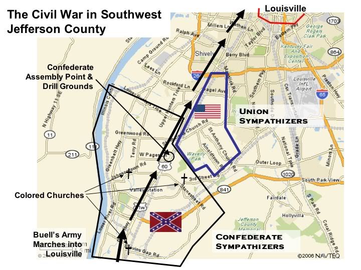
Some excerpts:
About Confederate sympathizers:
"In 1860 the young men of this section were Southerners and began drilling in order to join the Southern Army. They did their drilling in a field near Pleasure Ridge Park, on Mr Charles Pages' place. The Miller's, Camp's, Shively's, and most of the young men of the leading familys of that section went to the Confederate Camp at Bowling Green. Mr. Thomas Camp had four sons to go and a nephew....Mr. Camp's exhortation to them was never to run; if any of them came back shot in the back they need not come to him for help or expect to be allowed to stay in the house. They went off gaily to the war saying, "We will have the Yankees whipped and back home by Christmas to eat turkey with you." Some of them never got back.
The Camp family are mentioned again in this exploit:
" During the Civil War many young men wh were inducted by conscription into the Northern army deserted to the South. Some of these men came across the Ohio River near Goshen. In one instance a young boy of fourteen, William Adams, drove a spirited team and springboad wagon from Goshen to Valley Station. His mission was to deliver a grandfathers clock, but in the clocka Southern sympathizer was hiding. The boyt brought him through the back roads to the Camp farm, of whom the young deserter was a relative. He hid in the hills above the farm and the Camps fed him until he could join the Southern army
For the Louisville readers: the hills mentioned are visible today, off the Gene Synder freeway, and is that part of the Jefferson County Forest between Pond Creek and Blevins Gap.
The map upthread shows the route of the Don Carol's Buells Union army marching to Louisville. The history mentions this march up "Salt River Pike", todays Dixie Highway:
"Buell's Army, in his race with Bragg, passed along the pike....they camped one night in that territory between Salt River and Louisville. The next day there were not as many chickens, turkeys, geese, hogs, beehives, rail fences, and cordwood ast there was the day before, and there was some horse trading".
..this bivouac before reaching Louisville was someplace in southwest Jefferson County, off of Dixie Highway.
It should be said this area, though pro-South, was not really plantation country, thought there was some large old houses and big pieces of property, like this one along the river, on 200 acres (but enlarged later to 1,500 acres)...the Moorman House:
http://www.riverside-landing.org/images/housenew.jpg
The property was worked by slaves.
"Mr. Moorman was good to his slaves. He did every thing he could to encourage their legal marriage of slaves. Often he would buy or sell a slave so that the slave could be on the same farm with their legal husband or wife. After the war was over and the slaves where freed the head of each colored family recieved $100.00 to start on. Up until the time of his death, Israel Putnam, son of Alanson, heard from children of these old slaves. The letters came addressed to "Old Marse".
There apparently was a rural African-American population in SW Jefferson County into the 20th century. A "Cold. Church" shows on an old 1870s map, at around Pages Lane and 3rd Street Road. The history mentions two others:
One of the early colored churches in our community stands at Blevins Gap Road and Orell Road. It will soon be 100 years old. A school for colored children formerly was in the same area.
On Johnsontown Road and Mill Creek there stood at one time a church and school for colored folk. It was begun by the slaves and their families. At the end of World War I, it was burned with a firey cross supposedly by the Ku Klux Klan. There is now a good 'hog proof' fence around the plot and it is well kept and mowed by the descendants"
Which brings up a question of a "secret history"...what happened to this rural African American population? Where they driven out by racial violence prior to white suburbanization?
As Kentucky was a border state and Jefferson County was right on that border, there where Union sympathizers. One pro-union family left Southwest Jefferson County for Indiana for the duration of the war and returned when the war was over.
And there was a region of German farmers in Southwest County that where Union sympathizers, shown on the map above:
"Mr. Carl Schroerlucke remembers many stories told to him by his mother concerning the Civil War. He said that 50,000 Union soldiers where camped at the Old Folk Home in Shively and around Louisville. Some of the men visited in this German settlement, which was very strong Union. Hannah, Carl's mother, would as ask the little boy what he could possibly do in a battle, and he answered he was needed to beat the drum.
One of the Union soldiers by the name of Dickeman visited the farm often, and said he intended to return one tday to live in this valley. From Louisville this army went ot the battle of Shiloh, he was never heard from again and the Friauf's assumed he was kidded.
There was a company of 100 men from this Shardine Precinct...
So, just as their neighbors further south joined the CSA army, the German farmers formed a company to join the Union.
The history also makes passing mention to the depredations of the "guerillas". Kentucky (and Missouri) had quite a few irregulars, actually just plain bandits in many cases, called "guerillas". One famous one operated in the area south and southwest, was captured, and hung out on what is now Dixie Highway...
http://www.rulen.com/partisan/mundy.jpg
Sue Mundy (and no he wasn't a girl)
Probably not too interesting stuff, unless one is into local history, but for me it was neat to see how this grand epic of our history..The Civil War...played out in this little corner of Kentucky..
Well Again Steven I'm a born and raised Louisvillian AND I SWEAR TO THAT ONE, I have also however lived in Georgia (4 years). While from my personal experiences I can tell you that the Southern accent is not as profound here as in the Deep South, they are prominant here. PROVE ME WRONG. HELL I can say there's no Southern accents in Richmond (which is a lie), But do I have proof of that claim Hell NO, according to every source I've given on dialect, WHICH ARE THE ONLY ONES I'VE FOUND ON THE NET Louisville as well as Richmond are grouped in with the South more particularly the Mid/Upper South. LoL maybe you should actually try visiting one of those cities, instead of having a Southern perception based off Gone with the Wind. I'm not ignorant to the fact that their is a South Midland accent in Louisville, just as their is a Northeastern in Richmond. Despite those facts Louisville as well as Richmond are grouped in with the Southby all of these linguistic experts. Anywho about the Confederate Monument, I'm pretty sure kids in Nashville or Richmond aren't oh so moved by the spectical either, THEY'RE KIDS. Again if Louisville is truely this Northern/Midwestern city this monument would have been burned to ashes by now. You say my post are to lengthy, well I had just ended the 4 day war with 216.227.20.134|216.227.20.134, until you bursted in labeling your opinion as fact with not a single source. So to prove you wrong I posted sources, that are more credible than yourself, and with my sources labeling Louisville clearly as a SOUTHERN CITY, you got angry and started criticizing me for making valid points LOL. You challenged someone to defy anything you've just said LOL more than 3/4's of the page is defying what you've stated WITH SORUCES. So I think it's on YOU to prove your case for Louisville 's PRODOMINANTLY Midwestern culture. http://img.photobucket.com/albums/v342/Spartanburger/thesouth.jpg 74.128.200.135 17:06, 28 December 2006 (UTC)
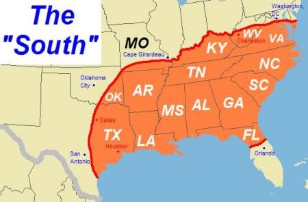
As far as the Majority of Louisvillians, Kentuckians, LMAO the only poll that I can recall that took on this subject was on Skyscrapercity and over twice as many people voted that Louisville is a Southern city, I'm in the process of relocating it. As far as Kentucky goes over 3/4's of people say Kentucky is a Southern state on the Urbanplanet poll. As a matter of fact on the Louisville (on the Soutehrn page) debate as of now we have more people who consider Louisville Southern. We're also in the majority on the adding Kentucky as a solidly Southern state (or the 3 tone map). Just look at this page, it's a war zone, every five minutes someones taking off the Wiki map in favor of the official map, BECAUSE.....Kentucky and Louisville are Southern. As a matter of fact Louisville isn't even mentioned in this article LOL. Where it has quite a few notable mentions in the Southern article where it truely belongs. Without anyone even caring about Louisville in the Midwest Article, you're still claiming that it's a "Lower Midwestern" city. Then again what is the Lower Midwest?? Cincinnati and St.Louis? St.Louis is in a state that was considered Southern all the way up until the 20th century.
On that Courier Journal article, WHERE'S IT UNDER OPINIONS LMAO
She didn't even list where the debate was taking place.
http://www.britannica.com/ebc/article-9049101
A vigorous campaign to reclaim the South's trade followed the war. In the 1880s the Louisville and Nashville Railroad was extended to Jacksonville, Florida.
http://www.bls.gov/ncs/ocs/compub.htm#TN
KENTUCKIANA DUH, let's not forget that Louisville's metropolitan area extends into the OFFICIAL MIDWEST region/Southern Indiana. I'm aware that Louisville's metro area may be considered Midwestern for that reason. However that same source considers the city of Louisville and Kentucky the South, as they go by the Official definition. East South Central!!
http://www.mostlivable.org/cities/louisville/home.html
Louisville is proud to host the two most exciting minutes in sports. This genteel Southern city is home to the Kentucky Derby, the world's most famous horse race.
http://www.answers.com/topic/louisville-kentucky
Noted for the Kentucky Derby, mint juleps, and southern charm, Louisville preserves the best of the past while looking forward to the future.
http://www.acfnewsource.org/democracy/louisville_lure.html
The once sleepy southern city is doing whatever it can to lure immigrants
http://en.wikipedia.org/wiki/Shawnee,_Louisville
As a southern city many of Louisville's public facilities were segregated
http://www.usatoday.com/news/nation/2002-11-03-louisville-usat_x.htm
After more than a century of churning out Triple Crown winners and Louisville Slugger bats, this Southern city has yet to play in the big leagues
http://www.worldcatlibraries.org/wcpa/top3mset/bc0c709903b0eb73a19afeb4da09e526.html
The growth of sport in a Southern city a study of the organizational evolution of baseball in Louisville, Kentucky, as an urban phenomenon, 1860-1900
http://www.southernaccents.com/accents/entertaining/parties/article/0,14743,1190201,00.html
Horses, hats, and mint juleps: Churchill Downs may be the place to be the first weekend of May, but every day of the year, you'll find great style and plenty to see and do in this classic Southern city
http://answers.yahoo.com/question/index?qid=20061219105743AA9gyqK
Lousiville is a southern city, but it is influenced by the midwest as well.
http://www.cordish.com/sub.cfm?section=news&type=article&newsid=46
Construction cranes, temporary street closings and the smell of fresh paint greet visitors to this once-sleepy Southern city.
http://louisville.bizjournals.com/bizwomen/louisville/content/story.html?id=1029463
Another cool thing about this area is the co-mingling of cultures. For what many consider to be a "Southern" city, we're a pretty diverse one.
http://www.americandrivingvacations.com/Ky/Louisville/Louisville.htm
If there was only one city in the South you can visit to discover the genteel Southern lifestyle, Southern Hospitality, and Soutehrn Heritage we suggest Louisville. But as the most Northern of the Southern cities, that sophistication comes with a "southern twist"
http://profile.myspace.com/index.cfm?fuseaction=user.viewprofile&friendid=133912385
LOL while I was doing a simple google search I came across this Louisville area rapper myspace page, and he had a few interesting polls One being "Kentucky is" No.1 Gateway to the South, No. 2 Swangin in tha Midwest, No. 3 Big East (AKA style New York rappers). LoL out of the 75 respondants 55 say it's the Gateway to tha South, 16 say it's the Midwest, and 5 say the Big East. Keep in mind this is a local rapper, so many if not most of the respondants are Louisvillians. Just thought it could contribute to the whole how Louisvillians feel about regional identity. I GUEST THEY'RE SOUTHERNERS TOO.
Louisvillian 01:55, 2 January 2007 (UTC)
- This entire debate could be resolved if those putting the WP regions map here would simply give a source citation for the map. As it is, it looks like something agreed upon by a committee of Wikipedians... a stance that strikes me (and others) as original research. -- SwissCelt 10:42, 3 February 2007 (UTC)
- There is no universal definition of the Midwestern region. Some sources will not include Missouri, and some will not include Kansas or the other states of the Great Plains, preferring instead just the states of the Northwest Ordinance. And yes, as much as it may irritate some editors, some sources will include regions of KY and WV in a cultural or geographic analysis of the Midwest. Numerous such sources have been provided on this page in the above sections. This is not original research as all of these sources are from NPOV sites outside of Wikipedia. As I stated earlier, the only reason for dismissal of this map would be an acceptance of the Census Bureau definitions as final and unquestionable, a stance that we should be extremely reticent to take as the Census Bureau is just one of dozens of verifiable sources. The Census Bureau places both Maryland and Delaware outside of the Mid-Atlantic or Northern United States, which is the exact opposite of the way that Wikipedia represents these states. --70.168.88.158 23:58, 3 February 2007 (UTC)
- Then let's do this: In the caption describing the map, cite at least one source which explains what the caption endeavours to explain, i.e. that KY and WV are considered by some to be Midwestern states. Without a source citation, it will seem that Wikipedia editors are imposing that definition upon these states, which is why the controversy has arisen. -- SwissCelt 05:53, 4 February 2007 (UTC)
- Seems to me that the sources used in making a map really belong on the map image page rather than some article that happens to use the map. The sources could be in articles too, but it is good practice when making maps to cite sources. But again, on the image page first, no? Pfly 06:03, 4 February 2007 (UTC)
- Actually, I just commented on Image talk:US map-Midwest.PNG with words to that effect. There needs to be a source for the image itself, yes. However, where this article is concerned, there also needs to be a source to substantiate what the caption in this article claims: "Kentucky and West Virginia are generally included in the South, but regions of these states are often included in the Midwest in maps, descriptions, and cultural delineations." This is presently an unverified claim. -- SwissCelt 06:11, 4 February 2007 (UTC)
- If you browse the talk archives here and on Southern United States talk archives you'll find an amazing number of sources for these claims. Feel free to add them to the map or page. Pfly 07:49, 4 February 2007 (UTC)
- Well frankly, I'm not sure why I should do that legwork for what I personally consider to be a dubious claim. But for those who would, you're right: Sources can be found. Any takers? -- SwissCelt 09:30, 4 February 2007 (UTC)
The Midwest region today sometimes refers not only to states created from the Northwest Ordinance, but also may include states between the Appalachian Mountains and the Rocky Mountains and south of the Ohio River. - a quote directly from the introductory section of this article; it is clearly referring to Kentucky and West Virginia as they are the only states south of the Ohio River to ever be considered partially Midwestern in culture/geography
I’m rather amazed that, three months later, there is still apparent ambiguity and discussion regarding the whole “portions” vs “entirety” issue (all or nothing, I suppose, seems to be popular on this page.) I also strongly disagree, as strongly as I possibly can, that this is not a consensus issue. Precisely because regional boundaries are imperfect, it is necessary to include a wide variety of sources in the analysis here, or we are deceiving readers by presenting a biased, incomplete, and one-sided portrayal of a region. Midwestern elements in these border states are mentioned nowhere in this article – even though they’re quite clearly there – so removing this map will further marginalize the cultural analysis here. As I and other continue to provide sources here only to have them promptly ignored, I will pursue arbitration in this matter if necessary, if editors keep removing the map after cites have been provided numerous times. I can assure you that the same points that I am raising were addressed during the creation of these regional maps, and sources were provided then and now. Again, regarding cultural definitions, they are (1. Not the same as arbitrary geopolitical boundaries such as the Mason-Dixon Line and Ohio River and (2. There is no universal source for regional definitions.
That being said, numerous sources have been provided, time and time again, regarding the existence of this map. This is not original research. For a brief summarization (and again, this is rather redundant as nearly all of this information has been posted before on this page and/or the Southern talk page):
D.W. Meinig, Shaping of America (summary by another editor): Going back in time, the strongest evidence can be seen in the Civil War era. He makes a convincing argument as to why the South and North could not be easily split apart. Although the Ohio River was then, as now, the common definition of the border, in truth the cultures were anything but sharply distinct, geographically. In discussing this era in "Shaping of America" vol. 2, he writes: "..Southerners left their imprint strongly upon southern Ohio, Indiana, and Illinois. Those states thereby stand out as ... geopolitical entities deeply split within themselves between a strongly Yankee Republican north and a strongly Southern Democratic south. ...A kind of mirror image of this pattern was displayed in the strongly Unionist areas within the slave states. Such a stance did not represent "Northernness" (except, in part, in such border cities as Wheeling [West Virginia], Louisville [Kentucky], and St. Louis [Missouri]..." (pg. 487). Moving ahead in time, in vol. 3, Meinig describes the emergence of the "Manufacturing Belt" in the Midwest, a region which at the time (late 1800s, early 1900s) was rooted in Pittsburgh and the west Pennsylvania region, linked to the Great Lakes and iron ore from the Duluth region, and the Ohio River along which goods and people moved, with new, large clusters of heavy industry on both sides of the river from Pittsburgh through Wheeling and on to Kentucky and southern Ohio (pp. 234-237). Many of the maps in these books show the Midwest/Manufacturing Belt/American "Core" region as including the northern panhandle of West Virginia where Wheeling is, and the northwest part of West Virginia fronting the Ohio River (eg., pg. 241, vol. 3). In volume 4, discussing more recent times, Meinig writes at length about cultural regions of America, noting the impossibility of precisely delineating them, but mapping them anyway. His map of cultural regions as of 1950 (vol. 4, pg. 192) shows several lines for the border between the Midwest and South. The Ohio River still the most commonly used border, Meinig offers the thickest line on the map as the nation's "primary cultural divide", and draws this line through northern West Virginia and southern Indiana and Illinois, so that Wheeling, WV, and Louisville, KY, fall to the north, while Evansville, IN, falls to the south.
Regarding Louisville, KY:
Columbia University Press – from Encyclopedia information about Louisville The Columbia Electronic Encyclopedia, Sixth Edition Copyright © 2003, Columbia University Press. Licensed from Columbia University Press. All rights reserved. www.cc.columbia.edu/cu/cup/ , accessible at http://www.answers.com/topic/louisville-kentucky
“(Louisville) is the largest city in Kentucky, a port of entry, and an important industrial, financial, marketing, and shipping center of the South and the Midwest.”
The Journal of Economic History (Vol. 49, N. 4), Midwestern Industrialization and the American Manufacturing Belt “The Midwest is defined as the manufacturing portion of the East and West North Central census regions plus West Virginia and Kentucky cities along the Ohio River. (pg 924) By Census definitions, portions of several MSAs in KY and WV sit in unquestionably Midwestern states. Those include: Louisville MSA(includes counties in Indiana) Henderson, KY (included in Evansville, IN MSA) Northern Kentucky counties of Boone, Kenton, Campbell – included in Cincinnati MSA Wheeling MSA (includes OH counties) Huntington-Ashland MSA – tri-state metro that includes West Virginia, Kentucky, and Ohio counties
This map is hardly out of the ordinary - for example, check this USGS site: [8] . Any map like that, used by the US government, is highly relevant and meritorious of inclusion in this discussion. When it was posted here before, directly above this section, it was subtly ignored.
This is in addition to a proliferation of other sources provided between the two talk pages that address specifics of ancestry, religion, etc. that show a clear inter-mixing of cultures in these border states. This information is readily accessible, and I would encourage those who continue to remove this map to take it into account. I certainly do not wish to further crowd this talk page with information that has already been posted, but the "claim" regarding these states is anything but unverified at this point. --70.168.88.158 00:49, 5 February 2007 (UTC)
- I would argue, in return, that those MSA's are primarily Southern or Appalachian in nature, and not Midwestern. But I'll let it drop at this. My major concern in this debate (and one I've stated several times throughout) is that this information be sourced. Now that it is, I'll respectfully bow out of the debate. -- SwissCelt 12:28, 5 February 2007 (UTC)
Here's the map right here
http://www.pfly.net/misc/GeographicMorphology.jpg
Actually Louisville is below (which covers a considerable amount of Southern Indiana) the Southern cultural barrier on this map. Maybe that's what you've said mybad if I misread your post. 74.128.200.135 01:45, 6 February 2007 (UTC)