
Studniska Dolne
Studniska Dolne | |
|---|---|
Village | |
.jpg) Village church | |
 Studniska Dolne  Studniska Dolne | |
| Coordinates: 51°06′10″N 15°03′42″E / 51.10278°N 15.06167°E | |
| Country | |
| Voivodeship | |
| County | Zgorzelec |
| Gmina | Sulików |
| Population | 670 |
Studniska Dolne [studˈniska ˈdɔlnɛ] is a village in the administrative district of Gmina Sulików, within Zgorzelec County, Lower Silesian Voivodeship, in south-western Poland, close to the Czech border.[1]
It lies approximately 4 kilometres (2 mi) north of Sulików, 7 kilometres (4 mi) south-east of Zgorzelec, and 139 kilometres (86 mi) west of the regional capital Wrocław.
Gallery[edit]
-
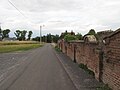 Wall of the cemetery
 -
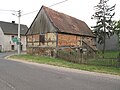 Old barn on the cross roads
 -
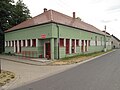 Community house
 -
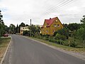 Houses by road
.jpg)
.jpg)
.jpg)
.jpg)
References[edit]
Wikimedia Commons has media related to Studniska Dolne.
This Zgorzelec County location article is a stub. You can help Wikipedia by expanding it. |