
St James Anglican Church, Māngere Bridge
| St James Anglican Church | |
|---|---|
| St James Anglican Church, Māngere Bridge | |
 St James Anglican Church in Māngere Bridge, 2024 | |
 | |
| Location | Māngere Bridge, Auckland |
| Denomination | Anglican |
| Website | https://www.st-james-nz.org/ |
| Architecture | |
| Functional status | Active |
| Architectural type | Church |
| Style | Selwyn stone Church |
| Clergy | |
| Priest(s) | Rev. Mark Barnard |
| Designated | 4th April 1983 |
St James Anglican Church is a heritage listed Anglican church in Tāmaki Makaurau Auckland, New Zealand. It is located in the suburb of Māngere Bridge on Church Road.[1] The church was built in the 1850s by tangata whenua.[2] It is the only remaining stone Selwyn church in Auckland.[3]
History[edit]
_(cropped).jpg)
St James Anglican Church and the surrounding cemetery are located in Māngere Bridge on land formerly occupied by Tāmaki Māori (Waiohua and later Ngāti Whātua). In 1837 Ngāti Mahuta were gifted land by Ngāti Whātua, later establishing a defensive settlement for Auckland.[4]
In 1849, the land where the church now sits was granted by Governor George Grey.[5] It is recorded that the building project was managed by Rev Arthur Purchas (first vicar of St Peters Anglican Church in the neighbouring suburb of Onehunga) and Tāmati Ngāpora. This venture was recorded to be co-funded by Bishop Selwyn and local Māori.[6][7] There is also evidence that Reverend Thomas Buddle stated the building of the church was also encouraged and overseen by the first Māori king, Pōtatau Te Wherowhero, cousin of Tāmati Ngapora.[8][9]
Construction of St James Anglican Church began in the 1850s at the foot of Te Pane o Mataaho / Māngere Mountain. The stones that make up the church were sourced from Te Pane o Mataaho / Māngere Mountain and carried down by Māori workers.[7]
The church was completed in 1859 but did not open officially until the 1st of January 1860.[8] The Southern Cross Newspaper reported:[8]
One of the neatest and most substantial Churches we have seen in New Zealand, is that recently erected in the native village of Mangarei. It is built of scoria, dug from the neighbouring quarries – the natives giving their labour, not only in providing the stone, but also in burning shells and supplying the lime, in rafting and conveying the timber, and in furnishing the interior fittings. On Sunday last, a fitting day, the Church was opened by his lordship Bishop Selwyn; a more attentive native audience we doubt if he ever had.
— Southern Cross Newspaper, 3 January 1860, page 3
Over the years, many efforts to preserve the church and churchyard have been made. The church was renovated in 1917 and the roof fixed in 1928 and again 1974.[8] This included in 1924, a group of women members of the church forming a guild to promote events and raise funds to maintain the church.[10] Later in 1938, further pleas to preserve the historic site were made. This resulted in an extensive renovation of the memorials to Māori chiefs Ēpiha Pūtini and Kati Takiwaru, who had great significance to the area.[11]
In 1863 the Government confiscated the land on which the church and urupā was built from Māori. By 1893 the land was claimed back as reported in the Auckland Star:[12]
It will be remembered that the old stone church at Mangere, built many years ago, was erected for the Europeans and natives, and for some years public worship has been held in it. Lately, however, the confiscated lands at Mangere have been returned to the natives, and last Sunday week the natives, as a mild reminder that the church was theirs, quietly locked the doors and removed the bell-ropes. It is not expected that any serious misunderstanding will arise.
— Auckland Star, 7 March 1893
Architecture[edit]
St James Church is built of scoria quarried from Te Pane o Mataaho / Māngere Mountain.[8] Designed by Bishop Selwyn, St James Church is the only surviving stone church from the Selwyn period in Auckland.[5] It is noted that Bishop Selwyn made several attempts at stone churches in Auckland, most of them left to decay or were completely abandoned.[13]
Due to the difficulty of stone construction, the chancel arch and arches of the doors are made from brick, not stone.[5] Foundations were laid by digging out volcanic top soil and foundation stones were set and mortared in place with crushed shell and washed sand from the nearby Manukau harbour.[14]
The original floor was replaced in 1988; however, the original windows remain today.[8] On the 4th April 1983 St James Church was registered by the New Zealand Historic Places Trust (now Heritage New Zealand) as a Category II historic place with registration number 689.[15]
Cemetery site[edit]
The urupā (Maori burial grounds) is a significant site for both Māori and Pakeha.[16] The urupā is overseen by Waikato Tainui.[2] In 2020 pleas were made from the whānau of ancestors resting at the urupā. They were seeking donations from the community to build a protective fence after headstones in the cemetery were vandalised.[17]
Current day[edit]
The current parish acknowledges its contested history and the importance of biculturalism to their history and future.[2] St James Anglican Church belongs to Te Takiwa o Manukau, a group of tikanga Māori Anglican churches. The current Reverend is Rev. Mark Barnard.[2]
Service times[edit]
- Sunday morning 9:30am (Holy communion with Kids church)
- Sunday (final Sunday of every month) all ages service
- Sunday 6:30pm bilingual worship (4th Sunday of the month)[2]
Gallery[edit]
-
 Side view St James Anglican Church Mangere Bridge, 2024
 -
 View of St James Church Mangere Bridge from cemetery, 2024
 -
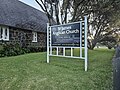 Sign at St James Anglican Church Mangere Bridge, 2024
 -
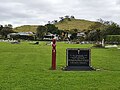 View of the urupā with Māngere Mountain in the background, 2021


References[edit]
- ^ "St James Anglican Church | Karakia/Services | Te Takiwa o Manukau". manukau.tetaitokerau.anglican.org. Retrieved 4 February 2024.
- ^ a b c d e "Home – St James". www.st-james-nz.org. Retrieved 4 February 2024.
- ^ "Welcome to Heritage New Zealand". Welcome to Heritage New Zealand. Retrieved 4 February 2024.
- ^ Patterson, Malcolm (21 March 2008). "Ngati Whatua o Orakei Heritage Report for State Highway 20; Transit Manukau Harbour Crossing" (PDF). Environmental Protection Authority. pp. 6–7. Retrieved 21 October 2021.
- ^ a b c "Footprints 07260". kura.aucklandlibraries.govt.nz. Retrieved 5 February 2024.
- ^ Auckland Council. "Māngere Bridge, Māngere East and Favona Heritage Survey- Historic Context Statement" (PDF). Auckland Council.
- ^ a b "Mangere Bridge Community Website :: Mangere Bridge History". www.mangerebridge.co.nz. Retrieved 4 February 2024.
- ^ a b c d e f "1 January 1860". kura.aucklandlibraries.govt.nz. Retrieved 4 February 2024.
- ^ "St James Church: Celebrating Life & Death". About Māngere Bridge. 12 May 2021. Retrieved 5 February 2024.
- ^ NEW ZEALAND HERALD (24 June 1924). "OLD MANGERE CHURCH". paperspast.natlib.govt.nz. Retrieved 4 February 2024.
- ^ NEW ZEALAND HERALD (29 December 1938). "HISTORIC CEMETERY". paperspast.natlib.govt.nz. Retrieved 4 February 2024.
- ^ Timespanner (7 September 2011). "Timespanner: The old stone church at Mangere". Timespanner. Retrieved 5 February 2024.
- ^ "Photo essay: Inside New Zealand's most spectacular churches". NZ Herald. 5 February 2024. Retrieved 5 February 2024.
- ^ Wallbank, Mark (3 January 2014). "St James Anglican Church & Cemetery – Mangere, Auckland | Paranormal NZ". Paranormal New Zealand. Retrieved 5 February 2024.
- ^ "Māngere Bridge (suburb)", Wikipedia, 21 January 2024, retrieved 4 February 2024
- ^ "St James Church: Celebrating Life & Death". About Māngere Bridge. 12 May 2021. Retrieved 5 February 2024.
- ^ Team, Waatea; Website (20 September 2020). "Community calls to defend urupa". Waatea News: Māori Radio Station. Retrieved 5 February 2024.