Nagyszénás
This article needs additional citations for verification. (September 2014) |
Nagyszénás | |
|---|---|
Large village | |
 Parish hall of Nagyszénás | |
| Coordinates: 46°41′N 20°41′E / 46.683°N 20.683°E | |
| Country | |
| County | Békés |
| District | Orosháza |
| Area | |
| • Total | 95.56 km2 (36.90 sq mi) |
| Population (2013) | |
| • Total | 5,063 |
| • Density | 54/km2 (140/sq mi) |
| Time zone | UTC+1 (CET) |
| • Summer (DST) | UTC+2 (CEST) |
| Postal code | 5931 |
| Area code | (+36) 68 |
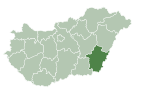
Nagyszénás is a large village in Békés County, in the Southern Great Plain region of south-east Hungary.
Main sights[edit]
- "Park" Bath of Nagyszénás
- Kiss György Observatory
- the Evangelist Church
- the Our Lady Catholic Church
Geography[edit]
It covers an area of 95.56 km² and has a population of 5063 people (2013).[1] The nearest town is Orosháza.
References[edit]
- ^ http://www.ksh.hu - Központi Statisztikai Hivatal: Magyarország közigazgatási helynévkönyve, 2013. január 1.
External links[edit]
![]() Media related to Nagyszénás at Wikimedia Commons
Media related to Nagyszénás at Wikimedia Commons
- Official website in Hungarian
46°41′N 20°40′E / 46.683°N 20.667°E


