
Little Rock, Mississippi
Little Rock, Mississippi | |
|---|---|
 Sign for Little Rock | |
 Little Rock, Mississippi  Little Rock, Mississippi | |
| Coordinates: 32°31′34″N 89°01′31″W / 32.52611°N 89.02528°W | |
| Country | United States |
| State | Mississippi |
| County | Newton |
| Elevation | 440 ft (130 m) |
| Time zone | UTC-6 (Central (CST)) |
| • Summer (DST) | UTC-5 (CDT) |
| ZIP code | 39337 |
| Area code | 601 |
| GNIS feature ID | 672659[1] |
Little Rock, Mississippi is an unincorporated community in Newton County, Mississippi. It lies along Little Rock Creek and Mississippi Highway 494 between Union and Meridian.[2] The elevation is 440 ft (130 m).[3] It was the former site of Beulah Hubbard High School.
A post office under the name Little Rock first began operation in 1914.[4]
Notable people[edit]
- Kortney Clemons (born 1980), Paralympic athlete in track and field
- Andy Ogletree (born 1998), amateur golfer, 2019 U.S. Amateur champion
- Randy Reeves (born 1962), Under-Secretary of Veterans Affairs for Memorial Affairs (2017−present)
Gallery[edit]
-
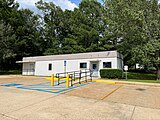 Little Rock Post Office

References[edit]
- ^ U.S. Geological Survey Geographic Names Information System: Little Rock, Mississippi
- ^ Mississippi Atlas & Gazetteer, DeLorme, 4th ed., 2010, p. 44 ISBN 089933346X
- ^ "GNIS Detail - Little Rock". geonames.usgs.gov. Retrieved November 11, 2017.
- ^ "Newton County". Jim Forte Postal History. Retrieved April 28, 2020.
Municipalities and communities of Newton County, Mississippi, United States | ||
|---|---|---|
| Cities |  | |
| Towns | ||
| CDPs | ||
| Other unincorporated communities | ||
| Ghost towns | ||
| Indian reservation | ||
| Footnotes | ‡This populated place also has portions in an adjacent county or counties | |
This Newton County, Mississippi state location article is a stub. You can help Wikipedia by expanding it. |