Lemsford, Saskatchewan
Lemsford | |
|---|---|
 Grain elevator originally from Lemsford, now located at a farm south of Leader, on Highway 21. | |
| Coordinates: 50°51′03″N 109°07′15″W / 50.8507°N 109.1209°W | |
| Country | Canada |
| Province | Saskatchewan |
| Region | Southwest |
| Rural municipality | Clinworth No. 230 |
| Restructured (Hamlet) | January 1, 1951 |
| Government | |
| • Governing body | Clinworth No. 230 |
| • MLA | Doug Steele |
| • MP | Jeremy Patzer |
| Time zone | CST |
| Area code | 306 |
| Highways | Highway 32 Highway 649 |
| Railways | Great Western Railway |
| [1][2][3][4] | |
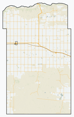
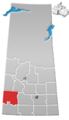
Lemsford is an unincorporated hamlet in Clinworth Rural Municipality No. 230, Saskatchewan, Canada. It previously held the status of village until January 1, 1951. The hamlet is located 42 km east of the Town of Leader at the intersection of Highway 32 and Highway 649, the hamlet is also serviced by the Great Western Railway.
History[edit]
Prior to January 1, 1951, Lemsford was incorporated as a village, and was restructured as a hamlet under the jurisdiction of the Rural municipality of Clinworth on that date.[5]
Infrastructure[edit]
- Lemsford Ferry, located 21 km north of Lemsford on highway 649.
- Great Western Railway, a Canadian short line railway company operating on former Canadian Pacific Railway trackage in southwest Saskatchewan.[6][7]
See also[edit]
References[edit]
- ^ National Archives, Archivia Net. "Post Offices and Postmasters". Archived from the original on October 6, 2006.
- ^ Government of Saskatchewan, MRD Home. "Municipal Directory System". Archived from the original on November 21, 2008.
- ^ Canadian Textiles Institute. (2005). "CTI Determine your provincial constituency". Archived from the original on September 11, 2007.
- ^ Commissioner of Canada Elections, Chief Electoral Officer of Canada (2005). "Elections Canada On-line". Archived from the original on April 21, 2007.
- ^ "Restructured Villages". Saskatchewan Ministry of Municipal Affairs. Archived from the original on March 25, 2008. Retrieved February 10, 2008.
- ^ Great Western Railway
- ^ Red Coat Road & Rail Ltd. - RCRR


