Kurjenrahka National Park
You can help expand this article with text translated from the corresponding article in Finnish. (April 2020) Click [show] for important translation instructions.
|
You can help expand this article with text translated from the corresponding article in Swedish. (September 2023) Click [show] for important translation instructions.
|
| Kurjenrahka National Park | |
|---|---|
 | |
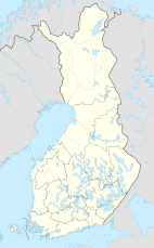
| Location | Southwest Finland, Finland |
| Coordinates | 60°43′14″N 22°23′01″E / 60.72056°N 22.38361°E |
| Area | 29 km2 (11 sq mi) |
| Established | 1998 |
| Visitors | 53000 (in 2015[1]) |
| Governing body | Metsähallitus |
| Website | www |
Kurjenrahka National Park (Finnish: Kurjenrahkan kansallispuisto, Swedish: Kurjenrahka nationalpark) is a national park in Southwest Finland. It was established in 1998 and covers 29 square kilometres (11 sq mi). The area consists mainly of bog but also includes primeval forests, some of which have been unmanaged for over 150 years. The Eurasian lynx is a permanent resident of Kurjenrahka, but brown bears and gray wolves have also been observed and are known to reside in areas within or close to the park. Marked trails in the general area extend to over 300 km.[2]
In Middle Ages the forests were jointly owned by the local parish. In early 1800s two manors bought them, but they had financially hard times and had to sell them to the state before end of the 19th century. Before selling, they logged clear all areas with easy access, but some islands in middle of mires remained unlogged.[3]
See also[edit]
References[edit]
- ^ "Käyntimäärät kansallispuistoittain 2015" (in Finnish). Metsähallitus. Archived from the original on 29 May 2019. Retrieved 29 December 2016.
- ^ "Kurjenrahka National Park". nationalparks.fi. Retrieved 29 December 2016.
- ^ "History and Sights of Kurjenrahka National Park". nationalparks.fi. Retrieved 29 December 2016.
External links[edit]
 Media related to Kurjenrahka National Park at Wikimedia Commons
 Kurjenrahka National Park travel guide from Wikivoyage
- Outdoors.fi – Kurjenrahka National Park


