
Kangasvuori
Kangasvuori | |
|---|---|
District of Jyväskylä | |
 Apartment houses and an R-kioski shop in Kangasvuori. | |
| Coordinates: 62°15′42″N 25°47′25″E / 62.2616°N 25.7903°E | |
| Country | |
| Province | Western Finland |
| Region | Central Finland |
| Sub-region | Jyväskylä sub-region |
| City | Jyväskylä |
| Ward | Huhtasuo |
| Time zone | UTC+2 (EET) |
| • Summer (DST) | UTC+3 (EEST) |
| Postal code | 40320, 40340[1] |
Kangasvuori is a district and a statistical area of Jyväskylä, Finland. The statistical area forms the Huhtasuo ward together with Huhtasuo and the Vääräjärvi suburb of Ankeriasjärvi.[1][2] Kangasvuori was mostly built during 1965–1976, making it the oldest suburban area in the ward.[2][3]
The statistical area of Kangasvuori is officially divided into five sub-districts (pienalue): Seppälä, Pupuhuhta, Rasinrinne, Läntinen Kangasvuori and Itäinen Kangasvuori.[1] Seppälä is a commercial area, Pupuhuhta is a suburb built in the 1970s.[4] The construction of Rasinrinne started in the 1990s.[5][6] Läntinen Kangasvuori is dominated by apartment buildings that were built in 1960s and 1970s, whereas Itäinen Kangasvuori mostly consists of row houses and single-family houses[2] along with some apartment buildings.
Gallery[edit]
-
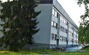 An apartment building in Läntinen Kangasvuori.
 -
 Pupuhuhta neighborhood.
 -
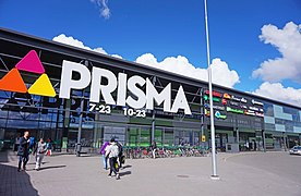 Prisma store in Seppälä.
 -
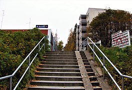
 Street Pupuhuhdantie.
 -
 Rasinrinne area
 -
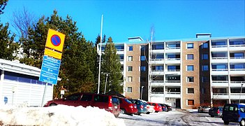
 An apartment house built in 1998.


References[edit]
- ^ a b c "Jyväskylän karttapalvelu". kartta.jkl.fi (in Finnish). Retrieved 2023-11-02.
- ^ a b c "Jyväskylän omakotialueita". www3.jkl.fi. Retrieved 2017-09-14.
- ^ Jyväskylän Huhtasuon Huhtakeskusostoskeskuksen rakennusinventointi 2009 - Loppuraportti (PDF)
- ^ Pupuhuhdan lähiö 9 - 11-vuotiaiden lasten silmin : kokemuksia ja kehittämisehdotuksia (PDF)
- ^ Geocaching. "Huhtasuon historiaa (2000-luku): Kuntaliitos". Retrieved 2018-01-20.
- ^ "Asumista liikunnan ehdoilla". SKV Kiinteistönvälitys. Retrieved 2017-09-14.
