
File:Salem Lake proposed 301m v1.svg

Size of this PNG preview of this SVG file: 636 × 600 pixels. Other resolutions: 255 × 240 pixels | 509 × 480 pixels | 815 × 768 pixels | 1,086 × 1,024 pixels | 2,172 × 2,048 pixels | 1,156 × 1,090 pixels.
Original file (SVG file, nominally 1,156 × 1,090 pixels, file size: 904 KB)
| This is a file from the Wikimedia Commons. Information from its description page there is shown below. Commons is a freely licensed media file repository. You can help. |
Summary
| Description |
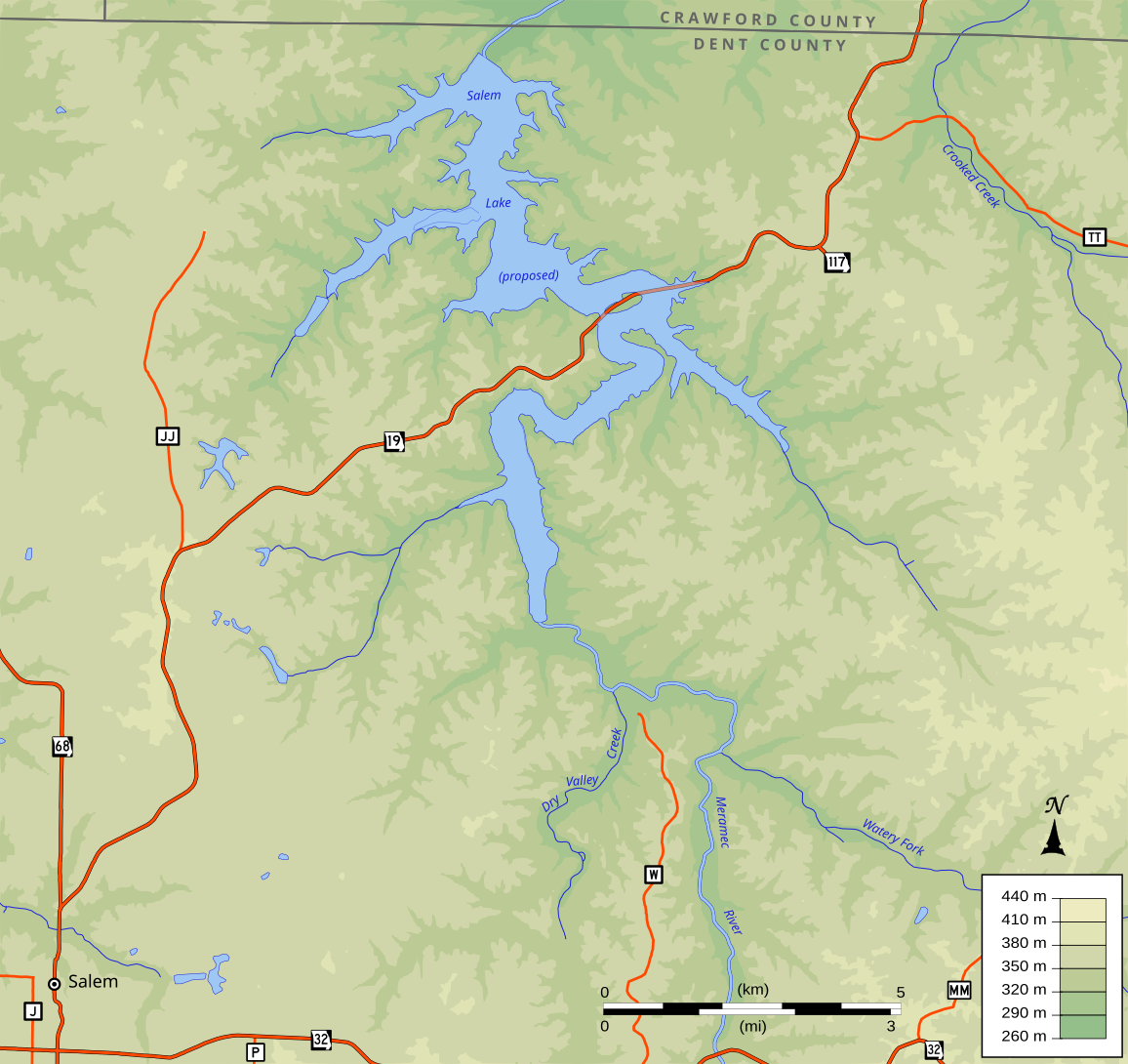
English: This map depicts the approximate location and extent of the reservoir on the Meramec River in Missouri near Salem that would have been formed by dam #27 of the cancelled Meramec Basin Project. This lake does not exist. The Salem reservoir was proposed as part of a second phase of dam building, being described as "economically justified", but not recommended as part of the initial flood-control plan. This map is based on an estimated pool elevation of 301 meters with a dam at 37.7839 N 91.4573 W, which were derived from a very low resolution map published by the Corps of Engineers. GIS data from the National Map. |
| Date | |
| Source | Own work |
| Author | Kbh3rd |
| Object location | | View this and other nearby images on: OpenStreetMap |
|---|
Projection: Missouri East state plane (EPSG archive copy at the Wayback Machine ID 3602)
World file (valid when rendered at 1156×1090 pixels):
16.094290657439448
0
0
-16.091743119266056
157650.000000000000000
217840.000000000000000
Licensing
I, the copyright holder of this work, hereby publish it under the following license:
This file is licensed under the Creative Commons Attribution-Share Alike 3.0 Unported license.
- You are free:
- to share – to copy, distribute and transmit the work
- to remix – to adapt the work
- Under the following conditions:
- attribution – You must give appropriate credit, provide a link to the license, and indicate if changes were made. You may do so in any reasonable manner, but not in any way that suggests the licensor endorses you or your use.
- share alike – If you remix, transform, or build upon the material, you must distribute your contributions under the same or compatible license as the original.
File history
Click on a date/time to view the file as it appeared at that time.
| Date/Time | Thumbnail | Dimensions | User | Comment | |
|---|---|---|---|---|---|
| current | 23:23, 13 September 2012 | | 1,156 × 1,090 (904 KB) | Kbh3rd | User created page with UploadWizard |
File usage
The following pages on the English Wikipedia use this file (pages on other projects are not listed):