
File:Queensland state primary and secondary schools and education regional boundaries map (excluding South-East Queensland), 2017.pdf

Size of this JPG preview of this PDF file: 424 × 599 pixels. Other resolutions: 170 × 240 pixels | 339 × 480 pixels | 543 × 768 pixels | 724 × 1,024 pixels | 1,449 × 2,048 pixels | 4,966 × 7,020 pixels.
Original file (4,966 × 7,020 pixels, file size: 3.59 MB, MIME type: application/pdf)
| This is a file from the Wikimedia Commons. Information from its description page there is shown below. Commons is a freely licensed media file repository. You can help. |
Summary
| Description |
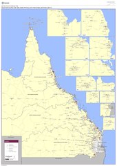
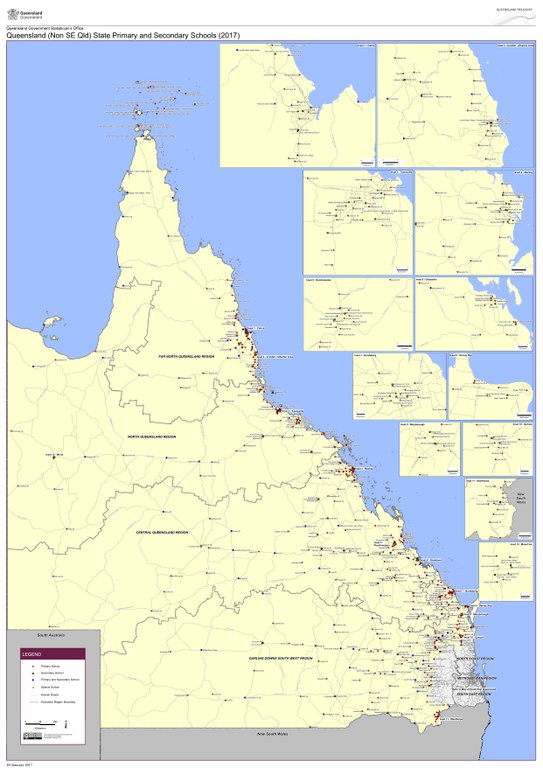
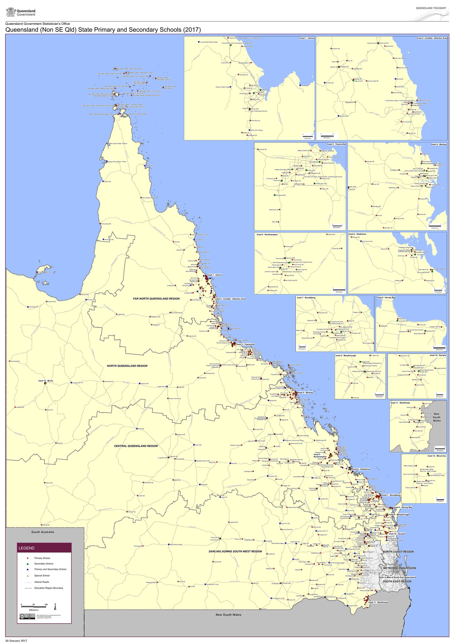
English: Queensland state primary and secondary schools and education regional boundaries map (excluding South-East Queensland), 2017. It is intended to be priinted on A0 paper so may need to be zoomed to read details. |
| Date | |
| Source | Queensland (Non SE Qld) State Primary and Secondary Schools (2017) published by the Queensland Government |
| Author | Unknown author |
Licensing
This file is licensed under the Creative Commons Attribution 4.0 International license.
- You are free:
- to share – to copy, distribute and transmit the work
- to remix – to adapt the work
- Under the following conditions:
- attribution – You must give appropriate credit, provide a link to the license, and indicate if changes were made. You may do so in any reasonable manner, but not in any way that suggests the licensor endorses you or your use.
File history
Click on a date/time to view the file as it appeared at that time.
| Date/Time | Thumbnail | Dimensions | User | Comment | |
|---|---|---|---|---|---|
| current | 01:57, 14 October 2017 |  | 4,966 × 7,020 (3.59 MB) | Kerry Raymond | User created page with UploadWizard |
File usage
The following pages on the English Wikipedia use this file (pages on other projects are not listed):