
File:Parkdale provincial Electoral District 1987–1999.pdf

Size of this JPG preview of this PDF file: 600 × 599 pixels. Other resolutions: 240 × 240 pixels | 481 × 480 pixels | 769 × 768 pixels | 1,025 × 1,024 pixels | 1,658 × 1,656 pixels.
Original file (1,658 × 1,656 pixels, file size: 45 KB, MIME type: application/pdf)
| This is a file from the Wikimedia Commons. Information from its description page there is shown below. Commons is a freely licensed media file repository. You can help. |
Summary
| Description |
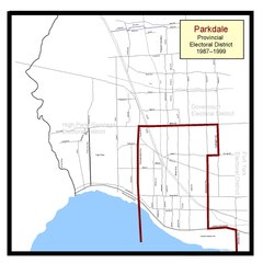
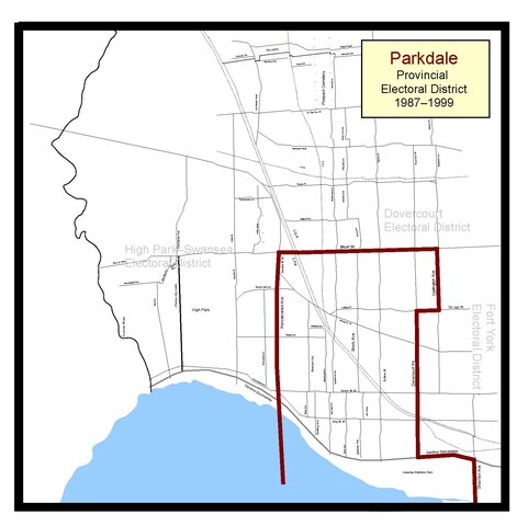
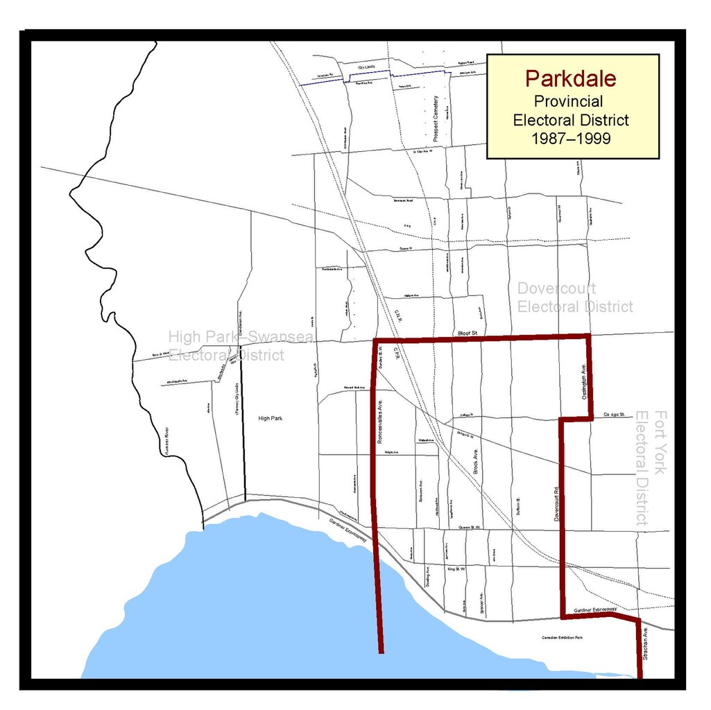
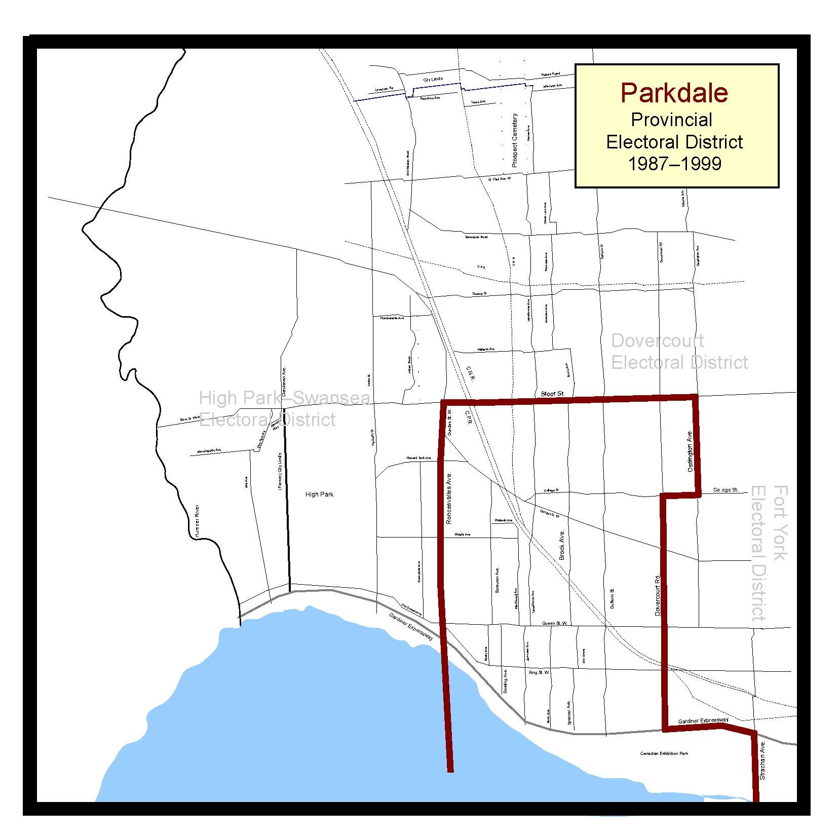
English: The final boundaries for the Parkdale Ontario provincial electoral district, as represented in the Ontario Legislature from 1987 to 1999. The 1987, 1990 and 1995 Ontario general elections were fought under these boundaries. Map based on maps from The Toronto Star, The Globe and Mail newspapers, and Elections Ontario. |
| Date | |
| Source | Own work |
| Author | Abebenjoe |
Licensing
I, the copyright holder of this work, hereby publish it under the following license:
This file is licensed under the Creative Commons Attribution-Share Alike 3.0 Unported license.
- You are free:
- to share – to copy, distribute and transmit the work
- to remix – to adapt the work
- Under the following conditions:
- attribution – You must give appropriate credit, provide a link to the license, and indicate if changes were made. You may do so in any reasonable manner, but not in any way that suggests the licensor endorses you or your use.
- share alike – If you remix, transform, or build upon the material, you must distribute your contributions under the same or compatible license as the original.
File history
Click on a date/time to view the file as it appeared at that time.
| Date/Time | Thumbnail | Dimensions | User | Comment | |
|---|---|---|---|---|---|
| current | 17:21, 20 January 2012 |  | 1,658 × 1,656 (45 KB) | Abebenjoe | Fixed error that had the Gardiner as part of the south west border. The correct border was from the lake straight to Roncesvalles Avenue. |
| 16:55, 20 January 2012 | 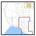 | 1,658 × 1,656 (46 KB) | Abebenjoe | Changed aspect ratio. | |
| 05:33, 19 January 2012 |  | 1,275 × 1,650 (35 KB) | Abebenjoe | Moved the south eastern border from Shaw Street, to further east to Strachan Avenue, which was the correct street: my mistake when I originally drew the map. | |
| 23:52, 17 January 2012 |  | 1,275 × 1,650 (35 KB) | Abebenjoe |
File usage
The following pages on the English Wikipedia use this file (pages on other projects are not listed):