
File:Parkdale Provincial Electoral District 1955–1967.pdf

Size of this JPG preview of this PDF file: 600 × 599 pixels. Other resolutions: 240 × 240 pixels | 481 × 480 pixels | 769 × 768 pixels | 1,025 × 1,024 pixels | 1,658 × 1,656 pixels.
Original file (1,658 × 1,656 pixels, file size: 46 KB, MIME type: application/pdf)
| This is a file from the Wikimedia Commons. Information from its description page there is shown below. Commons is a freely licensed media file repository. You can help. |
Summary
| Description |
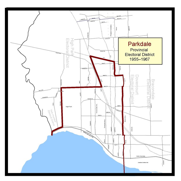
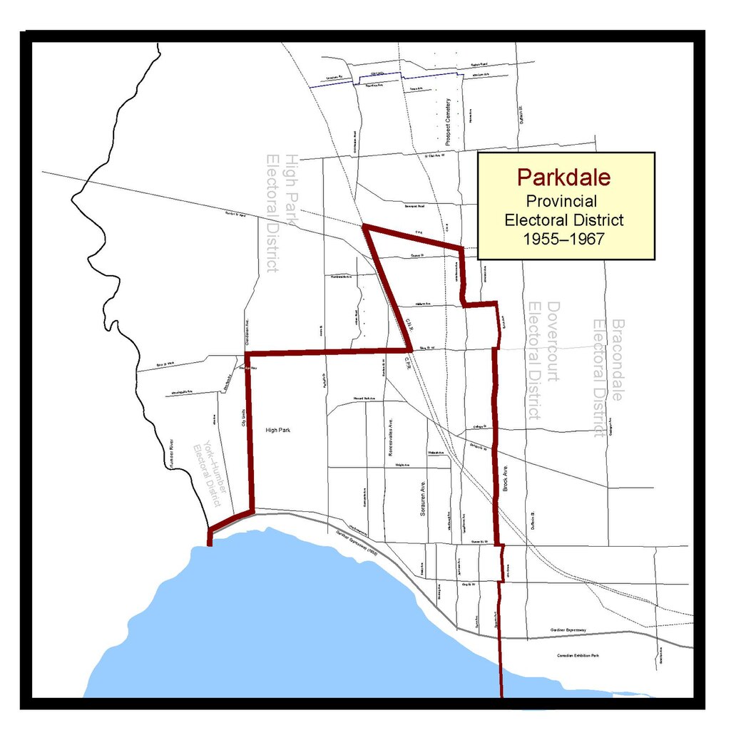
English: This is the Parkdale Ontario provincial electoral boundary map for the years 1955 until 1967. The 1955, 1959 and 1963 Ontario general elections were fought under these boundaries. Sourced from The Toronto Star, and the Ontario Ministry of Lands and Forests. |
| Date | |
| Source | Own work |
| Author | Abebenjoe |
Licensing
I, the copyright holder of this work, hereby publish it under the following license:
This file is licensed under the Creative Commons Attribution-Share Alike 3.0 Unported license.
- You are free:
- to share – to copy, distribute and transmit the work
- to remix – to adapt the work
- Under the following conditions:
- attribution – You must give appropriate credit, provide a link to the license, and indicate if changes were made. You may do so in any reasonable manner, but not in any way that suggests the licensor endorses you or your use.
- share alike – If you remix, transform, or build upon the material, you must distribute your contributions under the same or compatible license as the original.
File history
Click on a date/time to view the file as it appeared at that time.
| Date/Time | Thumbnail | Dimensions | User | Comment | |
|---|---|---|---|---|---|
| current | 05:37, 19 January 2012 |  | 1,658 × 1,656 (46 KB) | Abebenjoe | Recompiled it as a vector-graphics based file. Minor improvements in legibility. |
| 04:06, 18 January 2012 |  | 1,275 × 1,650 (1.28 MB) | Abebenjoe |
File usage
The following pages on the English Wikipedia use this file (pages on other projects are not listed):