
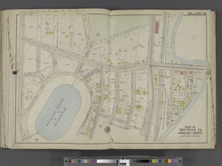
File:Bronx, V. 2, Double Page Plate No. 31 (Map bounded by E. 211th St., Bronx River, Holt Pl., Bainbridge Ave.) NYPL2020940.tiff

Size of this JPG preview of this TIF file: 800 × 600 pixels. Other resolutions: 320 × 240 pixels | 640 × 480 pixels | 1,024 × 768 pixels | 1,280 × 960 pixels | 2,560 × 1,920 pixels | 7,212 × 5,409 pixels.

Original file (7,212 × 5,409 pixels, file size: 111.67 MB, MIME type: image/tiff, 2 pages)
| This is a file from the Wikimedia Commons. Information from its description page there is shown below. Commons is a freely licensed media file repository. You can help. |
Summary
| Description | Bronx, V. 2, Double Page Plate No. 31 [Map bounded by E. 211th St., Bronx River, Holt Pl., Bainbridge Ave.]; Atlases of New York city. / Atlas of the city of New York : Borough of the Bronx ... from the actual surveys and official plans / by George W. and Walter S. Bromley. / Vol. 2 (1911) | |||||||||||||||||||||||
| Catalogue call number | Map Div.+++ (Bronx, New York) (Bromley, G.W. and Co. Atlas of the city of New York, borough of the Bronx. 1911) | |||||||||||||||||||||||
| Item/Page/Plate | 31 | |||||||||||||||||||||||
| Date | between 1911 and 1913 | |||||||||||||||||||||||
| Source |
http://digitalgallery.nypl.org/nypldigital/dgkeysearchdetail.cfm?imageID=2020940
|
|||||||||||||||||||||||
| Author | G.W. Bromley and Co. -- Publisher | |||||||||||||||||||||||
| Permission (Reusing this file) |
From The Lionel Pincus and Princess Firyal Map Division. http://maps.nypl.org
|
|||||||||||||||||||||||
| Location | Stephen A. Schwarzman Building / The Lionel Pincus and Princess Firyal Map Division | |||||||||||||||||||||||
| Digital item published | 7-11-2011 | |||||||||||||||||||||||
| Digital ID | 2020940 | |||||||||||||||||||||||

The making of this file was supported by Wikimedia UK.
To see other files made with the support of Wikimedia UK, please see the category Supported by Wikimedia UK.
|
File history
Click on a date/time to view the file as it appeared at that time.
| Date/Time | Thumbnail | Dimensions | User | Comment | |
|---|---|---|---|---|---|
| current | 07:54, 21 April 2014 |  | 7,212 × 5,409, 2 pages (111.67 MB) | Fæ | GWToolset:: Creating mediafile for Fæ. Tranche 2.3188 |
File usage
The following pages on the English Wikipedia use this file (pages on other projects are not listed):