
File:APISmap1.pdf
Size of this JPG preview of this PDF file: 505 × 599 pixels. Other resolutions: 202 × 240 pixels | 405 × 480 pixels | 647 × 768 pixels | 863 × 1,024 pixels | 1,283 × 1,522 pixels.
Original file (1,283 × 1,522 pixels, file size: 118 KB, MIME type: application/pdf)
| This is a file from the Wikimedia Commons. Information from its description page there is shown below. Commons is a freely licensed media file repository. You can help. |
| Description |
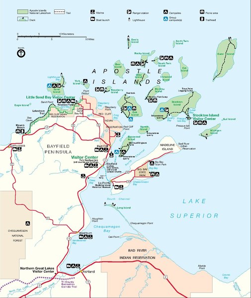
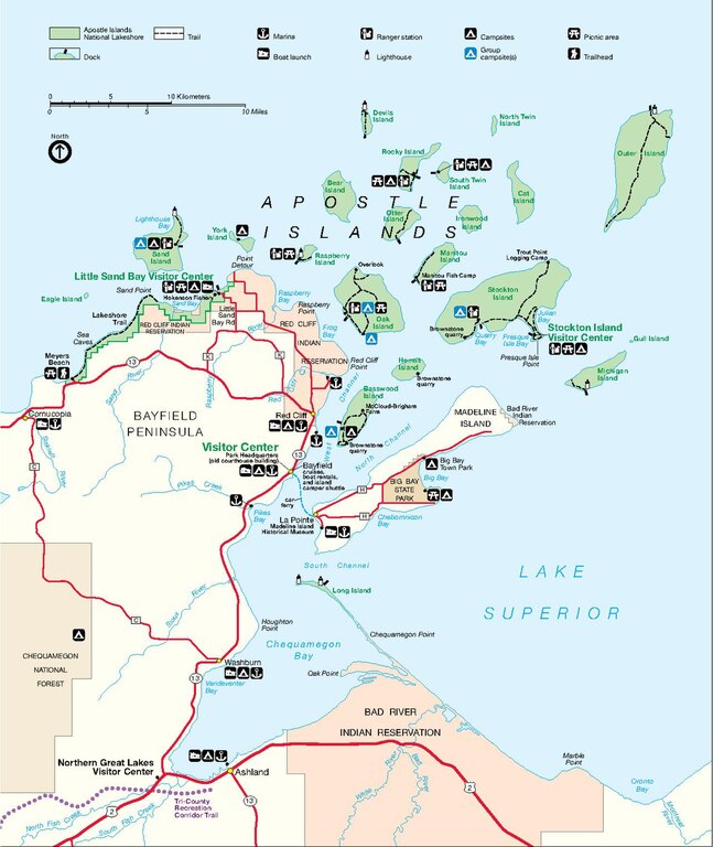
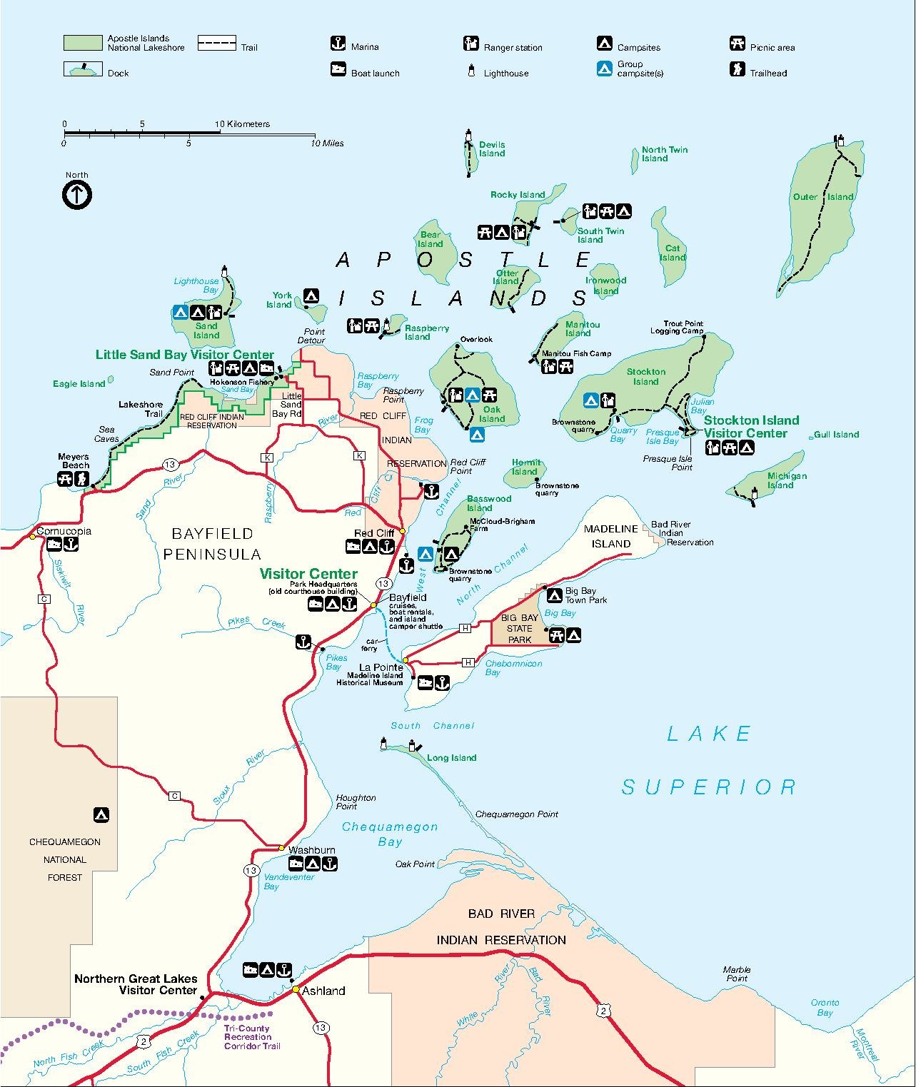
English: Park map produced by the National Park Service of the Apostle Islands National Lakeshore, on the Wisconsion south shore of Lake Superior. Located in Bayfeild and Ashland Counties, Wisconsin. |
| Date | Unknown date |
| Source | http://www.nps.gov/apis/planyourvisit/maps.htm |
| Author | National Park Service, Department of the Interior |
| Permission (Reusing this file) |
Work of the US government, information from http://www.nps.gov/disclaimer.htm |
| This image or media file contains material based on a work of a National Park Service employee, created as part of that person's official duties. As a work of the U.S. federal government, such work is in the public domain in the United States. See the NPS website and NPS copyright policy for more information. |
File history
Click on a date/time to view the file as it appeared at that time.
| Date/Time | Thumbnail | Dimensions | User | Comment | |
|---|---|---|---|---|---|
| current | 22:36, 15 November 2006 |  | 1,283 × 1,522 (118 KB) | Mashtato | {{Information |Description = Park map produced by the National Park Service of the Apostle Islands National Lakeshore, on the Wisconsion south shore of Lake Superior. Located in Bayfeild and Ashland Counties, Wisconsin. |Source = http://www.nps.gov/apis/p |
File usage
The following pages on the English Wikipedia use this file (pages on other projects are not listed):