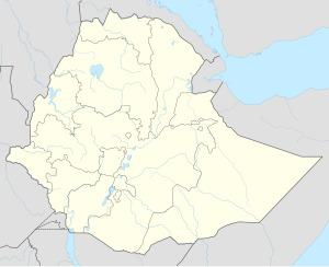
Dangila
Dangila | |
|---|---|
| Coordinates: 11°16′N 36°50′E / 11.267°N 36.833°E | |
| Country | Ethiopia |
| Region | Amhara Region |
| Zone | Agew Awi Zone |
| Population (2007)[1] | |
| • Total | 24,827 |
| • Estimate (2021)[2] | 53,225 |
| Time zone | UTC+3 (EAT) |
Dangila (Amharic: ዳንግላ) is a town in northwestern Ethiopia. Located in the Agew Awi Zone of the Amhara Region, this town has a latitude and longitude of 11°16′N 36°50′E / 11.267°N 36.833°E with an elevation of 2137 meters above sea level. It is the largest of three towns in Dangila woreda.
History[edit]
One of the earliest mentions of Dangila was when the Emperor Susenyos passed through the town in 1620.[3]
As late as the 1930s, Dangila was an important center of the African slave trade. Nagadras Habtewerq, director of customs in the town during the early 1930s, achieved a measure of success in liberating slaves despite the determined opposition of influential figures like the slaver Fitawrari Zelleqe.[4]
The British maintained a consulate in Dangila in the 1920s and 1930s, manned by R.E. Cheesman, who spent a considerable amount of energy mapping Agawmeder and nearby Gojjam.[5]
Dangila has played a role in Ethiopian literature. As a young man, Haddis Alemayehu, who was to become the foremost Amharic fiction writer, served for two years as a customs clerk at Dangila in the early 1930s. When consul Cheesman left, the consulate building was turned into a primary school, and Haddis Alemayehu became its headmaster for a year. Another author is Abe Gubegna, who attended grades 1-8 at the Bitwedded Mengesha Jembere school in the 1950s.[4]
Demographics[edit]
Based on the national census conducted by the Central Statistical Agency in 2007, Dangila had a total population of 24,827, of whom 12,389 were male and 12,438 were female.[6] The 1994 census reported this town had a total population of 15,437 of whom 6,796 were male and 8,641 were female.[7]
Notable residents[edit]
- Maru Teferi (born 1992), Israeli Olympic marathoner
Notes[edit]
- ^ "Population Projection Towns as of July 2021" (PDF). Ethiopian Statistics Agency. 2021. Retrieved 31 May 2022.
- ^ "Population and Housing Census 2007 – Amhara Statistical" (PDF). Ethiopian Statistical Agency. 2007. Retrieved 1 June 2022.
- ^ G.W.B. Huntingford, Historical Geography of Ethiopia from the first century AD to 1704 (London: British Academy, 1989), p. 176
- ^ a b "Local History in Ethiopia" Archived 2008-12-17 at the Wayback Machine (pdf) The Nordic Africa Institute website (accessed 17 December 2007)
- ^ He published an account his explorations in Lake Tana and the Blue Nile, London 1936.
- ^ "Population and Housing Census 2007 – Amhara Statistical" (PDF). Ethiopian Statistical Agency. 2007. Retrieved 1 June 2022.
- ^ "Population and Housing Census 1994 – Amhara Region" (PDF). Ethiopian Statistics Agency. 1994. Retrieved 1 June 2022.

