
Batiscanie

Batiscanie, a vernacular name, of a territory located in the Mauricie region, divided between the RCMs of Les Chenaux, Portneuf and Mékinac, in Quebec, Canada.
The name Batiscanie evokes, without geopositioning it, the territory of the Batiscan River watershed.[1]
Toponymy[edit]
The name Batiscanie is rooted in the historical and folkloric memories of the Mauricie region, without official reference, without location on maps.
For as long as we can remember, the Quebec French has used the name Batiscanie. Perhaps it is necessary to go back to the arrival of trappers, lumberjacks, settlers, from the beginning of colonization.[1]
Mentions can be found in audio media as well as in written documents, notes, dissertations, theses, reports, research, popular magazines, newspapers, etc.
The preservation of regionalisms is one of the ways to preserve the authenticity of a country's toponymy. The Commission de Toponymie du Québec promotes the preservation of a source of culture, through the officialization of names that are sometimes tasty and evocative
When applying for the official designation of a place, the Commission de toponymie du Québec encourages people to draw inspiration from facts, events and historical or folkloric characters that have marked local or regional life. The naming of places benefits from being inspired by the characteristics of the surrounding natural environment (flora, fauna, geology, etc.).
The commission pays particular attention to the preservation of regionalisms in toponymy.[2] Note: a request has been made to make the name of Batiscanie official (November 2023)
Mentions:
- Incursion en Batiscanie Geo Outdoors magazine (Fr)
- To further illustrate the life of a censitaire in Batiscanie in his seigneurial and parish relations, we have selected the case of the Marchand family, over three generations[3]
Flore[edit]
- On the Batiscan river's riparian strips
-
 Lilium canadense L. — Wild yellow lily
 -
 Cerastium arvense L. — Meadow chickweed
 -
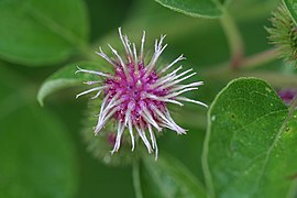 Arctium minus (Hill) Bernhardi — Common burdock
 -
 Viola L. — Violet
 -
 Heracleum maximum Bart. — Cow parsnip


Batiscan River[edit]
Upstream to downstream
- Forest sectors
- Notre-Dame-de-Montauban - Sainte-Geneviève-de-Batiscan
-
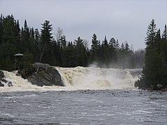 Chutes-de-Montauban Parc
 -
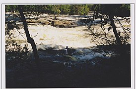
 Spring flood
 -
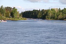
 Batiscan River Park, West Bank Trail
 -
 Kayaker, Batiscan River Park, West Bank Trail
 -
 Batiscan River Park, Grand-Basin sector
 -
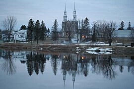
 Sainte-Geneviève-de-Batiscan
 -
 Sainte-Geneviève-de-Batiscan, winter open water net
 -
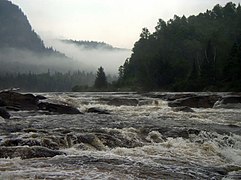 River rapids


- Rural & agricultural zones
- Saint-Stanislas - Sainte-Genevieve-de-Batiscan
-
 Saintt-Stanislas, rang de la Rivière Batiscan NE
 -
 Saint-Stanislas, rang de la Rivière Batiscan NE
 -
 St-Stanislas, rang de la Rivière Batiscan NE
 -
 Saint-Stanislas, la rivière, du rang de la Rivière-Batiscan NE
 -
 Saint-Stanislas, rang de la Rivière Batiscan NE
 -
 Saint-Stanislas, rang de la Rivière Batiscan NE,
 -
 Saint-Stanislas, rang de la Rivière Batiscan NE
 -
 Ste-Geneviève-de-Batiscan, rang Sud
 -
 Sainte-Geneviève-de-Batiscan, rang Sud (route 361)
 -
 Sainte-Geneviève-de-Batiscan, rang Nord


- Mouth, in Batiscan
-
 Old iron bridge, Chemin du Roy (Route 138)
 -
 Ice fishing huts
 -
 Sign on the river ice path, access from the Marina
 -
 Fishermen, brimbals, on the river ice
 -
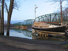
 Boats at the docks of the marina, from the bridge on the Chemin du Roy
 -
 Fishermen offshore, on the ice of the estuarian section of the St. Lawrence River and the mouth of the Batiscan River


- Structures
- Bridges, footbridge, built
-
 Batiscan, Chemin du Roy (Quebec Route 138)
 -
 Saint-Stanislas, bridge over the Batiscan River, (Quebec Route 159)
 -
 Batiscan River Park, footbridge, spring flow
 -
 Former annex of the Saint-Narcisse power plant


References[edit]
- ^ a b "Water Master Plan, Batiscan River" (PDF) (in French). December 2015. pp. 33 of 359. Retrieved 18 February 2024.
On the Batiscan River, log driving is said to have begun around 1852, when the first timber concessions in Batiscania were opened by William Price & Company
- ^ "Preservation of regionalisms". Commission de toponymie Quebec (in French). Government of Quebec. 2023-08-03. Retrieved 18 February 2024.
The creation of an authentic toponymy is based on the preservation and enhancement of the terms of the general language specific to Quebec French that are used in the composition of generics and specifics.
- ^ "La seigneurie de Batiscan à l'époque de la Nouvelle-France (1636-1760)". Université du Québec à Chicoutimi. January 2010. Retrieved 18 February 2024.
Located on the north shore of the St. Lawrence River, downstream from Trois-Rivières, this ecclesiastical seigneury of Batiscan was granted to the Jesuits by the Reverend Father de La Ferté, chaplain to the King and a member of the Compagnie des Cent-Associés.