Aura (Sinn)
| Aura (Sinn) | |
|---|---|
 The Aura near its junction with the Fellach | |
| Location | |
| Country | Germany |
| State | Bavaria |
| Physical characteristics | |
| Source | |
| • location | Forst Aura |
| Mouth | |
• location | Burgsinn |
• coordinates | 50°08′47″N 9°39′14″E / 50.1465°N 9.6538°E |
| Length | 13.3 kilometres (8.3 mi) [1] |
| Basin size | 59.2 square kilometres (22.9 sq mi) [1] |
| Basin features | |
| Progression | Sinn→ Franconian Saale→ Main→ Rhine→ North Sea |
| Tributaries | |
| • right | Fellach |
The Aura is a 13.3 kilometres (8.3 mi) tributary of the Sinn River in Bavaria, Germany.
Name[edit]
The name Aura originates from the Old High German Uraha. The word ur meant Aurochs, and the word aha meant stream,[2] meaning it was a river where Aurochs lived. The river gives the Gemeinde Aura im Sinngrund its name.
Course[edit]
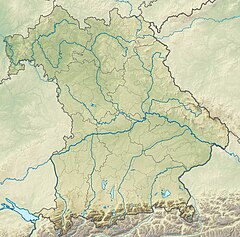
The river originates in the Forst Aura in a valley near Aura im Sinngrund and flows in a southerly direction. In Fellen, it meets its largest tributary, the Fellach. At its mouth, the Aura then turns to the east. The mouth of the river is in Burgsinn, where it flows into the Flutgraben, an anabranch of the Sinn
See also[edit]
References[edit]
- ^ a b Complete table of the Bavarian Waterbody Register by the Bavarian State Office for the Environment (xls, 10.3 MB)
- ^ Wolf-Armin Reitzenstein:Lexikon bayerischer Ortsnamen. Herkunft und Bedeutung.

