
Amiens station
Amiens | |
|---|---|
 | |
| General information | |
| Location | Amiens, Somme, Hauts-de-France |
| Coordinates | 49°53′26″N 2°18′30″E / 49.89056°N 2.30833°E |
| Line(s) | Longueau–Boulogne railway |
| Other information | |
| Station code | 87313874 |
| History | |
| Opened | 15 March 1847 |
Amiens station (locally known as: Gare du Nord) is the main railway station for the Northern French city of Amiens.
History[edit]
The station opened on 15 March 1847 when the line to Abbeville started passenger operations. It was razed by German shelling in World War I, rebuilt, then destroyed again by the Allied forces during World War II and replaced by the present structure built in 1955 by Auguste Perret. A tower called the Tour Perret was built at the same time close to the station. The station district's buildings were collectively registered as a historic monument in 2004.[1]
Amiens is both a terminus and a through station. A concourse was built over the six platforms to facilitate passenger movement. Although the station front was built between adjoining buildings, the hall is as big as its Parisian counterparts.
Services[edit]
The station is served by the local TER Normandie and TER Hauts-de-France services to destinations that include Rouen, Calais, Lille, Reims, Compiègne and Paris-Nord. The station is not served by the TGV (high-speed train), but there is currently a bus service between Amiens and the Haute-Picardie TGV station.[2]
| Preceding station | TER Hauts-de-France | Following station | ||
|---|---|---|---|---|
| Terminus | Krono+ GV K90+
|
Arras towards Dunkerque
| ||
| Krono+ GV K92+
|
Arras towards Calais-Fréthun
| |||
| Krono+ GV K94+
|
Arras towards Rang-du-Fliers
| |||
| Krono K10
|
Longueau towards Paris-Nord
| |||
| Longueau towards Paris-Nord
|
Krono K16
|
Abbeville towards Calais
| ||
| Terminus | Krono K20
|
Ham (Somme) towards Saint-Quentin
| ||
| Krono K21
|
Saint-Roch (Somme) towards Calais
| |||
| Corbie towards Lille-Flandres
|
Krono K45
|
Saint-Roch (Somme) towards Rouen-RD
| ||
| Terminus | Citi C10
|
Longueau towards Paris-Nord
| ||
| Proxi P10
|
Longueau towards Creil
| |||
| Proxi P20
|
Villers-Bretonneux towards Laon
| |||
| Saint-Roch (Somme) towards Abbeville
|
Proxi P21
|
Daours towards Albert
| ||
| Terminus | Proxi P22
|
Corbie towards Arras
| ||
| Proxi P23
|
Longueau towards Compiègne
| |||
| Proxi P24
|
Saint-Roch (Somme) towards Abancourt
| |||
| Proxi P45
|
Saint-Roch (Somme) towards Rouen-RD
| |||
Pictures[edit]
-
 Amiens station, at the beginning of the 20th century, and thus before its rebuilding by Auguste Perret.
 -
 New access to platforms 7,8,9,10,11 and 12.
 -
 Work in station.
 -
 General platform view (sideways).
 -
 The station seen over the canopies (marchionesses renovated).
 -
 At exit of station (on the left stabling sidings for rolling stock. In the centre lines towards Lille and Paris. On the right locomotive depot.)
 -
 The Platform 1 and 2 resurfaced.
 -
 Hoarding with SNCF commercial advertising on the square of the station during work reconstruction.
 -
 Main entrance of the station.
 -
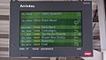 New system displaying train arrivals.
 -
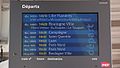 New system displaying train departures.
 -
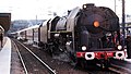 SNCF Class 141 R 180 passing through Amiens station.
 -
 Restoration of the station platforms.
 -
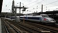 A very rare TGV in Amiens.
 -
 View of Platforms 1 2 3 and 4 of the station.
 -
 SNCF Class BB 67400 diesel locomotive being prepared for the Boulogne train.
.jpg)


See also[edit]
References[edit]
- ^ "La tour et l'ensemble Perret, Amiens". hauts-de-france.fr. Retrieved 6 February 2022.
- ^ Plan du réseau, TER Hauts-de-France, accessed 14 April 2022.
External links[edit]
- Amiens station at "Gares & Connexions", the official website of SNCF (in French)
| Authority control databases: Geographic |
|---|