
Portal:Myanmar
ကြိုဆိုပါတယ်။ / Welcome to the Myanmar Portal 

Myanmar, officially the Republic of the Union of Myanmar and also known as Burma (the official name until 1989), is a country in Southeast Asia. It is the largest country by area in Mainland Southeast Asia and has a population of about 55 million. It is bordered by Bangladesh and India to its northwest, China to its northeast, Laos and Thailand to its east and southeast, and the Andaman Sea and the Bay of Bengal to its south and southwest. The country's capital city is Naypyidaw, and its largest city is Yangon (formerly Rangoon).
Myanmar is a member of the East Asia Summit, Non-Aligned Movement, ASEAN, and BIMSTEC, but it is not a member of the Commonwealth of Nations despite once being part of the British Empire. Myanmar is a Dialogue Partner of the Shanghai Cooperation Organization. The country is very rich in natural resources, such as jade, gems, oil, natural gas, teak and other minerals, as well as also endowed with renewable energy, having the highest solar power potential compared to other countries of the Great Mekong Subregion. However, Myanmar has long suffered from instability, factional violence, corruption, poor infrastructure, as well as a long history of colonial exploitation with little regard to human development. In 2013, its GDP (nominal) stood at US$56.7 billion and its GDP (PPP) at US$221.5 billion. The income gap in Myanmar is among the widest in the world, as a large proportion of the economy is controlled by cronies of the military junta. Myanmar is one of the least developed countries; as of 2020, according to the Human Development Index, it ranks 147 out of 189 countries in terms of human development, the lowest in Southeast Asia. Since 2021, more than 600,000 people were displaced across Myanmar due to the surge in violence post-coup, with more than 3 million people in dire need of humanitarian assistance. (Full article...)
Selected articles -
-

The Burma Railway, also known as the Siam–Burma Railway, Thai–Burma Railway and similar names, or as the Death Railway, is a 415 km (258 mi) railway between Ban Pong, Thailand, and Thanbyuzayat, Burma (now called Myanmar). It was built from 1940 to 1943 by South East Asian civilians abducted and forced to work by the Japanese and a smaller group of captured Allied soldiers, to supply troops and weapons in the Burma campaign of World War II. It completed the rail link between Bangkok, Thailand, and Rangoon, Burma. The name used by the Japanese Government was Tai–Men Rensetsu Tetsudō (泰緬連接鉄道), which means Thailand-Burma-Link-Railway.
At least 250,000 Southeast Asian civilians were subjected to forced labour to ensure the construction of the Death Railway and more than 90,000 civilians died building it, as did around 12,000 Allied soldiers. The workers on the Thai side of the railway were Tamils, Malays, and fewer Chinese civilians from Malaya. Possibly over 345,000 died while working, with the death rate per month rivaling that of Auschwitz. (Full article...) -
The Burmese cat (Burmese: ဗမာကြောင်, Băma kyaung, Thai: ทองแดง or ศุภลักษณ์, RTGS: Thongdaeng or Supphalak, meaning copper colour) is a breed of domestic cat, originating in Burma, believed to have its roots near the Thai-Burma border and developed in the United States and Britain.
Most modern Burmese are descendants of one female cat called Wong Mau, which was brought from Burma to the United States in 1930 and bred with American Siamese. From there, American and British breeders developed distinctly different Burmese breed standards, which is unusual among pedigreed domestic cats. Most modern cat registries do not formally recognise the two as separate breeds, but those that do refer to the British type as the European Burmese. (Full article...) -
The Salween is a Southeast Asian river, about 3,289 kilometres (2,044 mi) long, flowing from the Tibetan Plateau south into the Andaman Sea. The Salween flows primarily within southwest China and eastern Myanmar (Burma), with a short section forming the border of Burma and Thailand. Throughout most of its course, it runs swiftly through rugged mountain canyons. Despite the river's great length, only the last 90 km (56 mi) are navigable, where it forms a modest estuary and delta at Mawlamyine. The river is known by various names along its course, including the Thanlwin (named after Elaeocarpus sp., an olive-like plant that grows on its banks) in Burma and the Nu Jiang (or Nu River, named after Nu people) in China. The commonly used spelling "Salween" is an anglicisation of the Burmese name dating from 19th-century British maps.
Due to its great range of elevation and latitude coupled with geographic isolation, the Salween basin is considered one of the most ecologically diverse regions in the world, containing an estimated 25 percent of the world's terrestrial animal species and thousands of plant species. Along its course the Salween provides water for agriculture and supports abundant fisheries, especially in the delta region. The Salween basin is home to numerous ethnic minority groups, whose ancestors largely originated in the Tibetan Plateau and northwest China. Starting about 5,000 years ago, people began migrating south along the river, establishing small kingdoms and city-states. (Full article...) -
The 1968 Burma cyclone was regarded as the worst to strike the country during the 20th century before it was surpassed by another unnamed cyclone in 2004 and further, Cyclone Nargis in 2008, respectively. The first tropical cyclone of the 1968 North Indian Ocean cyclone season, it started as a depression on May 7 on the northern Andaman Sea. With low wind shear and warm sea surface temperatures, the storm intensified in the waters near Burma before heading northwestwards. It then started to rapidly intensify, with an eye becoming apparent on satellite imagery on May 9. Also that day, it reached its peak intensity, with 3-minute maximum sustained winds of 220 km/h (140 mph) by the Indian Meteorological Department, which is equivalent to a super cyclonic storm; however, the agency treated the system as a severe cyclonic storm. Little to no changes happened on the cyclone as it turned northeastwards, making landfall near Akyab (now Sittwe) between 18:00 and 21:00 UTC on that day. Land interaction rapidly weakened the storm, dissipating on May 10 as an area of low-pressure in south Chin State.
The predecessor to the cyclone caused light to moderate downpour to the Andaman Islands; however, no deaths were reported. Winds reported from the cyclone inland Burma reached an estimate of 60–100 mph, altogether with heavy rainfall and large storm surges. The former flooded the crops, submerging them in floodwaters in the process while the latter washed out villages near the path of the storm. Schools and hospitals throughout Akyab were destroyed by high winds and large waves, while the port suffered major damages. The town was almost destroyed due to the storm. In addition, some ships in the said harbor, including the Greek freighter Geros Michalos were reportedly sunk in the Bay of Bengal. Houses were destroyed during the storm and many livestock died, mainly due to drowning. The death toll from the cyclone was finalized in May 1968 at 1,037 individuals, while 2,000 more were reportedly missing. The property damages were estimated at Ks.15 million ($3.248 million USD). (Full article...) -
The Tatmadaw (Burmese: တပ်မတော်; MLCTS: tatma.taw, IPA: [taʔmədɔ̀], lit. 'Grand Armed Forces') or Sit-Tat (Burmese: စစ်တပ်) is the military of Myanmar (formerly Burma). It is administered by the Ministry of Defence and composed of the Myanmar Army, the Myanmar Navy and the Myanmar Air Force. Auxiliary services include the Myanmar Police Force, the Border Guard Forces, the Myanmar Coast Guard, and the People's Militia Units. Since independence in 1948, the Tatmadaw has faced significant ethnic insurgencies, especially in Chin, Kachin, Kayin, Kayah, and Shan states. General Ne Win took control of the country in a 1962 coup d'état, attempting to build an autarkic society called the Burmese Way to Socialism. Following the violent repression of nationwide protests in 1988, the military agreed to free elections in 1990, but ignored the resulting victory of the National League for Democracy and imprisoned its leader Aung San Suu Kyi. The 1990s also saw the escalation of the conflict involving Buddhists and Rohingya Muslims in Rakhine State due to RSO attacks on the Tatmadaw forces, which saw the Rohingya minority facing oppression and, starting in 2017, genocide.
In 2008, the Tatmadaw again rewrote Myanmar's constitution, installing the pro-junta Union Solidarity and Development Party (USDP) in the 2010 elections, which were boycotted by most opposition groups. Political reforms over the next half-decade culminated in a sweeping NLD victory in the 2015 election; after the USDP lost another election in 2020, the Tatmadaw annulled the election and deposed the civilian government. The Tatmadaw has been widely accused by international organizations of human rights violation and crimes against humanity; including ethnic cleansing, political repression, torture, sexual assault, war crimes, extrajudicial punishments (including summary executions) and massacre of civilians involved in peaceful political demonstrations. The Tatmadaw has long operated as a state within a state. (Full article...) -
The Kingdom of Ava (Burmese: အင်းဝခေတ်, pronounced [ʔɪ́ɰ̃wa̰ kʰɪʔ]) was the dominant kingdom that ruled upper Burma (Myanmar) from 1365 to 1555. Founded in 1365, the kingdom was the successor state to the petty kingdoms of Myinsaing, Pinya and Sagaing that had ruled central Burma since the collapse of the Pagan Empire in the late 13th century.
Like the small kingdoms that preceded it, Ava may have been led by Bamarised Shan kings who claimed descent from the kings of Pagan. Scholars debate that the Shan ethnicity of Avan kings comes from mistranslation, particularly from a record of the Avan kings' ancestors ruling a Shan village in central Burma prior to their rise or prominence. (Full article...) -
Hkakaborazi National Park is a national park in northern Myanmar with an area of 1,472 sq mi (3,810 km2). It was established in 1998.
It surrounds Hkakabo Razi, the highest mountain in the country.
It ranges in elevation from 2,950 to 18,730 ft (900 to 5,710 m) comprising evergreen forest and mixed deciduous forests in Nogmung Township, Kachin State. It is managed by the Nature and Wildlife Conservation Division.
It is contiguous with Bumhpa Bum Wildlife Sanctuary and Hukaung Valley Wildlife Sanctuary. These protected areas together with Hponkanrazi Wildlife Sanctuary comprise the largest continuous expanse of natural forest called the Northern Forest Complex stretching over an area of 11,624 sq mi (30,110 km2). Its objective is to conserve the biodiversity of the Ayeyarwady and Chindwin river basins. (Full article...) -
The history of Myanmar (also known as Burma; Burmese: မြန်မာ့သမိုင်း) covers the period from the time of first-known human settlements 13,000 years ago to the present day. The earliest inhabitants of recorded history were a Tibeto-Burman-speaking people who established the Pyu city-states ranged as far south as Pyay and adopted Theravada Buddhism.
Another group, the Bamar people, entered the upper Irrawaddy valley in the early 9th century. They went on to establish the Pagan Kingdom (1044–1297), the first-ever unification of the Irrawaddy valley and its periphery. The Burmese language and culture slowly came to replace Pyu norms during this period. After the First Mongol invasion of Burma in 1287, several small kingdoms, of which the Kingdom of Ava, the Hanthawaddy Kingdom, the Kingdom of Mrauk U and the Shan States were principal powers, came to dominate the landscape, replete with ever-shifting alliances and constant wars. (Full article...) -
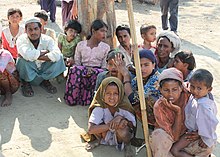
The Rohingya people (/roʊˈhɪndʒə, -ɪŋjə/; Rohingya: 𐴌𐴗𐴥𐴝𐴙𐴚𐴒𐴙𐴝, IPA: [rʊˈɜi̯ɲ.ɟə]) are a stateless Indo-Aryan ethnic group who predominantly follow Islam and reside in Rakhine State, Myanmar. Before the Rohingya genocide in 2017, when over 740,000 fled to Bangladesh, an estimated 1.4 million Rohingya lived in Myanmar. Described by journalists and news outlets as one of the most persecuted minorities in the world, the Rohingya are denied citizenship under the 1982 Myanmar nationality law. There are also restrictions on their freedom of movement, access to state education and civil service jobs. The legal conditions faced by the Rohingya in Myanmar have been compared to apartheid by some academics, analysts and political figures, including Nobel laureate Bishop Desmond Tutu, a South African anti-apartheid activist. The most recent mass displacement of Rohingya in 2017 led the International Criminal Court to investigate crimes against humanity, and the International Court of Justice to investigate genocide.
The Rohingya maintain they are indigenous to western Myanmar with a heritage of over a millennium and influence from the Arabs, Mughals, and Portuguese. The community claims it is descended from people in precolonial Arakan and colonial Arakan; historically, the region was an independent kingdom between Southeast Asia and the Indian subcontinent. The Myanmar government considers the Rohingya as British colonial and postcolonial migrants from Chittagong in Bangladesh. It argues that a distinct precolonial Muslim population is recognized as Kaman, and that the Rohingya conflate their history with the history of Arakan Muslims in general to advance a separatist agenda. In addition, Myanmar's government does not recognise the term "Rohingya" and prefers to refer to the community as "Bengali". Rohingya campaign groups and human rights organizations demand the right to "self-determination within Myanmar". (Full article...) -
The 969 Movement (Burmese: ၉၆၉ လှုပ်ရှားမှု) is a Buddhist nationalist movement opposed to what they see as Islam's expansion in predominantly Buddhist Myanmar (Burma). The three digits of 969 "symbolize the virtues of the Buddha, Buddhist practices and the Buddhist community". The first 9 stands for the nine special attributes of the Buddha and the 6 for the six special attributes of his Dharma, or Buddhist Teachings, and the last 9 represents the nine special attributes of Buddhist Sangha (monastic community). Those special attributes are the Three Jewels of the Buddha. In the past, the Buddha, Sangha, Dhamma, the wheel of Dhamma, and "969" were Buddhist signs.
The movement has had strong reactions within and beyond Myanmar. In the international media it has received criticism. The Straits Times reported that Ashin Wirathu, the movement's leader, responded to recent anti-Muslim violence with pledges to work for peace, but critics remain sceptical. (Full article...)


_(cropped).jpg)
Did you know (auto-generated) -

- ... that former Burmese actress Honey Nway Oo turned rebel and took up arms against the military junta following the 2021 Myanmar coup d'état?
- ... that Aung Myo Min, Union Minister of Human Rights for the National Unity Government of Myanmar, is the country's first openly LGBT minister?
- ... that Molly Burman resumed releasing music three years later after finding that "Happy Things" had accrued a million streams on Spotify?
- ... that as part of the coronation of Mindon Min, the square yuzana around the capital was designated a sanctuary?
- ... that clashes between the Myanmar military and local armed groups broke out in Lay Kay Kaw six years after it was established as a "town of peace" between the parties?
- ... that the Myanmar Photo Archive (example photograph shown) revealed "a side of modern Myanmar that, until very recently, remained hidden in dusty attics"?
- ... that the Burmese and South Korean first ladies held their first informal conversation 44 years after the establishment of bilateral relations between the two countries?
- ... that the Myanmar Coast Guard was initially proposed as a civilian law enforcement agency before being established as a branch of the military three years later?
Related portals and projects
General images -
-

-
 The shores of Irrawaddy River at Nyaung-U, Bagan (from Geography of Myanmar)
 -
 19th-century funeral cart and spire, which would form part of the procession from the home to the place of cremation (from Culture of Myanmar)
 -
 Myanmar (Burma) map of Köppen climate classification (from Geography of Myanmar)
 -
 Vegetable stall on the roadside at the Madras Lancer Lines, Mandalay, January 1886. Photographer: Hooper, Willoughby Wallace (1837–1912). (from History of Myanmar)
 -
 Recorder's Court on Sule Pagoda Road, with the Sule Pagoda at the far end, Rangoon, 1868. Photographer: J. Jackson. (from History of Myanmar)
 -
 A group of Buddhist worshipers at Shwedagon Pagoda, an important religious site for Burmese Buddhists (from Culture of Myanmar)
 -
 Sculpture of Myanmar mythical lion (from Culture of Myanmar)
 -
 Mountains near Pindaya on the Shan Plateau (from Geography of Myanmar)
 -
 Former US President Barack Obama poses barefoot on the grounds of Shwedagon Pagoda, one of Myanmar's major Buddhist pilgrimage sites. (from Culture of Myanmar)
 -
 Pagan Kingdom during Narapatisithu's reign. Burmese chronicles also claim Kengtung and Chiang Mai. Core areas shown in darker yellow. Peripheral areas in light yellow. Pagan incorporated key ports of Lower Burma into its core administration by the 13th century. (from History of Myanmar)
 -
 Hlei pyaingbwè - a Burmese regatta (from Culture of Myanmar)
 -
 A wide range of Burmese lacquerware from Bagan (from Culture of Myanmar)
 -
 Myinhkin thabin - equestrian sport (from Culture of Myanmar)
 -
 The restored Taungoo or Nyaungyan dynasty c. 1650 CE. (from History of Myanmar)
 -
 Temples at Mrauk U, was the capital of the Mrauk U Kingdom, which ruled over what is now Rakhine State. (from History of Myanmar)
 -
 Two female musicians play the saung at a performance in Mandalay. (from Culture of Myanmar)
 -
 Aung San Suu Kyi addresses crowds at the NLD headquarters shortly after her release. (from History of Myanmar)
 -
 Protesters in Yangon with a banner that reads non-violence: national movement in Burmese, in the background is Shwedagon Pagoda. (from History of Myanmar)
 -
 Protesters in Yangon carrying signs reading "Free Daw Aung San Suu Kyi" on 8 February 2021. (from History of Myanmar)
 -
 British soldiers dismantling cannons belonging to King Thibaw's forces, Third Anglo-Burmese War, Ava, 27 November 1885. Photographer: Hooper, Willoughby Wallace (1837–1912). (from History of Myanmar)
 -
 Jade Mine in Hpakant (from Geography of Myanmar)
 -
 Salween river at Mae Sam Laep on the Thai-Myanmar border (from Geography of Myanmar)
 -
 A theatrical performance of the Mon dance (from Culture of Myanmar)
 -

-
 A wedding procession, with the groom and bride dressed in traditional Burmese wedding clothes, reminiscent of royal attire (from Culture of Myanmar)
 -
 Mount Popa, a dormant volcano in the Central Lowlands (from Geography of Myanmar)
 -
 Aerial view of a burned Rohingya village in Rakhine state, Myanmar, September 2017 (from History of Myanmar)
 -
 British soldiers on patrol in the ruins of the Burmese town of Bahe during the advance on Mandalay, January 1945. (from History of Myanmar)
 -
 British soldiers remove their shoes at the entrance of Shwedagon Pagoda. To the left, a sign reads "Foot wearing is strictly prohibited" in Burmese, English, Tamil, and Urdu. (from Culture of Myanmar)
 -
 Grandfather Island, Dawei (from Geography of Myanmar)
 -
 Saint Mary's Cathedral in Downtown Yangon is the largest Roman Catholic cathedral in Burma. (from Culture of Myanmar)
 -
 A large fracture on the Mingun Pahtodawgyi caused by the 1839 Ava earthquake. (from Geography of Myanmar)
 -

-
 Boxing match, 19th-century watercolour (from Culture of Myanmar)
 -
 A bull fight, 19th-century watercolour (from Culture of Myanmar)
 -

-
 The paddle steamer Ramapoora (right) of the British India Steam Navigation Company on the Rangoon river having just arrived from Moulmein. 1895. Photographers: Watts and Skeen (from History of Myanmar)
 -
 Political Map of Burma (Myanmar) c. 1450 CE. (from History of Myanmar)
 -
 Portuguese ruler and soldiers mounting an Elephant. Philips, Jan Caspar (draughtsman and engraver) (from History of Myanmar)


_headquarter.jpg)


Major topics
Categories

More topics

Associated Wikimedia
The following Wikimedia Foundation sister projects provide more on this subject:
-
 Commons
Free media repository -
 Wikibooks
Free textbooks and manuals -
 Wikidata
Free knowledge base -
 Wikinews
Free-content news -
 Wikiquote
Collection of quotations -
 Wikisource
Free-content library -
 Wikiversity
Free learning tools -
 Wikivoyage
Free travel guide -
 Wiktionary
Dictionary and thesaurus


