
La Jolla Shores

La Jolla Shores, with its northern part Scripps Beach, is a beach and vacation/residential community of the same name in the community of La Jolla in San Diego, California. The La Jolla Shores business district is a mixed-use village encircling Laureate Park on Avenida de la Playa in the village of La Jolla Shores.
The beach is approximately one mile (1.6 km) long and stretches from the sea cliffs just north of La Jolla Cove to Black's Beach south of Torrey Pines State Park. La Jolla Shores meets the Scripps Institution of Oceanography campus and Kellogg Park and encompasses the Scripps Pier. It borders the San Diego-Scripps Coastal Marine Conservation Area and the Matlahuayl State Marine Reserve (SMR), formerly known as the San Diego-La Jolla Underwater Park.
The beach is a popular launch point for kayakers as it is the only beach boat launch in the San Diego city limits.[1] The beach is also popular among stand up paddlers, swimmers, and snorkelers.
The southern end of the beach is especially rich with wildlife. During certain times of year, leopard sharks, diamond stingrays, round stingrays, and species of guitarfish are common. Green sea turtles and broadnose sevengill sharks are elusive but can be found farther offshore.
Described by the Orange County Register as "the best beach in the area",[2] La Jolla Shores regularly features in the TruTV show, Beach Patrol: San Diego and Lifeguard on The Weather Channel.[3]
Public Art[edit]
A Map of the Grand Canyons of La Jolla,[1] located at Kellogg Park, was opened to the public in October 2020. The 2,200-square-foot mosaic map, embedded in the ground, shows more than 100 life-size images of creatures found just offshore. Significant underwater canyons are indicated by varying shades of blue to mark ocean depths. The mosaic, made using a process called LithoMosaic, was sponsored by the Walter Munk Foundation for the Oceans, among other community groups.[4]
In 2023, a 4-000 lb. bronze topographic map of the La Jolla Canyon was installed at Kellogg Park in La Jolla, titled “From the Heights of Mount Soledad to the Depths of the Grand Canyons of La Jolla.”[5]
Gallery[edit]
-
 Crowded La Jolla Shores beach in July, 1978
 -
 View of La Jolla Shores from the Pacific Ocean
 -
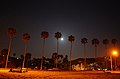 Palm trees along La Jolla Shores boardwalk
 -
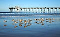 Birds in front of Scripps Pier
 -
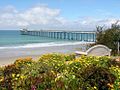 Scripps pier on La Jolla Shores
 -
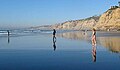
 La Jolla Shores
 -
 Sunset, La Jolla Shores
 -
 Scripps Beach
 -
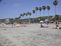
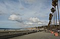
 La Jolla Shores Beach
 -
 Scripps Pier, La Jolla, at sunset
 -


.jpg)

See also[edit]
References[edit]
- ^ "Beach Amenities and Regulations | Lifeguard Services | City of San Diego Official Website".
- ^ Warner, GA, Stylish playground, Orange County Register, January 12, 2007. Retrieved April 6, 2007.
- ^ Garrick, David (2020-07-19). "San Diego beach areas use secret weapon to limit parking: illegally painted red curbs". Los Angeles Times. Retrieved 2020-07-21.
- ^ Mackin-Solomon, Ashley (October 19, 2020). "Map of the Grand Canyons of La Jolla's marine mosaic opens to the public". La Jolla Light. Retrieved 22 May 2024.
- ^ Elling, Regina (February 8, 2023). "Sculptor Dives into the Deep End for Bronze Map of La Jolla Canyons". La Jolla Light. Retrieved 23 May 2024.
External links[edit]
| To the North: Black's Beach |
California beaches | To the South La Jolla Cove |
| International | |
|---|---|
| National | |