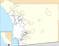
Via de la Valle, San Diego
This article needs additional citations for verification. (May 2021) |
Via de la Valle, San Diego | |
|---|---|
| Via de la Valle | |
| Coordinates: 32°58′52.2″N 117°14′41.3″W / 32.981167°N 117.244806°W | |
| Country | |
| State | |
| County | |
| City | |
Via de la Valle is a small residential neighborhood in northern San Diego, California. The neighborhood is bordered by the City of Solana Beach to the north and west, the unincorporated San Diego County community of Rancho Santa Fe to the east, and undeveloped natural areas of North City, San Diego to the south.[1] Due to its zip code, properties in the neighborhood typically use a Del Mar, California address despite being within San Diego city limits. Approximately 125 acres (51 ha) in size, Via de la Valle is the smallest community planning area in the City of San Diego.
See also[edit]
References[edit]
- ^ "Community Profiles: Via de la Valle | Planning Department | City of San Diego Official Website". www.sandiego.gov. Retrieved 2021-05-10.

