
User:Necrothesp/Resources/1500s Resources
< User:Necrothesp | Resources
International[edit]
- Maps
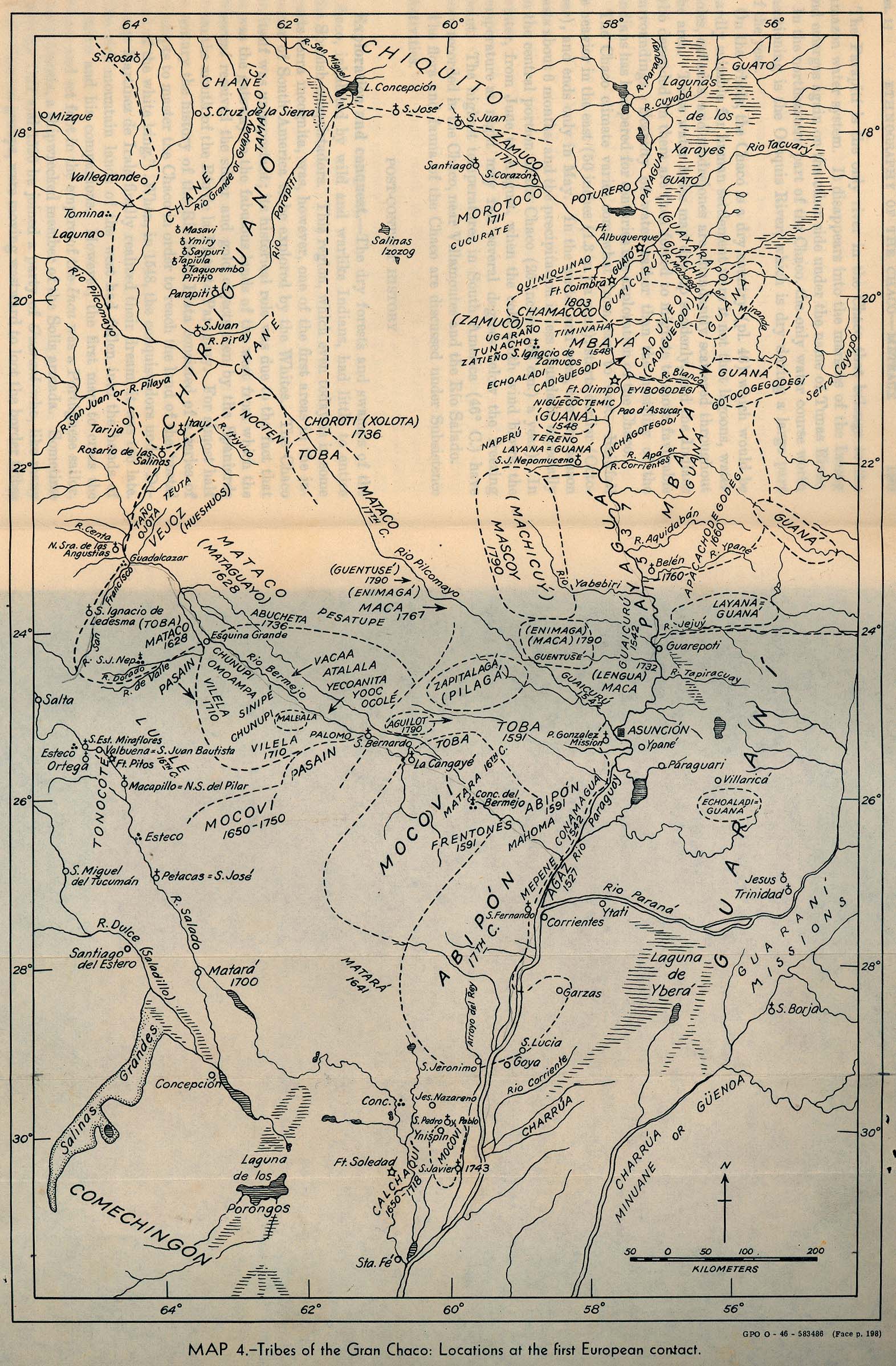
- Map of locations of the Gran Chaco tribes, South America, at first European contact
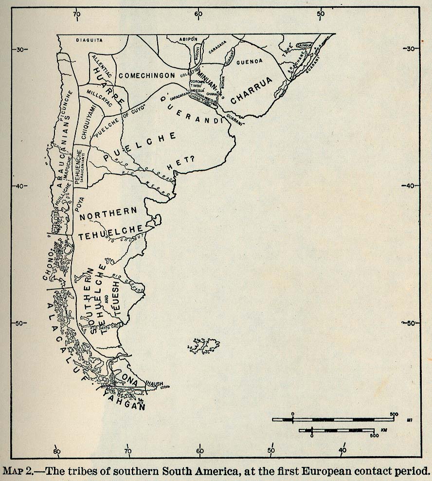
- Map of tribes of Southern South America at first European contact
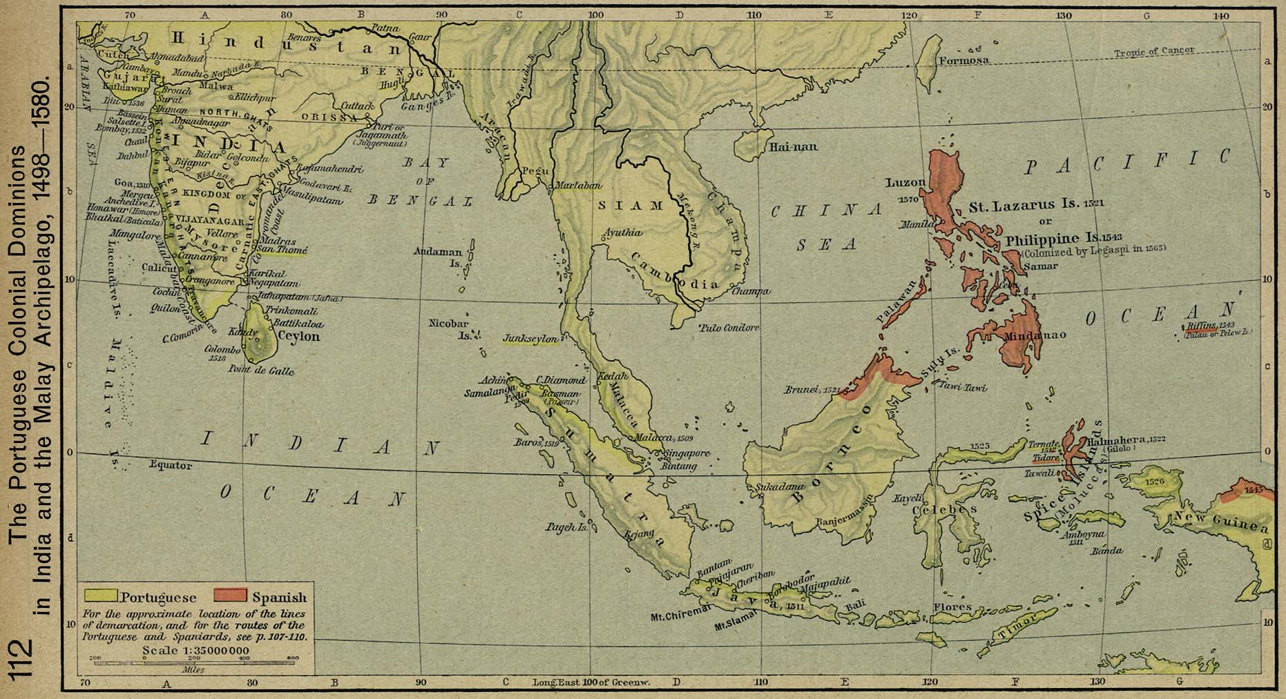
- Map of Portuguese and Spanish dominions in South-East Asia, 1498–1580
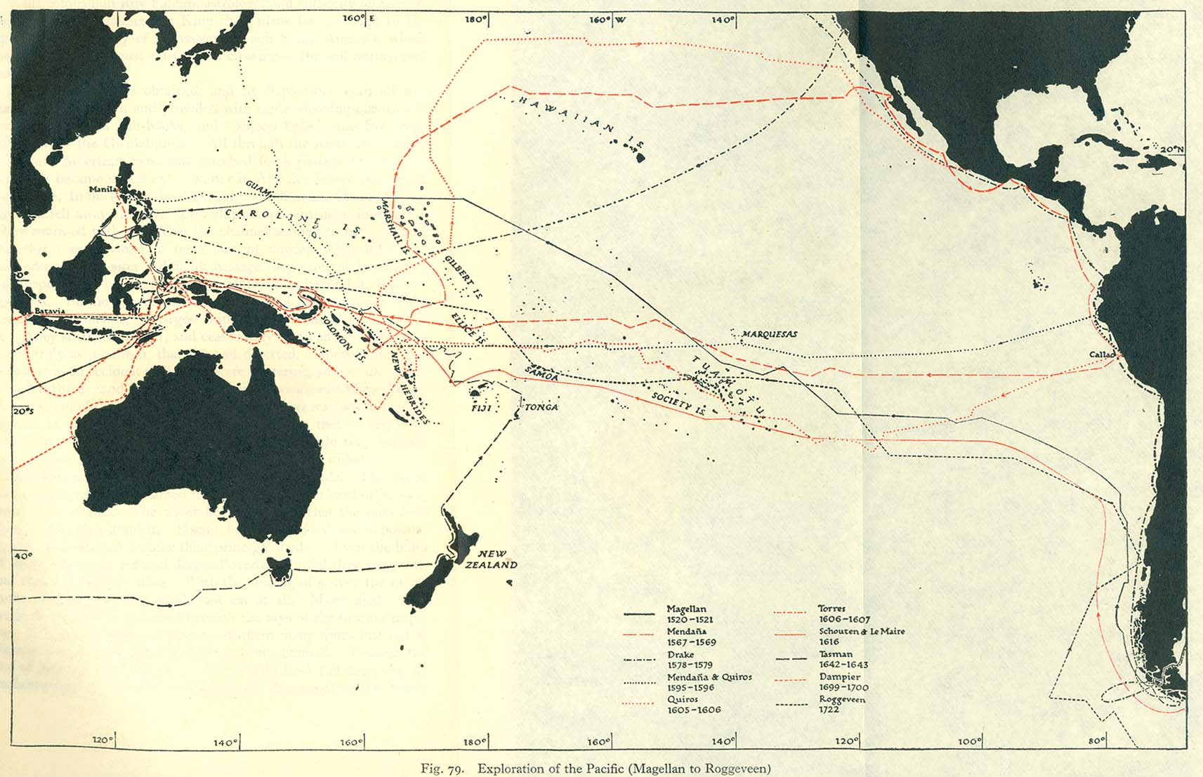
- Map of explorations of the Pacific, 1520–1722
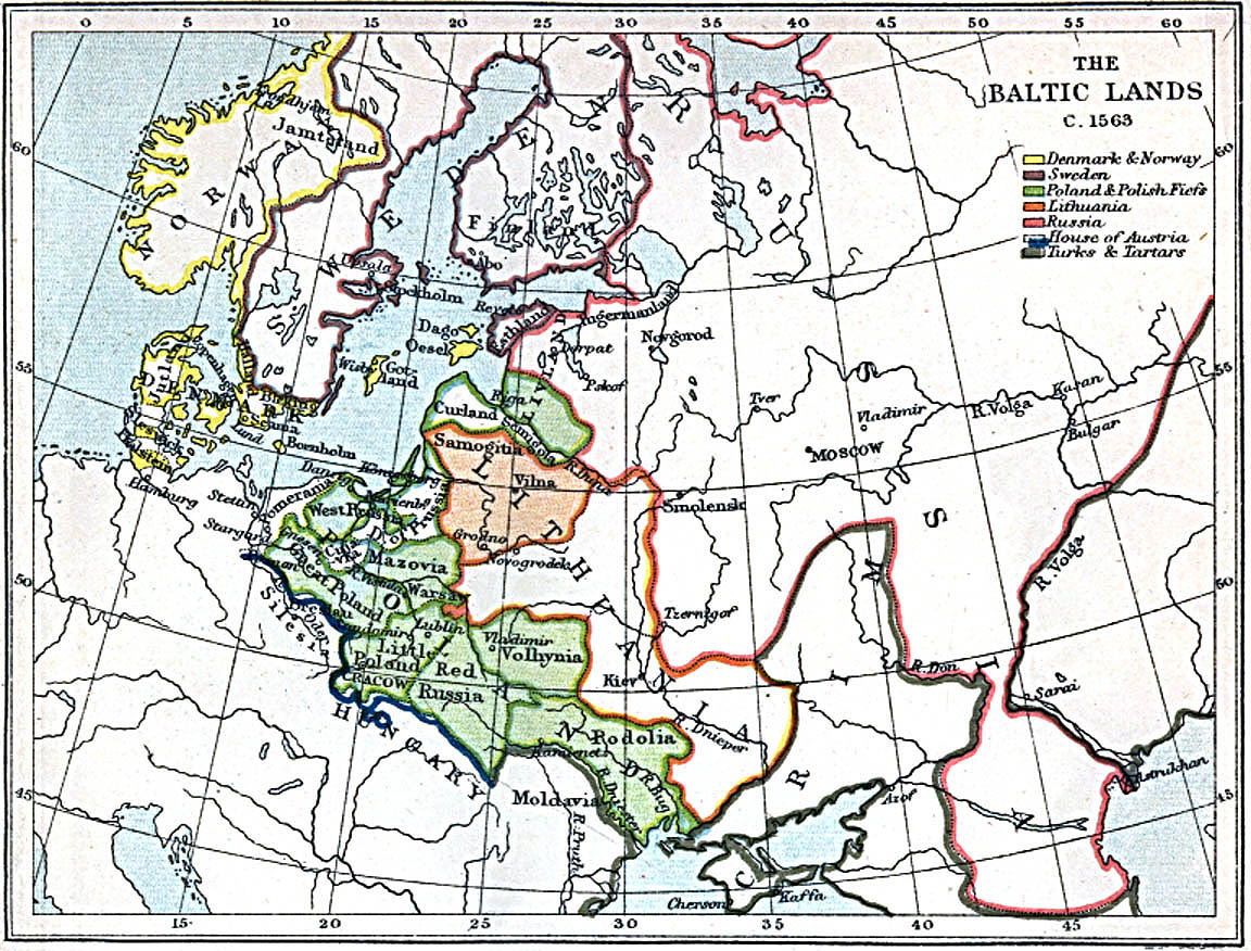
- Map of the lands surrounding the Baltic, 1563
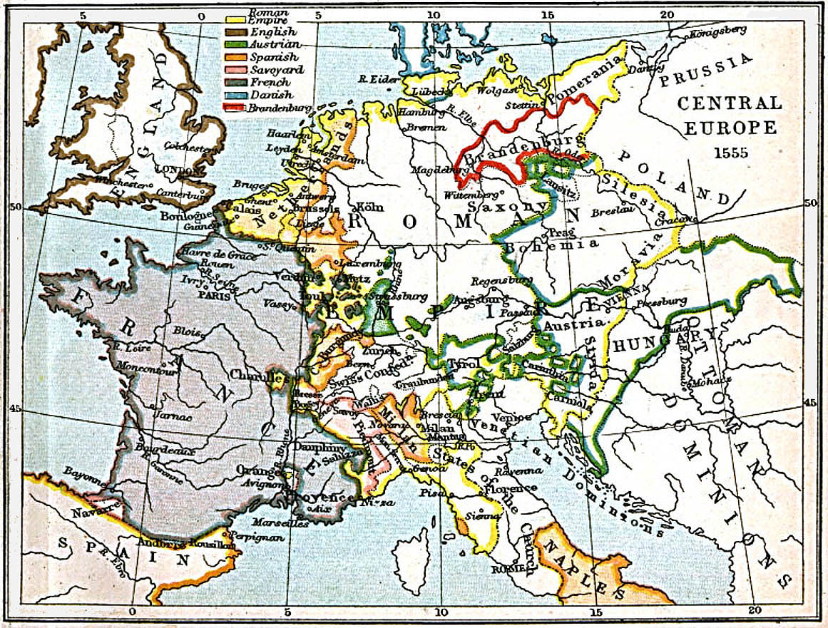
- Map of Central Europe, 1547
- Map of Central Europe, 1555
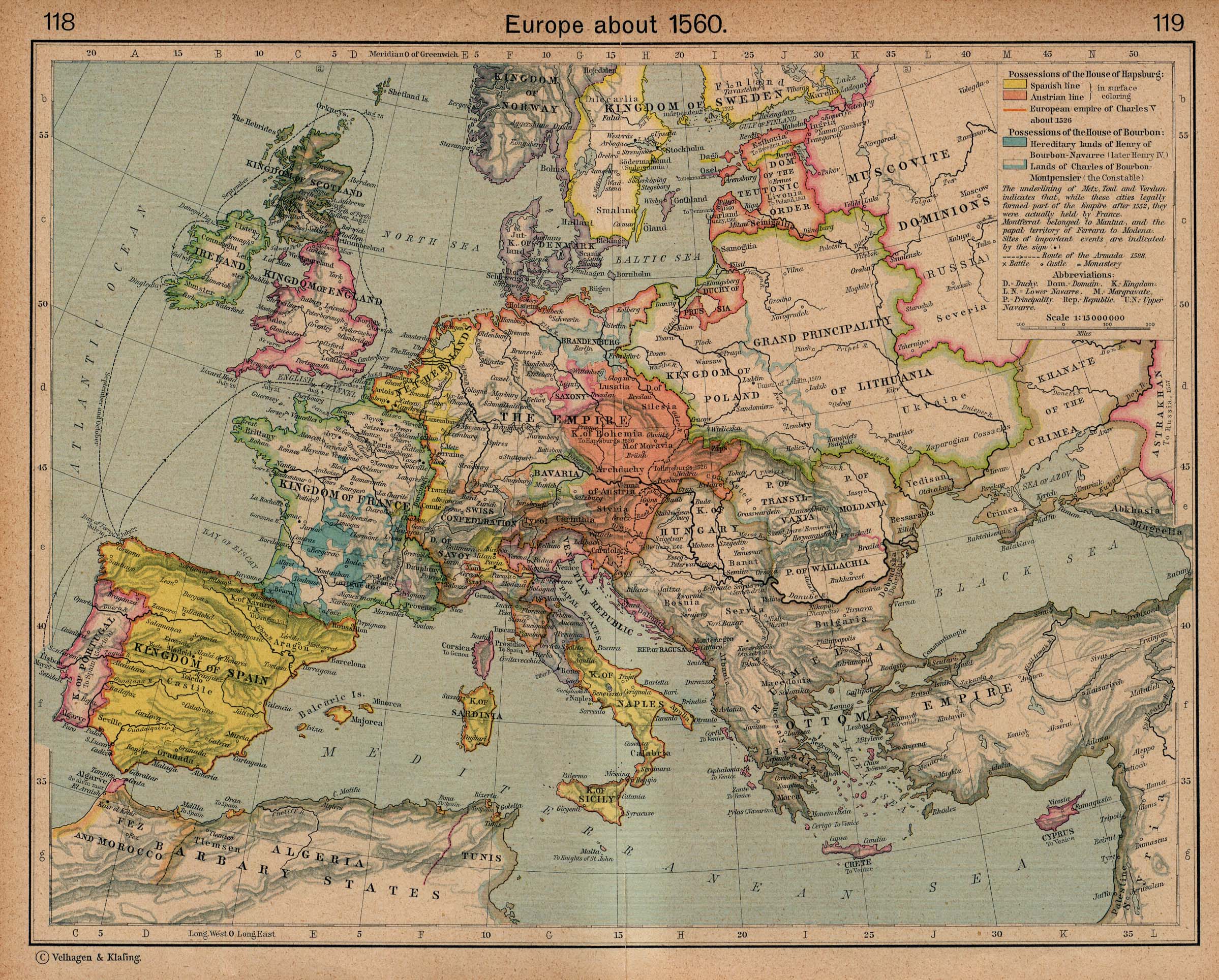
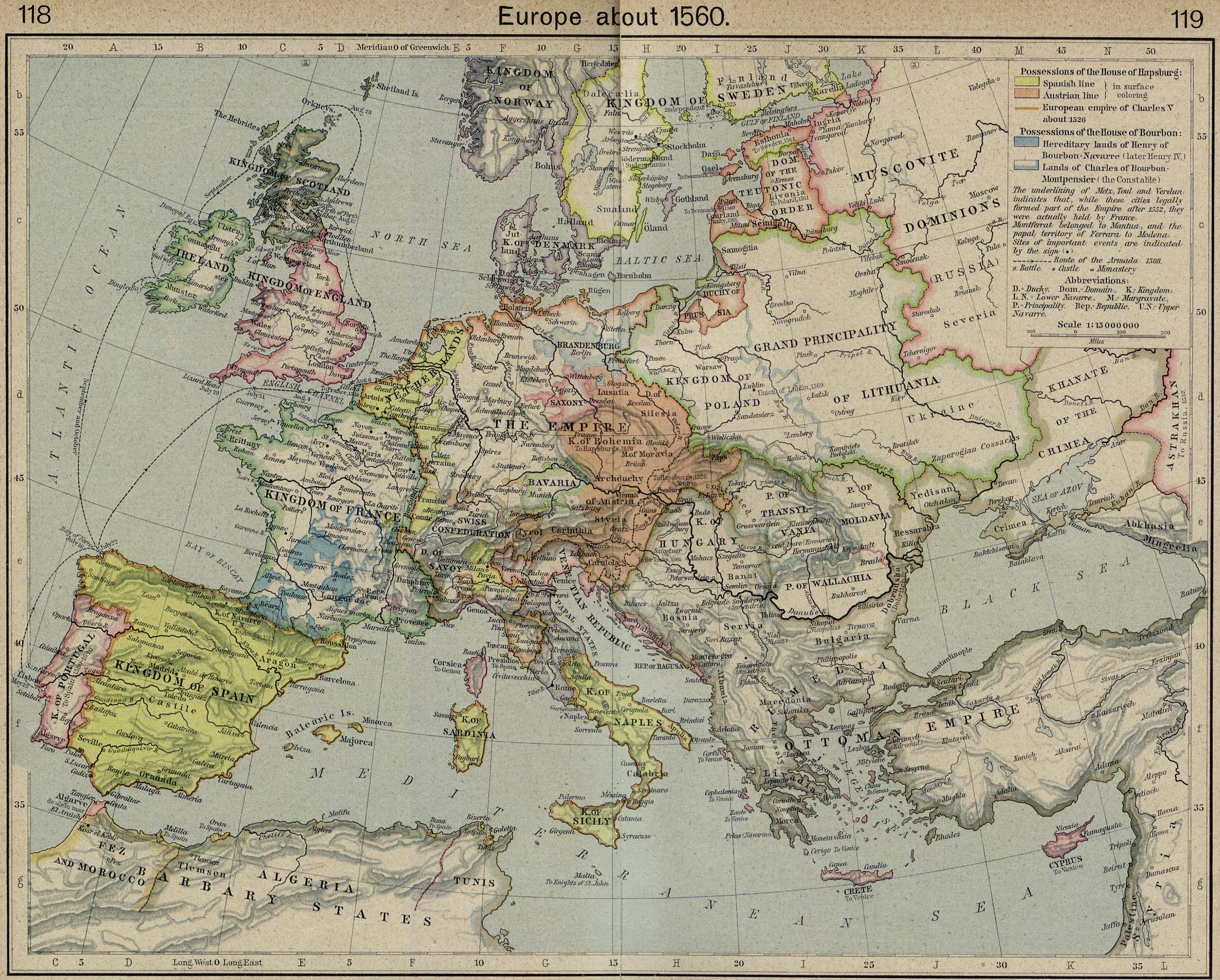
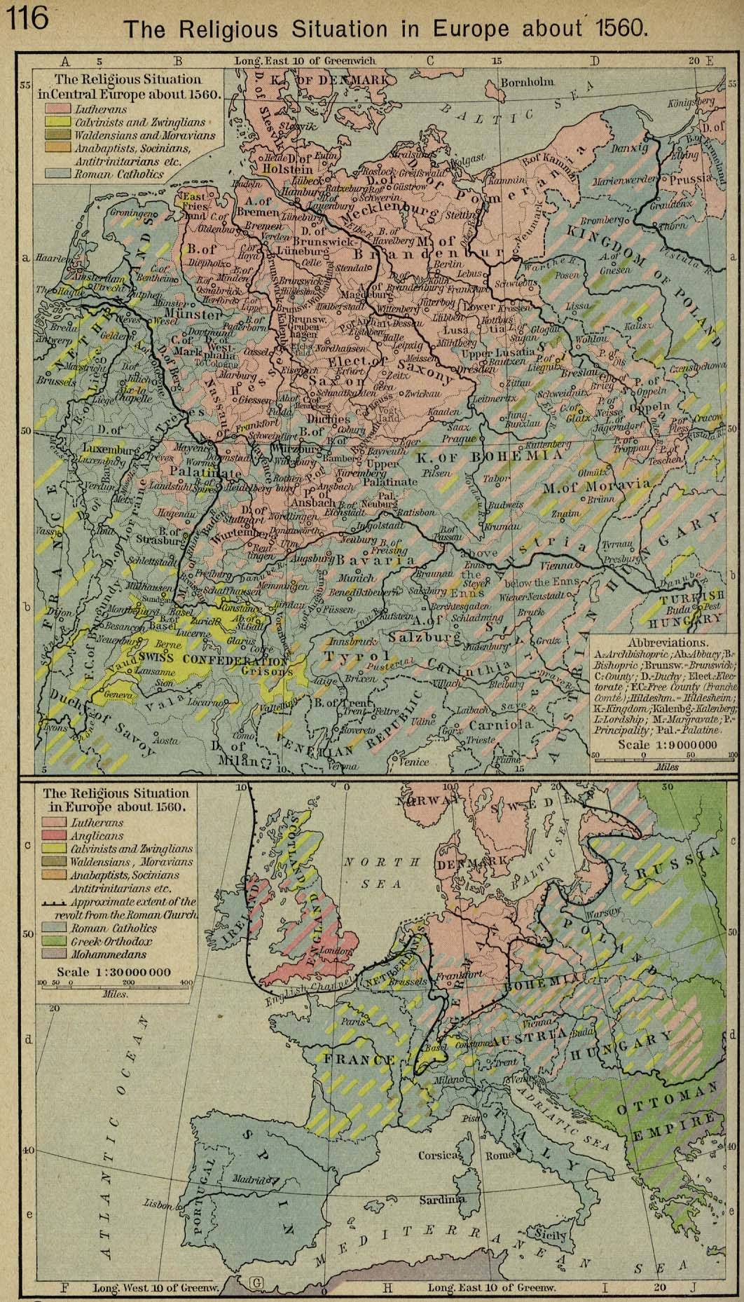
- Map of Europe, c.1560, and another version
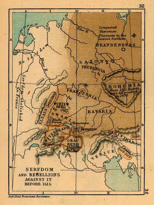
- Map of revolts against serfdom in Europe, 1325–1515
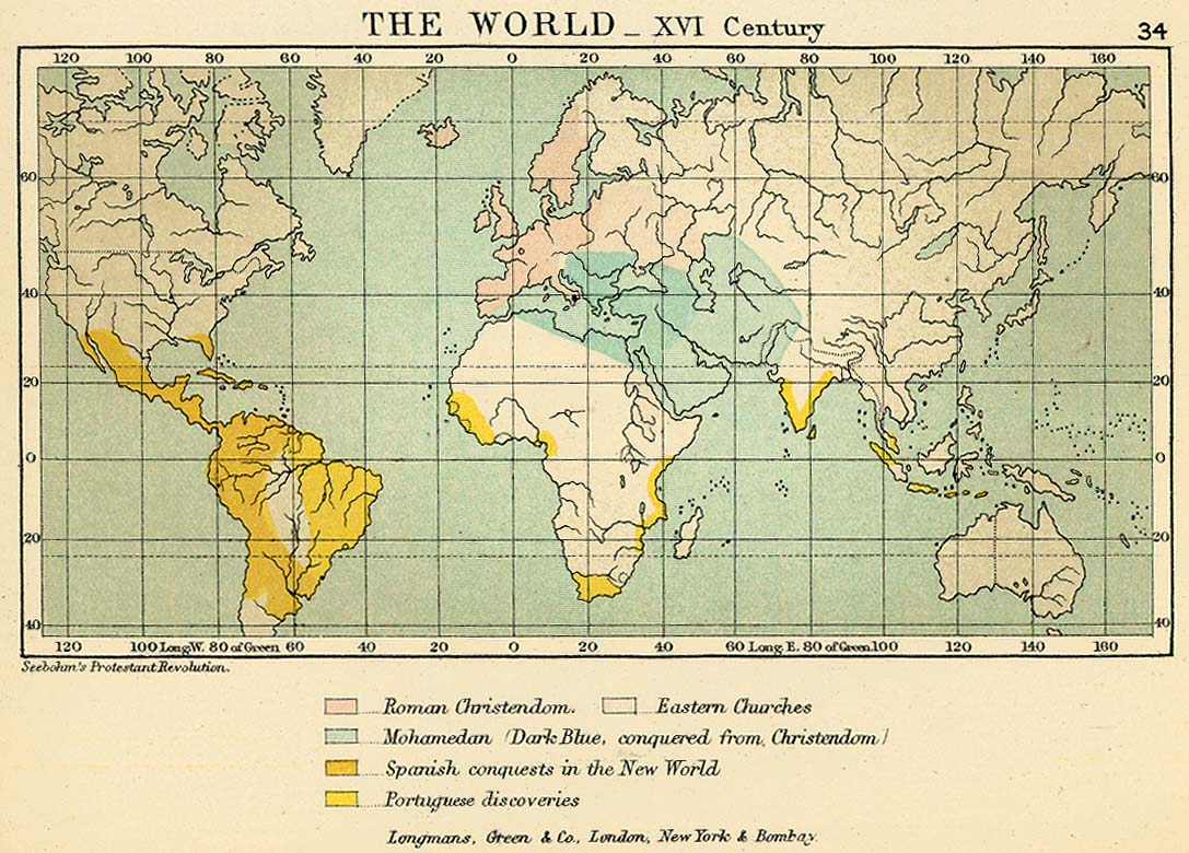
- Map of the world in the 16th century
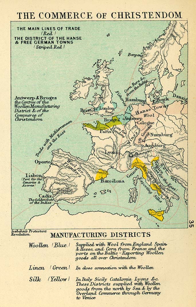
- Map of European commerce in the 16th century
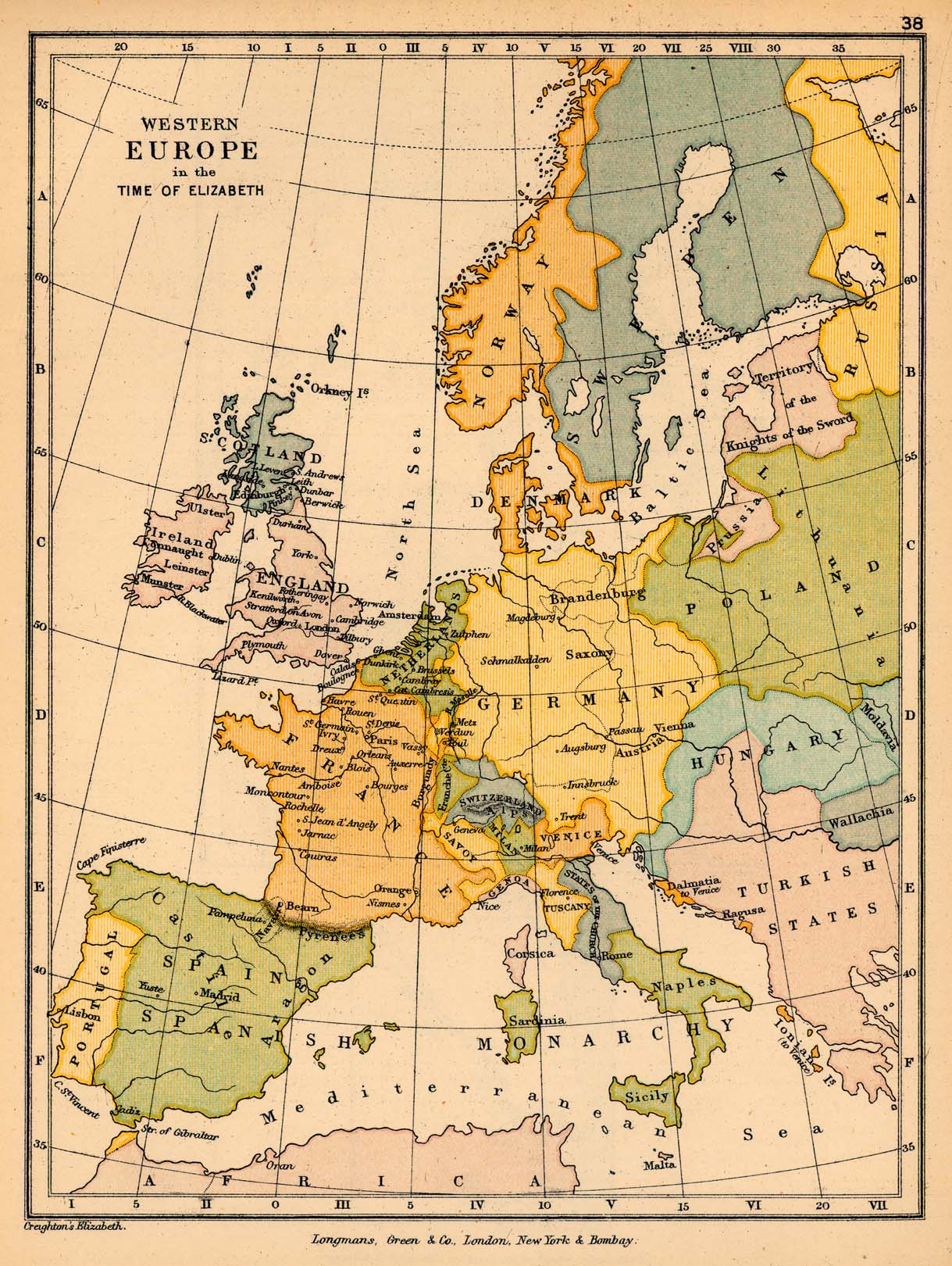
- Map of Western Europe, 1558–1603
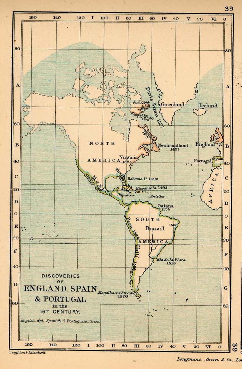
- Map of European colonisation in the Americas in the 16th century
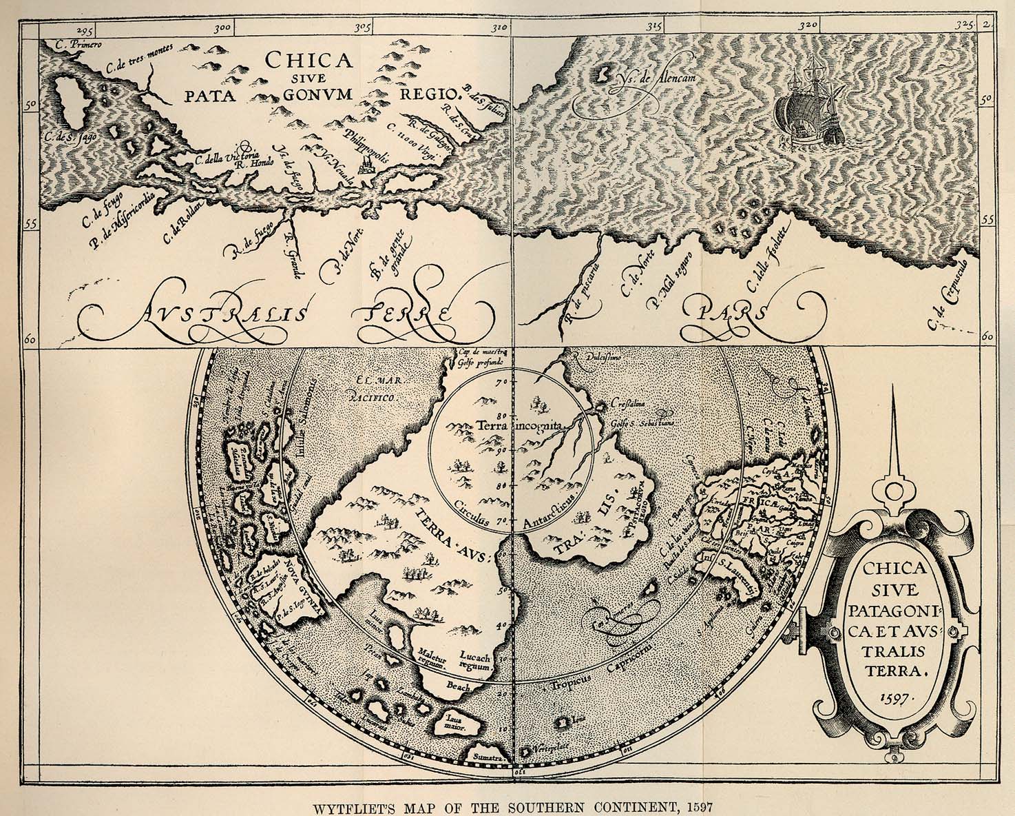
- Wytfliet's map of the southern continent, 1597
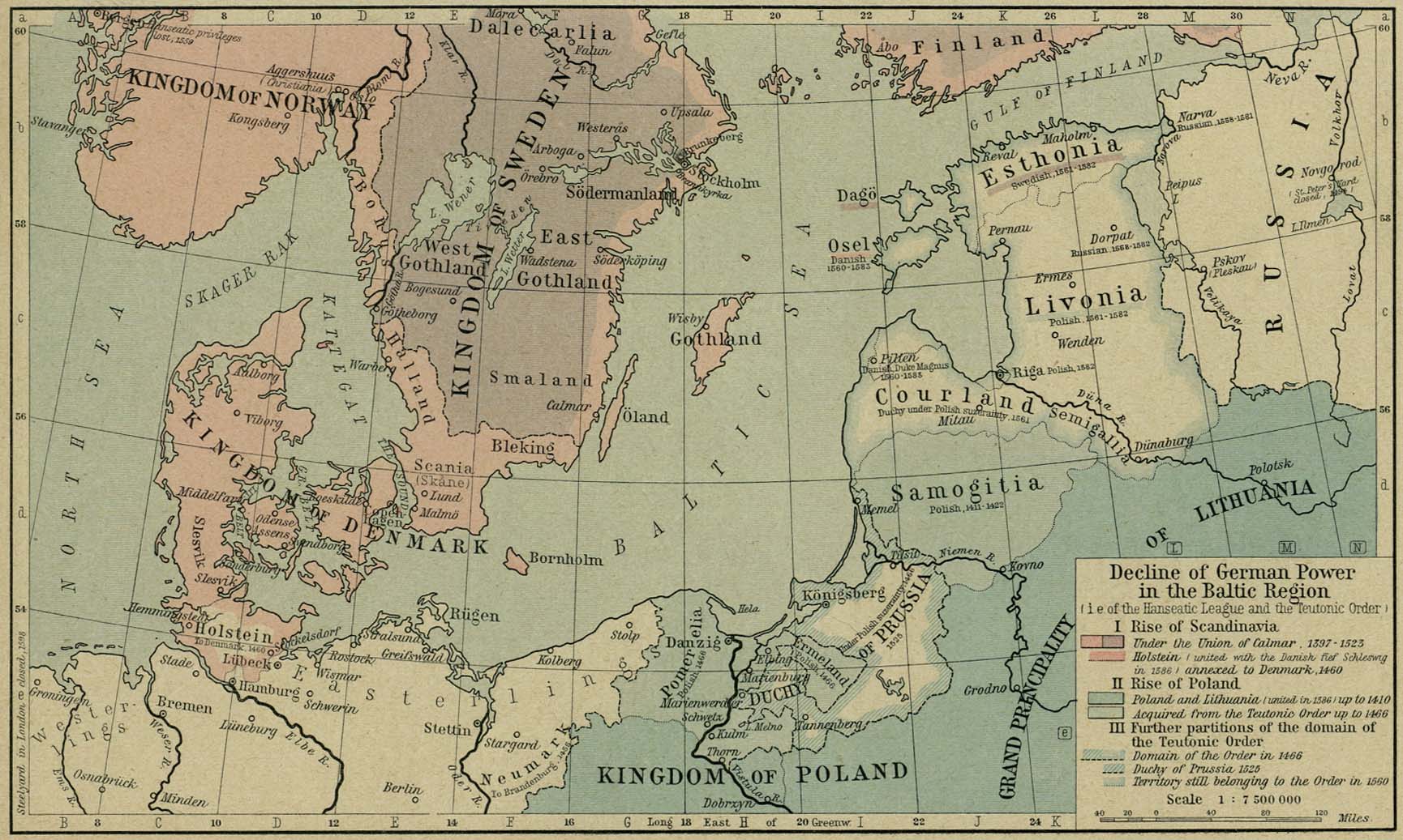
- Map of the Baltic Region, 1380–1560
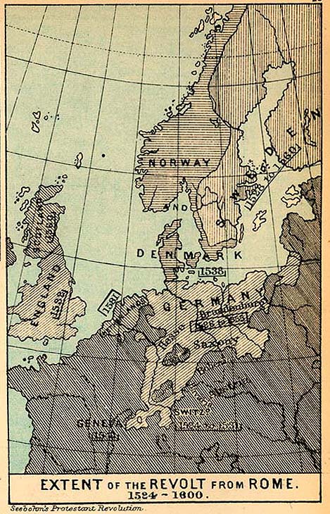
- Religion
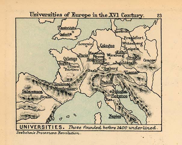
- Education
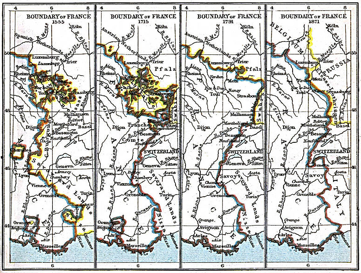
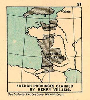
France[edit]
Guatemala[edit]
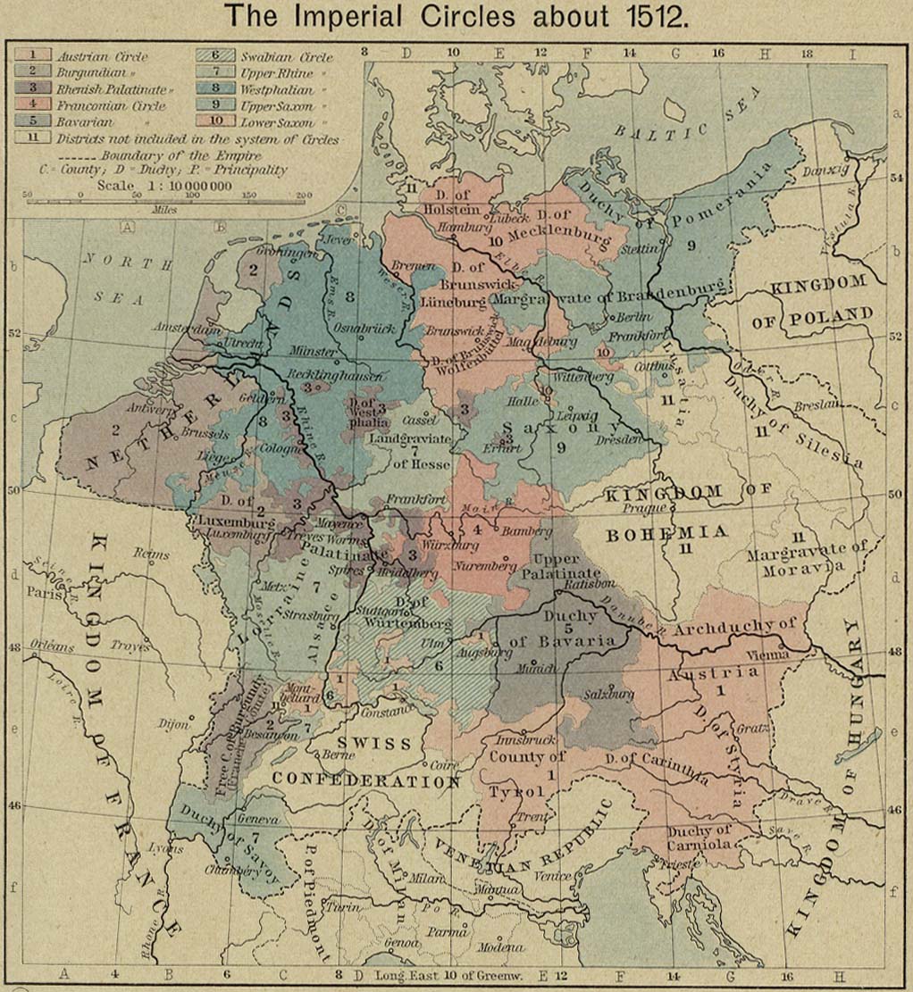
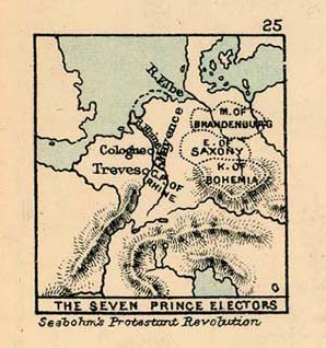
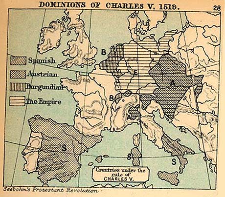
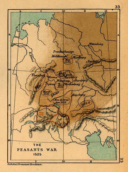
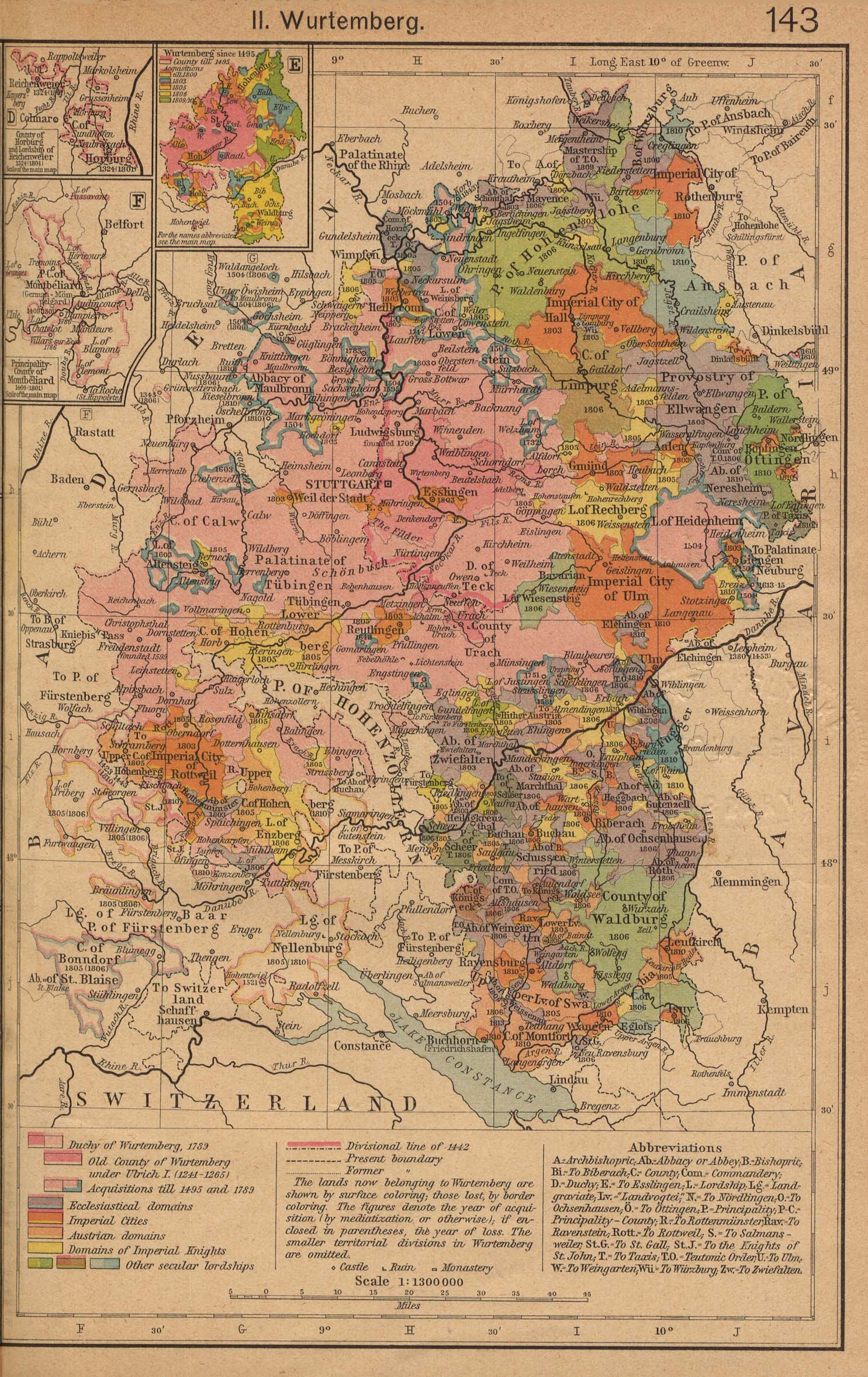
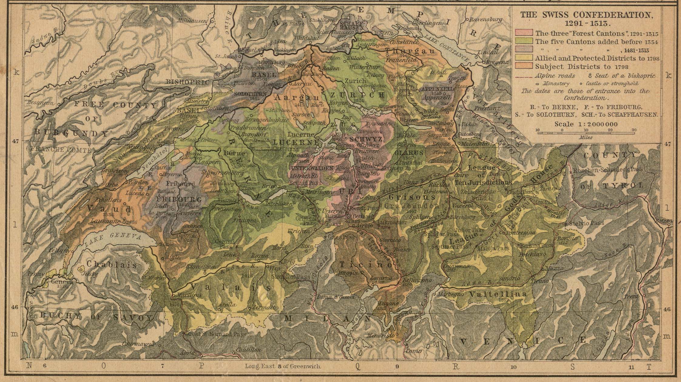
Holy Roman Empire[edit]
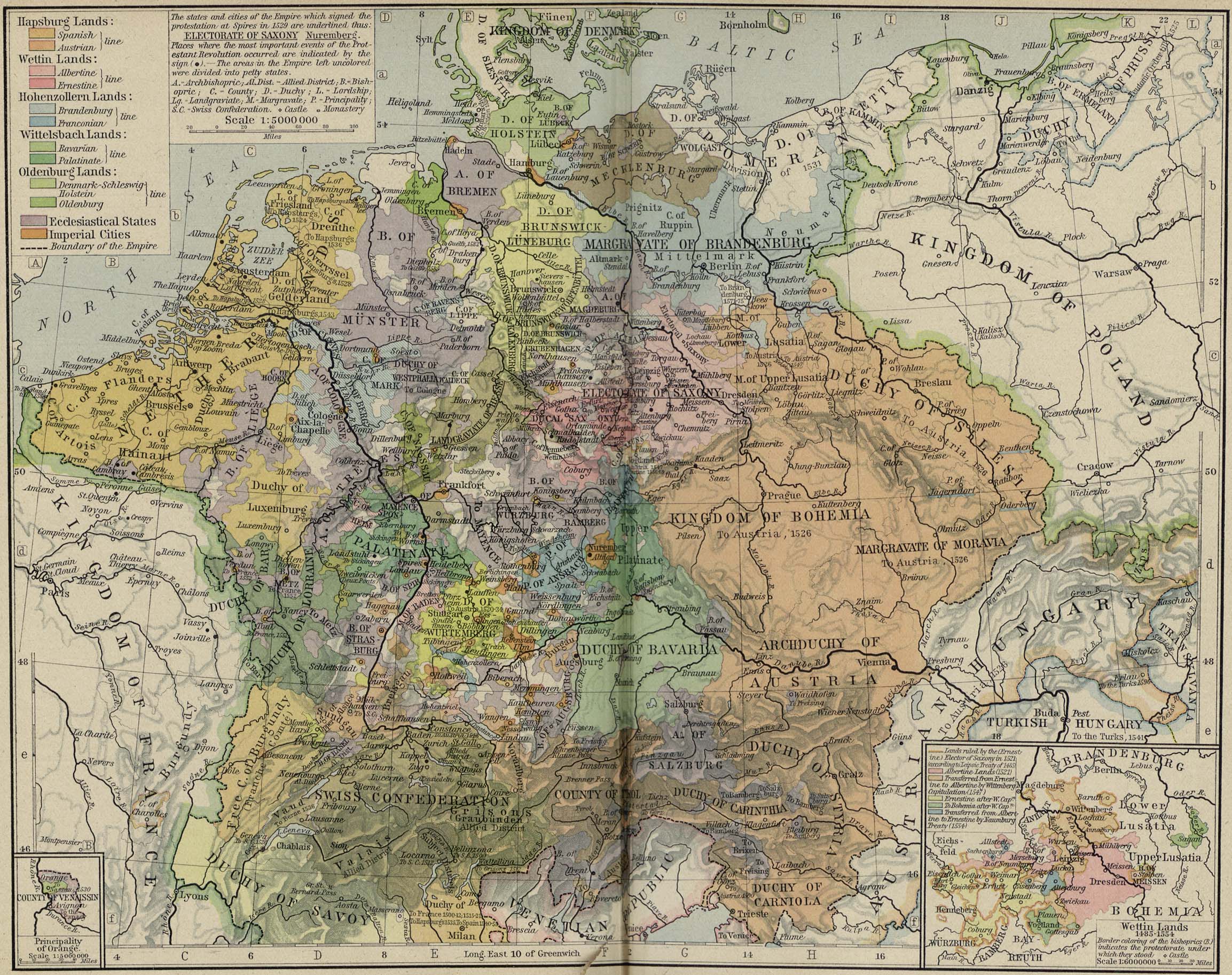
- Maps
Italy[edit]
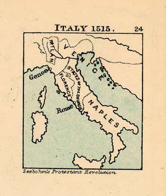
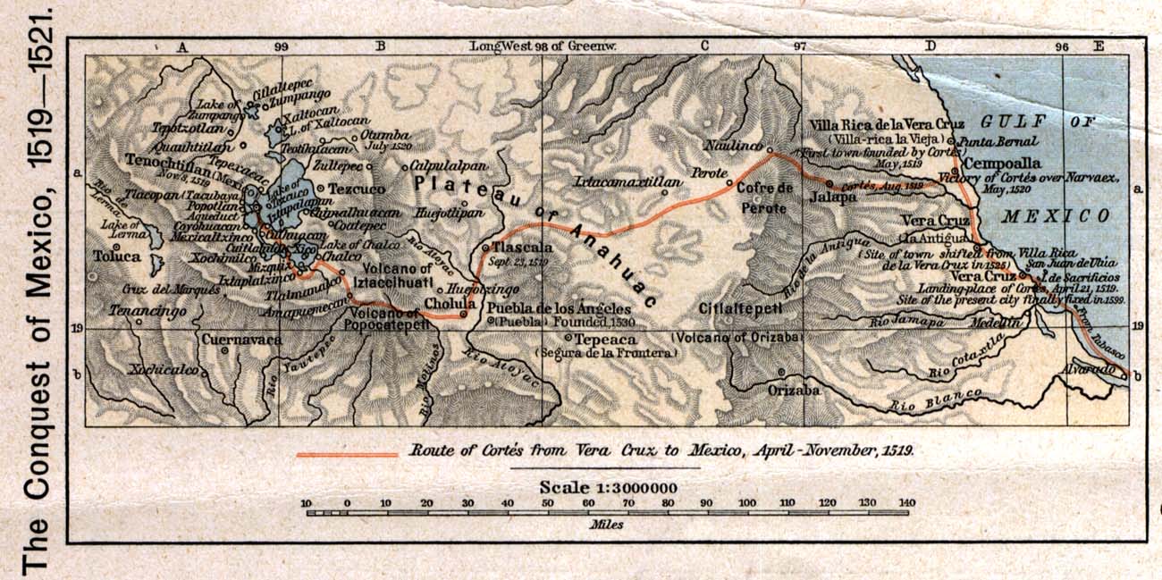
Mexico[edit]
- Maps
- Cities
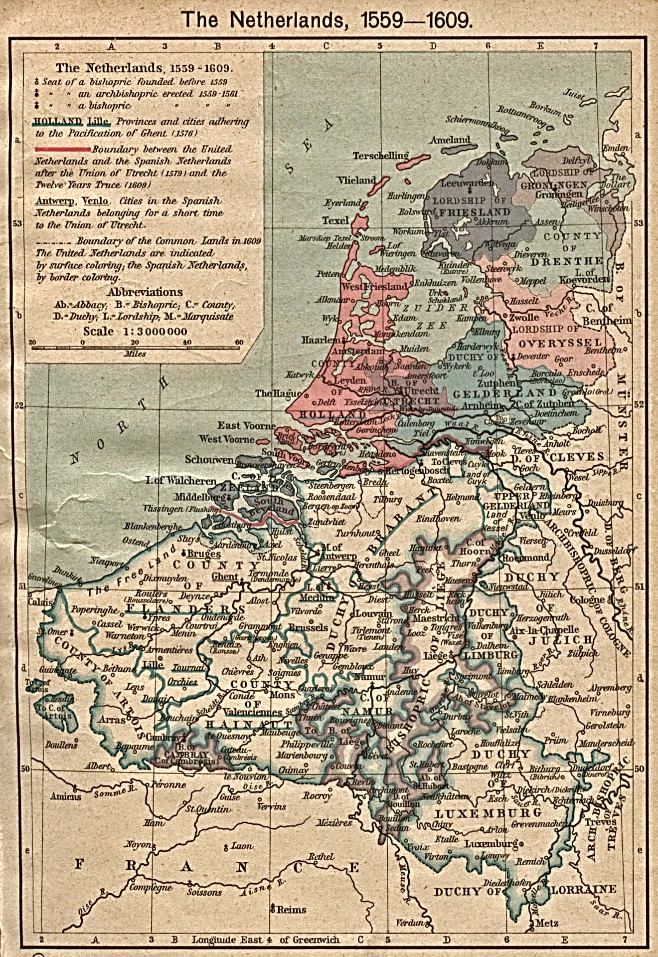
Netherlands[edit]
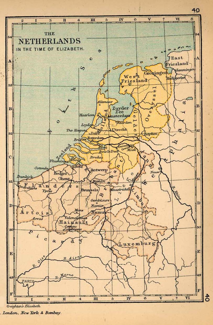
North America[edit]
- Maps
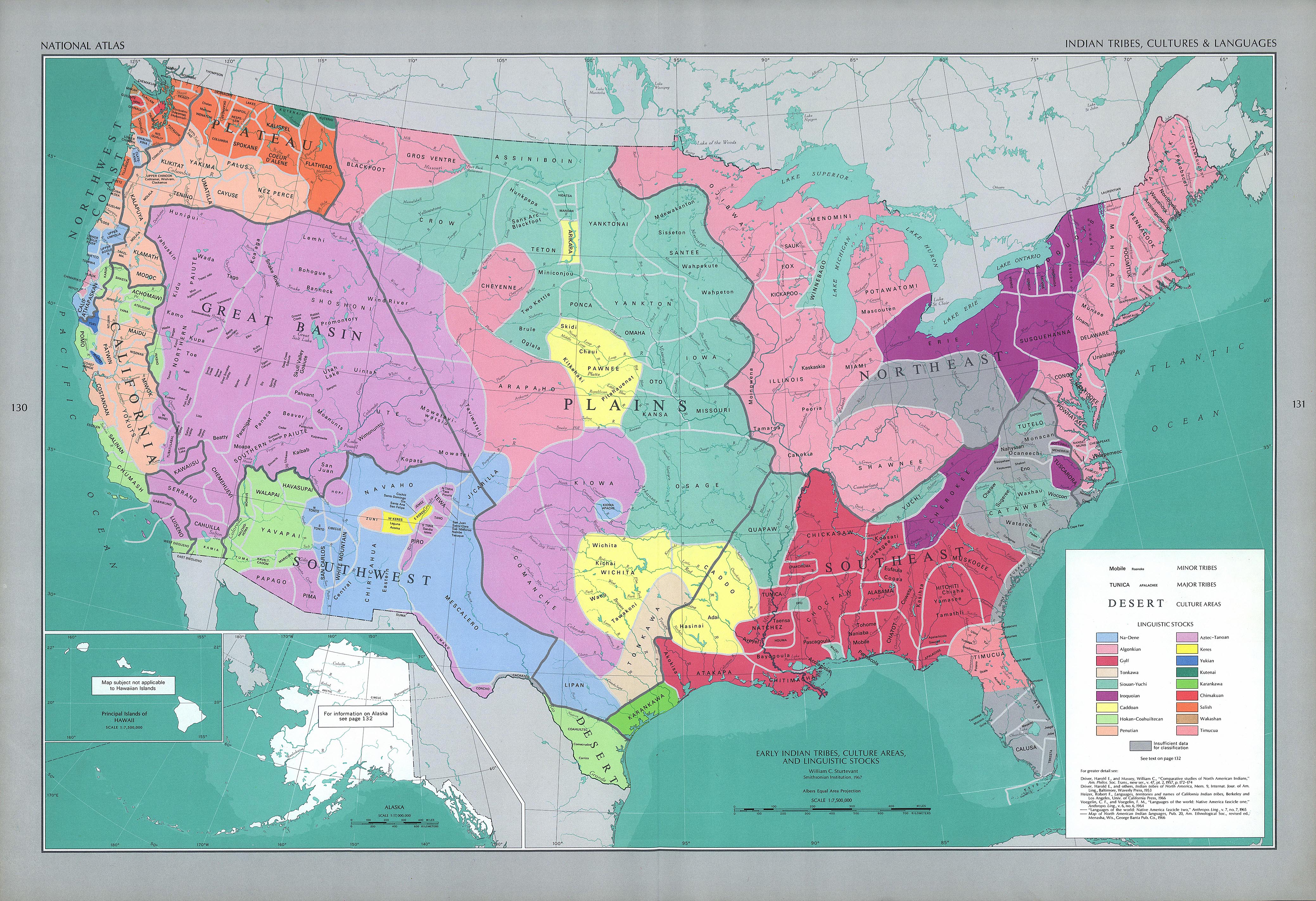
- Map of Indian tribes in the United States area before the arrival of Europeans
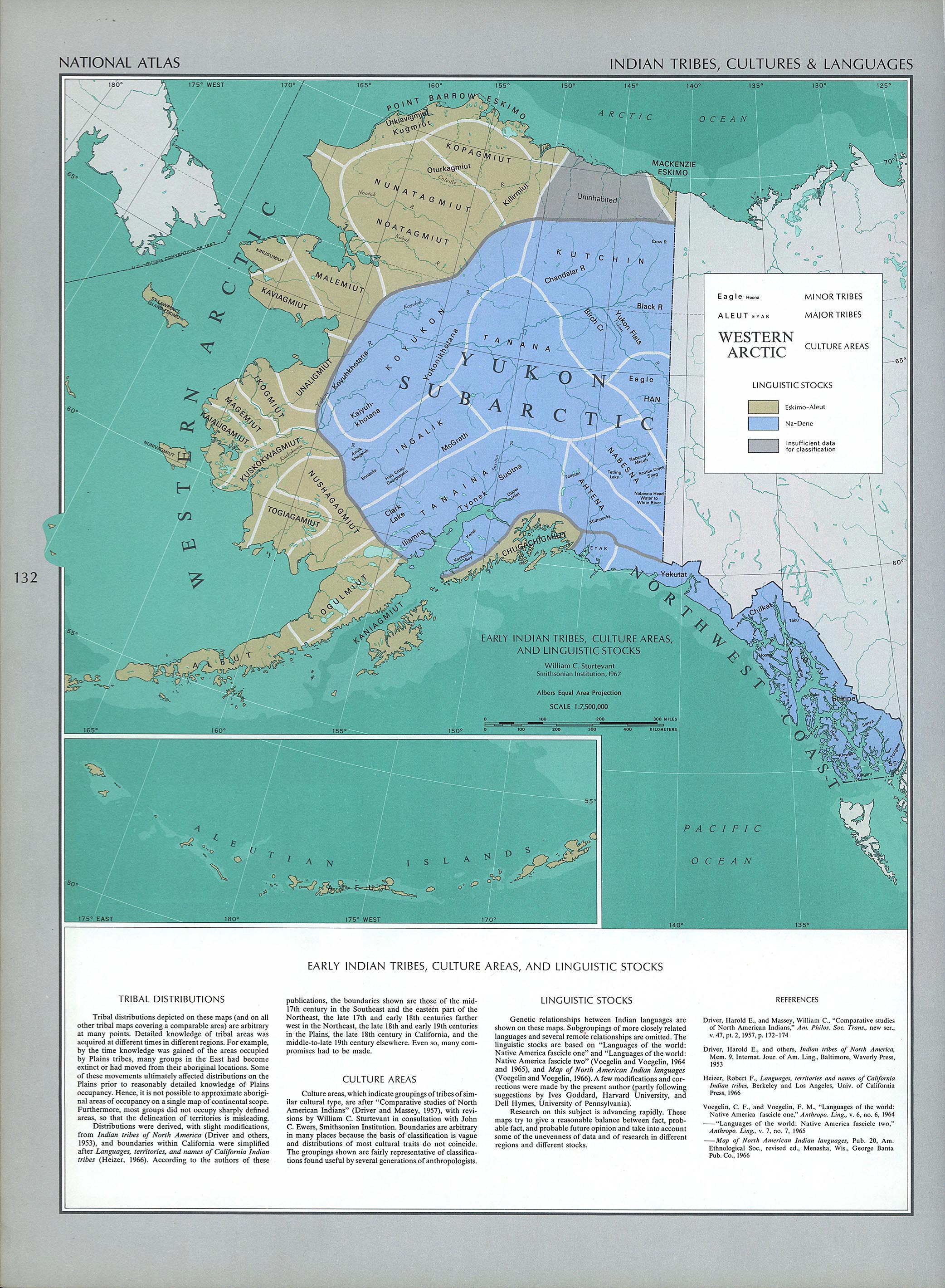
- Map of Indian tribes in Alaska and the Yukon before the arrival of Europeans
- Map of European voyages of exploration to North America, 1562–1794
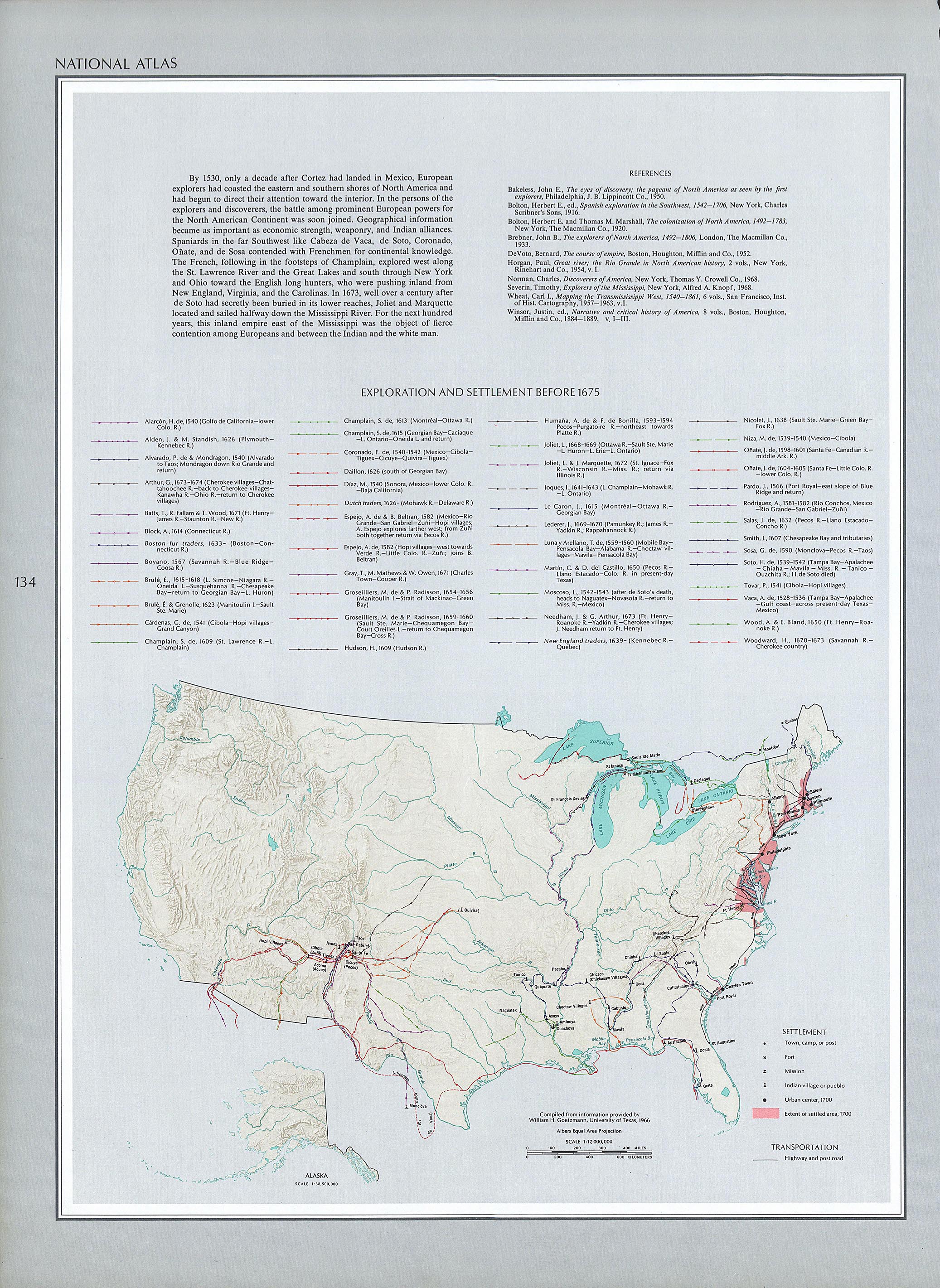
- Map of European settlement of the future United States, 1530–1675
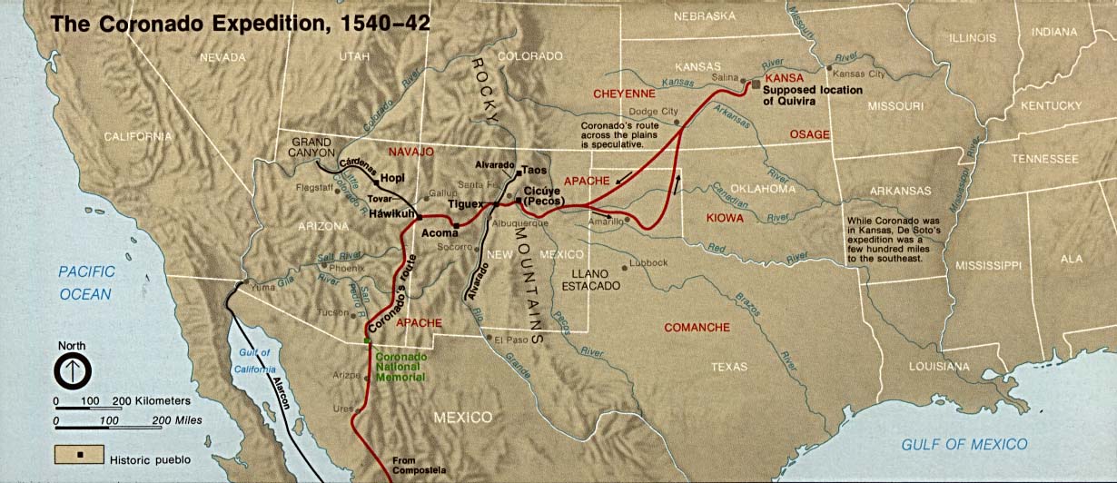
- Map of the Coronado Expedition, 1540–1542
Ottoman Empire[edit]
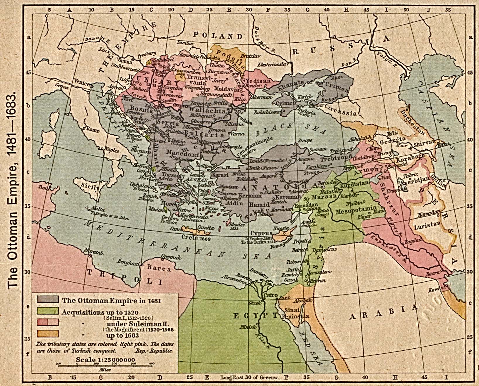
Peru[edit]
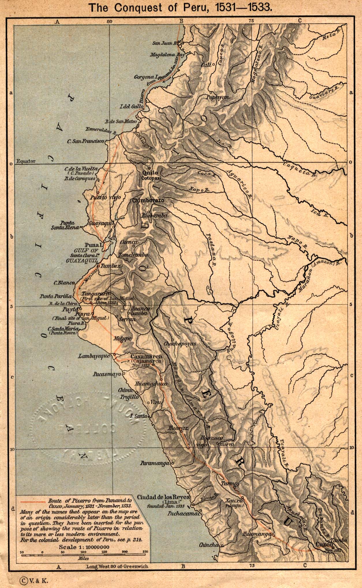
Russia[edit]
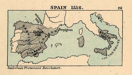
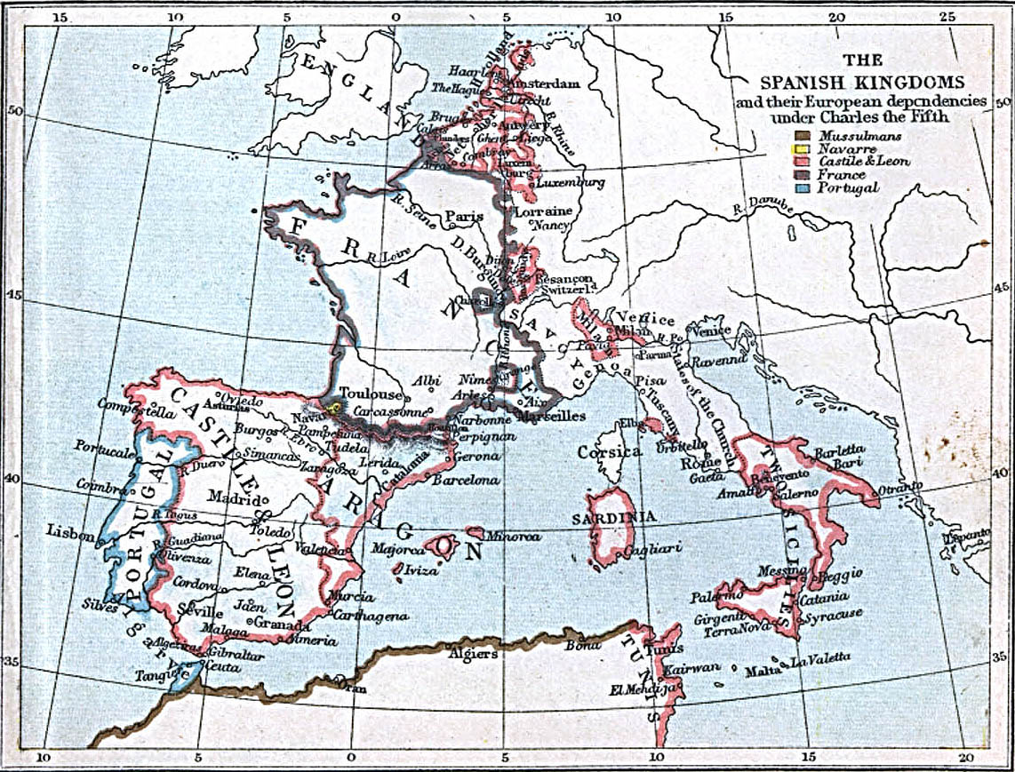
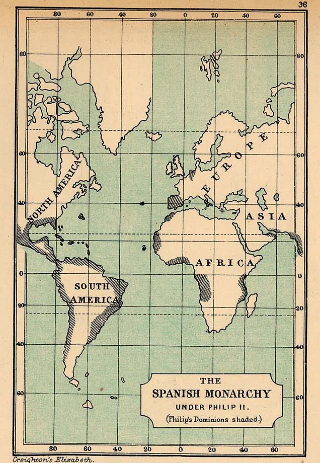
Spain[edit]
- Maps