From Wikipedia, the free encyclopedia
Anybody is more than welcome to help with this project, so long as you understand what exactly I am doing!
Preview (examples) [ edit ] First suggestion (mine) [ edit ] References I [ edit ] Second suggestion (EncMstr's) [ edit ] References II [ edit ] Third suggestion (my changes to EncMstr's) [ edit ]
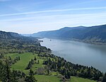
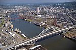
Name
Photo
Length
Max. flow
Min. flow
Source
Mouth
Drop
Number of dams
Color
Sub/urban
Description
References
Columbia River 2,000 kilometres (1,200 mi)
750000 cfs
32 cfs
Columbia Lake , British Columbia , 50°13′00″N 115°51′00″W / 50.21667°N 115.85000°W / 50.21667; -115.85000 (Columbia River (source) ) Pacific Ocean , 46°14′39″N 124°03′29″W / 46.24417°N 124.05806°W / 46.24417; -124.05806 (Columbia River (mouth) ) 8,000 metres (26,000 ft)
121
Mostly brown
2.17%
The longest river in the Pacific Northwest , from southeastern British Columbia south through Washington and east along the Oregon-Washington border into the Pacific Ocean .
[1] [2] [3]
Willamette River 200 kilometres (120 mi)
75000 cfs
8 cfs
Near Eugene , 44°01′23″N 123°01′25″W / 44.02306°N 123.02361°W / 44.02306; -123.02361 (Willamette River (source) )
Near Portland , 45°39′10″N 122°45′53″W / 45.65278°N 122.76472°W / 45.65278; -122.76472 (Willamette River (mouth) )
2,000 metres (6,600 ft)
0.5
Mostly blue
11.7%
Named after a Clackamas Indian village, the Willamette flows from the Cascade foothills north through the Willamette Valley into the Columbia River in Portland.
[4] [5]
References III [ edit ]
^ "Columbia Lake" . Natural Resources Canada. Retrieved January 31, 2011 .^ "Columbia River" . Geographic Names Information System . United States Geological Survey. November 28, 1980. Retrieved August 5, 2010 .^ Lang, Bill. "Columbia River" . Center for Columbia River History. Retrieved April 6, 2011.
^ "Willamette River" . Geographic Names Information System (GNIS) . United States Geological Survey. November 28, 1980. Retrieved August 6, 2010 .^ Bright, William (2004). Native American Placenames of the United States . Norman, Oklahoma: University of Oklahoma Press. p. 567. ISBN 0-8061-3576-X .
Fourth suggestion (my changes to my previous one) [ edit ]
Name
Photo
Description
Length
Max. flow recorded
Min. flow recorded
Source
Mouth
Drainage area
Number of dams
References
Columbia River The longest river in the Pacific Northwest , from southeastern British Columbia south through Washington and east along the Oregon-Washington border into the Pacific Ocean .
1,243 miles (2,000 km)
1,240,000 cubic feet per second (35,000 m3 /s)
12,100 cubic feet per second (340 m3 /s)
Columbia Lake , British Columbia , 50°13′00″N 115°51′00″W / 50.21667°N 115.85000°W / 50.21667; -115.85000 (Columbia River (source) ) Pacific Ocean , 46°14′39″N 124°03′29″W / 46.24417°N 124.05806°W / 46.24417; -124.05806 (Columbia River (mouth) ) 258,000 square miles (670,000 km2 )
14
[1] [2] [3] [4] [5]
Willamette River Named after a Clackamas Indian village, the Willamette flows from the Cascade foothills north through the Willamette Valley into the Columbia River in Portland
187 miles (301 km)
460,000 cubic feet per second (13,000 m3 /s)
4,200 cubic feet per second (120 m3 /s)
Near Eugene , 44°01′23″N 123°01′25″W / 44.02306°N 123.02361°W / 44.02306; -123.02361 (Willamette River (source) )
Near Portland , 45°39′10″N 122°45′53″W / 45.65278°N 122.76472°W / 45.65278; -122.76472 (Willamette River (mouth) )
11,478 square miles (29,730 km2 )
15
[6] [7] [8] [9] [10]
References IV [ edit ]
^ "Columbia Lake" . Natural Resources Canada. Retrieved January 31, 2011 .^ "Columbia River" . Geographic Names Information System . United States Geological Survey. November 28, 1980. Retrieved August 5, 2010 .^ Lang, Bill. "Columbia River" . Center for Columbia River History. Retrieved April 6, 2011.
^ "USGS Real-Time Water Data for USGS 14105700 Columbia River at the Dalles, OR" . United States Geological Survey. Retrieved 2008-08-06 .^ "River Overview" . Columbia River Keeper. 2000–2004. Retrieved 2008-04-01 .^ "Willamette River" . Geographic Names Information System (GNIS) . United States Geological Survey. November 28, 1980. Retrieved August 6, 2010 .^ Bright, William (2004). Native American Placenames of the United States . Norman, Oklahoma: University of Oklahoma Press. p. 567. ISBN 0-8061-3576-X .
^ "Physical Character" . Willamette Riverkeeper. Retrieved June 14, 2011 .^ Robbins, William G. "Willamette River" . The Oregon Encyclopedia . Portland State University. Retrieved June 4, 2010 . ^ "Water-Data Report 2009: 14211720 Willamette River at Portland, OR" (PDF) . United States Geological Survey. Retrieved June 30, 2010 .
For the smaller rivers/creeks [ edit ] {{List expand top|0|Columbia River}}
{{List expand mid|1|Skipanon River}}
{{List expand mid|1|Lewis and Clark River}}
{{List expand mid|1|Youngs River}}
{{List expand top|1|Klaskanine River|color=lightblue}}
{{List expand end|2|Wallooskee River}}
{{List expand end|1|John Day River (northwestern Oregon)}}
Work area [ edit ] Streams to use in tables [ edit ] Streams to use in collapsible bullet lists [ edit ] ![]() If you wish to discuss, please use the talk page of this draft.
If you wish to discuss, please use the talk page of this draft.


