
User:Acps110/NYCS Terminal Schematics
Current Terminals (2012)[edit]
| Service | Station | Platforms | [1] | Details |
|---|---|---|---|---|
| Fixes / Other Notes | ||||
| Van Cortlandt Park – 242nd Street | 1 island platform 2 side platforms |
2 |  | |
| ||||
| 238th Street | 2 side platforms | 3 |  | |
| Trains terminate on the northbound platform, then enter 240th Street Yard on west side of line; north of the station | ||||
| 137th Street – City College | 2 side platforms | 3 | | |
| Trains terminate on the northbound platform, relay north of station to center express track, return to service on the southbound platform | ||||
| South Ferry | 1 island platform | 2 |  | |
| ||||
| Wakefield – 241st Street | 1 island platform 2 side platforms |
2 | | |
| ||||
| Flatbush Avenue – Brooklyn College | 2 side platforms | 2 |  | |
| ||||
| Harlem – 148th Street | 1 island platform | 2 |  | |
| ||||
| Times Square – 42nd Street | 2 island platforms | 4 |  | |
| Trains terminate on the southbound express track, relay past station to a center track between express tracks, return to service on the northbound express track | ||||
| New Lots Avenue | 1 island platform | 2 | | |
| ||||
| Woodlawn | 1 island platform 2 side platforms |
2 | | |
| ||||
| Burnside Avenue | 2 island platforms | 3 |  | |
| Trains terminate on center express track, then continue light; north to Concourse or Jerome Yards | ||||
| Crown Heights – Utica Avenue | 2 island platforms | 4 |  | |
| Trains terminate at upper level island platform on either track, relay past station to a center track between express and local track, return to service at lower level island platform on either track | ||||
| Eastchester – Dyre Avenue | 1 island platform | 2 | | |
| ||||
| Nereid Avenue | 2 side platforms | 3 | | |
| Trains terminate on the northbound platform, then enter 239th Street Yard; north of the station | ||||
| East 180th Street | 2 island platforms | 3 | | |
| Trains terminate on the center track, open doors on both sides | ||||
| Bowling Green | 2 island platforms 1 side platform |
3 |  | |
| ||||
| Pelham Bay Park | 1 island platform 2 side platforms |
2 | | |
| ||||
| Parkchester | 2 island platforms | 3 | | |
| ||||
| Third Avenue – 138th Street | 2 island platforms | 3 | | |
| Trains terminate on the center track, open doors on both sides | ||||
| Brooklyn Bridge – City Hall | 2 island platforms | 4 |  | |
| ||||
| Flushing – Main Street | 2 island platforms | 3 |  | |
| ||||
| 111th Street | 2 side platforms | 5 |  | |
| Trains terminate on northbound local track, then enter Corona Yard | ||||
| Times Square | 1 island platform | 2 | | |
| ||||
| Times Square | 3 side platforms | 3 |  | |
| ||||
| Grand Central | 2 island platforms | 3 |  | |
| ||||
| Inwood – 207th Street | 1 island platform | 2 | | |
| ||||
| Dyckman Street | 2 side platforms | 4 |  | |
| Trains terminate on northbound track, then enter 207th Street Yard | ||||
| 168th Street | 2 island platforms | 4 |  | |
| ||||
| 59th Street – Columbus Circle | 3 island platforms | 4 |  | |
| <A> trains running light; enter service here in the PM | ||||
| Euclid Avenue | 2 island platforms | 4 | | |
| Trains terminate on southbound local track, relay south of station towards Pitkin Yard, return to service on northbound local track | ||||
| Ozone Park–Lefferts Boulevard | 1 island platform | 2 | | |
| ||||
| Far Rockaway – Mott Avenue | 1 island platform | 2 | | |
| ||||
| Rockaway Park – Beach 116th Street | 1 island platform | 2 | | |
| ||||
| Broad Channel | 2 side platforms | 2 |  | |
| Trains terminate on northbound track, relay north of station to siding east of line, return to service on southbound track | ||||
| Bedford Park Boulevard | 2 island platforms | 3 | | |
| ||||
| 145th Street | 2 island platforms | 3 | | |
| ||||
| Brighton Beach | 2 island platforms | 4 |  | |
| ||||
| Norwood – 205th Street | 1 island platform | 2 |  | |
| trains terminate on northbound track, relay on tail tracks east of station, return to service on southbound track | ||||
| Jamaica Center – Parsons/Archer | 1 island platform | 4 |  | |
| ||||
| Chambers Street (express) |
2 island platforms | 4 | | |
| World Trade Center (local) | ||||
| ||||
| Jamaica – 179th Street | 2 island platforms | 4 | | |
| ||||
| Kings Highway | 2 island platforms | 3 | | |
| ||||
| Court Square | 1 island platform | 2 | | |
| ||||
| Church Avenue | 2 island platforms | 4 | | |
| trains terminate on either track of southbound island platform, relay to lower level Church Avenue Yard, return to service on either track of northbound island platform | ||||
| Broadway Junction | 2 island platforms | 3 | | |
| trains terminate on center express track, continue light to East New York Yard | ||||
| Chambers Street | 3 island platforms 1 side platform |
4 |  | |
| trains terminate on southbound express track, relay south of station on lower level, return to service on northbound express track | ||||
| Broad Street | 2 side platforms | 2 |  | |
| trains terminate on southbound track, relay south of station on two center tracks, return to service on northbound track | ||||
| Eighth Avenue | 1 island platform | 2 | | |
| ||||
| Canarsie – Rockaway Parkway | 1 island platform | 2 | | |
| ||||
| Middle Village – Metropolitan Avenue | 1 island platform | 2 | | |
| ||||
| Myrtle Avenue | 2 island platforms | 3 | | |
| ||||
| Forest Hills – 71st Avenue | 2 island platforms | 4 | | |
| trains terminate on either track of northbound island platform, relay east of station on lower level toward Jamaica Yard, return to service on either track of southbound island platform | ||||
| Astoria – Ditmars Boulevard | 1 island platform | 2 | | |
| ||||
| 57th Street – Seventh Avenue | 2 island platforms | 4 |  | |
| ||||
| Canal Street | 2 side platforms | 4 | | |
| trains terminate on southbound track, relay south of station on lower level of City Hall, return to service on northbound track | ||||
| 36th Street | 2 island platforms | 4 | | |
| trains terminate on northbound express track, relay north of station, return to service on southbound local track | ||||
| Bay Ridge – 95th Street | 1 island platform | 2 | | |
| ||||
| Coney Island – Stillwell Avenue | 4 island platforms | 8 |  | |
| ||||
| Franklin Avenue | 1 side platform | 1 |  | |
| ||||
| Prospect Park | 2 island platforms | 4 | | |
| ||||
Notes[edit]
- ^ Tracks
Discussion[edit]

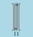
You might want to add to some of the diagrams; an arrow to one side with the text "Arriving Trains." Another arrow at the other end with the text "Departing Trains." Acps110 (talk • contribs) 16:48, 25 January 2012 (UTC)
(added image) Acps110 (talk • contribs) 19:40, 25 January 2012 (UTC)
- Yes, it would be useful for tracks that are terminal-only.
- The questions will follow. Vcohen (talk) 18:45, 25 January 2012 (UTC)
Ah, I see the image. I thought about two other cases.
If each track has its direction, I can add to them labels such as "boarding" and "alighting" (in addition to the existing "local" and "local").
If the train turns back within the station on a bi-directional track, I can draw something like this: ![]() Vcohen (talk) 20:41, 25 January 2012 (UTC)
Vcohen (talk) 20:41, 25 January 2012 (UTC)
- I think those arrows would look good, mid-platform on each track, to draw attention to them. I'm not quite sure about the boarding and alighting. That might be a bit too much text. Can you make an example, with and without the boarding and alighting for comparison? Acps110 (talk • contribs) 21:45, 25 January 2012 (UTC)
Here you are. If you read including the red text, it's with. If you don't, it's without.
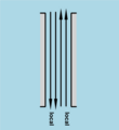
Another option is to use arrows like these: ![]() and
and ![]() . Vcohen (talk) 22:31, 25 January 2012 (UTC)
. Vcohen (talk) 22:31, 25 January 2012 (UTC)

- Wow, that's hard to read at thumbnail size! How were you planning to present these in their respective articles? I find it hard to decipher the meaning if the labels are placed far away from the platforms/tracks that they belong to. Would it make sense to put them along the edge of the platform? Or, opposite the platform edge, but more vertically centered on the image? (The point to be shown, is that the one side of the platform is for terminating locals and the other side is for expresses; the opposite platform is for boarding locals and expresses.)
- The arrows with a line, indicates an "end-of-track" to me. The larger you can get an arrow, the better it will be seen in thumbnail view. I'm not against arrows with a line, but the line should be at the end with the bumper blocks. Acps110 (talk • contribs) 00:13, 26 January 2012 (UTC)
You are right, I have to enlarge the font. The arrow heads have already been enlarged, you'll see it after I re-upload the images with corrections. The labels always belong to tracks and are placed on the continuations of their axes, it shouldn't be a problem. I prefer to use symbols rather than text labels, when possible. However, I'm planning to show the current configuration of services and not the physical tracks. If at a certain point of track all services terminate, I want to show dead-end, even if the track itself continues. I have to choose symbols that will be clear enough. Maybe, something like this?
![]()
![]() - bi-directional track, the train enters from the left and departs to the left
- bi-directional track, the train enters from the left and departs to the left
![]()
![]() - alighting only, the train enters from the left and departs to the right
- alighting only, the train enters from the left and departs to the right
![]()
![]() - boarding only, the train enters from the right and departs to the left Vcohen (talk) 09:24, 26 January 2012 (UTC)
- boarding only, the train enters from the right and departs to the left Vcohen (talk) 09:24, 26 January 2012 (UTC)
P.S. This is a quotation from the future introduction: The current version doesn't take into account:
- abandoned or closed levels (the only exception is Bergen Street (IND Culver Line), as its lower level hosts the express tracks of the same line that are unused, but still available for service);
- removed tracks;
- tracks not visible from the station (actually it means that I don't show levels without platforms; the only exception is 111th Street (IRT Flushing Line) where the express track is visible);
- difference between tracks that currently aren't in use and tracks that are unusable for passenger service;
- curvature of stations (I hope I may neglect it, since both City Hall (IRT Lexington Avenue Line) and South Ferry loops (New York City Subway) are abandoned);
- offset platforms or shorter platforms;
- bumper blocks (dead ends are shown where the service terminates and not where the track ends);
- curtain walls.
Vcohen (talk) 11:12, 26 January 2012 (UTC)
- I don't see a difference between the alighting only and boarding only symbols. I agree with the rest of what you said. Acps110 (talk • contribs) 17:18, 28 January 2012 (UTC)
The track directions are different. Vcohen (talk) 17:27, 28 January 2012 (UTC)
- That's not what boarding and alighting mean. Boarding means getting on a train that is getting ready for service. Alighting means all passengers leaving the train, as it prepares to relay or head to the yard empty. Acps110 (talk • contribs) 17:34, 28 January 2012 (UTC)
- For an example, take 168th Street (IND Eighth Avenue Line). Passengers from terminating C trains alight to the northbound island platform; the train relays beyond the station, returns to the station on the southbound platform, then accepts boarding passengers for its next southbound departure. Acps110 (talk • contribs) 17:42, 28 January 2012 (UTC)
One of us doesn't understand something. ![]() The arrow is the track. The circle is the end of the service. Vcohen (talk) 17:38, 28 January 2012 (UTC)
The arrow is the track. The circle is the end of the service. Vcohen (talk) 17:38, 28 January 2012 (UTC)
- That's not clear from the symbols with no key or legend in the corner of the image. Acps110 (talk • contribs) 17:42, 28 January 2012 (UTC)
- Also, the MTA uses squares for terminating services and circles for thru-service. Acps110 (talk • contribs) 17:43, 28 January 2012 (UTC)
An example has been uploaded. The size of the circles will be adjusted so they won't be confused with service designations.
Alternatively, I'm open to discuss other shapes. Vcohen (talk) 22:25, 28 January 2012 (UTC)

P.S. I've found an example (on the right) of using a circle to mark a terminal stop of a tram route. It isn't exactly our case, because (1) it's a route and a station, not a track and a point on it; (2) maybe this designation isn't common in the USA or in the world. Vcohen (talk) 12:58, 29 January 2012 (UTC)

And now, these are the promised questions. Their number is unexpectedly few: one question only.
Prospect Park (BMT Brighton Line). The article says: "The Franklin Avenue Shuttle terminates on the northbound local track while the southbound one is not normally used in revenue service." Do you say it's wrong? Vcohen (talk) 18:31, 2 February 2012 (UTC)
- Sorry for the delay, my Internet connection went down yesterday and I just got it back running this afternoon.
- I think that you should use the symbols that the MTA uses on its official map. Thru-services are circles and terminating services are squares. It is easily understood what the symbols mean on the example tram map via context, but there is no context on your schematics without comparing them to the official map.
- For your question about Prospect Park, see the track map here. The Franklin Avenue shuttle is depicted in brown so as not to be confused with a track that is not in-service.
- The Franklin Shuttle normally runs single-track with two trains except for the Botanic Garden station. The two trains normally pass each other there.
- In the evening, one of the trains is laid up on the southbound local at Prospect Park. That last trip is made with passengers and they exit the train onto the southbound platform. Service continues with only one train. The next time the schedule calls for two trains, that sleeping train on the southbound local is relayed south onto the express tracks and returns to service on the northbound local track.
- Alternatively, the going-to-bed train may terminate on its usual track and then wrong-rail past the station to layup between Prospect Park and Parkside Ave. on the northbound local track. Acps110 (talk • contribs) 22:31, 2 February 2012 (UTC)
Don't worry, there is no deadline. ![]()
I am not looking for service designations, nor am I looking for anything that could be confused with service designations. I want to mark a point on the track. (Also, if they use squares as terminals of circles, what do they use as terminals of diamonds?)
Do you want to fix the Tracks field in the infobox of Prospect Park?
I think I'll add a new item to my "doesn't take into account" list:
- occasional bi-directional use of tracks (such as at Prospect Park (BMT Brighton Line) or at Chambers Street (IND Eighth Avenue Line)). Vcohen (talk) 23:51, 2 February 2012 (UTC)
- Terminals of diamonds are also squares, with the exception of Parkchester which used to be marked as a terminal on the map.
- The track listing at Prospect Park is correct, 4 (3 in regular service). 3 are regularly used, and the 4th can be at a moment's notice.
- I agree with not marking occasional bi-directional use of tracks, that would just add confusion if it were included. Acps110 (talk • contribs) 12:46, 7 February 2012 (UTC)
Excuse me, what is "can be at a moment's notice"? I thought it meant emergency reroutings or so, not something happening every evening. Vcohen (talk) 13:28, 7 February 2012 (UTC)
- There is no consistency at Prospect Park about where the second train lays up. Sometimes it lays up on the southbound local, sometimes it lays up south of the station on the northbound local. Operationally it is easier to lay it up on the northbound local because that doesn't require a relay to put it back in service. However, trains are more vulnerable to being tagged with graffiti when they are left out in the open like that. Acps110 (talk • contribs) 18:12, 7 February 2012 (UTC)
Arbitrary break[edit]
The more I know, the more questions I have. With your help, I know the direction of every track. Now I want to mark terminal tracks. The rule is:
- if a track is terminal-only (including bi-directional, alighting-only or boarding-only), I mark it as such (and I remember that I haven't yet chosen a symbol for it);
- if a track is used as both terminal and through (or terminal for different directions during different times, such as East 180th Street (IRT White Plains Road Line)), I don't.
I'm trying to separate these two kinds of tracks, and I see two clear cases:
- if a station is terminal for all its trains then all its used tracks are to be marked as terminal;
- if a station has only two tracks with access to platforms and at least one through train, these tracks are not to be marked.
Beyond these clear cases there are some stations that I am not sure about. Here is the list:
- Broadway Junction (BMT Jamaica Line) (the article says, "north and south terminal for some midday trains", what does it mean?)
- Times Square (IRT 42nd Street Shuttle) (no question about the tracks, the question is about 3 platforms that none of them is island: what's wrong in the picture?)
- 145th Street (IND Concourse Line) (from here and on, the question is if the terminal track(s) is/are used by through trains as well)
- Chambers Street (BMT Nassau Street Line)
- Burnside Avenue (IRT Jerome Avenue Line)
- Euclid Avenue (IND Fulton Street Line)
Vcohen (talk) 12:28, 12 February 2012 (UTC)
- Broadway Junction; If it's used as the north terminal, trains run in service from Broad Street to Chauncey Street, switch to the middle track and terminate at Broadway Junction. The connecting track to East New York Yard is east of the station.
- If it's used as the south terminal, trains run in service from Jamaica Center to Alabama Avenue, switch to the middle track and terminate at Broadway Junction. The train operator goes to the other end of the train to run into the yard.
- Times Square; is already answered in the table at the top of the page.
- 145th Street (lower level); weekdays from 6:16 a.m. to 9:13 a.m. – the center track is used by the peak direction D express from the Bronx
- weekdays from 9:20 a.m. to 4:08 p.m. – the center track is used by the terminating B local
- weekdays from 4:11 p.m. to ??? (after PM rush hour) – the center track is used by the peak direction D express to the Bronx
- all other times – the center track is unused (Just recently, the C terminated at 145th Street on the lower level during weekend construction reroutes, with the A running local north of 145th Street upstairs)
- Chambers Street; Through J and Z trains use the outer tracks, opening doors on left to island platforms
- Terminating J trains (and formerly M trains) use the center tracks, opening doors on right to the same platforms
- Burnside; already answered in the table above; center track can be used by through express trains too.
- Euclid Ave; already answered in the table above; also, local tracks are used by through A trains during late nights when C doesn't operate. Acps110 (talk • contribs) 23:10, 12 February 2012 (UTC)
- Broadway Junction; If it's used as the north terminal, trains run in service from Broad Street to Chauncey Street, switch to the middle track and terminate at Broadway Junction. The connecting track to East New York Yard is east of the station.
Thank you. Where you say "already answered", my questions are not about what is already answered. ![]()
Now I know that the center tracks of Chambers Street are terminal-only, the rest of tracks in my last list are not.
However, I still don't understand the configuration of Times Square. It seems I am the one who does not know to ask. I am talking about the platform between tracks 1 and 3. Usually, if a platform is located between two tracks, it's an island platform and serves both of them. This one isn't and doesn't. What have I to draw along its southern edge? Why doesn't it serve track 1? Vcohen (talk) 08:41, 13 February 2012 (UTC)
- I thought I was clear in the description of the platforms above. I'm sorry if you still don't understand; I'll try again.
- The station was originally a local station on the 1904 IRT main line from City Hall to 145th Street. That means that it was built with two side platforms, each 5-cars long. When it was converted for shuttle service, Track 2 was removed and a side platform was built in its place. Here's picture of a train arriving on track 1. Track 3's side platform is on the left side of this picture, with a railing installed on the side towards Track 1.
- Track 1 and 4 are still served by their original side platforms. Track 1 and 3 were disconnected from the Bway – 7th Ave main line and bumper blocks installed. In the space between the bumper blocks and the main line, a connecting passageway was built between Track 1 and Track 3's side platforms. This connection also extends via a removable bridge across Track 4 to its side platform. This bridge is necessary because Track 4 is only connected to the Bway – 7th Ave northbound local. (At Grand Central, Track 4 ends at a bumper block.)
- Thus, all three side platforms are connected at the west end, but each track and platform functions independently. Unfortunately, this means passengers must play "guess the platform," to find out which train will depart next.
- (In the 1950s, all IRT local stations' platforms except 18th St (Lex), 91st St (Bway), 145th St (Lenox), City Hall, South Ferry loop, Times Square (shuttle) and Worth St were extended from 5-cars to 10-cars.)
- Does this help? Acps110 (talk • contribs) 14:55, 13 February 2012 (UTC)
Yes, thank you. The answer is "with a railing installed on the side towards Track 1". I tried to get the answer using the track map, but it seems to have some inaccuracies.
One question more. Not for my work on the station layouts, but only to understand what you say. In the table above there are some cases that you say: "Trains terminate on ... track, continue light to ... yard". Does it mean that they also begin their service from the same yard on the corresponding track? Vcohen (talk) 15:24, 13 February 2012 (UTC)
- "Train terminate on ... track" means that is where they drop off all remaining passengers. "Running light" means any train movement without passengers. Depending on track layout, they may or may not begin service again from the same track. Some trains may return from a yard to a different station before returning to service. Acps110 (talk • contribs) 16:02, 13 February 2012 (UTC)
Excuse me, it isn't what I wanted to ask. Your description in the table sounds like these stations are end of service only, not beginning of service. The question is if they are beginning of service too. Did you omit the way back for brevity, or are these stations indeed end of service only? Vcohen (talk) 16:42, 13 February 2012 (UTC)
- Yes, I did omit for brevity. The table was copied from List of New York City Subway terminals which lists all current terminals. There are other stations that can be used as terminals, such as Second Avenue (IND Sixth Avenue Line), etc., and also other stations that trains can use to enter service which may not be the end of service. Acps110 (talk • contribs) 16:56, 13 February 2012 (UTC)
Thank you. Anyway, if a track is both terminal and through, I don't mark it as terminal. Vcohen (talk) 17:11, 13 February 2012 (UTC)
P.S. Sorry, I've missed Crown Heights – Utica Avenue (IRT Eastern Parkway Line). My impression is that the express tracks are terminal-only and the local ones are both terminal and through. Am I right? Vcohen (talk) 18:17, 14 February 2012 (UTC)
P.P.S. Are these the kind of squares you spoke about? Vcohen (talk) 08:32, 15 February 2012 (UTC)

P.P.P.S. One more... At Flushing – Main Street, how are the three tracks distributed between the 7 and <7> trains? Does the <7> terminate on the middle track and the 7 on the two others? Vcohen (talk) 13:52, 16 February 2012 (UTC)
- At Utica Ave, a train can terminate on either track on the upper level. East of the station, both tracks have connections to the ramp to the lower level that is used by terminating trains to relay. Both tracks can also be used by through trains, because there is a diamond crossover east of the station that allows express trains to cross over to the local and continue to the IRT New Lots Line. On the lower level, only the Manhattan-bound local track can be used by through trains from the New Lots line. There is a diamond crossover west of the station, that allows local trains to cross to the express track and skip Kingston and Nostrand Aves stations. East of the station on both levels, only the local tracks connect to the New Lots line.
- What station are you depicting in the picture with the squares? Is this Euclid Ave? I'm having a hard time making sense of the picture without a legend or key to the symbols.
- At Flushing – Main Street any train can terminate on any track. Arriving track placement is decided on-the-fly, by what track is available, and is influenced by what that train will depart as. Typically in the AM, a <7> will depart from the center track, but that's not guaranteed. There are lighted signs in the mezzanine to indicate which track the next train will depart from and whether it will be an express or local. Also, in the AM some terminating 7 trains become <7> for the return trip, and in the PM all terminating <7> trains become 7 trains for the return trip because the <7> only operates in the peak direction. Acps110 (talk • contribs) 14:31, 16 February 2012 (UTC)
- We know the difference between regular service and occasional use. My question is about the regular case: which tracks of Utica Ave are usually used as terminal?
- It's an abstract example. It's like the legend of the MTA map (bottom left corner), general principles only, not something specific. Let's say it's Brooklyn Bridge – City Hall (IRT Lexington Avenue Line) without the side platforms, but it really doesn't matter. The key is very simple: platforms, tracks and something that we need to designate the point that trains with passengers don't pass.
- By the way, I've already marked Euclid Ave in my database as station with all through tracks. Is that an error? Vcohen (talk) 15:19, 16 February 2012 (UTC)
- At Utica Avenue, 4 and 5 express trains typically terminate on the express tracks, except when there is problem and they are routed down the local tracks from Franklin Ave or Atlantic Ave.
- Ok, I understand it as a concept. However, it doesn't apply to Brooklyn Bridge, because passengers are permitted to ride through the City Hall loop as 6 trains relay from southbound service back to northbound to speed up the relay process. (Most relays in the system do not allow passengers to protect the safety of the crew during the move. This means that the train must be checked to make sure all passengers are gone before it departs to the relay tracks.)
- Correct, Euclid Ave is a through station on all tracks at different times of the day. Acps110 (talk • contribs) 17:10, 16 February 2012 (UTC)

- Are there more terminal stations where passengers are permitted to stay in cars? Maybe, for example, Bowling Green?
- I keep trying to find a shape for this square, circle, dash or whatever. Is the above square similar to what you mean?
- Here is a new sketch. It has two notable items: a larger font and again a new shape. Is it better? Vcohen (talk) 17:47, 16 February 2012 (UTC)
- P.S. Do you know any set of templates like these, but for station layouts, with platforms and tracks? Vcohen (talk) 09:56, 20 February 2012 (UTC)
- I don't think there are any other relays that passengers are permitted to ride through. Bowling Green may allow it if platform conductors are not present to make sure the train is empty. (Such as, any time other than when the 5 normally terminates there.) (This video shows riding along a 6 train relaying through the SF loop after being rerouted to Bowling Green when the railroad blew up, but that was a special case.)
- I'm still unsure about the symbols you want to use to indicate a terminal track. You should probably just pick a few terminals that have different configurations that we can experiment with.
- I do like the larger font on this diagram. That's much more readable at thumbnail size.
- No, I don't know of anything like the rail line templates that could be used for stations. Acps110 (talk • contribs) 14:30, 23 February 2012 (UTC)
Another arbitrary break[edit]
I have uploaded some additional files that were missed before. They are in the new style, like the last sketch here. Later I will re-upload the whole series, but meanwhile we can discuss the style and improve it. Here are some examples:
|
|
 |
|
Vcohen (talk) 20:37, 23 February 2012 (UTC)
A new question again. I have accidentally discovered that the lower level of the Nostrand Avenue (IND Fulton Street Line) station has walls between the tracks, i.e. despite the usual description "2 side platforms" the level doesn't form a single space with 2 platforms and tracks between them. Before that I knew only two such stations: 14th Street (IND Sixth Avenue Line) and 23rd Street (IND Sixth Avenue Line). Are there more stations or levels that don't form a single space? Vcohen (talk) 18:17, 26 February 2012 (UTC)
- Walked in on a neat page here! (I hope such is not breaking any wiki-etiquette rules.) I think these would be great to include on terminal pages, especially the more complicated ones. I have one minor nit pick for the diagram notes- On the IRT Bronx terminals (Van Cortland Park, Woodlawn, Wakefield, and Pelham Bay Park) the side platforms are all substantially longer than 5 cars. VCP is about 8 cars long IIRC, and the others are close to, if not full length. 67.247.23.150 (talk) 03:02, 27 February 2012 (UTC) Also-
- 50th lower level on the E is separated for most of the lower level to provide another example of the above. 67.247.23.150 (talk) 03:04, 27 February 2012 (UTC)
- No, you are not breaking any etiquette rules chiming in. This is a discussion page like any other talk page.
- The reason that I said the side platforms were 5 cars long, is that most trains are sectioned, 5 cars and 5 more cars. The conductor can open a section individually from the rest of the train, but not 6 cars or 4 cars. Stations like the old South Ferry loops or 145th Street (IRT Lenox Avenue Line) are both about 6 cars long, but only the first 5 can open. Acps110 (talk • contribs) 18:51, 29 February 2012 (UTC)
Thank you, 67.247.23.150. These layouts are planned for all stations, not only terminal ones. However, the first version will have some restrictions, such as ignoring short platforms, offset platforms, connected platforms, curvature of stations and so on. Vcohen (talk) 07:49, 27 February 2012 (UTC)
I've taken the risk of putting some layouts here. Vcohen (talk) 09:01, 27 February 2012 (UTC)
- I see that many of the images on this page have updated to your newer versions. I do like the much larger arrows and fonts; it makes them much easier to read at thumbnail size.
- I don't think Nostrand Ave is a problem, (and by the way, it is a curtain wall if it doesn't support the structure above it.) Bergen Street (IRT Eastern Parkway Line) is another station that you can't see all the way across from one platform to the other. How does this change the diagrams if it is not a single space? Acps110 (talk • contribs) 18:51, 29 February 2012 (UTC)
I re-upload each image that I go to use. I don't want to re-upload them all before I have the final version. The process of re-uploading is too exhausting.
Here you can see the only three images that I have as of now that show "distributed" levels. What I do is simply leave some empty place for the hidden tracks.


I think you know what will be my next question: do you have the full list... Vcohen (talk) 21:46, 29 February 2012 (UTC)
- These look good; they are easily understood. Your 23rd Street image could be used for Bergen Street too. Acps110 (talk • contribs) 16:29, 2 March 2012 (UTC)
P.S. I've found some list. Until some hours ago I thought that a curtain wall is something like this. That's why I said my layouts didn't take curtain walls into account (see my message above dated 26 January 2012). You have drawn my attention to the fact that there are curtain walls of another type. I've looked for the words curtain wall in the articles here and found the next stations:
- Nostrand Avenue (IND Fulton Street Line) and Bergen Street (IRT Eastern Parkway Line) (the two we've already spoken about)
- Union Street (BMT Fourth Avenue Line), Ninth Street (BMT Fourth Avenue Line), Prospect Avenue (BMT Fourth Avenue Line), 25th Street (BMT Fourth Avenue Line) – Vcohen (talk) 17:09, 1 March 2012 (UTC)
- I'm not trying to throw a wrench in the whole works, but there are MANY more stations with curtain walls then just those you have listed. Most curtain walls have man-sized holes in them to be used by track workers when a train passes through. Examples include (but are not limited to) DeKalb Ave looking south on the Manhattan-bound platform, wall on right separates tunnel track from bypass tracks; Canal Street (Nassau St line) eastern island platform with niches being bricked up, this side now abandoned; Abandoned side of Bowery looking through the niches toward the active side.
- I think it is a good idea to generally ignore curtain walls because they don't contribute to the layout of the station or affect the crowd-flow through the station. So for all those local stations you've listed, the layout would still use...


To my deepest regret, it's impossible. My only source is the table made by you that says that each one of these stations has two tracks (because the rest are invisible). Therefore, before I found the description of the walls, I planned to use...
this diagram. No matter whether I decide to add 2 tracks or to widen the distance between the existing ones, somebody has to tell me which stations need this operation. Vcohen (talk) 18:26, 2 March 2012 (UTC)
P.S. I see this your edit. The original idea was to put the images in the same order as the station types are listed in the description: 2-track line, local stops, express stops. Vcohen (talk) 09:15, 4 March 2012 (UTC)
- I changed it because the six track DeKalb Ave station is a local station, thus the table was more suitable to have it in order of increasing number of tracks. Acps110 (talk • contribs) 20:32, 18 March 2012 (UTC)
P.P.S. I was noticeably surprised to find that these tracks behind curtain walls are still considered visible, both in your table and in the public opinion. It seems I didn't understand you. Do you mean that all such tracks are considered visible throughout your table?
I've found 5 subway lines with alternation of 2 and 4 tracks (IND Eighth Avenue Line, IND Queens Boulevard Line, IND Sixth Avenue Line, IRT Eastern Parkway Line, IRT Lexington Avenue Line). Is it true that all their stations with 2 tracks have the other 2 either on another level or in another tunnel (such as at Steinway Street (IND Queens Boulevard Line)), but not between the visible tracks behind curtain walls? Vcohen (talk) 16:25, 18 March 2012 (UTC)
- A curtain wall in my definition would be solid. The walls between the local and express tracks on the Fourth Avenue Line, (Union Street, 25th Street, etc.) have large holes in them every few feet to allow track workers to get out of the way of approaching trains. Thus you can still see across, and the walls look more like thick pillars, than a curtain wall.
- In answer to your second question...
- In northern Manhattan the Eighth Avenue line goes from 4 tracks across to 2 over 2. The local stops (155th, 163rd) have the express tracks running underneath them.
- Sixth Avenue's 14th and 23rd Street stations are the same.
- The Lexington line on the Upper East Side is the same.
- The Queens Boulevard line express tracks take a different route between 36th Street and Northern Blvd. Steinway Street, 46th St do have only 2 tracks, because the express tracks are under another street at that point. The express tracks return underneath Northern Blvd station, and east of there they rise back into their center position. Queens Track map (The Culver line express tracks do the same thing between Seventh Ave and Church Ave.)
- The Eastern Parkway line under Flatbush Avenue Ext. was built as part of the Dual Contracts for both the IRT and BMT. Brooklyn Heights Track map Thus that portion has the four tracks of the EP line and two more tracks of the BMT Brighton line.
- One question... You changed the Fulton Street (BMT Nassau Street Line) yesterday to say "two of five stations which don't have 24/7 service". What is the fifth station? I can only think of the two Nassau Street stations and the two 42nd Street Shuttle stations. Acps110 (talk • contribs) 20:32, 18 March 2012 (UTC)
![]()
The rest of my answer will follow later, I'm sorry. Vcohen (talk) 21:06, 18 March 2012 (UTC)
OK. If I take your table as a basis and decide to ignore walls with holes, there is nothing to change in my layouts. I know these maps, but I was lazy to look at them.
Do you mean that the walls of the BMT Fourth Ave Line have holes and those of Nostrand Ave and Bergen St have not? Vcohen (talk) 18:47, 21 March 2012 (UTC)
- Right. The walls on the Fourth Ave line are more like columns, and those others are solid walls with no holes in them. Acps110 (talk • contribs) 20:43, 24 March 2012 (UTC)
So, the last thing remaining to discuss here is that end-of-route shape that we didn't find yet. Do you want to say anything about it before I upload all my layouts in their draft version? Vcohen (talk) 21:28, 24 March 2012 (UTC)
- No, I don't have anything else to say about the layouts. You are on the right track, keep up the good work! Acps110 (talk • contribs) 01:54, 1 April 2012 (UTC)
OK, thank you. The upload will begin once I have some spare hours. Vcohen (talk) 04:46, 1 April 2012 (UTC)
One more break[edit]
My questions never are over...
 |
 |
 |
I've made a special image for the southbound platform of Fordham Road. Do the above quotations mean that Prospect Park and Brodway Junction (Canarsie) need a similar thing? Vcohen (talk) 07:31, 2 April 2012 (UTC)
P.S. If the answer (especially about Prospect Park) is positive then perhaps the sentence that I've colored in red is wrong and has to be deleted. Vcohen (talk) 15:04, 3 April 2012 (UTC)
- I like the modified layout for Fordham Road.
- For Prospect Park, I don't think anything needs to be shown about the north ends of the platforms being in the tunnel. However, you should change the southbound local track to a solid track instead of a dotted line.
- For Broadway Junction, this pic from the rear of a departing southbound train shows that only the first car southbound and the last car northbound are not directly accessible from each other. You could show the platform split the same way as Fordham, but with a shorter line showing the split. Acps110 (talk • contribs) 20:32, 3 April 2012 (UTC)
- This layout is not modified, there was no other version.
- We have created the following hierarchy: in regular service; not in regular service; not in passenger service; not for passenger service. I cannot use 4 different designations in my layouts, I have to choose how I reduce it to in use and not in use. My choice is: in regular service = in use; otherwise = not in use. The infobox of Prospect Park says that only 3 tracks are in regular service, this is what I show in my layout. However, there is another correction that I have to do: mark the left side of the left platform with a dotted line.
- Thank you for the picture, but, unfortunately, I don't understand it. I see one track and two platforms. Where is the split end?
- I can shorten the line showing the split to about 1/4 of the platform length. Will it be good enough for all the 3 stations?
- Is the sentence colored in red true or false? Vcohen (talk) 12:46, 4 April 2012 (UTC)
- For Prospect Park, I see two options...
- You could show the track in service but the edge of the platform as a dotted line like your Bway Junction diagram.
- Or, you could show both in service, but leave out the S bullet below the diagram, so it would be (blank), B/Q, B/Q, S.
- I think the second is better, because the track and platform are in service, just not regularly. The second choice is also more like using the standard three-track express station for elevated stations in the Bronx and Brooklyn that don't have regular express service. If you disagree and think that something needs to be shown to indicate that it is not regularly used, then the first choice is better with a dotted platform edge.
- After a bit more research, I'm undecided about how to handle the platforms. Here's a POV video; (First train (B) is Manhattan-bound, second train (Q) is Coney Island-bound, third train (Q) is Manhattan-bound) taken from the north end of the Manhattan-bound platform. This video was taken from the front window of a Brighton Beach-bound B train. Prospect Park appears between 4:20 and 6:00 if you want to skip the first four minutes. (Also there is a Franklin Ave Shuttle train parked on the southbound local at the far south end of the platform.) It's your call how to depict the split at the north end.
- For the picture of the Canarsie line, what is being shown is... The left platform is the southbound side platform and the right platform is one of the legs of the island platform. (The northbound track and other leg of the island platform are off the right side of the photo.) The legs don't really matter because the southbound trains don't use that platform. Southbound trains open their doors to the right onto the side platform, and northbound trains open their doors to the left onto the island platform. Thus, the diagram you have already made for that station is fine, with or without a line showing the split. It already shows the edge of the island platform as being not used because trains don't open their doors there. Again, it's your call if you want to depict a split or not. Acps110 (talk • contribs) 20:15, 4 April 2012 (UTC)
Thank you. All the problems have been solved, but the left track of Prospect Park.
My main field of interest here is consistency. There are two facts:
- The infobox says that this track is not in regular service.
- My layouts show tracks not in regular service as dotted lines.
I can change one of them, but I cannot leave them as-is and make a conclusion that contradicts them.
The dotted platform edge in the layout of Bway Jctn is dotted just because the trains on the adjacent track use the opposite platform. This is not the case in Prospect Park. Each solid track must have at least one solid platform edge. Vcohen (talk) 21:35, 4 April 2012 (UTC)
- Ok, well if each solid track must have at least one solid platform edge, then you should show both Prospect Park and Broadway Junction the same way. Consistency is a good goal. My problem with the dotted track or platform edge says something that is not true. The track is not used regularly, but can be at any moment. Just because a track is not normally used doesn't mean it should be shown out-of-service.
- Simplify, by saying "in service" / "not in regular service" = solid track and platform edge; "not in passenger service" / "not for passenger service" = dotted line and platform edge.
- Broadway Junction is like Bowling Green, they both have an island platform for one direction and a side platform for the other. However, the difference is that Bowling Green has a fence down the unused side of the island platform. Passengers CAN'T use that platform to board a northbound train. Broadway Junction is just like Prospect Park in that the island platform is normally unused by trains on the southbound track. However, when Broadway Junction is a terminal for southbound trains (during construction), both tracks are used, with doors opening to the island platform.
- The key to showing that the southbound track at Prospect Park is normally not used, is to leave out the S symbol; but still show the tracks and platforms as "available." Acps110 (talk • contribs) 21:14, 5 April 2012 (UTC)
As of now, my layouts reflect the currently existing routes rather than the system's potential capabilities. Here are some examples:
 |
|
 |
If I decide to reflect the system's capabilities, I must perform a lot of changes in all my files, including some difficult decisions, such as how to show the through tracks of Court Square currently used as a terminal station.
Alternatively, we can change the infobox and the description of Prospect Park to say that the forth track is in use. Vcohen (talk) 08:35, 6 April 2012 (UTC)
- I'm not talking about the system's capabilities, I'm talking about what is in service and what isn't. You said that you could only show two states (used or unused), but that we had four things to define. I'm fine with only being able to show two states, that simplifies the layout pictures greatly. My suggestion was the modify your definition slightly by only dotting tracks and platform edges that weren't in passenger service or were not for passenger service. It is confusing to show something as not in service, and then have a train show up and open its doors. To answer the question, "What is in service?"; look at the layout of the station and see if the track is served by passenger trains at any time (including re-routes), and is there a platform edge or a wall there?
- In answer to your questions above, there is nothing wrong with Court Square on the Crosstown line. That is where service usually ends, and trains don't go past the station to the yard anymore. G trains are now served by a yard at the other end of the line.
- Willets Point on the Flushing line is fine too, as you have drawn it. Trains on the northbound local can open their doors to either side.
- For Essex Street, please add the J, M and Z route bullets to the "southbound" track. That way, it can be understood that all traffic in one direction is on the same track, while in the other direction, the M uses a different track from through trains. Acps110 (talk • contribs) 19:59, 9 April 2012 (UTC)
OK, I think now I have understood you. My questions will follow.
The southbound track of Essex Street is its only southbound track. The southbound trains have no choice but to use it. Vcohen (talk) 20:52, 9 April 2012 (UTC)
To-do[edit]
So, this is the to-do list.
1. Generic layouts (most of them with express tracks in local stations) - have to be replaced (each one with the layout below it).
-
 59 stations
 -
 14 stations
 -
 7 stations
 -
 4 stations
 -

-

-

-


2. Additional layouts with dotted tracks - have to be edited (all tracks will be solid, along with their adjacent platform edges); for the westernmost track of Prospect Park I need its direction (whether it has be shown as bi-directional).


3. Layouts with tracks between two platforms, one of them dotted - I need to know which platforms have to be transformed to solid (some of these stations already have been listed in context of tracks).


4. How can I tell that one of platforms is typically used and the second only can be? Vcohen (talk) 18:24, 10 April 2012 (UTC)
- Looks good.
- Canal Street and Bowery, the eastern-most track is in service, but the platforms are not. If a train is re-routed via that track, it runs express to Essex. Hoyt–Schermerhorn is correct
, add G route bullets to center tracks. Prospect Park, western-most track is southbound local only, NOT bi-directional. Bergen Street, the express tracks are in service, but the platforms are unusable. Pelham Parkway, the southbound express track is in service as a bi-directional track; northbound express track doesn't exist. St. George is correct, because the western-most platform and those two tracks only lead to the closed Ballpark station (closed since 2010).
- 96th and 14th are correct, side platforms are walled off.
- 59th St – Columbus Circle is correct, center platform has fences down both sides of it.
- Atlantic Ave (Canarsie) is correct, there are no tracks installed at the other two platforms.
- Bowling Green is correct because a fence on the right side of the island platform prevents northbound trains from opening there.
- Broadway Junction, island platform is accessible to trains on either track.
- Bronx terminals are correct because the 5-car long side platforms can't be used.
- Brooklyn Bridge is correct because the side platforms are walled off.
- Chambers Street is correct because the center platform and side platform are unusable.
- Hoyt–Schermerhorn is correct because those outer platforms and tracks can't be used for passenger service unless the Transit Museum were to reopen as a station
, add G route bullets to center tracks. - Canal and Bowery, northbound express track doesn't exist, eastern platform unusable, eastern-most track in service. Acps110 (talk • contribs) 20:23, 10 April 2012 (UTC)
Thank you.
The G bullets are present, they are hardly visible on this background. Do you have any idea for another background color?
I see that many of existing layouts are correct. It frightens me twice. 1) Maybe some of our "not in regular service" in infoboxes have to be changed to "not in passenger service". 2) Maybe some of my generic layouts (question 1) are correct too and have to remain as-is.
My question 4 is important to me. If I show two platforms available to one track, I want to say which of them is typically used. By the way, I have a similar problem with tracks: if I show two codirectional tracks, I want to say which track is typically used (without drawing route bullets, because it may be a generic layout). Vcohen (talk) 21:23, 10 April 2012 (UTC)
- Ah, I see the G bullets now. It should be a bit easier to see when the image is enlarged to thumbnail size. These gallery presentations are slightly smaller than the thumbnails at the top of the page. You could add a small black border (1-5 px) around those bullets for better contrast from the background.
- Don't worry too much about "not in regular service" vs. "not in passenger service"; I think they are correct. I carefully went through the entire system when you updated the infoboxes and it appears that I only missed one (Hoyt–Schermerhorn). I checked the table in my talk page archives, and it said not in passenger service.
- For platforms on both sides of a single track, typically trains will open doors on the right. For example, an N train leaving Coney Island running express on the West End line will open to the northbound island platforms at Bay Pkwy, 62nd and 9th. L trains at Broadway Junction do the same thing. Southbound L trains open to the right (to the side platform). Express stops on the Flushing line and Pelham line are also the same. Towards Manhattan, To the right (southbound platform in the morning); Towards Pelham Bay Park or Main St, To the right (northbound platform in the evening). Acps110 (talk • contribs) 18:32, 11 April 2012 (UTC)
Sorry, I have problems with English... My question is how to show the used platform and the used track.
And my second trouble is generic layouts with dotted tracks that maybe I have to leave as-is. Vcohen (talk) 19:32, 11 April 2012 (UTC)
- I don't know how to show that in your diagrams. Perhaps that would be better explained in a caption such as "Trains on the center track typically open doors to the right in the direction of travel." The generic layouts shouldn't have any dotted tracks or platform edges to allow them be useful in the most number of situations without modification. Acps110 (talk • contribs) 20:39, 17 April 2012 (UTC)
I'm not going to modify generic layouts, I'm going to change their association with stations. There may be stations, like St.George, that don't need this change. Vcohen (talk) 22:08, 17 April 2012 (UTC)
Also, I don't know how I can mark the used tracks. Look here:
-
Only two tracks are used, so I don't say that all trains use them.
-
Four tracks are used, so I mark two tracks as "local" and two tracks as "expr".
Now I need an image with four solid tracks (like the right one above), but with some sign saying that only two tracks are regularly used.
I think that the possibility to establish an express service on a line that currently doesn't have it is more a possibility (or a capability) than something that exists (see our messages from April 9 above). Anyway, it isn't so questionless and undoubted.
I'd like to leave solid lines for regularly used things (tracks and platforms) only, as they are clearly contraposed to all other cases (not in regular service etc.). Any other approach requires decisions for every individual station and investigations of actual usage for every track.
The western track of Prospect Park is used more than the northbound side platform of Mets - Willets Point is, so I'd mark it as "in use" (in the infobox too). Vcohen (talk) 12:02, 18 April 2012 (UTC)
- Most articles already have text in them describing the track usage. A generic track layout is going to add significant information to that. There is no need to make special track layouts with dotted lines on the tracks that are not in regular service. As I have said many times before, those tracks "are" in service. A train can use them at a moment's notice, and it would be misleading to show the layout any other way. We already have examined the track usage via our discussions of the infoboxes. The only tracks that should be shown dotted are those which can't be used for passenger service, ie, the center track at Marcy Ave, the center track at Junius, the out-of-service express tracks on the Sea Beach and Rockaway lines, etc. Acps110 (talk • contribs) 18:03, 22 April 2012 (UTC)
Tracks in service redux[edit]
OK, potentially used tracks will be solid.
The missing image in the last gallery will be like the second one, but without the word "expr". The same solution ("local" near the regularly used tracks and nothing near the potentially used ones) will be applied to Canal+Bowery, Bergen (Culver) and Pelham Parkway.
Now I need something to mark the regularly used platform edge at Broadway Junction (Canarsie) and, by the way, Mets - Willets Point. Vcohen (talk) 11:50, 23 April 2012 (UTC)
Oops... Sea Beach and Rockaway, you say. I see on these two lines only two stations with "4 (2 in passenger service)": Aqueduct – North Conduit Avenue and Aqueduct Racetrack. Are there more? Vcohen (talk) 15:47, 23 April 2012 (UTC)
- Stations with tracks not in passenger service (all inclusive):
- The Bronx
- Morris Park (IRT Dyre Avenue Line) – Northbound express track not in passenger service
- Brooklyn
- Marcy Avenue (BMT Jamaica Line) – Center track not in passenger service
- Hoyt–Schermerhorn Streets (IND Fulton Street Line) – Local tracks on Fulton Street line not in passenger service
- Junius Street (IRT New Lots Line) – Center track not in passenger service
- East 105th Street (BMT Canarsie Line) – Yard track alongside northbound track
- Ninth Avenue (BMT Culver Line) – Entire lower level dedicated to Culver line not in passenger service
- Eighth Avenue (BMT Sea Beach Line) – Southbound express track not in passenger service
- Fort Hamilton Parkway (BMT Sea Beach Line) – Southbound express track not in passenger service
- New Utrecht Avenue (BMT Sea Beach Line) – Southbound express track not in passenger service
- 18th Avenue (BMT Sea Beach Line) – Southbound express track not in passenger service
- 20th Avenue (BMT Sea Beach Line) – Southbound express track not in passenger service
- Bay Parkway (BMT Sea Beach Line) – Southbound express track not in passenger service
- Manhattan
- Dyckman Street (IND Eighth Avenue Line) – 2 Yard tracks in the center of the station
- 135th Street (IND Eighth Avenue Line) – 2 Yard tracks between local and express tracks
- Canal Street (BMT Broadway Line) – Upper level; 2 express tracks not in passenger service
- City Hall (BMT Broadway Line) – Entire lower level tracks and platforms not in passenger service
- Bowling Green (IRT Lexington Avenue Line) – Shuttle track and platform not in passenger service
- Queens
- 111th Street (IRT Flushing Line) – 2 Yard tracks in the center of the station
- 111th Street (BMT Jamaica Line) – Center track not in passenger service
- Aqueduct Racetrack (IND Rockaway Line) – 2 express tracks not in passenger service
- Aqueduct – North Conduit Avenue (IND Rockaway Line) – 2 express tracks not in passenger service
- Howard Beach – JFK Airport (IND Rockaway Line) – Southbound express track not in passenger service
- At all other stations, all tracks are in service.
- For stations with platforms not in use; see List of closed New York City Subway stations#Open stations with closed platforms. (The list of stations with tracks not in service was taken from the track maps at nycsubway.org.) Acps110 (talk • contribs) 21:14, 23 April 2012 (UTC)
The infoboxes say something else.
- BMT Sea Beach Line (all the 6 stations) - tracks = "4 (2 in regular service)"
- Howard Beach – JFK Airport (IND Rockaway Line) - tracks = "4 (2 in regular service)"
- Morris Park (IRT Dyre Avenue Line) - tracks = "4 (2 in regular service)"
- Bowling Green (IRT Lexington Avenue Line) - tracks = "2"
I would edit these infoboxes, except Bowling Green. Vcohen (talk) 17:29, 26 April 2012 (UTC)
- The infoboxes say something else, because that was what we agreed on in December. The infoboxes are for an "at-a-glance" summary. We decided that the infoboxes should say how many tracks are visible with a bias towards what was in regularly scheduled passenger service. Because the Sea Beach and Rockaway line stations have differing amounts of tracks "in passenger service" and "in regular service", we decided that they should say that 2 are in regular service and leave out the details of the express tracks.
- The Sea Beach southbound express track is not in service from 4th Ave to Kings Highway. The northbound express track is in bi-directional service through there. (2 in regular service, 1 bi-directional, 1 not in service.) On the Rockaway line, south of Howard Beach has all four tracks in service. Just south of Howard Beach, the southbound track is out of service. Between Howard Beach and Aqueduct, the northbound express track merges with the northbound local. At Aqueduct and Aqueduct Racetrack, both express tracks are out of service. (2 in regular service for the entire way.) Same thing with Morris Park; it has 4 tracks with 2 in regular service, 1 bi-directional express track and 1 "yard" track that can't be accessed from either platform and ends north of the station before Pelham Parkway. Bowling Green's extra track is hidden behind a wall and hasn't been used since 1977, so it's not really part of the station anymore. The other end of that track is South Ferry loop, also unused. Acps110 (talk • contribs) 20:57, 26 April 2012 (UTC)
Hm... Do you want to show entire abandoned levels too? Currently I don't show levels that passengers are not allowed to enter to, except Bergen Street (IND Culver Line). Vcohen (talk) 09:53, 27 April 2012 (UTC)
- You may if you choose. I don't have strong feelings either way. If you want to show abandoned levels, you should show only those that have been opened to passengers at some point or are under construction to be opened. (Leave out stations like City Hall, Nevins Street, Second Avenue, etc. because those never opened.) Acps110 (talk • contribs) 16:36, 27 April 2012 (UTC)
OK OK OK, I don't touch abandoned levels...
Can you please explain me a little more about Howard Beach? I've seen the track map, but I don't see anything that could make the tracks of this station different from the stations before and after it. Vcohen (talk) 19:41, 27 April 2012 (UTC)
- The track map on nycsubway.org is not quite right. This is what it should look like. The southbound express track begins south of Rockaway Blvd but ends at a bumper block before Aqueduct Racetrack. It is out of service between there and Howard Beach. The switch from the local to the express south of Howard Beach is in service, so trains can short turn on either express track there. The northbound express track is in service to just south of Aqueduct where it merges with the northbound local. Acps110 (talk • contribs) 20:31, 27 April 2012 (UTC)
Next Steps[edit]
I understand, thank you. Now I'm going to:
- find a solution for the regularly used platform at Broadway Junction (Canarsie) and Mets - Willets Point (to use in the images, not elsewhere in a text)
- re-upload the images
- publish them on my user page
- discuss them in a wider forum
- maybe discuss something more (for example, station structures)
- maybe create a bot
- update about 500 infoboxes
Vcohen (talk) 20:57, 27 April 2012 (UTC)
- I've updated the top of this page with all of your latest images except for the ones that had problems:
- Bronx terminals (VCP, WDL, 241, PB Pk)
- Utica Ave – Needs updating
- Bedford Park Blvd – the center track is not an express track; It can better be described as a pocket track. (Tracks C1, C6, C2 west to east; Express tracks would be C3 or C4)
(I used its image on several other "north" terminals; Burnside, 145th St & Bway Junc)
- Jamaica Center – Your new version is rotated 90 degrees wrong. (Should be displayed north-south not east-west).
- World Trade Center – Missing image entirely; no suitable version (need one with two through express tracks on the west island platform and two terminal local tracks on the east island platform)
- Jamaica (179th) – Your new version is rotated 90 degrees wrong. (Should be displayed north-south not east-west). Also, all tracks are terminal tracks, none bi-directional
- Kings Highway – need image with a center express terminal track south
- Chambers Street – the two center "express" tracks are terminal tracks only south, but not bi-directional
- Coney Island – D & N trains terminate from the north, F & Q trains terminate from the south; all tracks bi-directional
- Prospect Park – Southbound local track terminates Shuttle trains, not bi-directional; northbound local track terminates Shuttle trains, but is bi-directional. Acps110 (talk • contribs) 21:32, 27 April 2012 (UTC)
Thanks once again. Most of these corrections have already been done on my local disk, but I don't upload each file after every correction.
- 145th St and Broadway Junction (Jamaica) are not terminals, as all their tracks are used for through traffic. I only show tracks as terminal when they are terminal-only according to the current schedule.
- I am not sure about Burnside. You said "center track can be used by through express trains too", but I didn't pay attention that you used "can be" including potential cases. I think that this track is terminal-only and this station's layout is almost identical to the one of BPB, but the tracks are local and express respectively.
- The map shows the northern ends of the Queens Bolevard and Archer Av lines at about 45 degrees, but it is NEE, not just NE, because north is not directly upwards. I approximate NEE as E, not N.
- WTC and Chambers St are considered two separate stations, therefore they will have two separate layouts. The same is true for Canal St.
- The southbound local track of Prospect Park will be marked as terminal south, but without route bullet (as not regularly used, in order to not contradict the body of the article).
Anyway, between clauses 3 and 4 of my numbered list above you will get the right of the first night to see the files and to comment them. Vcohen (talk) 21:09, 28 April 2012 (UTC)
 |
P.S. Am I right that the track map has an additional error? Both levels of Fulton St (Nassau) are shown with platforms on the right:
Here I see both levels with platforms on the left: So, I show this station with platforms on the left. Vcohen (talk) 09:26, 30 April 2012 (UTC) |
P.P.S. For clause 1 a solution can be a solid line for the regularly used platform and a dashed line with long dashes for the less used one. Vcohen (talk) 10:07, 1 May 2012 (UTC)
P.P.P.S. I want to use this solution (dashed line with long dashes) for the platform of Aqueduct Racetrack too. Vcohen (talk) 13:13, 2 May 2012 (UTC) Deleted by Vcohen (talk) 18:21, 2 May 2012 (UTC)
- Good point about those "through" terminals. I have changed their images back to generic three track express stations.
- For Jamaica – 179th and Jamaica Center... The reason I said they were displayed wrong is that there is no east or west in the system. Everything is described north/south in the infoboxes except for the BMT Eastern Division which required s-line templates there.
- WTC and Chambers Street are described combined into one section on the station complex article. That is why I would like to have a single image for that section showing the "through" express platform to the west of the the terminal local platform. Think about it from a rider's perspective... It makes much more sense to describe it as a single station. The naming of the platforms is only because they are offset from each other. The through express platform is more easily accessed from the Chambers Street area, and the terminal local platform is more easily accessed from further south, adjacent to the World Trade Center site.
- About Fulton Street on the Nassau Street Line... Yes, the track map is incorrect. If that station were on one level, it would be an island platform. Because it is two stacked side platforms, trains open their doors to the left on both levels. Acps110 (talk • contribs) 20:23, 14 May 2012 (UTC)
How do you want to see the two Canal Street (BMT Broadway) stations? Both together? Parallel or perpendicular? Vcohen (talk) 21:31, 14 May 2012 (UTC)
Also, how do you want to see the two Times Square stations? The Flushing Line station with the western end down and the shuttle station with the western end up? Vcohen (talk) 12:42, 19 May 2012 (UTC)
- Complexes should have a separate diagram for each level. Canal Street should have four diagrams for the upper level BMT Broadway, lower level BMT Broadway, IRT Lex, and BMT Nassau. Times Square should also have four diagrams for the IRT Bway-7th, BMT Broadway, Flushing and Shuttle levels. Acps110 (talk • contribs) 16:12, 19 May 2012 (UTC)
What about directions? Do you want the two Canal Streets parallel? Do you want the two Times Squares in opposite directions, according to their different conventional north? Vcohen (talk) 16:24, 19 May 2012 (UTC)
Two more examples of stations where I must show the real north rather than the railroad one: Middle Village (in the night the railroad north is in the north, during all other times it's in the south); Coney Island (it's the south terminal for all the 4 services, but 2 of them enter the station from the north and 2 from the south). Vcohen (talk) 15:52, 16 June 2012 (UTC)
Two more: 7th Av and Hoyt-Schermerhorn. Some trains have the north in the west while others in the east. I know you are not here, but I want to justify my position for those reading this. Vcohen (talk) 09:32, 11 July 2012 (UTC)
System Schematics[edit]
 |
 |
.png) |
Before you answer the last portion of questions, I'll add one more. Among the files I'm going to re-upload there are maps of the whole system intended to present lines, services and station locations. Each map consists of single and double line segments representing segments of railway lines. A segment will be double when its corresponding railway line allows bypassing or skipping stations, and single when all trains running on it stop at all stations. It means that the two-track skip-stop segment of the Jamaica Line is double, but the three-track Astoria Line is single (because its third track is not used by the existing services). Do you want to change anything? Vcohen (talk) 20:14, 5 May 2012 (UTC) |
- I hate these schematics. Only Manhattan is recognizable. Downtown Brooklyn looks nothing like the map, and is even harder to understand without the route colors. Please redraw them to approximate a map instead of an unrecognizable schematic. These are not useful for services, because they would perpetuate the myth of incorrectly calling a service a line. Acps110 (talk • contribs) 20:24, 14 May 2012 (UTC)
Attention![edit]
I have re-uploaded all the images. Now some parts of the discussion may become wrong or unclear. Vcohen (talk) 15:45, 16 June 2012 (UTC)
There are several galleries of these images:
- List of New York City Subway stations (two)
- List of New York City Subway transfer stations
- List of New York City Subway terminals
Vcohen (talk) 16:11, 16 June 2012 (UTC)
The great day is here! I don't know when you are planning to come back, but I promised and I'm fulfilling. My page with all the layouts and examples of infoboxes is ready. Note the doubled images of Canal St and Chambers St - WTC at the end of the list. The maps I planned to create won't be used, instead of them I've found much more map-like maps on the Dutch wikipedia. Vcohen (talk) 17:55, 20 June 2012 (UTC)