
Turtle Mound
 A photo of Turtle Mound in 1915 | |
 Location within Florida today | |
| Location | New Smyrna Beach, Volusia County, Florida, |
|---|---|
| Region | Volusia County, Florida |
| Coordinates | 28°55′51″N 80°49′37″W / 28.93083°N 80.82694°W |
| History | |
| Founded | 1000 BCE |
| Abandoned | 1400 CE |
| Cultures | St. Johns culture |
| Site notes | |
| Architecture | |
| Architectural styles | shell mound |
| Architectural details | Number of monuments: 1 |
Turtle Mound | |
  | |
| NRHP reference No. | 70000193[2] |
| Added to NRHP | September 29, 1970 |
| Responsible body: State of Florida[1] | |
Turtle Mound is a prehistoric archaeological site located 9 miles (14 km) south of New Smyrna Beach, Florida, on State Road A1A. On September 29, 1970, it was added to the U.S. National Register of Historic Places. It is the largest shell midden on the mainland United States, with an approximate height of 50 feet (15 m).[3] The mound extends for over 600 feet (180 m) along the Indian River shoreline and contains over 35,000 cubic yards (27,000 m3) of shells.[1] Turtle Mound was estimated to be 75 feet (23 m) high before it was reduced by shellrock mining in the 19th and 20th centuries.[4] Because it is visible seven miles out at sea, early Spanish explorers and subsequent mariners used the large mound as a landmark for coastal navigation. Today, the site is owned and managed by the National Park Service as part of Canaveral National Seashore.[5]
The turtle-shaped mound contains oysters and refuse from the prehistoric Timucuan people, who caught a variety of small mammals and reptiles here. Archaeologists believe that these people may have used this site as a high-ground refuge during hurricanes. It has been estimated to have been constructed between 800 and 1400 CE;[6] recent radio-carbon dating has dated it to around 1000 BCE.[7]
The Timucuan experienced greater competitive forces for finite resources such as arable land resulting in increased open conflict. This is apparent in some of the material found in the Turtle Mound location where it occupied an important location along the coast.[citation needed] Archaeologists have recently found 1,200-year-old pottery on the site.
Characteristics[edit]
The shell mound is a deposit of refuse composed mostly of oyster shells,[8] but no extensive excavations have been made.[9] The mound contains several species of tropical plants. Surveys have confirmed the presence of Amyris elemifera, Heliotropium angiospermum, Plumbago scandens, Harrisia fragrans, Sideroxylon foetidissimum, Schoepfia chrysophylloides, and other species. The site represents the northernmost distribution for several species.[6][10] The heat retention of shells and the proximity to the Atlantic Ocean maintains warmer temperatures than surrounding areas.[11][12]
History[edit]
Currently called Turtle Mound, it has had several names throughout history including Surruque in the 16th century, named after the cacique (chief) and Indian tribe that lived in the area, Mount Belvedere (1769), The Rock (1769), Mount Tucker (1796), and Turtle Mount (1823).[13] In 1605, the Spanish explorer Alvaro Mexia visited the site and reported natives launching their dugout canoes at the mound's base. Over many years of this practice, the mound began to take the form of a turtle, giving the feature its name.
Gallery[edit]
-
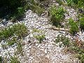
 Oyster shells visible beneath the overgrowth
 -
 1924 Photo of Turtle Mound
 -
 1929 Photo of Turtle Mound
 -
 Sign pointing the way to mound
 -
 Walkway towards mound
 -
 Shells visible through vegetation
 -
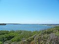 Looking west from top of mound
 -
 Boardwalk to top of mound


References[edit]
- ^ a b "Turtle Mound Located in the Canaveral National Seashore". Volusia County Historic Preservation Board and the Volusia County Government. Archived from the original on May 3, 2012. Retrieved April 8, 2012.
- ^ "National Register Information System". National Register of Historic Places. National Park Service. July 9, 2010.
- ^ Volusia County Heritage. "Turtle Mound". Volusia County Government. Archived from the original on May 3, 2012. Retrieved September 15, 2007.
- ^ Milanich, Jerald T. (1998). Florida's Indians from Ancient Times to the Present. Gainesville, Florida: University Press of Florida. pp. 38–39. ISBN 0-8130-1599-5.
- ^ "New Smyrna Beach". Retrieved September 5, 2007.
- ^ a b National Park Service. "Canaveral National Seashore: Scenic Vistas" (PDF). Retrieved September 5, 2007.
- ^ name="lostworlds"
- ^ Small, John Kunkel (1929). From Eden to Sahara: Florida's Tragedy. Seminole Soil & Water Conservation District.
- ^ "Turtle Mound: Canaveral" (PDF). National Park Service. Retrieved November 17, 2008.
- ^ National Park Service. "Canaveral National Seashore: Plants" (PDF). Retrieved November 17, 2007.
- ^ Richard Stalter; Dwight Kincaid (January 2004). "The Vascular Flora of Five Florida Shell Middens". Journal of the Torrey Botanical Society. 131 (1). Torrey Botanical Society: 94. doi:10.2307/4126930. JSTOR 4126930.
- ^ Norman, E. M. (1976). An Analysis of Vegetation at Turtle Mound. Florida Scientist 39: 19-31.
- ^ Kunkel, John. Collected reprints, Volume 1. Cornell University page 202.
External links[edit]
- Volusia County listings at National Register of Historic Places: Turtle Mound
- Volusia County listings at Florida's Office of Cultural and Historical Programs - Turtle Mound


- Shell middens in Florida
- Woodland period
- Native American history of Florida
- Archaeological sites in Florida
- Archaeological sites on the National Register of Historic Places in Florida
- National Register of Historic Places in Volusia County, Florida
- Protected areas of Volusia County, Florida
- Mounds in Florida
- Florida Native American Heritage Trail
- Timucua