
Star Mills, Kentucky
Star Mills, Kentucky | |
|---|---|
 Star Mills  Star Mills | |
| Coordinates: 37°35′57″N 85°58′49″W / 37.59917°N 85.98028°W | |
| Country | United States |
| State | Kentucky |
| County | Hardin |
| Elevation | 643 ft (196 m) |
| Time zone | UTC-5 (Eastern (EST)) |
| • Summer (DST) | UTC-4 (EDT) |
| Area code(s) | 270 & 364 |
| GNIS feature ID | 504267[1] |
Star Mills is an unincorporated community in Hardin County, Kentucky, United States. Star Mills is located on Kentucky Route 1375, 9.6 miles (15.4 km) southwest of Elizabethtown.[2]
References[edit]
- ^ "Star Mills". Geographic Names Information System. United States Geological Survey, United States Department of the Interior.
- ^ State Primary Road System: Hardin County (PDF) (Map). Kentucky Transportation Cabinet. 2012. Retrieved May 1, 2013.
Municipalities and communities of Hardin County, Kentucky, United States | ||
|---|---|---|
| Cities | 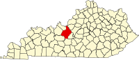 | |
| CDPs | ||
| Other unincorporated communities | ||
| Footnotes | ‡This populated place also has portions in an adjacent county or counties | |
This Hardin County, Kentucky state location article is a stub. You can help Wikipedia by expanding it. |