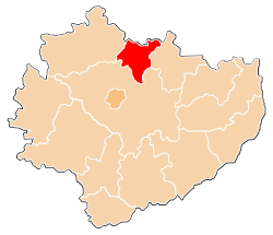
Skarżysko County
Skarżysko County
Powiat skarżyski | |
|---|---|
 Location within the voivodeship | |
| Coordinates (Skarżysko-Kamienna): 51°7′N 20°55′E / 51.117°N 20.917°E | |
| Country | |
| Voivodeship | Świętokrzyskie |
| Seat | Skarżysko-Kamienna |
| Gminas | Total 5 (incl. 1 urban) |
| Area | |
| • Total | 395.30 km2 (152.63 sq mi) |
| Population (2019) | |
| • Total | 74,343 |
| • Density | 190/km2 (490/sq mi) |
| • Urban | 53,415 |
| • Rural | 20,928 |
| Car plates | TSK |
| Website | http://www.skarzysko.powiat.pl |
Skarżysko County (Polish: powiat skarżyski) is a unit of territorial administration and local government (powiat) in Świętokrzyskie Voivodeship, south-central Poland. It came into being on January 1, 1999, as a result of the Polish local government reforms passed in 1998. Its administrative seat and largest town is Skarżysko-Kamienna, which lies 34 kilometres (21 mi) north-east of the regional capital Kielce. The only other town in the county is Suchedniów, lying 10 km (6 mi) south-west of Skarżysko-Kamienna.
The county covers an area of 395.30 square kilometres (152.6 sq mi). As of 2019 its total population is 74,343, out of which the population of Skarżysko-Kamienna is 45,068, that of Suchedniów is 8,347, and the rural population is 20,928.[1]
Neighbouring counties[edit]
Skarżysko County is bordered by Szydłowiec County to the north, Starachowice County to the east, Kielce County to the south and Końskie County to the west.
Administrative division[edit]
The county is subdivided into five gminas (one urban, one urban-rural and three rural). These are listed in the following table, in descending order of population.
| Gmina | Type | Area (km2) |
Population (2019) |
Seat |
| Skarżysko-Kamienna | urban | 64.2 | 45,068 | |
| Gmina Suchedniów | urban-rural | 74.9 | 10,139 | Suchedniów |
| Gmina Bliżyn | rural | 141.1 | 8,091 | Bliżyn |
| Gmina Skarżysko Kościelne | rural | 53.2 | 6,023 | Skarżysko Kościelne |
| Gmina Łączna | rural | 61.7 | 5,022 | Łączna |
Territorial changes[edit]
As of 2006, Skarżysko County has undergone three territorial changes since its creation in 1999 – several villages from neighbouring counties have been incorporated:
- 2000: Pogorzałe and Książece from Szydłowiec County, until then separate villages, became districts of Skarżysko-Kamienna.
- 2001: Majków and Michałów from Starachowice County became part of Gmina Skarżysko Kościelne.
- 2004: Kierz Niedźwiedzi from Szydłowiec County became part of Gmina Skarżysko Kościelne.
References[edit]
- ^ GUS. "Population. Size and structure and vital statistics in Poland by territorial division in 2019. As of 30th June". stat.gov.pl. Retrieved 2020-09-14.


