
Saxe, Virginia
Saxe, Virginia | |
|---|---|
Unincorporated community | |
 Post office | |
 Saxe  Saxe | |
| Coordinates: 36°55′48″N 78°39′48″W / 36.93000°N 78.66333°W | |
| Country | United States |
| State | Virginia |
| County | Charlotte |
| Elevation | 338 ft (103 m) |
| Time zone | UTC-5 (Eastern (EST)) |
| • Summer (DST) | UTC-4 (EDT) |
| ZIP code | 23967 |
| Area code | 434 |
| GNIS feature ID | 1477721[1] |
Saxe is an unincorporated community in Charlotte County, Virginia, United States. Saxe is 5.6 miles (9.0 km) southwest of Drakes Branch. Saxe has a post office with ZIP code 23967, which opened on May 2, 1889.[2][3] Annefield and Roanoke Plantation, both of which are listed on the National Register of Historic Places, are located near Saxe.[4]
References[edit]
- ^ "Saxe". Geographic Names Information System. United States Geological Survey, United States Department of the Interior.
- ^ United States Postal Service (2012). "USPS – Look Up a ZIP Code". Retrieved February 15, 2012.
- ^ "Postmaster Finder – Post Offices by ZIP Code". United States Postal Service. Retrieved December 28, 2012.
- ^ "National Register Information System". National Register of Historic Places. National Park Service. July 9, 2010.
Municipalities and communities of Charlotte County, Virginia, United States | ||
|---|---|---|
| Towns | 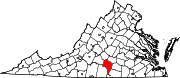 | |
| Unincorporated communities | ||
This Charlotte County, Virginia state location article is a stub. You can help Wikipedia by expanding it. |