
Nkolmetet
Nkolmetet | |
|---|---|
 Huts | |
| Country | |
| Time zone | UTC+1 (WAT) |
Nkolmetet is the name of one of the villages of the Beti tribe in the Nyong ang So'o division, in the center province of Cameroon.
Nkolmetet is a combined word of two different Beti words Nkol which means hill and the word Metet which is a kind of edible plant also called in Beti yolyolo. Because of it bitterness, the plant is commonly called in Cameroon Ndole of Ewondo and Duala language; also known as bitterleaf (Vernonia amygdalina).
Some 25 years ago the late prince Zang Zambo Salomon Dessalo, a wise man of the locality, predicted Nkolmetet will be a very big town. Today the village is a district en voie to be a subdivision.
Gallery[edit]
-
 Oveng Forest at Nkolmetet
 -
 House
House -
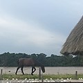
 Horses near the cabin
 -
 River in Nkolmetet
 -
 Lodge in Oveng Nkolmetet


See also[edit]
| Lekié |  | |
|---|---|---|
| Haute-Sanaga | ||
| Mbam-et-Inoubou | ||
| Mbam-et-Kim | ||
| Méfou-et-Afamba | ||
| Méfou-et-Akono | ||
| Mfoundi | ||
| Nyong-et-Kéllé | ||
| Nyong-et-Mfoumou | ||
| Nyong-et-So'o | ||
3°26′N 11°46′E / 3.433°N 11.767°E
This Centre Region (Cameroon) location article is a stub. You can help Wikipedia by expanding it. |