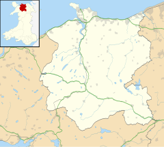
Melin-y-Coed
| Melin-y-Coed | |
|---|---|
 The three remaining mill workers' cottages at Glanllyn Terrace, Melin-y-Coed. | |
Location within Conwy | |
| OS grid reference | SH815603 |
| Community | |
| Principal area | |
| Country | Wales |
| Sovereign state | United Kingdom |
| Post town | LLANRWST |
| Postcode district | LL26 |
| Dialling code | 01492 |
| Police | North Wales |
| Fire | North Wales |
| Ambulance | Welsh |
| UK Parliament | |
| Senedd Cymru – Welsh Parliament | |
Melin-y-Coed is a small rural village in the county of Conwy, Wales. (Translated as Mill in the Woods into English). The earliest surviving building in the village is Cyffdy Hall, built in 1596.[1]
The village lies about a mile and a half southeast of the town of Llanrwst. Behind the village to the east the hills rise to Moel Seisiog (467m). The B5427 links Melin-y-Coed to Llanrwst.
Listed buildings[edit]

The Bethel Chapel (built 1822, rebuilt 1879)[2][3] and two bridges also dating from 1822 are Grade II listed.[4][5] Cyffdy Hall together with its Coach House is Grade II* listed.[6]
References[edit]
- ^ Archaeologia Cambrensis: The Journal of the Cambrian Archaeological Association. W. Pickering. 1976.
- ^ Stuff, Good. "Bethel Chapel, Bro Garmon, Conwy". britishlistedbuildings.co.uk. Retrieved 4 November 2019.
- ^ "Bethel Welsh Calvinistic Methodist Chapel, Melin-y-coed (7764)". Coflein. RCAHMW. Retrieved 30 September 2021.
- ^ Stuff, Good. "Road Bridge 60m E of Melin-y-Coed Bridge, Bro Garmon, Conwy". britishlistedbuildings.co.uk. Retrieved 4 November 2019.
- ^ Stuff, Good. "Melin-y-Coed Bridge and adjoining revetment walls to E and W., Bro Garmon, Conwy". britishlistedbuildings.co.uk. Retrieved 4 November 2019.
- ^ Cadw. "Cyffdy Hall (including attached Coach House) (123)". National Historic Assets of Wales. Retrieved 30 September 2021.
Wikimedia Commons has media related to Melin-y-Coed.

